What to see
Catalan Pyrenees: what to see? The 12 essential sights
We may earn a commission when you book through links on this page, at no extra cost to you. We don't visit or try the places we cover: we summarize published sources. How we work
In short
- The Catalan Pyrenees are the eastern French end of the range, in the Pyrénées-Orientales: Conflent, the Canigó massif (about 2,780 m / 9,120 ft), Cerdagne and Capcir.
- The Vauban fortifications of Villefranche-de-Conflent and Mont-Louis are UNESCO-listed; the Yellow Train runs about 63 km (39 mi) between Villefranche-de-Conflent and Latour-de-Carol.
- Four to five days link the Conflent, Cerdagne and Capcir without rushing; for a weekend, stick to one valley.
- A car is the most flexible way to get around; Perpignan, with its airport and station, is the natural gateway.
Between the Mediterranean and the high mountains, the Catalan Pyrenees form one of the most contrasting corners of the range. Here you come across ramparts designed by Vauban, Romanesque abbeys clinging to cliffs, a yellow train climbing toward the peaks, sunny plateaus and a legendary summit, the Canigó, which Catalans consider a sacred mountain. All this in the Pyrénées-Orientales department, with the beach less than two hours by road from the ski resorts.
This guide presents what to see in the Catalan Pyrenees: twelve sights grouped by area (Conflent, Canigó, Cerdagne, Capcir), with tips for linking them. For an overview of the range, see the complete guide to the Pyrenees. And if you prefer a ready-made route, the 4-day road trip in Ariège and the Cerdagne crosses part of this scenery.
The Catalan Pyrenees at a glance: geography and key facts
The Catalan Pyrenees are the eastern part of the range on the French side, in the Pyrénées-Orientales. This area, also called “Northern Catalonia,” shares language, traditions and part of its history with Spanish Catalonia. You will see place names in Catalan on road signs, red-and-yellow flags at windows and popular festivals where people dance the sardana.
Four main areas structure a visit:
- The Conflent, the Têt valley, with Prades, Villefranche-de-Conflent and the foot of the Canigó.
- The Canigó massif, an emblematic summit of about 2,780 m (9,120 ft), surrounded by gorges, villages and abbeys.
- The Cerdagne, a broad sunny plateau around Font-Romeu, Saillagouse and Bourg-Madame.
- The Capcir, a forested plateau dotted with lakes farther north, around Formiguères and Les Angles.
Perpignan, with its airport and station, serves as the natural gateway. Depending on the destination, allow one to one and a half hours by road to reach the Conflent, and a little more for the Cerdagne or Capcir. To organize your trips in detail, see the article on how to get around the Pyrenees.
1. Villefranche-de-Conflent: Vauban’s fortified town
Nestled at the bottom of a narrow gorge, Villefranche-de-Conflent is one of the most beautiful fortified villages in France. Founded in the Middle Ages, it keeps its ramparts, medieval lanes and stone houses. Vauban strengthened it in the late 17th century, and its fortifications are part of the Vauban sites inscribed on the UNESCO World Heritage list in 2008, along with those of Mont-Louis.
Stroll along Rue Saint-Jacques, lined with craft shops, and climb onto the wall-walk to appreciate the village’s defensive position, squeezed between the Têt and the mountain. Above the village, Fort Libéria, built under Louis XIV, overlooks the valley. You reach it by a long underground staircase of several hundred steps, or by a shuttle depending on the season. Villefranche is also the starting point of the Yellow Train, which makes it a logical stop for a day or half a day.
Sleeping in the Pyrénées-Orientales
Charming hotels, gîtes and guesthouses in the Conflent and the Cerdagne.
2. The Yellow Train: crossing the Pyrenees in an open car
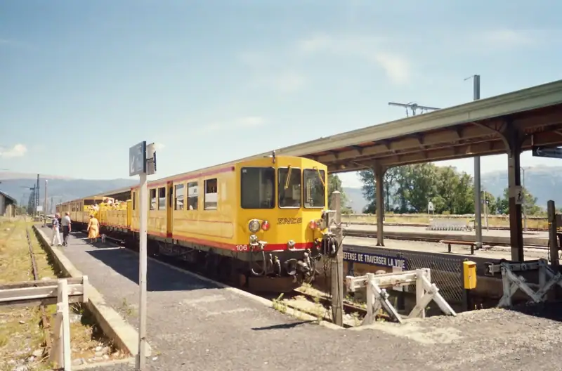
Nicknamed the Little Yellow Train or “Canari,” this mountain train links Villefranche-de-Conflent to Latour-de-Carol, over about 63 km (39 mi). Its line, electrified with a third rail, climbs to the Cerdagne plateau, crossing gorges, bridges and viaducts. Two structures are famous: the Séjourné viaduct, with its stone arches, and the Gisclard bridge, a railway suspension bridge.
Depending on the season, open panoramic cars run, letting you watch the scenery go by without glass. The train serves Mont-Louis, Font-Romeu-Odeillo-Via, Saillagouse, Bolquère-Eyne and other villages, and you can get off wherever you like before catching a later train. Timetables vary by time of year: check them before planning your day, and book ahead in high season. For the line as seen from Font-Romeu, the guide to Font-Romeu details the most convenient stop.
3. Mont-Louis: France’s highest fortress town
About thirty kilometers (19 mi) from Villefranche, Mont-Louis is a citadel built by Vauban from 1679 to protect the new border born of the Treaty of the Pyrenees. Located at about 1,600 m (5,250 ft) of altitude, it is known as the highest fortress town in France. Its ramparts, gate and parade ground form a remarkable ensemble, also UNESCO-listed.
The citadel is still occupied by the army, which houses a training center there: only some parts can be visited, often on a guided tour. You can, however, walk around the ramparts on foot, free of charge, admiring the Forçats well, a relic of military engineering. Mont-Louis also has a link with solar energy: a small solar furnace was trialed there just after the war, before the construction of the big Odeillo furnace.
4. The Canigó massif: the Catalans’ sacred mountain
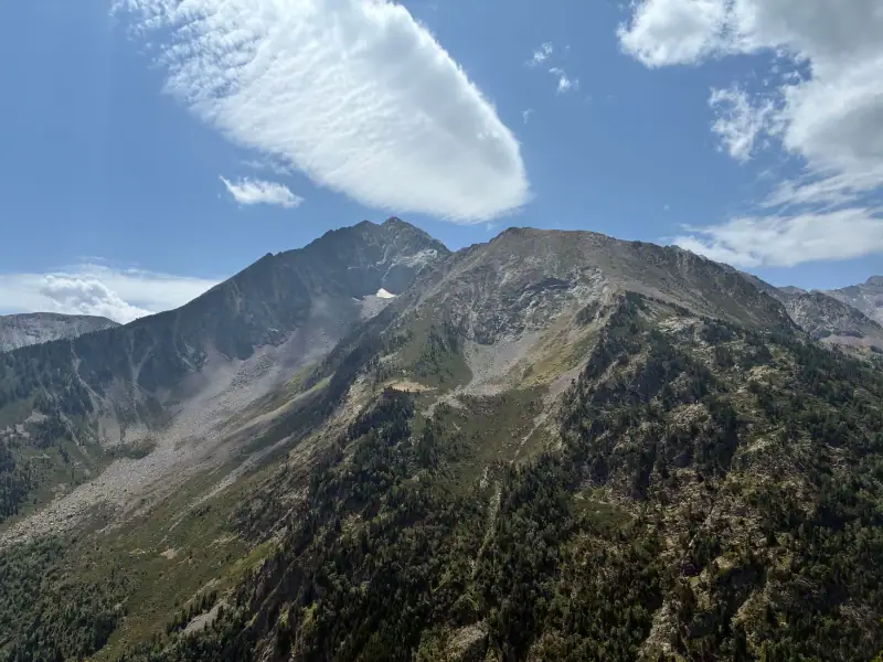
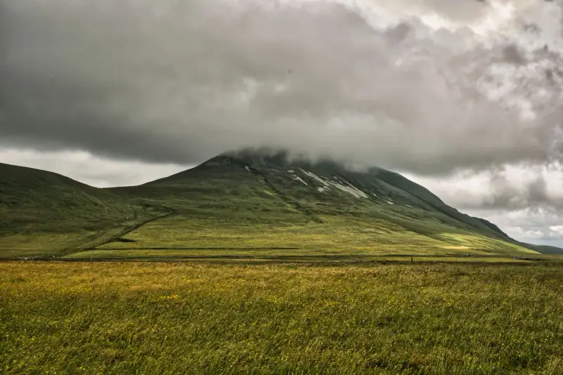
Visible from the Roussillon plain and sometimes from the sea, the Canigó peaks at about 2,780 m (9,120 ft). Catalans have made it a symbol of identity: every year on Saint John’s Eve, fires are lit at the summit and then carried down as torches to the villages of the region. This popular tradition attracts many visitors in late June.
For hiking, several routes lead to the summit. The most popular itineraries start from a hut or a high-altitude parking lot, and require good physical condition, stable weather and suitable equipment. Summer thunderstorms can form quickly. If you are not aiming for the summit, shorter loops around the lakes and shepherds’ huts let you enjoy the massif without particular difficulty. Find more ideas in the selection of hikes in the Pyrenees.
5. Saint-Martin-du-Canigou abbey: a Romanesque balcony
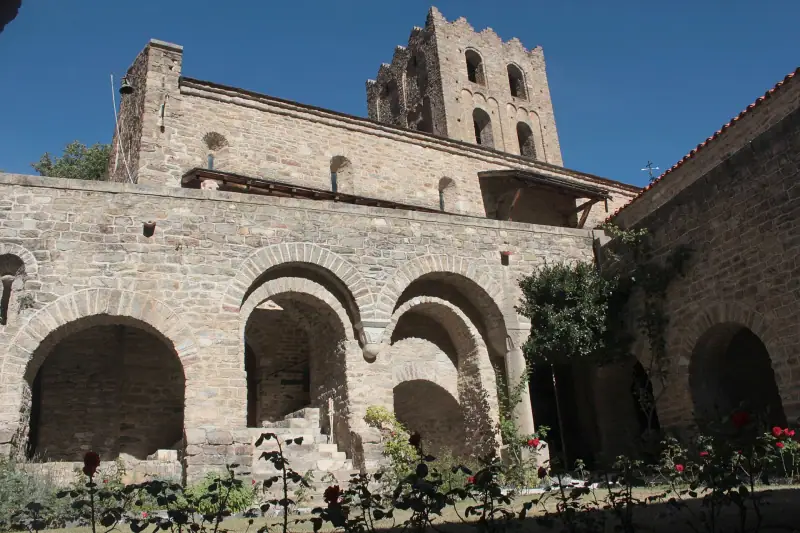
Perched on a rocky spur at about 1,000 m (3,280 ft) of altitude, above the village of Casteil, Saint-Martin-du-Canigou abbey is one of the most photographed monuments in the Pyrenees. It dates from the early 11th century and embodies Lombard Romanesque art: thick walls, a square bell tower, a cloister with carved capitals, a low crypt. The setting, facing the massif, adds to its charm.
Access is on foot from Casteil by a steep path, which takes about half an hour of walking. It can be visited on a guided tour, with times that vary by season. Wear closed-toe shoes and avoid climbing in the hottest hours in summer.
6. Saint-Michel-de-Cuxa abbey and Prades
A few kilometers from Prades, Saint-Michel-de-Cuxa is another great Romanesque abbey of the region. Its partially reconstructed cloister and its church with horseshoe arches give this place a serene atmosphere, between Catalan and pre-Romanesque influences. Some elements of its cloister are kept at The Cloisters museum in New York.
Prades, a lively little town of the Conflent, welcomed the cellist Pablo Casals, who lived there in the 1950s and created a music festival that is still held in summer. Its market, its Saint-Pierre church and its shaded squares make it a practical base for exploring the valley. For where to eat and what to taste here, see the Pyrenean food specialties.
Rent a car from Perpignan
Compare rental companies to explore the valleys at your own pace.
7. The Carança gorges and the Canigó villages
At the foot of the Canigó, the Carança gorges are one of the region’s most spectacular trails. The path, cut into the rock wall, follows a canal and crosses suspended walkways above the torrent. It starts from the village of Thuès-entre-Valls and is aimed at hikers without a fear of heights. Avoid it in bad weather, as the exposed sections become slippery.
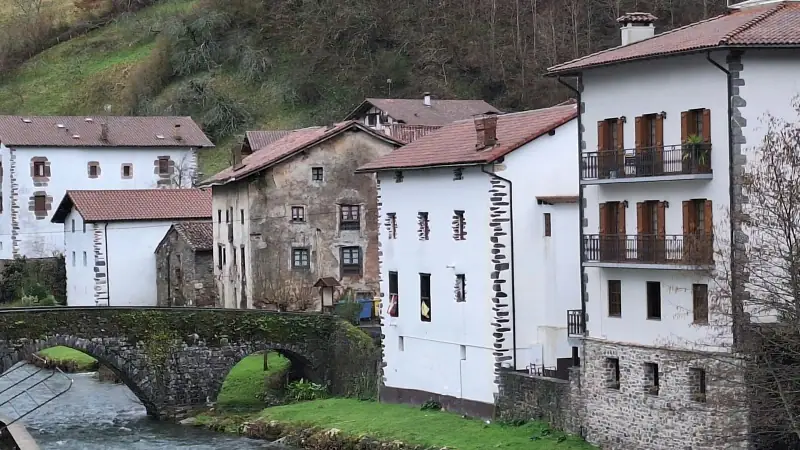
In the area, several villages deserve a stop: Vernet-les-Bains, a spa town with old-world charm, Casteil, the access point to the abbey, or Castelnou, a medieval village dominated by its castle, farther east in the Aspres. Their dry-stone lanes and flowery facades give an idea of Catalan rural life.
8. The Cerdagne: a large sunny plateau
To the west, the Cerdagne completely changes the scenery: a broad high-altitude plateau, facing due south, surrounded by peaks. The landscape is open, the villages are built of pale stone and the sky is bright. Between Font-Romeu, Saillagouse and Bourg-Madame, you cross meadows, pine forests and farming hamlets.
Several stops lend themselves to a day of visiting, and the villages of Err and Eyne are worth the detour. Eyne, perched on the side of the valley, overlooks a nature reserve known for the richness of its flora, which blooms mostly in early summer. At Saillagouse, a market and a few restaurants serve as a supply point. Hot springs, like those at Dorres, are a good way to relax after a hike.
9. Llívia: a Spanish enclave in French land
A geographical curiosity, Llívia is a Spanish municipality entirely surrounded by French territory, a short distance from Bourg-Madame. This goes back to the Treaty of the Pyrenees of 1659, which ceded the villages of the Cerdagne to France but left Llívia to Spain because it had the status of a “town.”
You will find an old town with quiet lanes, a fortified church and a museum devoted to local history, which notably presents an old pharmacy. Crossing into Spain here is done without formalities, which lets you have lunch with tapas or do a bit of shopping at Spanish prices. Shops often close for a longer midday break. Entry rules depend on your passport, so bring it and check your government’s official travel advice before you go (checked November 2026).
10. The Capcir and the high lakes
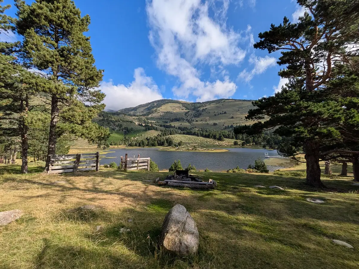
North of the Cerdagne, the Capcir is a plateau covered with mountain pine forests, dotted with lakes and peat bogs. Lac de Matemale is a site for walks and water sports in summer. The villages of Formiguères and Les Angles serve as bases for skiers in winter and hikers in summer.
Close to Font-Romeu, Lac des Bouillouses, at about 2,000 m (6,560 ft), opens the door to the Carlit massif and several dozen glacial lakes. The access road may be closed or limited at certain times depending on snow cover, and a shuttle system runs in high season: find out before you go. If winter tempts you, the article on winter activities in the Pyrenees details skiing, snowshoeing and the baths.
11. The Odeillo solar furnace
It is impossible to talk about the Cerdagne without mentioning the Odeillo solar furnace, a gigantic parabolic mirror that concentrates sunlight to reach very high temperatures. It is a CNRS laboratory, set up here because of the strong local sunshine. The building, spectacular from afar, is recognized as a historic monument. Visiting arrangements change regularly: ask the tourist office before you come.
Excursions around Perpignan and Roussillon
Guided visits, tastings and activities offered on GetYourGuide.
12. Perpignan and the coast: the ideal complement
Before or after the mountains, Perpignan deserves half a day. Its Palace of the Kings of Majorca, a 13th-century fortress, overlooks the town, and the old center has a very southern atmosphere. From Perpignan, the Vermilion Coast and its fishing villages such as Collioure are reachable by car for a contrasting day, in exchange for some driving.
Combining sea and mountains is precisely one of the region’s assets: a morning at the top of a pass, an afternoon at the beach. Keep your days reasonable, though, as mountain roads are slower than they look.
When to go to the Catalan Pyrenees
Spring suits the Conflent and the villages, with orchards in bloom and mild temperatures. Summer is the best season for lakes, high-altitude hiking and village festivals, but also the busiest. Autumn offers magnificent forest colors and fewer people. Winter is reserved for snow sports in the Cerdagne and Capcir. The guide when to go to the Pyrenees details these periods across the whole range.
What to eat in the Catalan Pyrenees
Catalan cuisine marks the region: cargolade (grilled snails), boles de picolat (meatballs in sauce), crème catalane, Collioure anchovies, mountain cured meats and Roussillon wines. In the mountains you also find winter dishes based on potatoes, cabbage and pork. Taste seasonal specialties in small village restaurants and at markets rather than in the most touristy places.
Organizing your stay: sample programs
- Weekend (2 days): day 1, Villefranche-de-Conflent and the Yellow Train to Mont-Louis; day 2, Saint-Martin-du-Canigou abbey or the Carança gorges.
- 4 days: add a day in the Cerdagne (Eyne, Llívia, solar furnace) and a hiking day at Lac des Bouillouses.
- 7 days: add the Capcir, Prades and Saint-Michel-de-Cuxa, and a detour to Perpignan and the coast.
Practical tips
- Car: essential for remote villages. Allow time, as roads are winding.
- Weather: in the mountains it changes fast. Set out early for hikes and bring a warm layer even in summer.
- Mobile network: check your carrier’s international plan or use a travel eSIM; some valleys have no coverage.
- Budget: the region is overall more affordable than the big Alpine resorts. The article on the budget in the Pyrenees gives guidelines.
- Insurance: for hiking or skiing, check that your insurance covers mountain rescue costs.
A mountain with Catalan accents
The Catalan Pyrenees are discovered in touches: a Vauban rampart, a Romanesque cloister, a mountain train, a high lake, a village where Catalan is spoken. Choose one or two areas rather than trying to see everything, give yourself time to wander, and you will leave with the feeling of having crossed several countries in a few days.
Frequently asked questions
What should you not miss in the Catalan Pyrenees?
The essentials are the Canigó massif, the fortifications of Villefranche-de-Conflent and Mont-Louis (UNESCO-listed as Vauban sites), the Yellow Train, the Romanesque abbeys of Saint-Martin-du-Canigou and Saint-Michel-de-Cuxa, the Cerdagne plateau and the lakes of the Capcir and the Bouillouses.
How many days should you allow to visit the Catalan Pyrenees?
Four to five days let you link the Conflent, Cerdagne and Capcir without rushing. With a weekend, concentrate on a single valley, for example the Conflent around Villefranche and the Canigó.
Where are the Catalan Pyrenees?
They occupy the eastern part of the range, in the Pyrénées-Orientales department, between the Mediterranean and the Spanish border. The area notably includes the Conflent, Cerdagne, Capcir, Vallespir and Haut-Vallespir.
Do you need a car to visit the Catalan Pyrenees?
A car remains the most flexible way, notably for isolated villages and trailheads. The Yellow Train, however, links Villefranche-de-Conflent to Latour-de-Carol and serves several interesting stops without driving.
What is the best time to visit the Catalan Pyrenees?
June to September for hiking and high lakes, with long, sunny days. Winter suits skiing and snowshoeing in the Cerdagne and Capcir, while spring and autumn are ideal for the villages of the Conflent.
Do you need a passport to go to Llívia?
Llívia is a Spanish enclave in the middle of the Cerdagne, and there is no systematic border check there. Entry rules depend on your passport, so bring your passport and check the official travel advice of your government before you go (checked November 2026).
Do you need an eSIM to travel in the Catalan Pyrenees?
Check your carrier's international plan before you go, or consider a travel eSIM, including for an excursion into Spain. Expect a few areas without coverage at the bottom of valleys or in the high mountains.
More Pyrenees guides
Keep reading
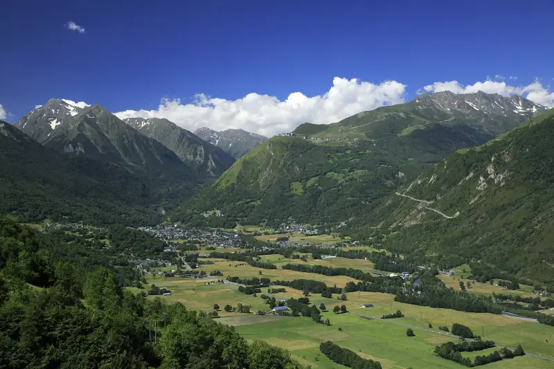
What to see in the Aure valley: Saint-Lary, Néouvielle, Arreau and villages of character
What to see in the Aure valley (Hautes-Pyrénées): Saint-Lary-Soulan, Néouvielle reserve, Arreau, Sarrancolin, Aragnouet and passes.
Visiting Ax-les-Thermes: what to see and do in Haute-Ariège
Visiting Ax-les-Thermes: Bassin des Ladres, thermal baths, Bonascre gondola, Beille plateau and excursion ideas. A guide to plan your stay.
What to see in the Luchonnais: valleys, Romanesque villages and lakes around Luchon
What to see in the Luchonnais? Larboust valley, Saint-Aventin church, Lac d'Oô, Peyragudes, Oueil valley and Saint-Bertrand-de-Comminges.
Ready-made
Pyrenees itineraries
7 days
Hautes-Pyrénées and Ariège in one week by car: is the itinerary doable?
CauteretsBagnères-de-LuchonFoix
Can be adapted in the planner
5 days
5 days in the Hautes-Pyrénées: an itinerary through Lourdes, Cauterets and Gavarnie
CauteretsLuz-Saint-Sauveur
Can be adapted in the planner
4 days
4-day road trip in Ariège and the Cerdagne: Foix, Montségur, Ax-les-Thermes, Font-Romeu
FoixAx-les-ThermesFont-Romeu
Can be adapted in the planner