What to see
Visiting Eysturoy: Complete Guide to the Faroe Islands' Second Island
We may earn a commission when you book through links on this page, at no extra cost to you. We don't visit or try the places we cover: we summarize published sources. How we work
In short
- In one day, see Gjógv's natural harbor, Funningur's fjord and church, and the Risin og Kellingin viewpoint at Eiði. Add Slættaratindur (880 m / 2,887 ft) on a second day.
- Tórshavn to Eiði is about 50 to 55 km (31 to 34 mi), 50 to 60 minutes by car; most visitors stay in Tórshavn and visit Eysturoy as a day trip.
- The Eysturoyartunnilin subsea tunnel is a toll tunnel paid online at tunnil.fo within 6 days; with a rental car, the toll is settled through the rental company.
- The Slættaratindur hike takes 2 to 3 hours round trip from the Eiðisskarð pass; do not go in low cloud or fog.
It does not have the fame of Vágar and its viral waterfall, nor the postcard charm of the capital Tórshavn. And yet Eysturoy may be the most fascinating island in the Faroes for anyone who loves wide open spaces, committing hikes and landscapes that take something out of you. This is where Slættaratindur, the highest point in the archipelago, stands. This is where the legend of the Two Giants, the two rocks that wanted to steal the Faroes, makes full sense as you look at the cliffs from Eiði. And this is where the village of Gjógv clings to the edge of the world like nowhere else.
Second island by area, Eysturoy long remained in the shadow of its neighbors. Today, thanks to the subsea tunnels that connect the archipelago, it can be reached in twenty minutes from Tórshavn and has become an essential stop on any stay in the Faroe Islands.
Eysturoy at a glance
Eysturoy covers about 286 km² (110 sq mi) and has roughly 10,500 inhabitants spread over about twenty villages. It is linked to Streymoy by a bridge over the Sundini strait, one of the few fixed links in the archipelago. This bridge, opened in 1973, transformed the island by letting it share in Tórshavn’s economic momentum while preserving its rural character.
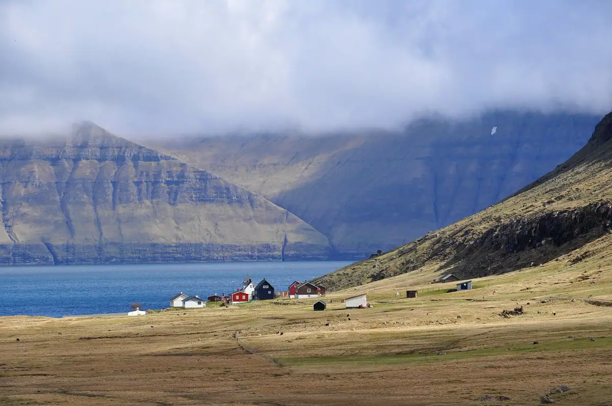
Eysturoy’s geography is a condensed version of Faroese contrasts: coasts cut by deep fjords, windswept grassy plateaus and volcanic peaks piercing the clouds. The main road runs along the east of the island, winding between the sea and the mountains. It is dotted with villages of colorful houses and turf roofs, small pictures that stay in the memory.
The island is administratively divided into several municipalities. For the traveler, it is visited along two main axes: the center and south (easily reached from Tórshavn), and the wild north with its legendary villages.
What to see on Eysturoy: quick answers
Eysturoy is the second-largest island in the archipelago and, with Streymoy, the most populated. If you only have one day, keep these four stops: Gjógv for its natural harbor, Funningur for its fjord and church, Eiði for the viewpoint over Risin og Kellingin, and Slættaratindur (880 m / 2,887 ft) if the weather and your legs allow. The table below sums up the essentials.
| Place | Why go | Who it suits |
|---|---|---|
| Gjógv | Natural gorge harbor, colorful houses, puffin cliffs | All travelers |
| Funningur | Black wooden church with a turf roof, head of the fjord, Hvíthamar viewpoint | Photographers, contemplative travelers |
| Eiði | Viewpoint over the Two Giants, the legend of Risin og Kellingin | Families, short walk |
| Slættaratindur | Highest point in the Faroes (880 m / 2,887 ft) | Experienced hikers |
| Oyndarfjørður | The “rocking stones”, a quiet village | Curious travelers, off the beaten path |
| Runavík, Toftir, Fuglafjørður | Services, knitwear shops, Varmakelda hot springs | Practical stop, meals, groceries |
Eysturoy is reached by car through the subsea tunnel with its roundabout, whose toll is paid online: the details are in our guide to tunnel tolls in the Faroe Islands. Without a car it is possible but restrictive: see our article on the Faroe Islands without a car by bus and ferry.
Car rental in the Faroe Islands
Essential for exploring Eysturoy at your own pace. Book early in high season, as the fleet is limited.
Slættaratindur: the top of the Faroes
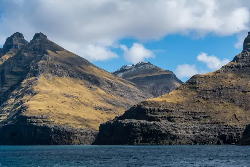
At 880 meters (2,887 ft), Slættaratindur is the roof of the Faroe Islands. Its Faroese name means something like “the flattened peak”, an honest description of its summit plateau, which contrasts with the steep slopes around it. The hike to reach it is the archipelago’s number one mountain challenge, and for good reason.
Getting to the trailhead
The most common starting point is the Eiðisskarð pass, on the road between Eiði and Funningur/Gjógv, where you park by the roadside. Another, longer route starts at sea level in Gjógv. The start is not formally signposted as in the Alps: in the Faroe Islands, you walk by map and instinct.
The route
The climb follows grassy, rocky slopes that steepen gradually. The terrain is often wet (sometimes knee-deep mud after rain). From the Eiðisskarð pass, allow about 1 to 1 h 30 for the climb for an intermediate walker (about 1.8 km / 1.1 mi each way). The arrival on the summit plateau is striking: the wind blows almost constantly, and the views open onto the whole archipelago; in clear weather, you can see about ten islands.
Level: Intermediate to experienced (no cables or via ferrata, but unstable terrain in rain) Elevation gain: About 470 to 500 m (1,540 to 1,640 ft) from Eiðisskarð (nearly 800 m / 2,625 ft from Gjógv, at sea level) Total round trip: 2 to 3 hours from the pass Required gear: Waterproof hiking shoes, windbreaker, map (Faroe Islands Hiking app or paper topo map)
Safety tip: Do not set off if the clouds are very low or if fog is forecast. The summit plateau is dangerous in reduced visibility, with too few landmarks or cairns.
Eiði and the Two Giants (Risin og Kellingin)
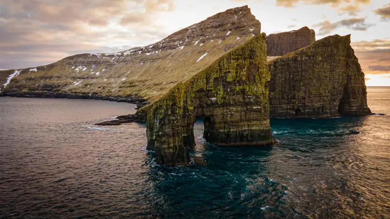
At the northwest tip of Eysturoy, the village of Eiði occupies a spectacular position on a narrow isthmus between two bays. Sea on either side. Ahead, a few kilometers out in the Atlantic, two rocks rise from the waves like petrified sentinels. They are Risin og Kellingin, the Giant and the Witch.
The legend
The legend tells of an Icelandic giant and his witch wife who tried one evening to tie the Faroe Islands to Iceland and tow them away. They worked all night fastening their ropes around the island of Eysturoy. But the sun rose before they had finished, and like all creatures of the night, they were turned to stone at the first ray of light. The giant and the witch still stand there in the Atlantic, forever petrified.
The viewpoint from Eiði
The two rocks are very visible from the cliffs north of the village. The climb from Eiði takes about twenty minutes on foot. The panorama from the heights is one of the most impressive on Eysturoy: the ocean in 360°, the two stone giants in the foreground and, in clear weather, the island of Streymoy and the peaks of Saksun in the distance.
Eiði deserves a stop in itself. The village has a few hundred residents and a particularly serene atmosphere. The local church is a fine example of Faroese community architecture: plain, functional, nestled in the landscape.
Guided tours in the Faroe Islands
Small-group tours around Eysturoy and the other islands, with a local guide.
Funningur: the fjord that inspires daydreams
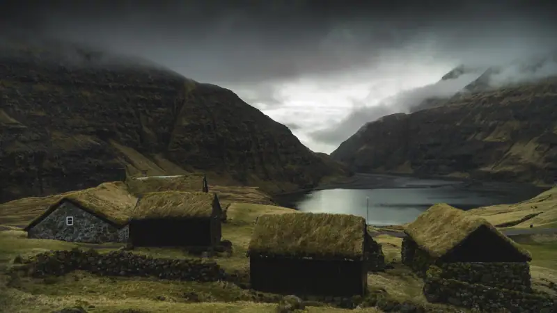
Funningur is one of those Faroese villages that take you by surprise. Set at the head of the Funningsfjørður, surrounded by mountains that plunge straight into the dark waters of the fjord, it is considered by many travelers to be one of the most beautiful sites on Eysturoy.
Funningur church
Funningur church is a black wooden church with a turf roof, surrounded by a stone wall. Inaugurated on November 30, 1847, it was built by Jákup Andreassen of Syðrugøta and stands facing the fjord on a slightly raised promontory. Its location is perfect for photography: you frame it with cloud-covered mountains behind and the calm waters of the fjord below.
The interior is not always accessible, but the exterior and the adjoining cemetery are well worth the detour. It is a calm, moving site that gives a good idea of how intimate Faroese communities are with their natural surroundings.
Hikes around the fjord
The slopes of the Funningsfjørður offer several paths that let you look down over the village and take in the whole fjord. The trails are lightly marked and often wet, so waterproof shoes are a must. The reward is a series of some of the most photographed viewpoints on Eysturoy. On the other shore, Elduvík has a sea gorge and a 6 km (3.7 mi) trail to Funningsfjørður.
Gjógv: the village at the end of the precipice
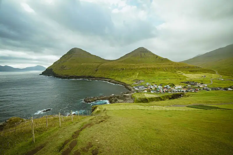
Gjógv is often described as one of the most spectacular villages in the archipelago. And after Gásadalur, you might think that is exaggerated, but it is not. Gjógv has something unique: a natural gorge cut into the basalt cliffs that has served as a natural harbor for centuries. This tiny harbor, reached by a staircase cut into the rock, is the beating heart of the village.
The gorge (the gjógv, which gives the village its name) is about 200 meters (655 ft) long and a few meters wide. Fishing boats have found shelter there for generations. Today a few boats still rest there, rocked by the Atlantic waters.
Above the village, paths lead to the northern cliffs and to the puffin colonies that nest in the crevices of the rock between May and August. It is one of the best birdwatching spots on the island.
See our complete guide to Gjógv for all the details on this exceptional village.
Accommodation on Eysturoy
Guesthouses and hotels in the villages of Eysturoy and in the Tórshavn area.
Hikes on Eysturoy: the essentials
Eysturoy is an exceptional playground for hikers. Besides Slættaratindur, several routes are worth mentioning.
The Gjógv loop (intermediate level)
This hike starts from the village of Gjógv and climbs toward the northern cliffs, with views straight down onto the Atlantic and the gorges of the natural harbor. The trail is partly waymarked. Allow 3 to 4 hours for the full loop, depending on your pace and photo stops.
Separate excursion: the Enniberg cliffs (experienced level)
The Enniberg cliffs are not on Eysturoy: they are near Viðareiði, on the island of Viðoy in the Norðoyar (Northern Islands). You reach them from Klaksvík (on Borðoy) via the Árnafjørður tunnel. They reach about 750 meters (2,460 ft), among the highest in Europe. Some coastal hikes lead to promontories with dizzying views. These routes demand good fitness and a dedicated day.
Around Lake Eiðisvatn
Lake Eiðisvatn stretches between two arms of the sea in the north of Eysturoy, creating a typically Faroese landscape of moorland and fresh water. A peaceful walk follows its shores, accessible to all levels. It is a good warm-up before climbing Slættaratindur.
For a complete overview of all the hikes in the archipelago, see our guide to hiking in the Faroe Islands.
South and east Eysturoy: Runavík, Fuglafjørður and the bay villages
Many travelers rush north and forget the south of Eysturoy, which is very practical: shops and services are concentrated here, right at the exit of the subsea tunnel.
Runavík and Toftir. Runavík is a deep-water port where trawlers and cargo ships dock. Toftir, its immediate neighbor, is home to the main store and workshop of the knitwear maker Navia, near the tunnel exit on the Eysturoy side (Runavík). It is a good stop for shopping or lunch before heading north.
Oyndarfjørður. This quiet village is known for its two “rocking stones”: two blocks, one of which still rocks, and which are also a dive site. A short visit, away from the crowds.
Fuglafjørður. A town of a little over 1,600 inhabitants, beside a sheltered fjord suited to kayaking. There is a tourist office, trails (including the one that reaches Hellurnar via Altarið) and, to the south, the Varmakelda hot springs.
Syðrugøta and Norðragøta. About ten kilometers (6 mi) north of Runavík, Syðrugøta hosts the G! festival on the beach every July. In Norðragøta, the 19th-century Blásastova farm can be visited.
Funningur, oldest village? The official tourist office presents it as possibly the oldest village in the Faroe Islands, settled around 825. One more reason to stop there.
To choose where to base yourself in this area, read our comparison where to stay on Eysturoy.
Suggested itinerary on Eysturoy
Here is how to organize one or two days on the island:
Day 1: The wild north
- Morning (8 am to noon): Leave Tórshavn by car, cross the Sundini bridge, head for Eiði along the east coast. Arrive in Eiði around 9:30 am, climb to the cliffs to see Risin og Kellingin. Then cross the Eiðisskarð pass and stop at Funningur for the church and the fjord.
- Lunch: Picnic prepared in Tórshavn (no restaurant is guaranteed in Eiði out of season).
- Afternoon (1 pm to 6 pm): Drive to Gjógv (about 15 minutes from Funningur). Visit the natural harbor, hike to the cliffs, watch the birds in season. Return to Tórshavn in the late afternoon.
- Total distance: About 130 to 150 km (80 to 93 mi) of driving for the full loop (Eiði, Eiðisskarð, Funningur, Gjógv, then back through the tunnel).
Day 2 (for hikers): Slættaratindur
- Morning (7 am): Very early start from Tórshavn to reach the trailhead before 9 am.
- Hike (9 am to 12:30 pm): Climb Slættaratindur from the Eiðisskarð pass, with a break at the summit for photos and the panorama.
- Afternoon: Easy descent, stop in a village to recover before returning to Tórshavn.
- Tip: Check the weather the day before. Only sun or a lightly veiled sky gives worthwhile views from the summit.
To fit Eysturoy into a multi-day plan, see our Faroe Islands road trip.
Where to stay on Eysturoy
Accommodation on the island remains limited compared with Tórshavn or Klaksvík. Here are the main options:
Guesthouses in Eiði and the villages
A few family guesthouses offer simple rooms in Eiði and in other villages in the north of the island. These places are often small, run by locals who know the island like the back of their hand. Book well ahead in summer, as places are few.
From Tórshavn (recommended option)
For most travelers, staying in Tórshavn and visiting Eysturoy as a day trip is the most practical solution. The Sundini bridge makes the island very accessible. You get the capital’s wider choice of accommodation (hotels, guesthouses, apartments) while exploring Eysturoy during the day.
To compare Runavík, Gjógv and Eiði, read our guide where to stay on Eysturoy. See our complete guide to the Faroe Islands for accommodation recommendations across the archipelago.
Flights to the Faroe Islands
Compare flights to Vágar (FAE), the international airport of the Faroe Islands.
Weather and best time to visit Eysturoy
Eysturoy has the same temperate oceanic climate as the rest of the archipelago: mild, windy, unpredictable. But its geography, with high mountains, exposed coasts and many fjords, creates local microclimates that can be surprising.
Summer (June to August): Mild temperatures (10 to 15 °C / 50 to 59 °F), very long days (up to 19 to 20 hours of light in June). This is high season: trails are passable, and ferries and excursions run at full capacity. Puffins are present at Gjógv until the end of August.
Spring (April to May): The grass is an intense green, and waterfalls are at peak flow. Few tourists. Some trails may still be snowy or very muddy at high altitude.
Fall (September to October): Dramatic light, frequent fog on the cliffs, powerful photographic moods. The Slættaratindur hike is still passable in September.
Winter (November to March): The island is accessible all year thanks to the tunnels and the bridge. Hiking conditions are difficult on the heights. On the other hand, the northern lights are sometimes visible on clear nights.
To choose the right window for your trip, read our guide to the best time to visit the Faroe Islands.
Practical information
Getting there from Tórshavn:
- By car: Sundini bridge (free), then the main road, 20 to 55 min depending on the destination
- By bus: SSL (Strandfaraskip Landsins) lines from Tórshavn bus station, limited frequency
- By taxi: an expensive option, especially for destinations in the north of the island
Road network:
- Well-maintained roads to the main villages
- Some tracks leading to trailheads are gravel (passable in a standard car)
- Subsea tunnel (Eysturoy Tunnel, opened in 2020) linking the south of Eysturoy directly to Streymoy
Services on the island:
- Gas stations: available in mid-sized villages (not in the small hamlets of the north)
- Supermarkets: a few grocery stores in the main villages, limited hours on weekends
- Mobile network: good 4G coverage in the villages, patchier signal in the mountains
- Hospitals/emergencies: referral to Tórshavn (Streymoy)
Hiking rights:
- In the Faroe Islands, walking on uncultivated land is traditionally allowed, but some landowners now charge for access to trails or viewpoints (so far no fee is charged for Slættaratindur, but this can change). Check with Visit Faroe Islands or your accommodation before hiking, and respect restrictions during sheep roundups
- Always close any gates you open (sheep must stay in their pasture)
- Respect crops and avoid walking through private gardens
Eysturoy is an island that cannot be summed up in a few hours. It has to be earned: by the effort of mountain trails, by the patience of changing light, by the curiosity that makes you stop in each village to guess its history. It is not the best known of the Faroes, and that is precisely what makes it one of the most precious.
To build your complete plan, see our 7-day Faroe Islands itinerary and our guide to hiking in the archipelago.
Sources
Frequently asked questions
How do you get to Eysturoy from Tórshavn?
Eysturoy is linked to Streymoy (where Tórshavn is) by a bridge over the Sundini strait. From Tórshavn, allow about 20 to 30 minutes by car to reach the south of the island. The new subsea tunnel with its roundabout, opened in 2020, makes travel from Streymoy even easier.
What is the best hike on Eysturoy?
Slættaratindur (880 m / 2,887 ft), the highest point in the Faroe Islands, is Eysturoy's star hike. Allow 2 to 3 hours round trip from the Eiðisskarð pass. For less experienced hikers, the climb to the cliffs of Gjógv offers exceptional panoramas with less difficulty.
Can you see the Two Giants (Risin og Kellingin) from Eysturoy?
Yes, the two legendary sea stacks of Risin og Kellingin are visible from the northwest cliffs of Eysturoy, near the village of Eiði. The best viewpoint is on the heights overlooking the village. By boat (excursions from Klaksvík or Tórshavn), you can get close to them from the sea.
Do you need a car to visit Eysturoy?
A car is strongly recommended for exploring the island at your own pace. Bus lines (SSL) link Tórshavn to several Eysturoy villages, but service is infrequent and some sites (such as Slættaratindur or the northern cliffs) can only be reached by car or on foot.
Where to stay on Eysturoy?
Accommodation is limited on the island. A few guesthouses are available in Eiði and in other villages. Most travelers choose to stay in Tórshavn or Klaksvík and visit Eysturoy as a day trip, since the bridge makes it easily accessible.
How long does it take to visit Eysturoy?
One full day covers the main points (Eiði, the Two Giants, Funningur, Gjógv). To add the Slættaratindur hike, allow two days. Hiking and photography enthusiasts would happily spend a whole week.
What should you see on Eysturoy in one day?
Gjógv and its natural harbor, Funningur's fjord and church, and the viewpoint over Risin og Kellingin from Eiði. Add Slættaratindur (880 m / 2,887 ft) if you have a second day and clear weather.
Is there a toll to get to Eysturoy?
The Sundini bridge is free, but the Eysturoyartunnilin subsea tunnel is a toll tunnel. For a private car, payment is made online at tunnil.fo, no later than 6 days after the crossing, otherwise extra fees apply. With a rental car, the toll is settled through the rental company.
How far is Eiði from Tórshavn on Eysturoy?
Eiði, the main village in the north of Eysturoy, is about 50 to 55 km (31 to 34 mi) from Tórshavn by road, roughly 50 to 60 minutes by car depending on tunnel traffic.
More Faroe Islands guides
Keep reading
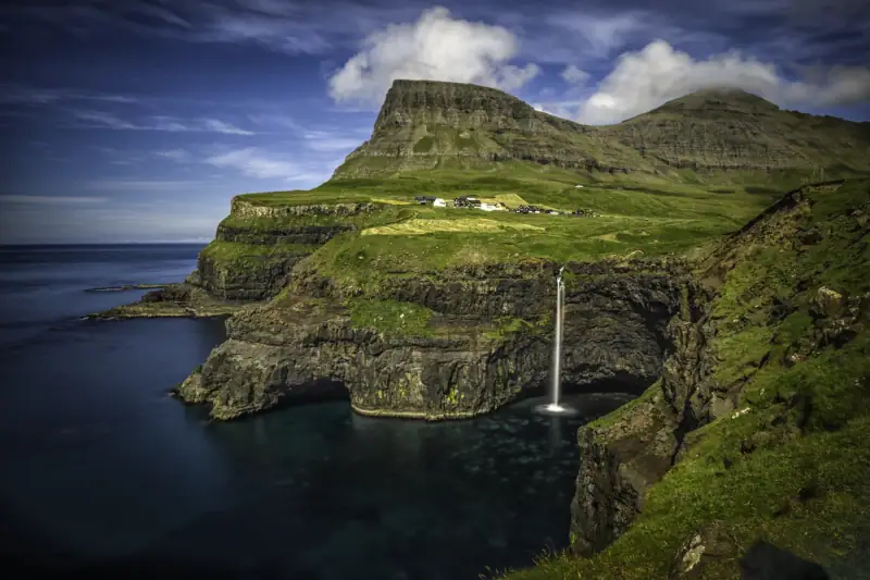
Gásadalur: The Village at the Edge of the World (Múlafossur Waterfall)
Visiting Gásadalur in the Faroe Islands: Múlafossur waterfall, hilltop village, hikes. Complete guide to reaching this remote village on the island of Vágar.
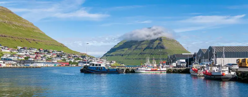
Visiting Klaksvík: Complete Guide to the Faroe Islands' Second Town
Klaksvík, second town of the Faroe Islands on Borðoy: what to see and do, where to stay, how to get there. A complete practical guide for your visit.
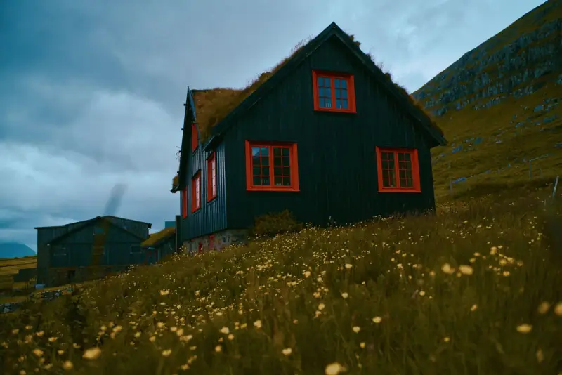
Kirkjubøur from Tórshavn without a car: bus, time needed and is it worth the detour?
Getting to Kirkjubøur from Tórshavn without a car: bus, visit time, St. Magnus Cathedral, Roykstovan and Ólavskirkjan church. Worth the detour?
Ready-made
Faroe Islands itineraries
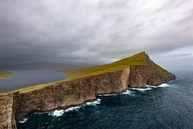
14 days
Faroe Islands Road Trip: A 10 to 14 Day Itinerary by Car
Faroe Islands road trip itinerary in 10 to 14 days. Scenic roads, subsea tunnels, remote villages and the essential natural sites.
2 days
Borðoy Road Trip: 2 Days Between Klaksvík and the Northern Islands
2-day itinerary on Borðoy: Klaksvík, Klakkur, the Kallur lighthouse on Kalsoy, Kunoy and Viðoy. The wild north of the Faroe Islands.
2 days
Suðuroy Road Trip: Complete Guide to the Island at the End of the World
Suðuroy road trip in the Faroe Islands: ferry, Fámjin, Beinisvørð cliffs, Tvøroyri, Vágur, Sumba. 2-day itinerary and practical tips.