What to see
Gjógv: The Village with the Faroe Islands' Most Spectacular Natural Harbor
We may earn a commission when you book through links on this page, at no extra cost to you. We don't visit or try the places we cover: we summarize published sources. How we work
In short
- Gjógv is about 63 km (39 mi) from Tórshavn, 1 h to 1 h 15 by car with stops; a car is needed, as no practical bus connection is listed.
- The natural gorge is about 200 m (655 ft) long and a 5-minute walk from the parking lot; the edges are not fenced everywhere.
- Puffins nest from late April to late August; the best viewing is in the evening (6 pm to 10 pm).
- The Gjaargardur guesthouse is the only place to stay and eat in the village: book 2 to 4 months ahead in June to August.
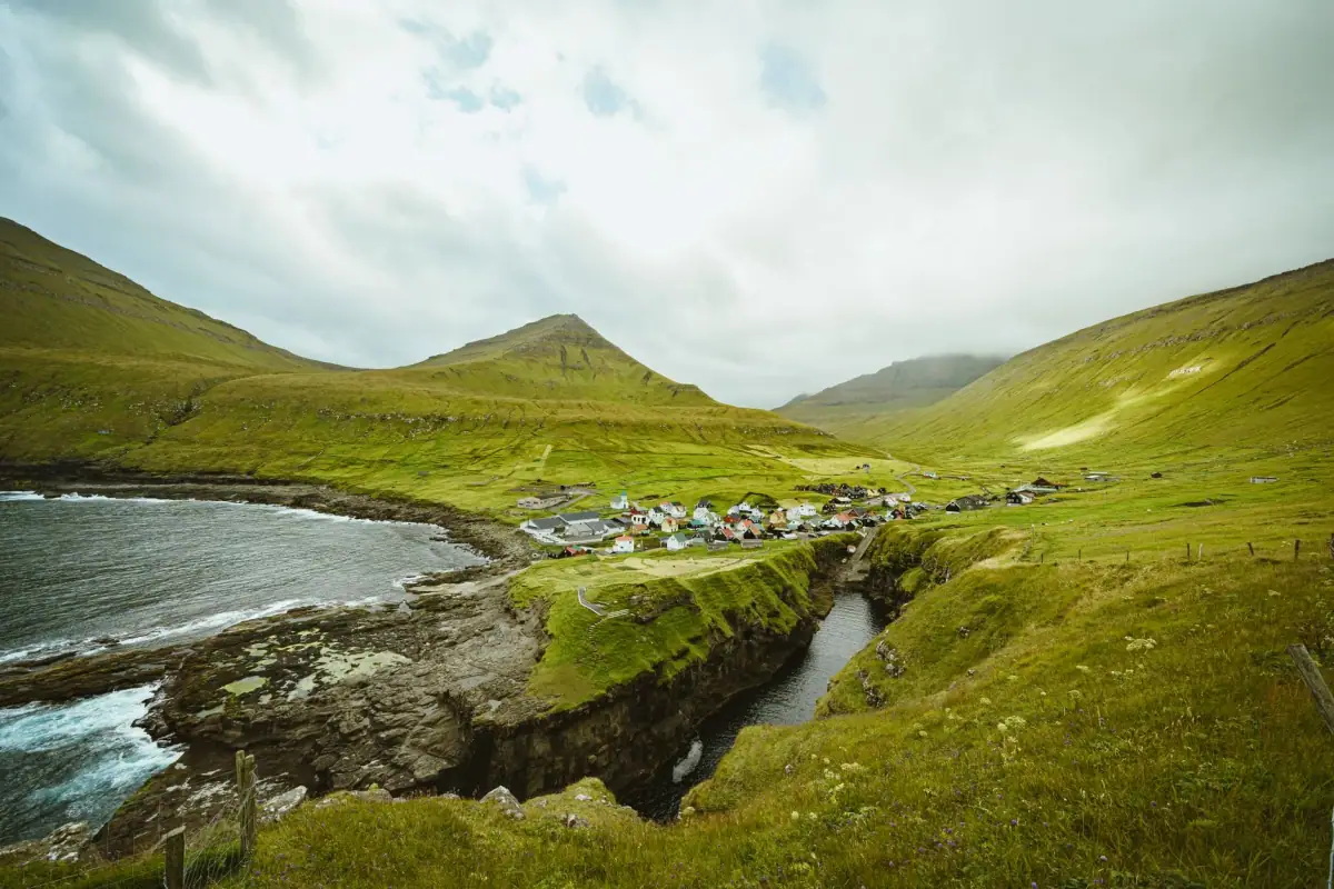
Some villages in the Faroe Islands stay with you forever. Gjógv is one of them. Tucked at the northern end of the island of Eysturoy, this hamlet of about 19 permanent residents is home to one of the archipelago’s most spectacular geological curiosities: a natural gorge that opens into the cliff and once served as a harbor for fishermen. Between the turf-roofed houses, the puffins swirling above the cliffs and the summit of Slættaratindur dominating the whole scene, Gjógv is both an exceptional natural site and a living village, inhabited since at least 1584 according to the first records, with probable earlier habitation that is not confirmed. Here is everything you need to know before going.
Gjógv: a village whose name says it all
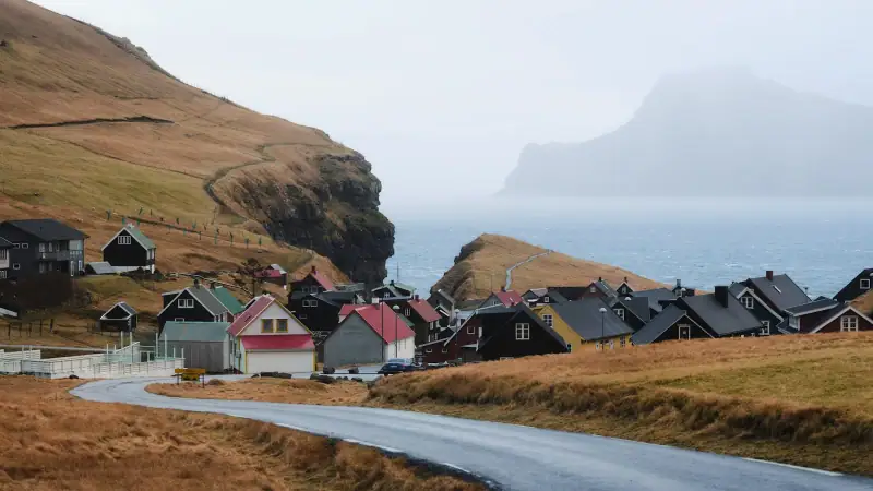
The Faroese name gjógv literally means “gorge” or “crack”. It is hard to sum up the place better. The village owes its existence and its name to this fracture in the basalt rock that opens from the Atlantic and shelters boats from violent winds. Before modern roads and the bridges of Eysturoy, this gorge-harbor was the village’s reason for being; without it, no fisherman could have settled here.
Gjógv is located at the northeast tip of Eysturoy, one of the two large islands at the heart of the archipelago. With about 19 permanent residents, it is among the most isolated villages on the island. Yet its Gjaargardur guesthouse, known across the Faroes, draws hundreds of hikers, photographers and travelers seeking authenticity every summer.
The road there from Tórshavn crosses landscapes that are already magnificent (fjords, green valleys, hillside villages) before taking on the last steep kilometers that lead to the gorge.
Car rental in the Faroe Islands
A car is essential to reach Gjógv and explore Eysturoy freely.
The natural gorge: an extraordinary harbor
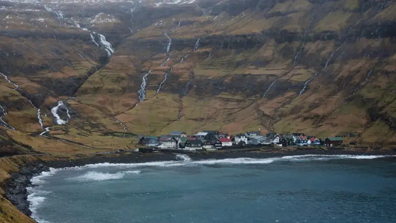
The Gjógv gorge is the founding element of the village and its main curiosity. About 200 meters (655 ft) long and sometimes barely a few meters wide, this crack in the basalt runs inland from the sea. The walls, several dozen meters high (30 to 50 meters / 100 to 165 ft depending on the section), are covered in moss and ferns. At the bottom, luminous blue-green water turns to white churning in storms.
A natural harbor unique in the archipelago
What makes Gjógv absolutely unique is how the residents have used this gorge over the centuries. With no built harbor, fishermen moored their boats inside the crack itself, sheltered from Atlantic waves. Iron rings set in the rock still bear witness to this practice. The smallest boats could be hauled up on rudimentary ramps cut into the cliff.
Today a few colorful boats remain in the gorge. It is no longer an active fishing harbor, but the view from the edge, with the walls closing in, the water shimmering below and the Atlantic horizon at the far end, is strikingly beautiful.
Getting to the gorge
From the village parking lot, just follow the path that descends toward the cliffs, about 5 minutes on foot. A wooden walkway lets you look over the gorge from above. Be careful: the edges are not fenced along their whole length. Take care, especially with children or in strong wind.
The best time to photograph the gorge is mid-morning, when the light enters the crack at an angle and makes the water sparkle. In rough seas, the waves surging into the gorge make a remarkable show of sound and sight.
Hiking to Slættaratindur: the top of the Faroes
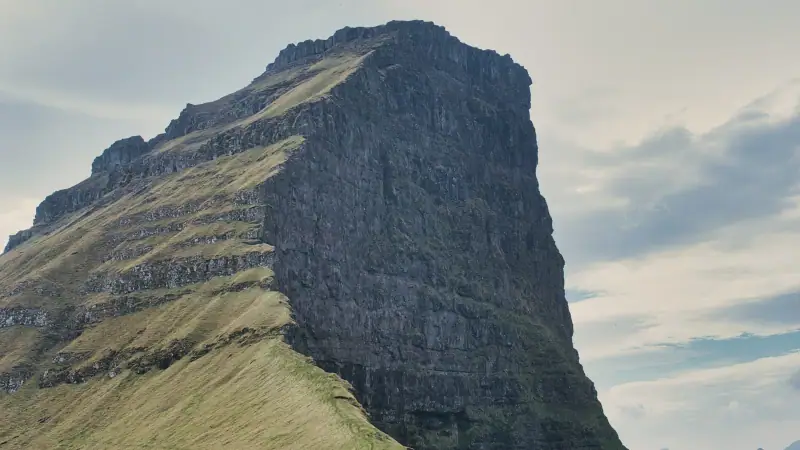
Gjógv is the traditional starting point for climbing Slættaratindur, the highest point in the Faroe Islands at 880 meters (2,887 ft). It is not the highest mountain in Europe, but its island setting gives it an impressive presence: in clear weather, you can see almost all 18 islands of the archipelago from the summit.
The trail from Gjógv
The trail starts from the village, climbs steadily through grassy moorland, crosses a few rocky areas and reaches the summit plateau in about 4 hours according to Visit Faroe Islands. The elevation gain is about 850 meters (2,790 ft). The descent follows the same route, taking 1 h 30 to 2 h.
Level: Intermediate to difficult. There are no cables or safety equipment. The trail is not formally marked along its whole length.
Time: 5 to 6 hours round trip depending on pace. A shorter start exists from the Eiðisskarð pass; ask about possible trail access fees.
Essential gear: Waterproof hiking shoes with lugged soles, waterproof clothing, water (2 liters minimum), energy bar, map or the FaroeTrails app, thermal layers.
Warning: The weather can change radically during the hike. Do not go for the summit if low clouds are forecast; fog above 600 meters (1,970 ft) can make the descent dangerous. Check forecasts on yr.no.
The view from the top
In clear weather, which generally requires a precise weather window, the view from Slættaratindur is one of the finest in the Faroes. You can make out Streymoy and Tórshavn to the southwest, Borðoy and Klaksvík to the northeast, Vágar and its cliffs to the west, and the more distant islands of Suðuroy in exceptional weather. The summit is flat, vast and swept by wind. Bring something to cover up and sit in the hollow of a rock for shelter.
For other hikes on Eysturoy and across the archipelago, see our complete guide to hiking in the Faroe Islands.
Guided tours on Eysturoy
Tours with a local guide to Gjógv, Slættaratindur and the wonders of Eysturoy.
The puffins of Gjógv
Gjógv is one of the best places in the Faroe Islands to watch Atlantic puffins (Fratercula arctica). These colorful-billed birds nest in burrows dug into the grassy cliffs around the village, notably along the slopes above the gorge.
When and how to watch them
The nesting season runs from late April to late August. Puffins spend most of the day at sea fishing. The best time to see them is in the late afternoon and evening (6 pm to 10 pm), when they come back with fish in their beaks to feed their chicks.
The cliffs on the gorge side and the grassy slopes above the village are the most productive areas. Approach slowly, keep a reasonable distance (a few meters is enough, as these birds are fairly unafraid) and never block the entrance to a burrow.
Photographing puffins
Gjógv’s puffins are used to a moderate human presence. Bring a telephoto lens (200-400 mm to isolate the subject), settle low in the grass and wait. In the evening, the low light brings out the bright colors of the bill. Avoid flash, which disturbs the birds.
For a bird-watching focus, our article on birdwatching in the Faroe Islands gives the best techniques and the other essential sites.
Where to stay in Gjógv: Gjaargardur
Gjaargardur (literally “the house at the gorge”) is Gjógv’s emblematic accommodation. This family guesthouse offers several private rooms and dorms in a traditional red-painted wooden building a short walk from the gorge. The common room with a view of the cliffs, the homemade breakfast and the authentic atmosphere make it a much-loved place.
Booking
Capacity is limited. Book 2 to 4 months ahead in high season (June to August). Out of season, places are easier to get, but check that the place is open; it sometimes closes in winter.
Nearby options
If Gjaargardur is full, neighboring villages offer a few options:
- Eiði (30 min to the south): a few rooms in private homes and the narrow Eiðisvatn bridge, one of the most spectacular panoramas in the Faroes.
- Funningur (15 to 20 min to the south): turf-roofed church, remarkable fjord, a few guesthouses.
- Tórshavn (1 h to 1 h 15): the capital offers the biggest choice of accommodation for a fallback base.
Accommodation on Eysturoy
Guesthouses and hotels on Eysturoy, near Gjógv and Eiði.
How to get to Gjógv
By car from Tórshavn (recommended)
A car is the only practical way to reach Gjógv. From Tórshavn:
- Cross the Streymin Bridge to Eysturoy (or take the paid Eysturoyartunnilin subsea tunnel)
- Head north on Eysturoy’s main road
- Go through Eiði and stop to take in the panorama from the Eiðisvatn bridge
- From Eiði, take the north road toward Gjógv (clear signs)
- The last 8 km (5 mi) are on a narrow single-lane road, so drive carefully
Distance: About 63 km (39 mi) from Tórshavn Time: 1 h to 1 h 15 with sightseeing stops (direct trip about 45 min)
The Eysturoyartunnilin tunnel: This subsea tunnel, opened in 2020, links Tórshavn directly to Strendur on Eysturoy, shortening the trip considerably. It is a toll tunnel (175 DKK without an annual subscription, about €23 / $27 in 2024). The route via the Sundalagio bridge is free but longer.
The route from Klaksvík
Coming from the north (Borðoy/Klaksvík), the road to Gjógv goes by ferry crossing or through the network of subsea tunnels in the north of the archipelago. From Klaksvík, allow about 1 hour via Eiði.
Public transport
No practical bus connection to Gjógv is listed (check timetables at ssl.fo). SSL (Strandfaraskip Landsins) buses link Tórshavn to several Eysturoy villages, but Gjógv is not served directly. A taxi from Eiði or Funningur is still possible (budget 300 to 500 DKK for the ride).
The village and its turf-roofed houses
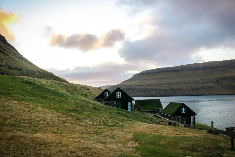
Beyond the gorge and the hike, Gjógv deserves a quiet stroll through its lanes. The village is small, about twenty houses at most, but extraordinarily photogenic.
Traditional Faroese houses
Several buildings have a turf roof (grassrooftop), an insulation technique inherited from the Norse settlers who came to the Faroes around the 9th century. These living roofs change with the seasons: intense green in spring, golden yellow in fall, sometimes covered in snow in winter. Gjaargardur itself is a perfect example of this architecture.
Gjógv church
The village church, a small white-painted chapel, stands on a slight rise above the houses. Built in the 20th century, it replaces older places of worship that existed in the valley since medieval times. It is not always open to the public, but its setting, between the grassy slopes and the sea horizon, makes it a much-photographed subject.
Village life
Gjógv is unusual in being lived in all year by a small, active community. Residents still raise sheep (the Faroes have more sheep than inhabitants), fish and do various crafts. In summer, the influx of hikers and visitors brings welcome liveliness without turning the village into a commercial tourist attraction.
Fitting Gjógv into your itinerary
With 7 days in the Faroe Islands
Devote a full day to Eysturoy with Gjógv as the high point. Leave Tórshavn early:
- Morning: Drive to Eiði, stop at the Eiðisvatn bridge panorama
- Late morning: Arrive in Gjógv, visit the gorge
- Lunch: Picnic at the gorge or a meal at Gjaargardur (by reservation)
- Afternoon: Hike to Slættaratindur (if the weather is good) or walks around the cliffs
- Evening: Puffin watching (May to July) and golden light on the gorge
To structure your whole trip, our 7-day Faroe Islands guide offers an optimized day-by-day plan.
With 3 to 4 days
Include Gjógv in an Eysturoy day, combined with Funningur and the two-level road tunnel (the “Tórshavn fork”). Gjógv can be the last stop before heading back.
On a Faroe Islands road trip
Gjógv fits naturally into an Eysturoy, Borðoy, Klaksvík circuit. From Gjógv, head north up the island to reach the subsea tunnels to Borðoy. See our complete Faroe Islands road trip for the details of this circuit.
Flights to the Faroe Islands
Compare available flights to Vágar Airport (FAE), the international airport of the Faroe Islands.
Weather and best time to visit Gjógv
The Faroe Islands have a reputation for changeable weather, and it is deserved. Gjógv, exposed on the northeast coast of Eysturoy, is particularly sensitive to northeast winds that can blow violently in fall and winter.
Summer (June to August): Best period for the Slættaratindur hike and for puffins. Very long days (up to 20 hours of light), temperatures between 10 and 15 °C (50 to 59 °F). It is also the busiest period, so book Gjaargardur far ahead.
Spring (May): Ideal for puffins and for the first hikes. The grass is bright green, and waterfalls are at peak flow. Fewer people than in summer.
Fall (September to October): Dramatic light, cliffs in the clouds, rough seas surging spectacularly into the gorge. The puffin season is over but the atmosphere is incomparable.
Winter (November to April): Gjógv feels even more like the end of the world. The Slættaratindur hike is not recommended without suitable winter equipment. Gjaargardur is sometimes closed.
To choose your travel window according to your priorities, our guide to the best time to visit the Faroe Islands will give you all the elements for a decision.
Practical information
Access: Car required (no direct bus) Distance from Tórshavn: 63 km (39 mi) / 1 h to 1 h 15 with stops Parking: Free parking at the village entrance Accommodation: Gjaargardur (rooms + dorms, booking essential) Food: Gjaargardur café-restaurant in season (check hours), no other address, so bring supplies Mobile network: Good (4G on Eysturoy) Toilets: Toilets at the parking lot in high season Emergencies: Faroese emergency number: 112
Must bring:
- Waterproof clothing (even in summer)
- Hiking shoes if you plan Slættaratindur
- Water and supplies for the day
- Camera (and patience for the puffins)
- Map or offline navigation app (Maps.me, Organic Maps)
- Thermal layers; the northern wind cools you quickly
Gjógv is one of those places you do not necessarily plan for in your itinerary but which ends up being its strongest moment. There is something irreducibly human about this village: these people who chose to live at the edge of a crack in the rock, who turned a gorge into a harbor, who cut trails to the highest summit of their country. Gjógv is not a site to tick off; it is a conversation with a different relationship to the world.
Discover the archipelago’s other remarkable villages in our guide to the most beautiful villages in the Faroe Islands, or plan your trip from the start with our complete guide to the Faroe Islands.
Sources
Frequently asked questions
How do you get to Gjógv from Tórshavn?
From Tórshavn, take the road to Eysturoy by the Streymin Bridge or the subsea tunnel. Allow about 1 hour to 1 h 15 of driving (63 to 65 km / 39 to 40 mi). A car is essential: no practical bus connection to Gjógv is listed (check timetables at ssl.fo). The final road from Funningur or Eiði is narrow and winding, so drive carefully.
What exactly is the Gjógv gorge?
The Gjógv gorge is a natural crack in the basalt rock, about 200 meters (655 ft) long, running inland from the sea into the cliffs of Eysturoy. The gorge is the village's natural harbor; fishermen once moored their boats there, sheltered from the Atlantic. It is a unique geological formation in the archipelago, carved by sea erosion over the centuries.
Can you hike to Slættaratindur from Gjógv?
Yes, the trail to Slættaratindur (880 m / 2,887 ft, the highest point in the Faroe Islands) starts from the heights of Gjógv. Allow 5 to 6 hours round trip for an intermediate to difficult hike (about 4 hours up, 1 h 30 to 2 h down). The trail is not formally marked along its whole length, so a topographic map or the FaroeTrails app is essential. In clear weather the view from the top covers almost the whole archipelago. Check before you set off: landowners have announced access fees for the climb, and a shorter start exists from the Eiðisskarð pass.
Is there accommodation in Gjógv?
Yes! Gjógv is home to Gjaargardur, one of the most famous guesthouses in the Faroe Islands. This family guesthouse offers rooms and a friendly common room. Book several weeks ahead in summer, as capacity is very limited. It is one of the few places to stay in such an isolated village.
When can you see puffins at Gjógv?
Puffins are present at Gjógv from late April to late August. They nest in burrows dug in the cliffs around the gorge and on the surrounding grassy slopes. The best time to watch them is in the evening (6 pm to 10 pm) when they return from fishing. Keep a respectful distance and do not block the entrances to their burrows.
Is Gjógv worth the detour from Tórshavn?
Absolutely. Gjógv is one of the most authentic and picturesque villages in the Faroe Islands. The natural gorge, the turf-roofed houses, the view of the Atlantic and the end-of-the-world atmosphere make it an essential stop on Eysturoy. Allow at least half a day, or a night there to enjoy the evening light.
Is there a restaurant in Gjógv?
Gjaargardur has a café-restaurant open in season (in principle April to September, reduced hours in the shoulder season, closed in winter). Check hours and book with the establishment. Apart from that, there is no other restaurant or café in the village. Bring supplies from Eiði or Tórshavn. The village has about 19 permanent residents, so the offer is limited to Gjaargardur.
More Faroe Islands guides
Keep reading
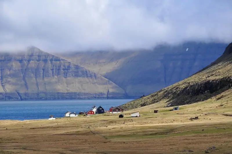
Visiting Eysturoy: Complete Guide to the Faroe Islands' Second Island
Everything for exploring Eysturoy in the Faroe Islands: Gjógv, Eiði, Slættaratindur, Funningur, the Two Giants. Hikes, villages and dramatic landscapes.
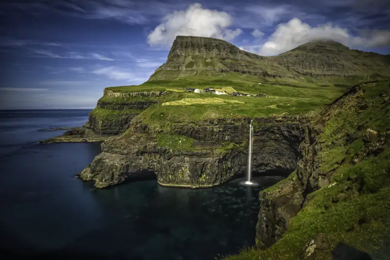
Gásadalur: The Village at the Edge of the World (Múlafossur Waterfall)
Visiting Gásadalur in the Faroe Islands: Múlafossur waterfall, hilltop village, hikes. Complete guide to reaching this remote village on the island of Vágar.
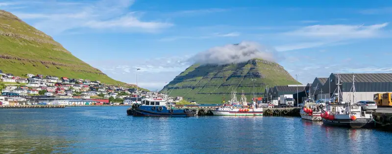
Visiting Klaksvík: Complete Guide to the Faroe Islands' Second Town
Klaksvík, second town of the Faroe Islands on Borðoy: what to see and do, where to stay, how to get there. A complete practical guide for your visit.
Ready-made
Faroe Islands itineraries
14 days
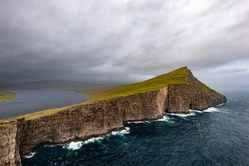
Faroe Islands Road Trip: A 10 to 14 Day Itinerary by Car
Faroe Islands road trip itinerary in 10 to 14 days. Scenic roads, subsea tunnels, remote villages and the essential natural sites.
2 days
Borðoy Road Trip: 2 Days Between Klaksvík and the Northern Islands
2-day itinerary on Borðoy: Klaksvík, Klakkur, the Kallur lighthouse on Kalsoy, Kunoy and Viðoy. The wild north of the Faroe Islands.
2 days
Suðuroy Road Trip: Complete Guide to the Island at the End of the World
Suðuroy road trip in the Faroe Islands: ferry, Fámjin, Beinisvørð cliffs, Tvøroyri, Vágur, Sumba. 2-day itinerary and practical tips.