Itineraries
Borðoy Road Trip: 2 Days Between Klaksvík and the Northern Islands
We may earn a commission when you book through links on this page, at no extra cost to you. We don't visit or try the places we cover: we summarize published sources. How we work
Day by day
- Day 1Klaksvík: Christianskirkjan, harbor, Klakkur hike, evening at the harbor
- Day 2Ferry to Kalsoy, Kallur lighthouse hike, return via Kunoy
Where to sleep
- Klaksvík2 nights
In short
- Two days cover Klaksvík and the Klakkur hike (413 m / 1,355 ft) on day 1, then Kalsoy (Kallur lighthouse) and Kunoy on day 2, about 120 km (75 mi) by car plus the ferry.
- A rental car is essential. The Klaksvík to Syðradalur ferry takes about 20 minutes; check ssl.fo for timetables and book a car space ahead in high season.
- The Norðoyatunnilin toll is about 50 DKK (about €7 / $8) per trip; estimated budget is €150 to 250 (about $175 to 290) per person for 2 days.
- Klaksvík is the only reasonable base: book 2 to 3 months ahead in July and August.
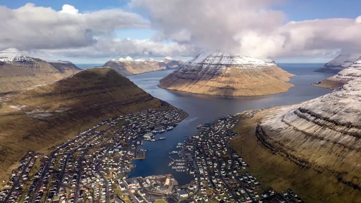
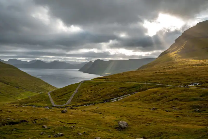
The north of the Faroe Islands is another planet. While travelers concentrate on Tórshavn, Mykines and the Gásadalur waterfall, the island of Borðoy and its neighbors (Kalsoy, Kunoy, Viðoy) remain the archipelago’s best-kept secret. Vertical cliffs plunging into the Atlantic, a wind-lashed lighthouse at the end of a wild peninsula, fishing villages frozen in time, subsea tunnels linking islands once cut off in winter.
This two-day road trip around Borðoy is one of the most intense and authentic circuits you can do in the Faroe Islands. No crowds, no selfie sticks: just nature, wind and a few sheep to keep you company on the ridges.
Overview of the 2-day Borðoy circuit
| Day 1 | Day 2 | |
|---|---|---|
| Morning | Arrive in Klaksvík, discover the town center | Ferry to Kalsoy, village of Syðradalur |
| Afternoon | Hike to the summit of Klakkur | Hike to the Kallur lighthouse from Trøllanes |
| Evening | Klaksvík harbor, dinner | Return to Klaksvík via Kunoy |
| Accommodation | Klaksvík | Klaksvík |
Total driving distance: about 120 km (75 mi) over the two days (not counting the ferry) Estimated budget: €150 to 250 (about $175 to 290) per person for 2 days (accommodation, meals, ferry, car rental)
Day 1: Klaksvík, capital of the north
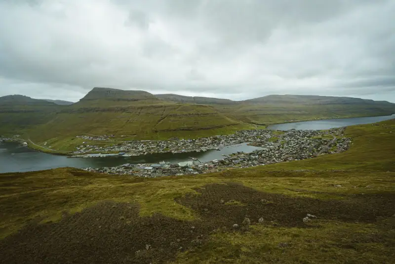
Arriving and settling in Klaksvík
From Tórshavn, the road to Klaksvík takes the main road north, crosses the island of Eysturoy and dives under the Norðoyatunnilin, the 6.2 km (3.9 mi) subsea tunnel that links Eysturoy to Borðoy under the fjord. This tunnel, opened in 2006, revolutionized life for people in the north: where the ferry was once the only way to reach Klaksvík from the rest of the Faroes in bad weather, you can now make the trip by car in every season, at any hour.
Practical note: The tunnel is a toll tunnel (about 50 DKK, around €7 / $8, per trip in 2025). Have cash or a bank card ready.
Once in Klaksvík, take time to settle into your accommodation before setting off on foot to discover the center. The town is easily visited on foot: the harbor, Christianskirkjan church and the main shopping streets are all within a 30-minute walk.
Where to stay in Klaksvík
Guesthouses and rooms in private homes in the second town of the Faroe Islands.
Morning: Christianskirkjan church and the harbor
Start with Christianskirkjan church, Klaksvík’s most emblematic building. Consecrated in 1963, it holds an exceptional archaeological curiosity: a granite offering vessel of debated age (sometimes put at about 4,000 years), from a ruined church in North Zealand (Denmark) and given by the National Museum of Denmark, set in this modern space. The church is announced as closed to visitors in 2026 for works: check its opening with Visit Faroe Islands before going.
Walking back down toward the harbor, you cross the heart of the town. Klaksvík’s harbor is one of the busiest in the Faroes for deep-sea fishing: modern trawlers, inshore fishing boats, the smell of iodine. Morning is the best time to see activity on the quay.
A short walk from the harbor, if you like craft beer, ask about a visit to the Föroya Bjór brewery, the national brewery of the Faroe Islands, founded in 1888, which resumed beer production in 1980 (end of the beer prohibition in the Faroes; free sale in bars dates only from 1992) and whose beers are much appreciated locally. Check with the brewery whether guided tours are offered and on what terms.
Afternoon: hike to the summit of Klakkur (413 m / 1,355 ft)
This is the day’s big hike, and perhaps the finest panoramic view reachable from a village in the Faroe Islands. Klakkur (413 m / 1,355 ft) rises directly above Klaksvík and offers, in clear weather, a 360° panorama over the fjords, the island of Borðoy and the neighboring islands of Kunoy, Kalsoy and Viðoy.
Practical information:
- Start: marked trail from central Klaksvík (signposts from the harbor)
- Time: about 2 h round trip for the main trail
- Elevation gain: about 400 m (1,310 ft)
- Difficulty: moderate, well-defined trail but terrain sometimes wet
- Gear: waterproof hiking shoes, windbreaker (the wind can be fierce at the summit)
The climb first crosses flowering meadows (in summer), then heather moorland, before reaching the rocky ridge. The last meters before the summit already give spectacular views of Klaksvík’s double fjord.
On the way down, enjoy the late-day light which, in summer, tints the fjords in golden shades until after 10 pm. For more details on hikes in the area, see our guide to hiking in the Faroe Islands.
Evening in Klaksvík
The harbor in the evening, with boats coming in and gulls wheeling, is worth the detour. For dinner, Klaksvík’s offer is modest but honest: local food around the harbor, a café-bakery for a light meal, and sometimes evening specialties in guesthouses that also take half-board guests. Do not expect a food scene like Tórshavn’s; authenticity comes first here.
Car rental in the Faroe Islands
Essential for exploring Borðoy and the northern islands at your own pace.
Day 2: Kalsoy and the Kallur lighthouse
Morning: ferry to Kalsoy
Get up early: the ferry to Kalsoy leaves Klaksvík harbor in the morning, and departures are infrequent. Be sure to check the up-to-date timetable on ssl.fo (the Faroese public transport site) before you leave, as it varies by season.
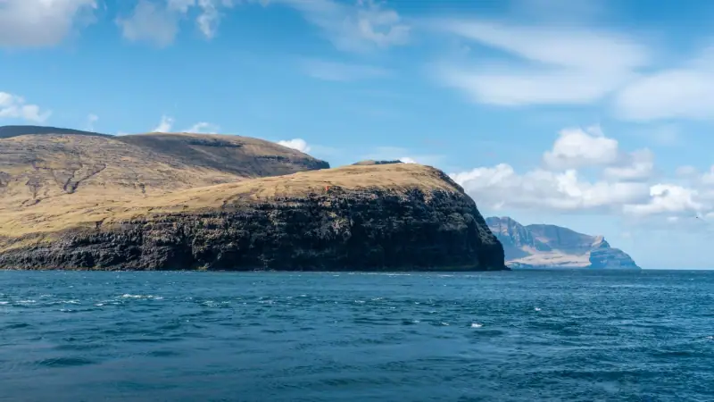
The crossing to the island of Kalsoy takes about 20 minutes. From the ferry deck, the view of Borðoy’s cliffs and the mouth of the fjord is already spectacular. The ferry drops passengers at the village of Syðradalur, in the south of the island.
Kalsoy is nicknamed “the flute” (blokkfloytan in Faroese) because of its long, narrow shape. The island is about 18 km (11 mi) long and in places less than 3 km (1.9 mi) wide. It has a few hamlets linked by a single road, dotted with short single-lane tunnels. Traffic in these tunnels works with alternating signals; always wait for green before entering.
The hike to the Kallur lighthouse
This is the main goal of the day, and one of the most photographed hikes in the Faroe Islands. The Kallur lighthouse stands at the northern tip of Kalsoy, on a rocky ridge that drops dizzyingly into the Atlantic on three sides.
Practical information:
- Start: village of Trøllanes, at the northern tip of the island (end of the road)
- Distance: about 4.8 km (3 mi) round trip
- Elevation gain: about 300 to 400 m (985 to 1,310 ft)
- Time: 2 h 30 to 3 h 30 depending on pace and conditions
- Difficulty: moderate to high depending on weather; the final ridge is exposed and can be slippery
- Gear: waterproof hiking shoes mandatory, warm clothing and a windbreaker, water and food (no services at Trøllanes)
The trail leaves the Trøllanes parking lot and climbs gradually through the moorland. After about 45 minutes, the ridge opens onto breathtaking views: on the left, Kalsoy’s inner fjords; on the right, the Atlantic as far as the eye can see. The lighthouse, small and white, appears at the end of the rocky peninsula.
Weather warning: If the wind exceeds 15 to 20 m/s (34 to 45 mph) or visibility is very low, postpone the hike. The cliff edge is dangerous and the route can become hard to follow in fog.
Guided tours in the north of the Faroe Islands
Guided excursions to Kalsoy and the Kallur lighthouse from Tórshavn or Klaksvík.
Return via Kunoy: the forgotten cliffs
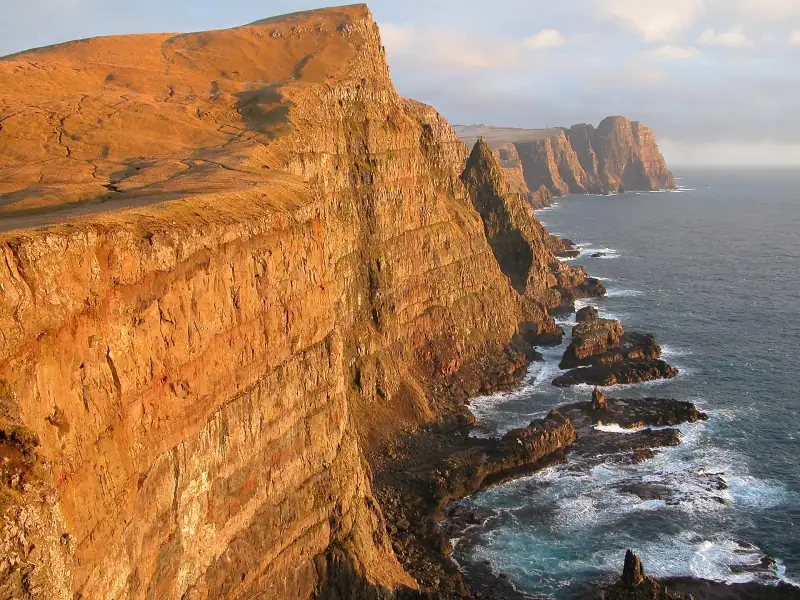
On the way back from Kalsoy, rather than heading straight back to Klaksvík, make a detour to the island of Kunoy. Reached from Klaksvík by a short road (about 15 to 20 km / 9 to 12 mi including the causeway), Kunoy is the island of cliffs: some rise over 800 m (2,625 ft) straight from the sea, among the highest in the Faroes.
The village of Kunoy itself, a few dozen colorful houses at the head of a fjord, is one of the most photogenic in the archipelago. If you are lucky enough to arrive at the right angle of light in late afternoon, the scene is almost unreal: dark cliffs in the background, red and yellow houses by the water, fishing boats in the small harbor.
From Klaksvík to Kunoy: Cross the Haraldssund causeway that links Borðoy directly to Kunoy by following the main road. Allow about 20 to 25 minutes’ drive from central Klaksvík.
Optional: Viðoy, the northernmost island
If you have energy and time, the island of Viðoy, reached from Borðoy by a road and a bridge, is the northernmost permanently inhabited island of the archipelago. The landscapes are among the wildest in the Faroes: low moorland, cliffs lashed by northern winds, a particular light filtering in from the Arctic horizon.
The village of Viðareiði, on Viðoy, is known for its views of Cape Enniberg, a dizzying 754 m (2,474 ft) cliff on Viðoy itself, and of the islands of Fugloy and Svínoy on the horizon in good weather. The road from Klaksvík to Viðareiði is about 25 to 30 km (16 to 19 mi).
Tip: Keep Viðoy for travelers with a third day, or for those who want to skip Kalsoy if the weather is bad that day.
Logistics of the Borðoy road trip
How to reach Borðoy
From Tórshavn (about 73 km / 45 mi):
- By car: Route 10 north, then the Norðoyatunnilin tunnel under the fjord. Toll about 50 DKK (about €7 / $8).
- By bus: Bus 400 (or express bus 401), several departures a day, about 1 h 05 by express and up to 1 h 40 on the regular line. Convenient for reaching Klaksvík but limiting for exploring the neighboring islands.
From Vágar Airport (about 80 km / 50 mi):
- Allow 1 h 15 to 1 h 30 by car via Tórshavn and the tunnel.
The Kalsoy ferry
The Klaksvík-Syðradalur ferry serves the island of Kalsoy from Klaksvík harbor. Timetables vary by season (summer/winter) and day of the week.
- Crossing time: about 20 minutes
- Vehicles: accepted but limited spaces, so book ahead in high season
- Fare: check the current fare at ssl.fo
- Tip: Take the first ferry of the morning to have enough time for the hike to the Kallur lighthouse and a comfortable return.
The tunnels
Borðoy and its neighboring islands are linked by several tunnels, some single-lane with passing places. The principle is simple: a red light at each entrance, and you wait for green. These tunnels can be a slightly unsettling experience the first time (they are dark, narrow and sometimes long) but they are perfectly safe if you obey the lights.
The Norðoyatunnilin (6.2 km / 3.9 mi, between Eysturoy and Borðoy) is the longest on this circuit. It is straight and direct, with no junction or roundabout; do not confuse it with the Eysturoyartunnilin (opened in 2020), which has a famous subsea roundabout.
Where to stay for this road trip
Klaksvík is the only reasonable logistics base for this circuit. Supply is more limited than in Tórshavn but enough for two nights:
- Guesthouses: several places offer simple, clean rooms, often with a shared kitchen and a fjord view. Book 2 to 3 months ahead in high season (July and August).
- Rooms in private homes: an authentic option for meeting northern Faroese people and getting local advice on hikes and weather.
- Hostels: dorms available for tight budgets.
See our complete guide to where to stay in Klaksvík for the best current addresses.
Flights to the Faroe Islands
Compare flights to Vágar Airport, the only air gateway to the Faroe Islands.
Best time for this road trip
June to August: ideal
Summer is the prime season for this circuit. Days are very long (up to 19 to 20 hours of natural light in June), temperatures mild (10 to 16 °C / 50 to 61 °F), ferries more frequent and hiking trails at their best. The crossing to Kalsoy is more regular, and the ferry timetable allows a full day on the island.
May and September: a good alternative
Late spring and early fall offer very acceptable conditions. Fewer tourists, more dramatic light, and the cliffs sometimes wrapped in morning mist. Check ferry timetables, as they may be reduced out of season.
Winter: possible but demanding
The north of the Faroe Islands in winter is a world apart: the wind can blow hard, days are very short, and some ferries or roads may be disrupted. For photography fans, the winter light is exceptional. Check road conditions and ferry timetables before you plan.
See our guide to the best time to visit the Faroe Islands to refine your planning.
Tips for a successful road trip
Real-time weather: The yr.no app (Norwegian weather, very accurate in the Faroes) is your best ally. Check the forecast every morning. If wind exceeds 15 m/s (34 mph) or fog is forecast, adapt the program (stay in Klaksvík rather than doing Kalsoy that day).
Book early: In high season, accommodation in Klaksvík fills up months ahead. The same goes for car spaces on the Kalsoy ferry. Do not leave it to chance.
Fill up on gas in Tórshavn or on arrival in Klaksvík. Gas stations become rare on the neighboring islands.
Carry cash. Some small establishments and the ferry only accept cash or local debit cards.
Respect the wildlife. Sheep (there are more of them than inhabitants in the Faroes!) are everywhere on the trails. Do not scare them, do not feed them, and leave fences as you find them.
To prepare your whole trip to the Faroe Islands, see our complete Faroe Islands road trip, which fits Borðoy into a wider circuit of the archipelago.
This Borðoy road trip in summary
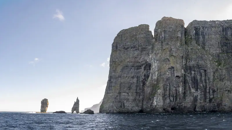
Two days in the north of the Faroe Islands means two days without queues, tourist buses or packed restaurants. It is Klaksvík waking up with its fishermen, Klakkur giving you the whole archipelago at a glance, the Kallur lighthouse standing at the end of the world, and Kunoy reminding you that 800-meter cliffs can drop straight into the sea without warning.
The north of the Faroe Islands is the part of the archipelago that stays with you. Not in photos, since all the photos have already been taken. In sensations: the wind, the silence, the light that never quite fades, and the awareness of being somewhere extraordinarily real.
Highlights of this circuit:
- The 360° panorama from the summit of Klakkur over the northern fjords
- The ferry crossing to Kalsoy, with Borðoy’s cliffs in the background
- The Kallur lighthouse, reached on foot from Trøllanes, one of the most spectacular hikes in the Faroes
- The cliffs of Kunoy, among the highest in the Faroes
- Absolute authenticity: few tourists, residents living their lives, landscapes with no development
For accommodation, see our guide to where to stay in Klaksvík and for the whole island, our guide to the island of Borðoy.
Sources
- Tunnil (Faroese subsea tunnel company): prices checked November 2026
- Tunnil (Faroese subsea tunnel company): figures checked November 2026
- Strandfaraskip Landsins (SSL): figures checked November 2026
Frequently asked questions
How many days do you need to explore Borðoy and the northern islands?
Two full days cover the essentials: Klaksvík and Klakkur on the first day, then Kalsoy (Kallur lighthouse) and a stop at Kunoy or Viðoy on the second. With 3 days, you can slow down and enjoy the hikes without rushing.
Do you need a car for this road trip?
Yes, a rental car is essential. It lets you reach the various hiking trailheads, cross the subsea tunnels and take the ferry to Kalsoy with your vehicle if you wish. Book ahead, especially in high season, as supply can be limited.
How do you get to Kalsoy from Klaksvík?
A ferry links Klaksvík to Syðradalur on the island of Kalsoy. The crossing takes about 20 minutes. The ferry also carries cars (limited spaces). Check the timetable at ssl.fo, as departures are infrequent, especially out of season.
Is the hike to the Kallur lighthouse difficult?
The round trip from Trøllanes to the Kallur lighthouse is about 4.8 km (3 mi) with 300 to 400 m (985 to 1,310 ft) of climbing. Difficulty is moderate to high depending on weather. The trail can be slippery in rain and the final ridge is exposed to wind. Waterproof hiking shoes are essential.
Is there accommodation on Borðoy outside Klaksvík?
Options are almost nonexistent in Borðoy's villages outside Klaksvík. A few rare guesthouses exist on Kunoy or Viðoy, but they must be booked very far ahead. Klaksvík is the natural logistics base for this road trip, with the best accommodation options.
Can you do this road trip from Tórshavn in a single day?
Technically yes to see Klaksvík alone, but not to include Kalsoy and Klakkur. The Tórshavn to Klaksvík distance is about 73 km (45 mi) by road (1 h to 1 h 15 by car via Eysturoy and the Norðoyatunnilin tunnel). To make the most of the north, 2 nights in Klaksvík are strongly recommended.
More Faroe Islands guides
Keep reading
Faroe Islands Budget 2026: What Does It Really Cost?
Hotels, restaurants, car rental and activities: a complete budget guide to plan your trip to the Faroe Islands without bad surprises.
Visiting Eysturoy: Complete Guide to the Faroe Islands' Second Island
Everything for exploring Eysturoy in the Faroe Islands: Gjógv, Eiði, Slættaratindur, Funningur, the Two Giants. Hikes, villages and dramatic landscapes.
Gásadalur: The Village at the Edge of the World (Múlafossur Waterfall)
Visiting Gásadalur in the Faroe Islands: Múlafossur waterfall, hilltop village, hikes. Complete guide to reaching this remote village on the island of Vágar.
Ready-made
Faroe Islands itineraries
14 days
Faroe Islands Road Trip: A 10 to 14 Day Itinerary by Car
Faroe Islands road trip itinerary in 10 to 14 days. Scenic roads, subsea tunnels, remote villages and the essential natural sites.
2 days
Suðuroy Road Trip: Complete Guide to the Island at the End of the World
Suðuroy road trip in the Faroe Islands: ferry, Fámjin, Beinisvørð cliffs, Tvøroyri, Vágur, Sumba. 2-day itinerary and practical tips.