Itineraries
Suðuroy Road Trip: Complete Guide to the Island at the End of the World
We may earn a commission when you book through links on this page, at no extra cost to you. We don't visit or try the places we cover: we summarize published sources. How we work
Day by day: 2-day Suðuroy road trip
- Day 1Ferry from Tórshavn, Tvøroyri, Fámjin church and harbor
- Day 2Beinisvørð cliffs, Lopra, Vágur and Lake Vágsvatn, Sumba, Akraberg lighthouse
Weather through the year on this route
| Jan | Feb | Mar | Apr | May | Jun | Jul | Aug | Sep | Oct | Nov | Dec | |
|---|---|---|---|---|---|---|---|---|---|---|---|---|
| High °F (°C) | 436 | 436 | 436 | 457 | 468 | 5010 | 5211 | 5412 | 5211 | 489 | 468 | 436 |
| Low °F (°C) | 394 | 394 | 394 | 415 | 436 | 468 | 5010 | 5010 | 489 | 457 | 436 | 394 |
| Rain in (mm) | 4.9125 | 4.1105 | 4.1105 | 3.180 | 2.665 | 2.665 | 3.180 | 3.590 | 4.3110 | 4.7120 | 4.5115 | 5.1130 |
Normals 1991–2020 at Tórshavn: averages over 30 years, not a forecast. Source: NASA POWER (MERRA-2), grid of about 50 km. Figures computed by us in November 2026.
In short
- Suðuroy is reached by the Strandfaraskip Landsins (SSL) car ferry from Tórshavn to Krambatangi, about 2 hours; book a car space well ahead in summer.
- Two days cover Tvøroyri and Fámjin (the Faroese flag village) on day 1, then the Beinisvørð cliffs, Vágur and Sumba on day 2.
- There is no car rental on the island: take your own rental car on the ferry. Accommodation (guesthouses in Tvøroyri and Vágur) is very limited.
- Sumba is the southernmost village of the Faroe Islands; check the last ferry back before you set off.
There are places in the Faroe Islands that even seasoned visitors to the archipelago do not reach. Suðuroy is one of them. Separated from the rest of the islands by a stretch of sea that only the ferry crosses, this southern island concentrates everything that makes the Faroes singular (breathtaking cliffs, villages at the edge of the abyss, landscapes swept by Atlantic winds) without ever being overrun by tourist coaches. A road trip on Suðuroy is the Faroese experience in its purest form.
Here is the complete guide to organizing your stay on this exceptional island, from the ferry to the southernmost village of the archipelago.
Getting to Suðuroy: the ferry, your first road trip
Suðuroy is reached almost exclusively by sea (an Atlantic Airways helicopter also serves Froðba, near Tvøroyri, a few flights a week: check the days and booking). The public operator Strandfaraskip Landsins (SSL) runs several daily services between Tórshavn harbor and the Krambatangi terminal in the north of Suðuroy, from where you reach Tvøroyri by car in a few minutes. The crossing takes about 2 hours, depending on weather.
The ferry is a car ferry: you can take your rental car on board, which is strongly recommended to explore the island freely. Book your car space on the SSL site well ahead; in midsummer, crossings are often full several days in advance. Passengers without a car can board without a reservation, but car spaces are limited.
The trip itself is already a show. Leaving the Tórshavn fjord, the boat heads south, sailing between the islands (east of Sandoy, then of Skúvoy and the Dímun islets) before reaching Suðuroy. In fair weather, the silhouettes of the islands follow one another on the horizon. In heavy swell, the stretch of sea between Streymoy and Suðuroy reminds you that the North Atlantic is not the Mediterranean.
Tip: Go up to the outside deck as soon as you leave port to watch the transition from the sheltered waters of the fjord to the open sea. In summer, the trip may come with sightings of cetaceans or petrels.
Car rental in the Faroe Islands
Rent your car in Tórshavn or at Vágar Airport and take it on the ferry to explore Suðuroy freely.
Tvøroyri: the quiet capital of Suðuroy
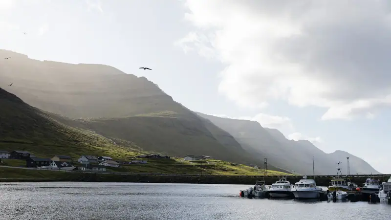
The first image of Suðuroy for most visitors: the harbor of Tvøroyri appearing at the mouth of the Trongisvágsfjørður fjord. Tvøroyri is the island’s largest town, which in the Faroes means a few hundred residents, a main street, a supermarket, a harbor and a calm provincial atmosphere that contrasts pleasantly with the relative bustle of Tórshavn.
What do you do in Tvøroyri?
Tvøroyri is not a museum town. It lives from fishing, a few shops and a typically Faroese community solidarity. It is also the only place on the island where you can stock up: load up on food and water before heading out to explore.
The harbor deserves a stroll: fishing boats, colorful boat sheds and turf-roofed houses climbing the hills make a typically Faroese picture. The view of the fjord from the heights of the village, especially in late afternoon, is remarkable.
The village of Trongisvágur, which residents often call by its full name, forms a continuous built-up area with Tvøroyri; the two are in fact a single main town.
Logistics starting point
Tvøroyri is also your logistics base. This is where you will find the only real accommodation on the island, and the few restaurants and cafés. If you stay a night (recommended), book far ahead.
Accommodation on Suðuroy
Guesthouses and hotels in Tvøroyri and Vágur. Book early, as capacity is very limited in summer.
Fámjin: the village of the Faroese flag
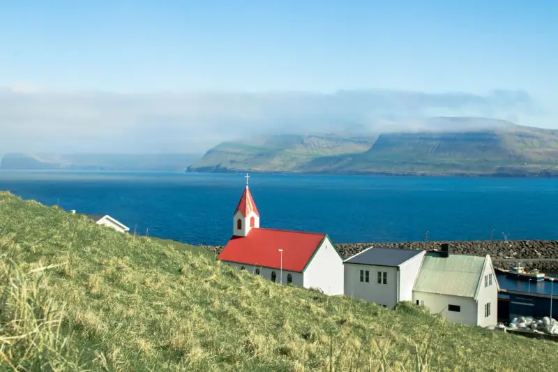
About 16 km (10 mi) west of Tvøroyri (by the island’s roads), the village of Fámjin is one of the places most steeped in history in the whole archipelago. Tucked in a mountain cirque that slopes gently down to a pebble beach and a small harbor, this hamlet of a handful of houses is the legendary cradle of the Merkið, the Faroese national flag.
The story of the flag
Tradition holds that the Merkið, the Scandinavian cross, red edged in blue on a white field, was first raised on June 22, 1919 in Fámjin itself, created that year by Jens Oliver Lisberg and two Faroese students in Copenhagen. The original Merkið (the prototype created by Jens Oliver Lisberg) is kept in Fámjin church, a modest building of wood painted red and white that overlooks the harbor from the hill.
Flaggdagur (Faroese flag day) is celebrated on April 25, the date on which the British officially recognized the Merkið in 1940. The great Faroese national holiday is Ólavsøka, celebrated on July 28 and 29 in honor of Saint Olaf. Fámjin church is therefore much more than a tourist curiosity: it is a place of national memory. You can visit the church freely if it is open; otherwise, the key is usually available from residents.
The road to Fámjin
The road linking Suðuroy’s east coast to Fámjin is one of the most spectacular on the island. It crosses the island’s heights from east to west, with views of both coasts and the fjords. Some stretches are narrow: pass with care and yield on the tightest sections. Parking spots let you stop to photograph the panoramas.
The Beinisvørð cliffs: Atlantic vertigo
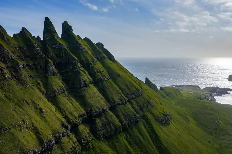
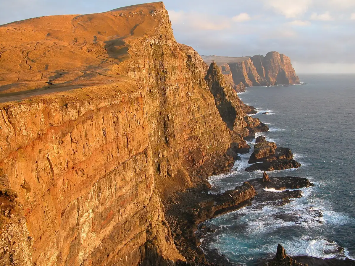
Located in the southern part of the island, above the village of Lopra, not far from Sumba, the Beinisvørð cliffs are Suðuroy’s most impressive natural site. These basalt walls plunge vertically into the Atlantic from a height of more than 450 meters (1,475 ft), a display that leaves even travelers used to dramatic landscapes speechless.
Excursions and activities in the Faroe Islands
Guided tours to the cliffs, hikes and visits to the natural sites of Suðuroy and the archipelago.
Hiking along the cliff edge
A trail runs along the cliff edge and gives successive viewpoints over the Atlantic. The terrain is grassy and undeveloped, with no barriers or guardrails. Approach the edges with great caution, especially in strong wind (frequent on the west coast). The grass can be slippery after rain.
Looking down, you may spot columns of puffins fishing along the walls. Kittiwakes and northern gannets also frequent these cliffs in season. For birdwatchers, Beinisvørð is a top site. See our guide to birdwatching in the Faroe Islands to plan your visit.
Access from Lopra
The starting point for reaching the cliffs is the village of Lopra, at the southwest tip of Suðuroy. A trail leaves Lopra toward the heights above the Atlantic. The village of Hvalba, one of the oldest on Suðuroy, is further northeast on the island and is a separate stop; its turf-roofed houses and small harbor deserve their own visit. The name “Hvalba” (literally “whale farm”, from Old Norse bø meaning farm settlement) recalls the historic importance of whaling in this region.
Vágur: the island’s second hub
At the southern end of the Vágsfjørður fjord, the town of Vágur is Suðuroy’s second settlement. It shares with Tvøroyri the role of service center for island residents. Its harbor is active, and nearby Lake Vágsvatn is a fine setting for a quiet walk.
The coastal road between Tvøroyri and Vágur follows the edge of the fjord and reveals changing views of calm waters and green slopes. The distance between the two towns is short, about half an hour by road, so they combine easily.
Vágur is also a convenient starting point for reaching Sumba and the island’s southern cape.
Sumba: the end of the world, really
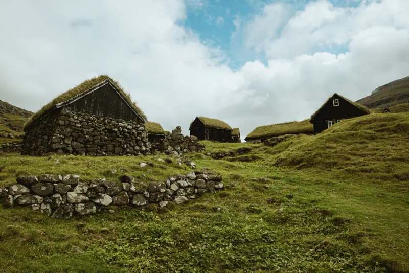
Sumba is the southernmost village in the Faroe Islands. At the southern tip of Suðuroy, this hamlet of a few dozen residents embodies the idea of the end of the world better than any other place in the archipelago. The sea is present on all sides, the wind blows almost constantly and the Atlantic light gives the turf houses a golden tint late in the day.
Not far from the village, the Akraberg lighthouse marks the southern point of Suðuroy. The archipelago extends a few more kilometers south via the isolated rock of Munkurin (also called Sumbiarsteinur), the true southernmost point of the Faroe Islands, visible from the lighthouse in clear weather. The path to the lighthouse crosses open, wind-swept moorland. The view from the point, under clear skies, is one of the most memorable experiences in the archipelago: the North Atlantic as far as the eye can see, with nothing between you and Scotland.
There is nothing to “do” in Sumba in the tourist sense. No café, no souvenir shop, no developed parking lot. That is precisely why this village is precious.
2-day Suðuroy road trip itinerary
Here is a practical breakdown to make the most of the island in two days:
Day 1: Ferry + east coast + Fámjin
- Morning (8 am to 10 am): Ferry from Tórshavn. Enjoy the crossing on deck.
- 10 am to noon: Arrive in Tvøroyri. Stroll in the harbor, stock up.
- Noon to 2 pm: Drive to Fámjin over the heights. Photo stops on the passes with views of both coasts.
- 2 pm to 4 pm: Visit Fámjin: church, harbor, traditional houses.
- 4 pm to 6 pm: Return to Tvøroyri by a different road if possible.
- 6 pm: Dinner and night in Tvøroyri or Vágur.
Day 2: Beinisvørð + Vágur + Sumba
- 9 am to 11 am: Drive to Lopra and the Beinisvørð cliffs. Hike along the cliff edge (2 h minimum).
- 11:30 am to 1 pm: Return via Lopra, lunch break (takeaway supplies preferred).
- 1 pm to 2:30 pm: Drive to Vágur. Walk by Lake Vágsvatn.
- 3 pm to 5 pm: Drive to Sumba and walk to the Akraberg lighthouse.
- 5 pm: Return to Tvøroyri to take the ferry back.
Tip: Check the time of the last ferry back before you set off. Evening crossings can be limited depending on the day of the week. See the SSL site for exact, up-to-date times.
To fit Suðuroy into a complete tour of the Faroes, see our 10-day Faroe Islands road trip.
Where to stay on Suðuroy
Accommodation on Suðuroy is modest but sufficient. You will mainly find family guesthouses in Tvøroyri and Vágur, plus one hotel-type place in Tvøroyri. Rooms are clean and functional, and the welcome warm, typical of Faroese hospitality.
Book ahead without fail, ideally several weeks before you arrive in summer. The island’s total accommodation capacity is very small.
Some travelers choose to sleep in Tórshavn and make the round trip in a day, but this option forces you to choose between Fámjin and the Beinisvørð cliffs; you will not have time to see both. Spending a night on the island fundamentally changes the experience.
For budget accommodation options across the archipelago, see our guide to cheap hotels in the Faroe Islands.
Practical tips for your road trip
When to go: June to August for the long hours of light and the best weather. Because Suðuroy is an exposed island, the weather can be more changeable than on the central islands. Check the forecast on yr.no before each day. To choose the best time for the Faroes in general, read our guide to the best time for the Faroe Islands.
Budget: Plan for the cost of the car ferry (fare varies by season; check at ssl.fo) plus fuel to go around the island, which is modest. Suðuroy is no more expensive than the rest of the Faroes, but since dining options are limited, takeaway meals from Tórshavn can save money. Find all the figures in our Faroe Islands budget guide.
Connectivity: Mobile coverage is generally good in the main villages, but may be intermittent on mountain roads or at the cliff edge. Download offline maps (Maps.me or Google Maps) before you go.
Caution on the roads: Suðuroy’s roads are in good condition but often narrow. Priority goes to the uphill car on sloping sections. Adapt your speed to conditions; fog can appear quickly on the passes.
Respect for the environment: Suðuroy is home to people who live there all year. Never cross fences without permission, leave no trash and respect bird nesting areas in season.
The island of Suðuroy rewards those who make the effort to reach it. In an already spectacular archipelago, it represents the next degree of preserved beauty and authenticity. Two days are enough to grasp the essentials, but you will probably leave promising yourself to return for longer, and you will keep that promise.
Sources
- Strandfaraskip Landsins (SSL): figures checked November 2026
Frequently asked questions
How do you get to Suðuroy from Tórshavn?
Suðuroy is reached mainly by ferry (the Atlantic Airways helicopter exists but is limited to a few flights a week). The operator Strandfaraskip Landsins (SSL) runs several daily crossings from Tórshavn harbor to Tvøroyri, taking about 2 hours. The ferry carries cars, so you can bring your rental car to explore the island freely. Book your car space ahead, especially in summer.
Do you need a car to visit Suðuroy?
A car is strongly recommended to explore the whole island. The villages are linked by sometimes narrow, winding roads, but any standard vehicle can handle them. There is no car rental on the island itself, so you must either bring your own vehicle on the ferry or rent a car in Tórshavn and load it on the boat. Local buses run between the main villages but with limited frequency.
How long does it take to visit Suðuroy?
Allow at least 2 days to discover the island properly: one day for the north (Tvøroyri, Fámjin) and one for the south (Vágur, Beinisvørð, Sumba). A night on the island is ideal to enjoy the evening light and the island's complete calm once the day-trippers have left. It is technically possible to do a round trip in one day, but it is very short.
What makes Suðuroy unique among the Faroe Islands?
Suðuroy is the southernmost and most isolated of the Faroe Islands. Its access by sea only gives it an end-of-the-world atmosphere rare even in the archipelago. The island is known for its dramatic cliffs (notably Beinisvørð), the historic village of Fámjin (legendary cradle of the Faroese flag) and a landscape even more spared from mass tourism than the main islands. It is the favorite destination of travelers seeking Faroese authenticity without the crowds.
What is the southernmost village in the Faroe Islands?
Sumba is the southernmost village in the Faroe Islands, at the southern tip of Suðuroy. Not far away, the Akraberg lighthouse marks the southern point of the island of Suðuroy; the southernmost point of the whole archipelago is the Munkurin rock, about 5 km (3 mi) further south. The village of Sumba has fewer than a hundred residents and offers an atmosphere of absolute serenity, with the cliffs and the Atlantic as its only neighbors.
Where to stay on Suðuroy?
Accommodation on Suðuroy is modest but exists. Tvøroyri and Vágur have a few guesthouses and one or two hotel-type places. It is essential to book far ahead, especially in summer, because capacity is very limited. Some travelers prefer to sleep in Tórshavn and make a round trip in a day, but spending a night on the island remains the best way to really feel its atmosphere.
More Faroe Islands guides
Keep reading
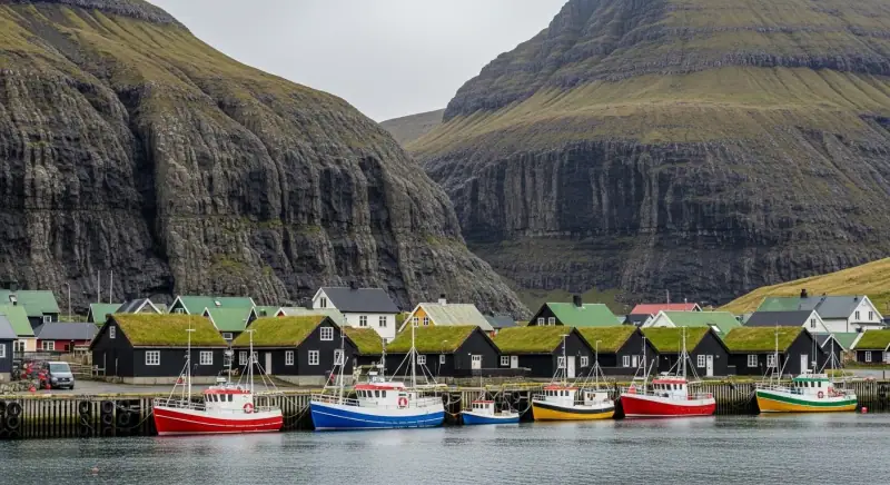
Faroe Islands Budget 2026: What Does It Really Cost?
Hotels, restaurants, car rental and activities: a complete budget guide to plan your trip to the Faroe Islands without bad surprises.
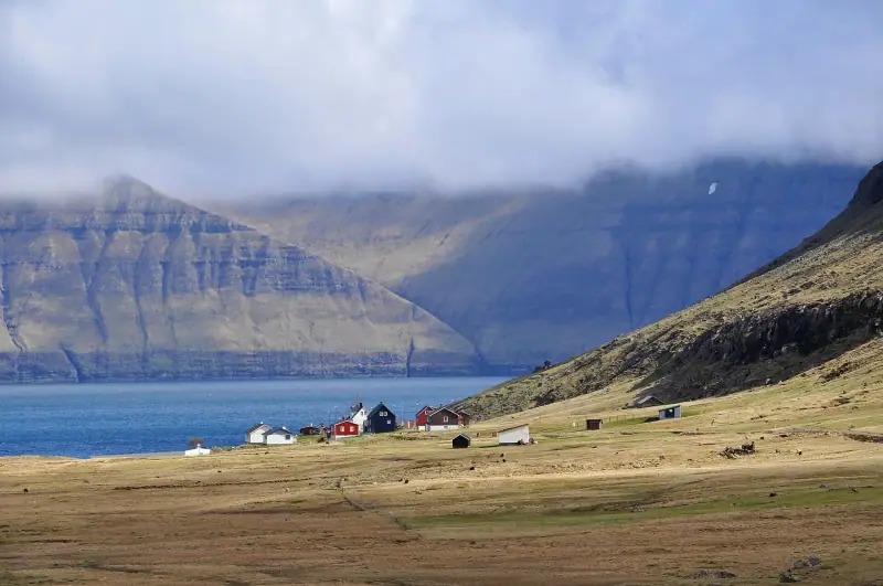
Visiting Eysturoy: Complete Guide to the Faroe Islands' Second Island
Everything for exploring Eysturoy in the Faroe Islands: Gjógv, Eiði, Slættaratindur, Funningur, the Two Giants. Hikes, villages and dramatic landscapes.
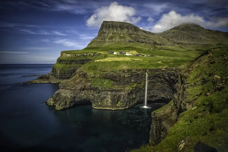
Gásadalur: The Village at the Edge of the World (Múlafossur Waterfall)
Visiting Gásadalur in the Faroe Islands: Múlafossur waterfall, hilltop village, hikes. Complete guide to reaching this remote village on the island of Vágar.
Ready-made
Faroe Islands itineraries
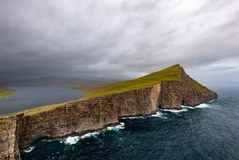
14 days
Faroe Islands Road Trip: A 10 to 14 Day Itinerary by Car
Faroe Islands road trip itinerary in 10 to 14 days. Scenic roads, subsea tunnels, remote villages and the essential natural sites.
2 days
Borðoy Road Trip: 2 Days Between Klaksvík and the Northern Islands
2-day itinerary on Borðoy: Klaksvík, Klakkur, the Kallur lighthouse on Kalsoy, Kunoy and Viðoy. The wild north of the Faroe Islands.