Itineraries
One week in Ecuador: a 7-day itinerary, day by day
We may earn a commission when you book through links on this page, at no extra cost to you. We don't visit or try the places we cover: we summarize published sources. How we work
Day by day
- Day 1Arrive in Quito, walk the colonial historic center
- Day 2Mitad del Mundo, Pichincha cable car, museums and parks
- Day 3Otavalo market and nearby waterfall or crater lake, back to Quito
- Day 4Cotopaxi National Park, Limpiopungo lagoon, night in Latacunga
- Day 5Quilotoa lagoon, then road to Baños
- Day 6Baños: waterfalls, hot springs and outdoor activities
- Day 7Drive back to Quito and depart
Where to sleep
- Quito3 nights
- Latacunga1 night
- Baños2 nights
Opens the trip planner with these stops and nights already filled in. Add a stop, drop one or change the nights.
In short
- Seven days cover the northern and central Andes: Quito (2 days), Otavalo, Cotopaxi, Quilotoa and Baños, with daily drives rarely over three or four hours.
- The first two days are easy in Quito, at about 2,800 m (9,190 ft); the route only climbs above 3,500 m (11,500 ft) at Cotopaxi and Quilotoa afterwards.
- Ecuador uses the US dollar. Keep small bills for buses, markets and park entrances.
- The Galápagos, the coast, Cuenca and the Amazon each need extra time and are best kept for a longer trip.
Seven days is short for a country that combines snow-capped volcanoes, indigenous markets, cloud forests and a world-famous archipelago. It is still enough to build a coherent trip if you accept making choices. This itinerary focuses on the northern and central Andes: a UNESCO-listed colonial capital, a major craft market, an active volcano, a crater lake and a hot-spring resort on the edge of the Amazon.
The route forms a loop with no needless backtracking: Quito, Otavalo, back to Quito, then south to Latacunga, Quilotoa and Baños, before returning to the capital for the flight home. Daily drives rarely exceed three or four hours, leaving time to sightsee rather than to drive.
Before you go: pace and logistics
The key to this week is altitude. Quito sits at about 2,800 m (9,190 ft), and the plan peaks above 3,500 m (11,500 ft) at Cotopaxi and Quilotoa. The first two days are therefore deliberately easy, with walking visits in the capital, before going higher. For anything health-related, ask your doctor or a travel clinic, and see the official travel health pages (CDC in the US, TravelHealthPro in the UK). If you want to go deeper in the capital, our 3-day Quito guide details more neighborhoods and museums.
For seasons, the difference between the drier and wetter periods shows mostly in volcano visibility. Our guide to the seasons in Ecuador helps you choose your dates, and the budget article gives an idea of the costs to plan for.
As for formalities, entry rules depend on your passport. Check the official travel advice of your government before you book: travel.state.gov (US), GOV.UK (UK), travel.gc.ca (Canada), Smartraveller (Australia) (checked November 2026). Our article on formalities, health and money brings the rest together. The official currency is the US dollar, and it helps to keep small bills for buses, markets and park entrances.
To stay connected, check your carrier’s international plan or use a travel eSIM. Saily offers plans in more than 150 countries: check the offer for Ecuador before you leave. Our comparison of SIM cards and eSIMs in Ecuador details the options.
Day 1: arrival in Quito and the historic center
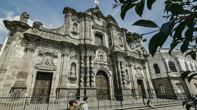
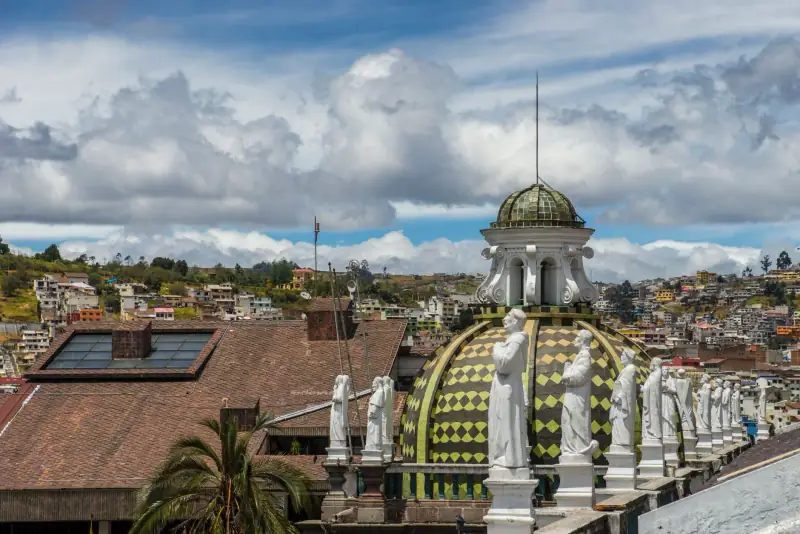
Quito is one of the best-preserved capitals in Latin America, and its historic center was among the first sites inscribed on the UNESCO World Heritage list. For your first day, avoid any athletic ambition: you probably arrive after a long flight, at altitude, with a significant time difference.
Settle in, drop your bags, then set off on foot into the colonial center. The Plaza Grande and Plaza San Francisco, the white facades, wooden balconies and baroque churches make a setting that is easy to discover. The interiors of the large churches are richly decorated, and several can be visited for a small entrance fee. Walk slowly and take breaks.
In the late afternoon, head up to a viewpoint over the city to see the valley stretch between the mountains. In the evening, keep dinner simple. The local soups, very common, make an excellent first meal; our article on Ecuadorian cuisine lists the dishes to try during the week.
For sleeping, the historic center appeals for its atmosphere, while the more modern northern districts are quieter in the evening. Our guide to where to stay in Quito compares the areas.
🏨 Where to stay in Quito: historic center or modern districts, compare accommodation for your first two nights.
Day 2: Quito at altitude and the equator line
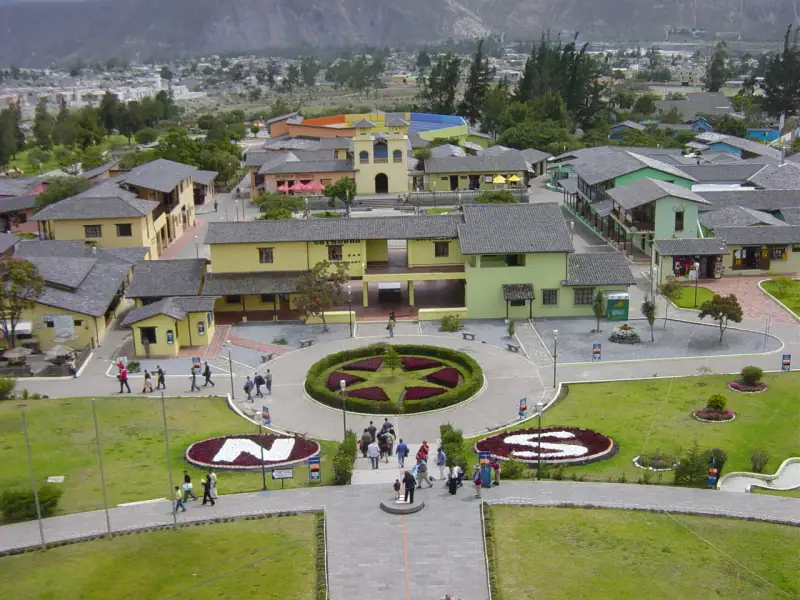
For the second day, enjoy what makes the country unique: its position on the equator. The Mitad del Mundo site is north of the capital, about half an hour by road depending on traffic. It has a monument, exhibits and a chance to be photographed straddling both hemispheres. Keep in mind that the exact line, measured by GPS, passes nearby: an amusing detail that takes nothing away from the charm of the visit.
The rest of the day can be split between museums, parks and panoramas. The cable car rising on the slopes of Pichincha volcano climbs to about 4,000 m (13,125 ft): a spectacular way to gain height over the city, but the altitude is felt as soon as you step out of the cabin. Stay only a short time at the top, and choose a clear morning, as clouds often arrive in the afternoon.
If you prefer calm, spend the afternoon in a city park or a museum, then head back early. Remember that the itinerary gets busier from the next day, so it is better to arrive rested.
Day 3: Otavalo, its market and surroundings
Otavalo is about 95 km (59 mi) north of Quito, a trip of around two hours by bus or car. The town is famous for its craft market, one of the best known in the country, where you find textiles, ponchos, jewelry, baskets and paintings. The market is liveliest on Saturday, but stalls are there all week. If your schedule allows, make this day a Saturday.
Take time to stroll, compare and bargain politely: haggling is common, but keep a friendly tone. Favor locally made pieces and do not rush to buy in the first aisle.
After the market, you can reach a natural site nearby, such as a waterfall reachable on foot or a crater lake, before heading back. Our article on Otavalo and Mindo excursions from Quito offers variations, notably if you prefer a day in the cloud forest. The return to Quito is in the late afternoon; allow a margin, as traffic can slow the entry into the capital.
If you prefer to sleep in town rather than return, see our guide to where to stay in Otavalo. In that case, the next day’s drive to Cotopaxi will be longer: adjust your departure.
Day 4: Cotopaxi National Park and Latacunga
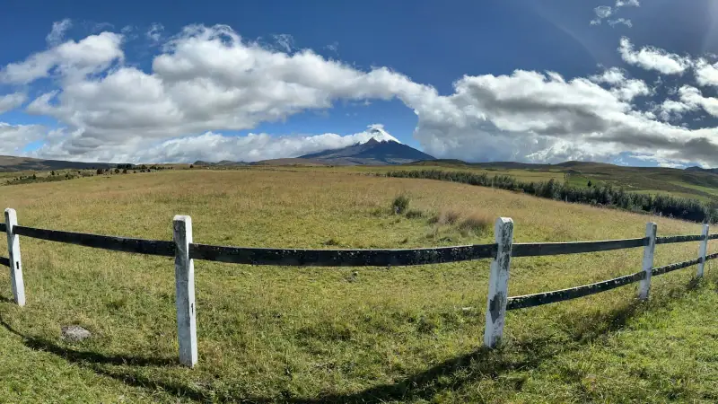
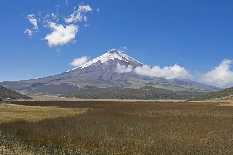
Leave Quito in the morning heading south. Latacunga is about 90 km (56 mi) from the capital, around an hour and a half to two hours of driving. Cotopaxi National Park can be reached before or around this town depending on the entrance you choose. It is one of the most famous active volcanoes in the world, with an almost perfect cone rising to just under 5,900 m (19,360 ft).
In the park, Limpiopungo lagoon, at over 3,800 m (12,470 ft), offers an easy walk of about an hour, with a view of the volcano when the sky is clear. You may also spot wild horses, high-altitude birds and páramo vegetation, the tall-grass landscape typical of the Andes. The more energetic continue to the higher areas, but the climb is steep and on loose ground. Access to these areas can be restricted depending on volcanic activity and weather: ask your accommodation or a local agency.
Climbing to the summit is a mountaineering ascent reserved for equipped people accompanied by a high-mountain guide. It does not fit this one-week program.
End the day in Latacunga, a mid-sized town that is a convenient base for what follows. For a more detailed version of this part of the route, see our article on the Avenue of the Volcanoes.
🎟️ Cotopaxi excursions: guided days, horseback or bike rides in the park. Compare formats, durations and cancellation conditions.
Day 5: Quilotoa lagoon, then the road to Baños
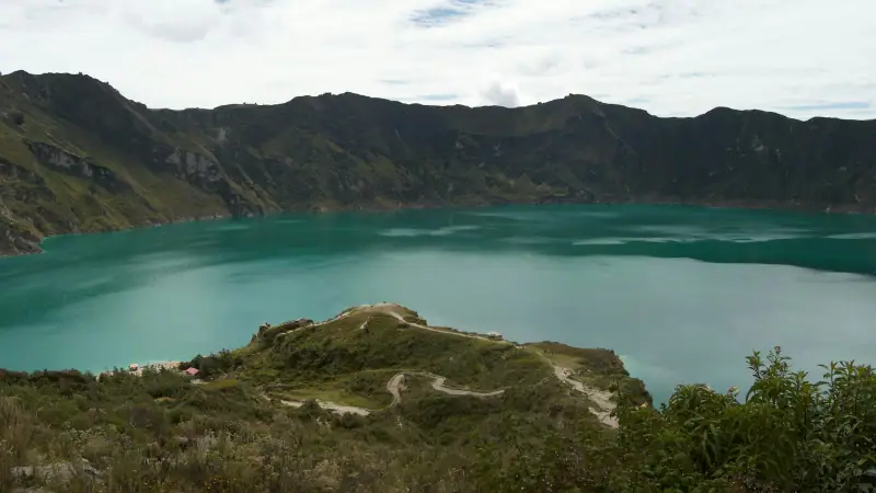
From Latacunga, Quilotoa is about two hours by road, climbing west through Andean villages and terraced fields. Quilotoa is a collapsed volcanic crater filled with a lagoon whose color varies from green to turquoise depending on the light. It is one of the country’s emblematic images.
At the crater rim, enjoy the viewpoints, then, if you are up to it, walk down to the shore on a steep trail. The way down is easy, but the climb back is at altitude, on a dusty trail: allow noticeably more time than for the descent. It is generally possible to ride back up on a mule for a fee. Bring water, sunscreen and a warm layer, as the wind is often cold at the rim, even in sunny weather.
Toward the end of the morning or early afternoon, hit the road to Baños de Agua Santa, via Latacunga and Ambato. Allow half a day of travel with connections if you use public transport. The scenery shifts: Baños nestles at about 1,800 m (5,900 ft), at the foot of Tungurahua volcano, with a milder, wetter and greener climate.
On arrival, wander the center, try the molasses candies stretched by hand in front of the shops, then relax. Our guide to where to stay in Baños helps you choose an area.
Day 6: waterfalls, hot springs and activities in Baños
This is the most playful day of the week. Baños is Ecuador’s capital of outdoor activities: canyoning, rafting, suspension bridges, giant swings facing the volcano, hikes to viewpoints. A scenic road runs down the Pastaza valley to the east, toward the Amazon, passing several waterfalls, including the Pailón del Diablo. You can do it by bike, local bus or on an excursion.
Thrill activities call for a few precautions. Choose an agency that provides equipment in good condition and qualified guides, read recent reviews and do not let a street tout rush you. If you prefer a quiet day, a hike to a viewpoint followed by a thermal bath in the evening makes an excellent plan.
Pools fed by hot springs are the town’s great tradition. They are popular in the evening; for more peace, go in the early morning. Bring a swimsuit, a towel and something to rinse off with after the bath.
🏨 Where to stay in Baños: hostels, small hotels and places with valley views. Compare accommodation for your dates.
Day 7: back to Quito and departure
The last day is for the return. Between Baños and Quito, allow about 180 km (112 mi) and three and a half to four hours, more with traffic or stops. If your flight leaves in the evening, you can use the morning for a last soak or walk before leaving. If the flight leaves early the next day, sleep in Quito rather than risk a delay on the road.
A simple rule: never schedule an international flight the same day without a comfortable margin. Mountain roads can be slowed by a landslide, dense fog or roadworks, and Quito’s airport is outside the city, which adds travel time.
✈️ Find a flight to Quito: fares vary a lot with the season and the number of stops. Compare offers before locking in your dates.
Variations to suit your tastes
The itinerary above is a solid base, but it is easy to adjust.
- More nature: replace Otavalo with a day in the Mindo cloud forest, closer to Quito, to watch birds and orchids.
- More mountains: after Baños, push on to Riobamba and Chimborazo. Our article on Chimborazo, Riobamba and the Devil’s Nose train details this option, but it adds at least a day.
- More cities: if you have ten days, add Cuenca, the beautiful colonial city in the south, with our 2-day Cuenca guide.
- The Galápagos: the archipelago deserves a trip of its own. See our guide to the Galápagos islands to visit to estimate the time needed.
Packing for the week
The climate varies enormously between Quito, Quilotoa and Baños. The principle is to dress in layers: a T-shirt, a sweater or fleece, a waterproof windbreaker, a warm hat for mornings at altitude and comfortable walking shoes. Add a hat, sunglasses and high-SPF sunscreen, as the sun is intense at altitude, even on cloudy days. For the hot springs, a swimsuit and a small towel are useful.
On the electronics side, Ecuador’s sockets are type A/B, as in the United States, with 120 V current. If your plugs differ (for example in the UK or Australia), bring an adapter, and check the input voltage printed on your chargers before you leave.
Practical tips for the week
- Altitude: the plan starts in Quito before going higher. For health questions, ask your doctor or a travel clinic.
- Transport: intercity buses are very cheap and serve the main towns. For natural sites, add a taxi, a pickup truck or an organized excursion.
- Weather: aim for the morning for viewpoints, as summits are often in cloud in the afternoon.
- Money: the US dollar is the country’s currency. Keep small bills, as market vendors and small shops struggle to give change for large notes.
- Insurance: travel insurance with medical assistance is recommended for a stay in the mountains.
- Safety: as in any large city, stay alert with your belongings on public transport and in markets, and avoid walking alone at night in quiet areas.
Following this pace, you will see a very complete sample of the Ecuadorian Andes in a week: a colonial capital, an indigenous market, an active volcano, a crater lake and a spa town, without ever stringing together more than a few hours of driving a day. All that is left is to pick your dates and book.
Frequently asked questions
Is one week enough to see Ecuador?
One week lets you discover the northern and central Andes: Quito, Otavalo, Cotopaxi, Quilotoa and Baños. The Galápagos, the coast, Cuenca and the Amazon each need extra time and are best kept for a longer stay.
Can you add the Galápagos to this 7-day plan?
It is hard without sacrificing the rest: the round-trip flight from the mainland and the minimum number of nights on the islands use up several days by themselves. It is better to plan a dedicated extension, detailed in our guide to the islands to visit.
Do you need to rent a car for this itinerary?
No. Buses link Quito, Otavalo, Latacunga and Baños, and excursions or taxis serve the natural sites. A car gives freedom but means mountain driving, with fog and sometimes poor roads.
How should you handle altitude during the week?
The plan starts with two days in Quito, at about 2,800 m (9,190 ft), and only then climbs to the highest sites. For anything health-related, ask your doctor or a travel clinic, and see the official travel health pages (CDC in the US, TravelHealthPro in the UK).
What budget should you plan for a week?
Ecuador uses the US dollar and stays affordable: buses, set-menu lunches and simple lodging cost little. The main expense is the international flight. Our budget article details costs by category and travel style.
When is the best time for this route?
The drier period, roughly June to September, generally offers the best chances of clear summits. The Andes stay changeable all year: always pack a warm layer and a waterproof jacket.
More Ecuador guides
Keep reading
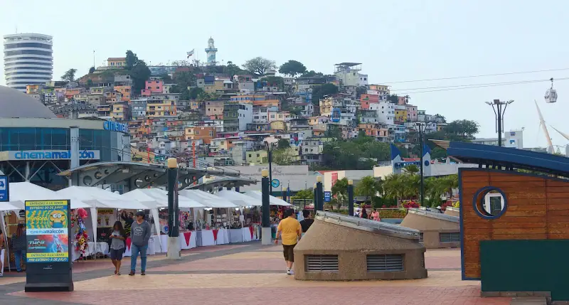
Where to stay in Guayaquil: areas and types of accommodation to help you choose
Where to stay in Guayaquil: downtown and Malecón, Las Peñas, Urdesa, Kennedy, the airport area or Samborondón. Areas, lodging types and tips for choosing.
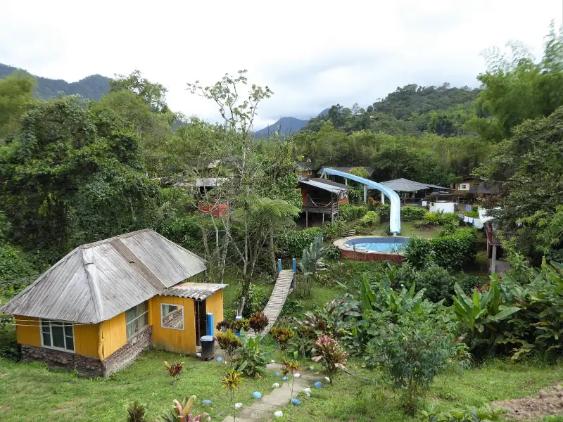
Where to stay in Mindo: areas and types of accommodation to help you choose
Where to stay in Mindo: the village, waterfall roads, river banks, cloud forest lodges. Areas, accommodation types and tips for choosing by trip.
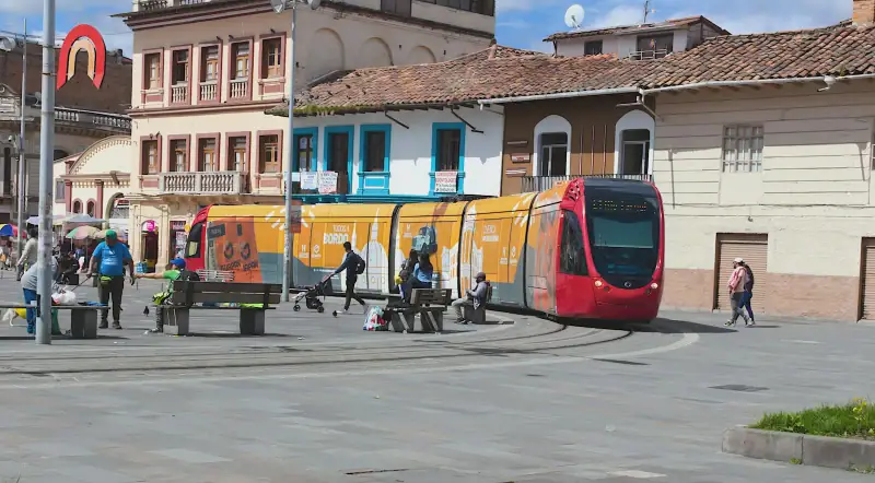
Where to stay in Cuenca: areas and types of accommodation to help you choose
Where to stay in Cuenca: historic center, Tomebamba riverside, San Blas, El Ejido or Turi. Areas, accommodation types and tips for choosing by trip.
Ready-made
Ecuador itineraries
5 days
Avenue of the Volcanoes in Ecuador: Cotopaxi, Quilotoa and Baños in 5 days
A 5-day itinerary on the Avenue of the Volcanoes from Quito: Cotopaxi, Quilotoa lagoon, Baños and Chimborazo, with travel times, stops and altitude notes.
3 days
What to do in Quito in 3 days: historic center, volcano views and the Mitad del Mundo
Quito in 3 days: UNESCO-listed historic center, Panecillo, cable car, La Ronda and the Mitad del Mundo. A realistic itinerary that builds up gradually.