What to see
What to see around Mont Ventoux: the climb, Nesque gorges, Dentelles and villages
We may earn a commission when you book through links on this page, at no extra cost to you. We don't visit or try the places we cover: we summarize published sources. How we work
In short
- Mont Ventoux rises to about 1,910 m (6,266 ft), the highest point in the Vaucluse. Three paved roads lead to the summit, from Bédoin, Malaucène and Sault.
- The Sault road is the gentlest (about 19 km / 12 mi, average grade about 3.5%). The top section can close in high wind, snow or ice.
- A weekend covers the summit, Sault, the Nesque gorges and the Dentelles; add Vaison-la-Romaine and the wine villages with three to four days.
- A car is almost essential. Bring a windbreaker even in summer: the summit is among the windiest places in France.
It can be seen from very far away, sometimes from the Luberon or the Rhône valley: Mont Ventoux, nicknamed the “Giant of Provence,” towers over the northern Vaucluse with a bare summit that looks, in summer, like a field of snow. Yet reducing the region to its summit would be a shame. Around it stretch spectacular gorges, a lacework of limestone ridges, well-known vineyards, a lavender plateau, stone villages and one of the most beautiful Roman cities in Provence.
This discovery guide helps you understand what there is to see in the Mont Ventoux region, site by site, and to put together a stay of one to four days depending on your pace. If you want to combine it with the lavender fields, our 3-day itinerary Valensole, Sault and Luberon already passes through the Sault area. Opening hours, prices and access conditions change: check with tourist offices before you go.
Mont Ventoux, a summit apart
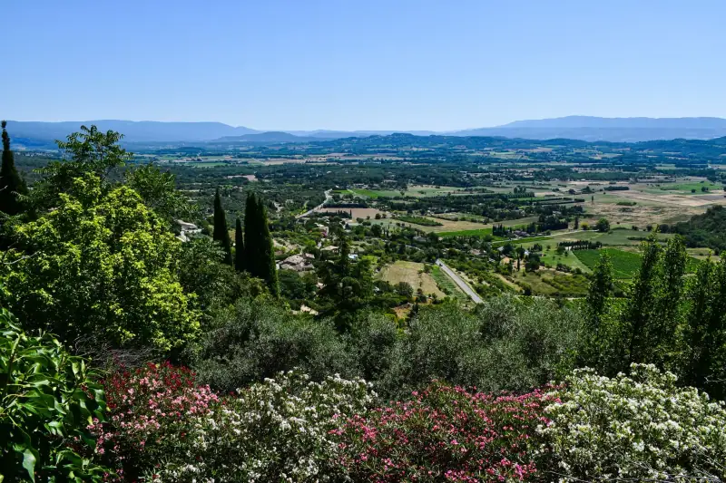
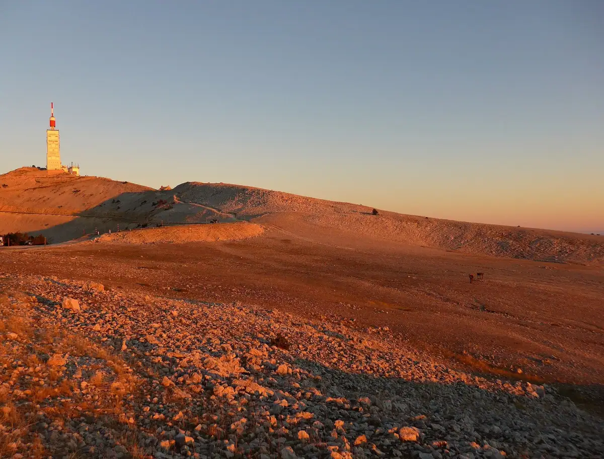
The summit of Mont Ventoux rises to about 1,910 m (6,266 ft), making it the highest point in the Vaucluse. It stands almost isolated above the plain, which explains both the exceptional view from the top and the harshness of the climate. The mountain is classified as a UNESCO biosphere reserve and a Natura 2000 site: the vegetation changes sharply with altitude, from scrubland and holm oaks at the foot to cedars, pines and the white scree of the summit.
A high-mountain climate in the deep south
The summit is very exposed: wind blows about 240 days a year, the mistral is frequent and the average annual temperature is around 3 °C (37 °F). Snow can stay at the summit for a good part of the winter, and fog is frequent. In practice, it can be very hot in Bédoin and late-fall weather at the summit a few kilometers higher up. Always bring a windbreaker, a warm layer and water, even in midsummer.
A tower, an antenna, a panorama
The summit is recognizable from afar by its observation tower with an antenna, installed since the mid-1960s. On a clear day, the panorama extends over the Comtat plain, the Alps, the Luberon and sometimes as far as the Rhône valley. Perfectly clear days are not the rule: if visibility is poor down below, it is better to postpone the climb by a day.
The three roads up Ventoux
Three paved roads lead to the summit. They do not have the same character, and the choice greatly influences the experience.
- From Bédoin (south): about 21.6 km (13.4 mi) with grades between 7.4 and 10%. This is the best-known climb, open since the late 19th century. It first crosses forest, then comes out at the Chalet Reynard before the bare part of the summit.
- From Malaucène (north): about 21 km (13 mi), with an average grade of about 7.5%. This road, laid out in the 1930s to serve the Mont Serein resort, offers fine views of the Dentelles de Montmirail.
- From Sault (east): about 19 km (12 mi) with an average grade of about 3.5%, the gentlest of the three. It joins the Bédoin road at the Chalet Reynard, from where the end of the ascent is shared.
By car, the Sault road is the quietest; by bike, it is the least demanding. For a loop, go up one face and come down another: you won’t see the same landscapes twice. Keep in mind that the summit section can be closed in high wind, snow or ice, particularly in winter: check official information before you go, and never count on the road being open outside the good season.
Ventoux by bike
Ventoux is a legendary cycling climb, regularly used by the Tour de France. A monument near the summit commemorates the British cyclist Tom Simpson, who died on these slopes in 1967: many cyclists stop there. If you ride up, start early, carry plenty of water and warm clothes for the descent, and don’t trust the village weather. For local bike rental companies, ask the tourist offices of Bédoin or Malaucène.
Stay at the foot of Ventoux
Bédoin, Malaucène, Sault: compare hotels, B&Bs and gîtes before the season fills everything.
Hiking on Ventoux
You don’t need to be a cyclist to enjoy the mountain. Old drailles, the paths used by flocks, are now hiking trails, including the GR 4 and GR 9. A pilgrimage path also reaches the summit from Bédoin through the Combe Fiole.
A few principles for hiking safely:
- Choose a suitable loop: routes starting from Bédoin or the Chalet Reynard do not have the same duration or elevation gain. Ask the tourist office for advice or consult an IGN map before you go.
- Start early: in summer, the late-afternoon thunderstorm is a risk in the mountains.
- Come prepared: hiking shoes, plenty of water, a windbreaker, a hat. There is almost no shade in the upper part.
- Respect the reserve: stay on the trails, don’t pick anything and take your litter with you.
In winter, the Mont Serein resort, on the north side, lets you discover the mountain on snowshoes or cross-country skis when snow conditions allow. Check conditions before you travel.
Sault and its lavender plateau
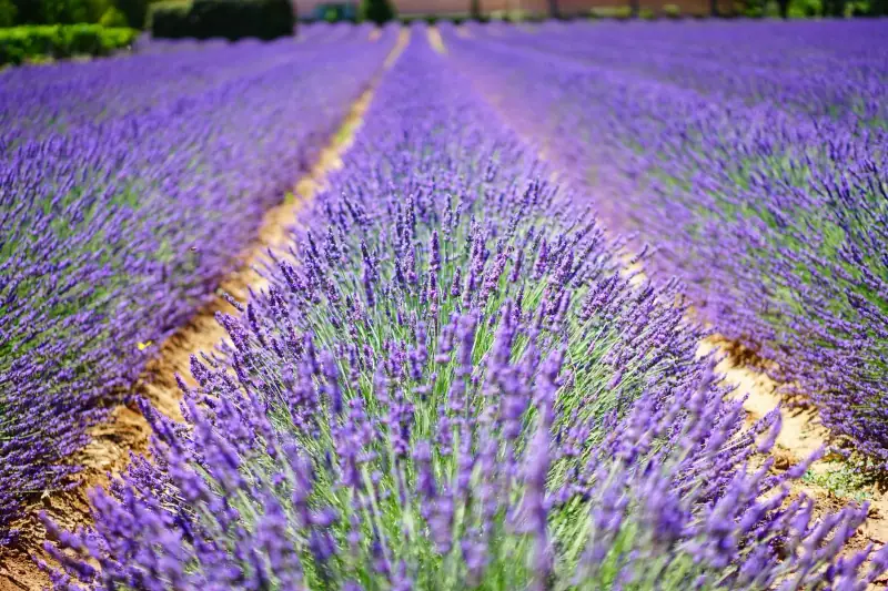
Perched at about 760 m (2,490 ft), Sault is the village that opens Ventoux to the east. With about 1,300 inhabitants, it is oriented toward mountain farming: lavender and lavandin, einkorn wheat, honey and other local products. It is also known for its nougat, made by a local firm known beyond the region.
Each year the village holds the Lavender Festival on August 15. Bloom depends on the weather and altitude: it is generally later than in Valensole, which makes it a good destination for the end of the season. Our guide to when to go to Provence details the calendar.
Sault is a good base if you are looking for calm: it is away from the main roads, close to the gentlest road to the summit and within reach of the Nesque gorges. To compare places to stay in Provence, see our guide on where to stay in Provence.
Excursions around Ventoux
Don't want to drive on mountain roads? Compare guided visits and excursions in the region.
The Nesque gorges
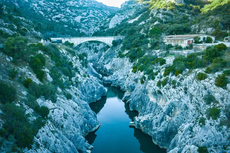
The Nesque gorges cut into the Vaucluse mountains between Monieux and Méthamis. The river drops from about 625 m (2,050 ft) south of Monieux to about 270 m (886 ft) at the foot of Méthamis, a loss of about 355 m (1,165 ft). Some cliffs exceed 200 m (656 ft) in height, which gives the road running alongside them an almost alpine character.
The D942, a viewpoint road
The D942 departmental road follows the heights of the gorges and offers several developed viewpoints, including a lookout at about 734 m (2,408 ft). The most famous is the Castelleras viewpoint, from where you see the Rocher du Cire, called Lou Roucas dou Cire in Provençal. A stele in honor of Frédéric Mistral was placed there in 1966. It is an excellent photo stop, best in morning or evening light.
Hiking in the gorges
The GR 9 crosses the gorges near the Saint-Michel chapel. The hikes there are more committing than the roadside stops: the terrain is rocky and shade is limited. Find out about passable trails and safety conditions before you go, especially in great heat.
The Dentelles de Montmirail
West of Ventoux, the Dentelles de Montmirail form a long ridge of upturned limestone slabs, resembling lace cutouts. The massif is about eight kilometers (5 mi) long and covers nearly 5,000 hectares (about 12,400 acres). It lies north of Carpentras, south of Vaison-la-Romaine and west of Ventoux. Its highest point is the Saint-Amand ridge, at about 722 m (2,369 ft).
Villages and vineyards
The massif is shared among several communes: Gigondas, Vacqueyras, Sablet, Séguret, Beaumes-de-Venise, Le Barroux, Lafare, Suzette and La Roque-Alric. It lies within the Côtes-du-Rhône appellation, and its slopes carry terraced vines. It is an ideal setting to combine hiking and tasting: a walking loop in the morning, a winery visit in the afternoon. To better understand the appellations, read our guide to Provence wines.
Hiking and climbing
The massif is also a place for hiking, mountain biking and rock climbing. The trails are fairly technical on the ridges; ask the tourist office for advice before choosing a route, and carry water.
Le Barroux and its villages
Le Barroux is a village of about 660 inhabitants, perched on a limestone pinnacle. Its castle overlooks the Comtat plain. A fortress was built there in the 12th century; it was turned into a Renaissance castle in 1538, then fortified in the late 17th century. Burned in 1944, it was restored from the 1960s and is only partly open to visitors. The commune also has the Sainte-Madeleine abbey, founded in the late 1970s and raised to abbey status in 1989.
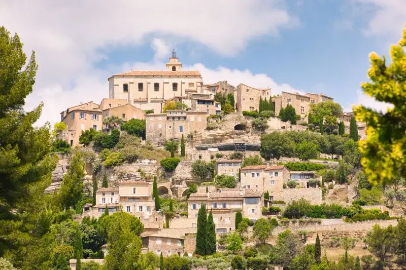
In the surrounding area, Séguret, Gigondas and Beaumes-de-Venise are among the typical villages of the Dentelles. Take time to stroll there on foot: cobbled lanes, fountains, views over the vines. To compare these villages with others, our guide to Gordes and the hilltop villages of the Luberon offers a good point of comparison.
Vaison-la-Romaine, ancient city and medieval town
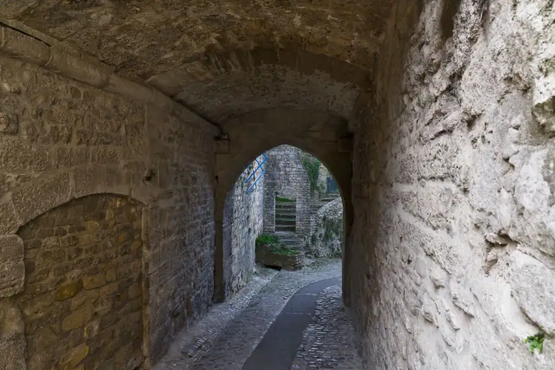
Northwest of Ventoux, Vaison-la-Romaine is one of the richest cultural stops in the region. At its height in the 2nd century, the city covered about 70 to 75 hectares (about 173 to 185 acres); about fifteen hectares (37 acres) of the Gallo-Roman town have been uncovered, the rest lying under the present-day town.
What to see:
- The Gallo-Roman remains: the excavated districts, including La Villasse, are visited in several groups. Check ticket offices and hours before you travel.
- The Roman bridge: a single arch spans the Ouvèze. It withstood the flood of September 22, 1992.
- The medieval upper town: built on a rock on the left bank of the Ouvèze, it dates largely from the 13th century. Its comital castle, built by the counts of Toulouse and later passed to the popes, overlooks the town.
- Notre-Dame-de-Nazareth cathedral and its cloister: a Romanesque building to discover in peace.
- The Tuesday market: one of the oldest in the region, authorized in 1483 by Pope Sixtus IV. It can host several hundred vendors in summer. Come early to find parking.
Wine tastings in the Dentelles
Winery visits, food walks and workshops around Gigondas and Vaison-la-Romaine.
Planning your stay
A weekend: summit and gorges
- Day 1: climb to the summit of Ventoux, by the Sault or Bédoin road, with a stop at the Chalet Reynard, then lunch and a stroll in Sault.
- Day 2: Nesque gorges along the D942 with the viewpoints, then the road to the Dentelles de Montmirail for a walk and a tasting.
Three to four days: add Vaison and the vineyards
Add a day in Vaison-la-Romaine (ideally a Tuesday for the market) and half a day in the villages of Gigondas, Séguret or Le Barroux. This itinerary stays compact: distances between stops are short, but the roads are winding, so allow more time than the map suggests.
When to come
- Late June to August: lavender and wide horizons, but heavy crowds and heat. Early morning is ideal for going up to the summit.
- May-June and September-October: excellent periods for hiking, with soft light and fewer people.
- Winter: summit often cold, windy or snowy, road sometimes closed. Stick to the villages and wineries.
Getting around
A car is almost essential: public transport serves mountain villages poorly. Mountain roads are winding and the summit is exposed: check the road status before going up. Our guide to getting around Provence compares the options.
Rent a car for Ventoux
Compare rental companies: in season, cars go fast, so book early.
Practical tips
- Weather: check the mountain forecast, not just the village’s. Wind can make the summit uncomfortable, even dangerous.
- Water and food: few places to resupply at altitude, so stock up before going up.
- Booking: accommodation fills early in July and August, and during cycling events.
- Respect for nature: stay on the trails, take your litter with you, don’t pick lavender from the crops.
- Budget: to estimate your spending, see our guide to the Provence budget.
Key takeaways
The Mont Ventoux region is much more than a legendary climb: it is a complete territory, with a windy summit, spectacular gorges, the ridges of the Dentelles de Montmirail, a lavender plateau around Sault, vineyards and the Roman city of Vaison. A weekend lets you taste the essentials; three or four days leave time to hike, taste and stroll. Check the weather and the road status before going up, leave some flexibility in your stops, and let the variety of the landscapes surprise you.
Frequently asked questions
How high is Mont Ventoux?
The summit rises to about 1,910 m (6,266 ft) by the most-cited value, making it the highest point in the Vaucluse. A 2016 survey by the departmental council measured the highest point of the road at about 1,897 m (6,224 ft). That small difference explains why you find several figures depending on the source.
Which roads lead to the summit of Mont Ventoux?
Three roads lead to the summit: from Bédoin in the south (about 21.6 km / 13.4 mi, grade of 7.4 to 10%), from Malaucène in the north (about 21 km / 13 mi, average grade of about 7.5%) and from Sault in the east, via the Chalet Reynard (about 19 km / 12 mi, average grade of about 3.5%, the gentlest). The Bédoin and Sault roads join at the Chalet Reynard.
Can you drive up Mont Ventoux?
Yes, all three roads are paved. The summit section can be closed in winter or in strong wind, snow or ice. Check the road status on official sites before you go, and keep a windbreaker even in summer: the summit is often windy and noticeably cooler than the plain.
What is the weather like at the summit of Mont Ventoux?
The summit is one of the windiest places in France. Wind blows about 240 days a year, the mistral much of the year, and the average annual temperature is around 3 °C (37 °F). Snow can linger for a good part of the winter. Even on a perfect day in the valley, bring a jacket, a windbreaker and good shoes.
How long does it take to visit the Mont Ventoux region?
A weekend is enough for a first discovery: one day for the summit and Sault, one day for the Nesque gorges or the Dentelles de Montmirail. With three to four days, you add Vaison-la-Romaine, the wine villages and a few hikes without rushing.
Where should you stay to visit Mont Ventoux?
Bédoin, Malaucène and Sault are the most practical bases, each at the foot of an access road. Bédoin and Malaucène suit cyclists and walkers; Sault, higher and quieter, is ideal for lavender and panoramas. For the vineyards and the Dentelles, look instead at Vaison-la-Romaine or the villages around Gigondas.
When can you see lavender around Mont Ventoux?
Around Sault, bloom is generally a little later than elsewhere in Provence, with a peak often around mid-July depending on the year. Dates vary with the weather: ask the tourist office before you book. Our guide to the lavender seasons details the calendar.
More Provence guides
Keep reading
What to see on the Valensole plateau: villages, lavender and gorges to explore
What to see on the Valensole plateau: Riez, Valensole, Puimoisson, Gréoux, Quinson and Les Mées, villages, heritage and landscapes beyond the lavender.
What to see in the Alpilles: Les Baux, Saint-Rémy and villages worth a stop
What to see in the Alpilles: Les Baux-de-Provence, Saint-Rémy, Glanum, Fontvieille, olive groves and trails. A guide to plan 2 to 3 days in the range.
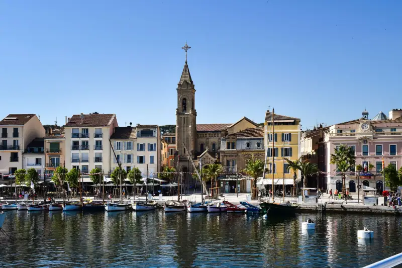
Visiting Cassis: what to see and do in 1 to 2 days
Harbor, Cap Canaille, Route des Crêtes, calanques from Port-Miou to En-Vau, local white wines: a guide to visiting Cassis and planning your stay.
Ready-made
Provence itineraries
3 days
Lavender route in Provence in 3 days: Valensole, Sault and the Luberon, stops and distances
Moustiers-Sainte-MarieSault
3 days
3 days between Marseille, Cassis and Aix-en-Provence: a detailed itinerary
3-day Provence itinerary: Marseille and the Vieux-Port, Cassis calanques, Aix-en-Provence and its fountains. Day by day, distances and tips.
5 days
5-day Provence itinerary: Avignon, Luberon, Alpilles and Camargue
A day-by-day 5-day Provence itinerary: Avignon, Luberon, Alpilles, Arles, Camargue, Aix and Cassis, with realistic distances and practical tips.
Can be adapted in the planner