What to see
Visiting Salta and the Quebrada de Humahuaca: a guide to northwest Argentina
We may earn a commission when you book through links on this page, at no extra cost to you. We don't visit or try the places we cover: we summarize published sources. How we work
In short
- Salta is the best base, with an airport linked to Buenos Aires (a domestic flight of about two hours).
- The Quebrada de Humahuaca can be explored in one long day or, better, in two to three days; it has been a UNESCO World Heritage site since 2003.
- Altitude rises fast: Salta is at about 1,200 m (3,940 ft), Tilcara about 2,500 m (8,200 ft), Humahuaca almost 3,000 m (9,840 ft).
- The dry season, from autumn to the end of the austral winter (about March to October), is the most comfortable.
Far from the clichés of Buenos Aires, northwest Argentina shows a very different face of the country: mountains striped with red, ochre and green, adobe villages with dusty lanes, high-altitude vineyards and a thriving Andean culture. Salta, the regional capital, is an ideal base to explore the famous Quebrada de Humahuaca, a UNESCO site, and the road to Cafayate. Here is how to plan this trip.
In short:
- Salta is the best starting base, with an airport linked to Buenos Aires
- The Quebrada de Humahuaca can be explored in one long day or, better, in two to three days
- Altitude rises quickly along the route
- The dry season, from autumn to the end of the austral winter, is the most comfortable
Salta, the ideal base in the northwest
Nicknamed “la Linda” (the beautiful), Salta is a colonial city surrounded by mountains, at about 1,200 m (3,940 ft) of altitude. Its center is organized around Plaza 9 de Julio, lined with arcades, cafés and the cathedral. It is a pleasure to stroll, to discover churches, museums devoted to Andean history and lively nightlife, notably in the peñas, venues where you listen to folk music over dinner.
The city deserves a full day, especially if you arrive from Buenos Aires on a domestic flight of about two hours. The cable car up San Bernardo Hill gives an overview of the Lerma Valley. In the evening, try empanadas salteñas, famous across the country, locro or tamales.
For lodging, the city center is the most practical: everything is on foot, excursion agencies are plentiful and departures to the quebrada leave early in the morning. Boutique hotels in colonial houses sit alongside cheaper hostels.
Staying in Salta?
Hotels, guesthouses and hostels in central Salta: compare by dates.
The Quebrada de Humahuaca, a listed cultural landscape
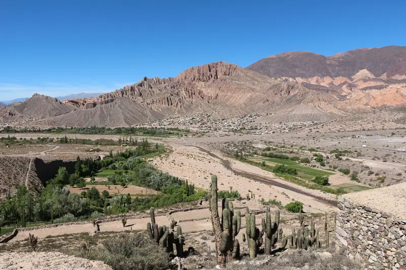
The Quebrada de Humahuaca is a long, narrow valley carved by the Río Grande, climbing north from the Jujuy area to the altiplano. It has been a UNESCO World Heritage site since 2003. For centuries it served as a corridor between the Andean highlands and the plains: llama caravans, pre-Columbian peoples, then the Spanish used it.
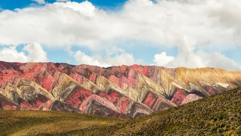
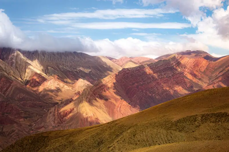
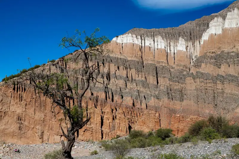
What strikes you first is the color. The sedimentary rocks, red, pink, yellow, green or gray depending on the minerals, form walls and hills that the morning or late-day light makes spectacular. Cardón cacti, small raw-earth villages and llama herds complete the picture.
From Salta, allow about three hours’ drive to reach Purmamarca and half a day to reach Humahuaca, farther north. The road follows the valley and offers many viewpoints: plan to stop, if only for photography.
Purmamarca and the Hill of Seven Colors
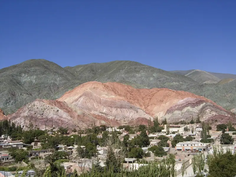
Purmamarca is probably the most photographed village in the quebrada. It lies at the foot of the Cerro de los Siete Colores, a hill whose colored layers are especially beautiful in the morning. A small circular road, often called the “Seven Colors loop”, lets you see it up close, on foot or by car.
In the center, the main square hosts a craft market with wool weavings, hats, cardón wood objects and jewelry. Prices are sometimes negotiable, but generally stay reasonable. Restaurants serve simple Andean food: empanadas, llama or quinoa stews, corn-based dishes.
Sleeping in Purmamarca lets you see the hill without the crowd of day excursions, when the colors are softest. It is also a starting point for the climb to the Salinas Grandes, an immense salt desert above 3,000 m (9,840 ft), reached by a winding mountain road.
An excursion in the quebrada?
Guided days to Purmamarca, Tilcara and Humahuaca, or to Cafayate, to book ahead.
Tilcara and Humahuaca, high-altitude villages
Farther north, Tilcara is a lively village, popular for its relaxed atmosphere, small museums and pedestrian lanes. Its archaeological site, the Pucará de Tilcara, is a partly reconstructed pre-Columbian fortress perched on a hill overlooking the valley. You climb gently, among cacti and stone walls, for a view over the quebrada.
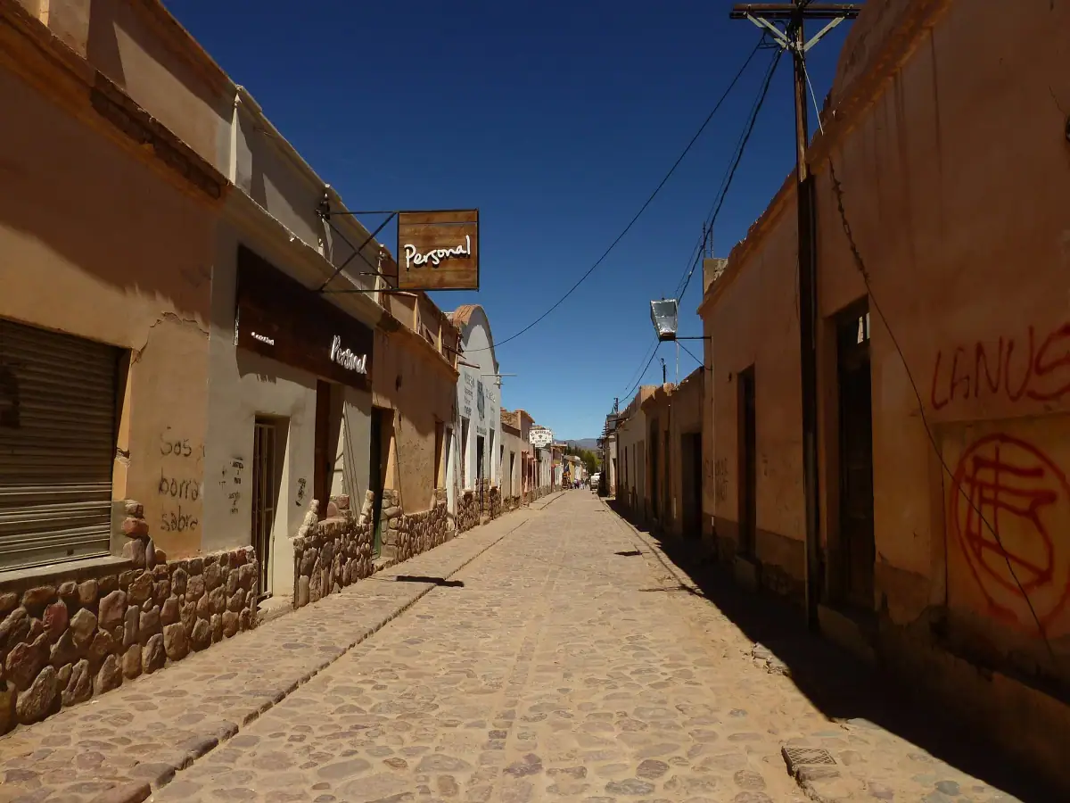
Humahuaca is the town that gave the valley its name. You explore it on foot around its square, with its church, craft market and an independence monument that dominates the town. The cobbled streets, low facades and high-altitude light give the whole a very Andean charm. Farther on, the colorful Hornocal hill, about thirty kilometers (19 mi) away, is another famous viewpoint, but it lies above 4,000 m (13,120 ft).
From Tilcara on, altitude becomes a factor: the town is at about 2,500 m (8,200 ft), Humahuaca at nearly 3,000 m (9,840 ft). Ask your doctor or a travel clinic about high altitude, and see the official travel health pages (CDC in the US, TravelHealthPro in the UK).
A night in Purmamarca or Tilcara?
Sleeping in the quebrada lets you enjoy the villages early in the morning and late in the day.
The Cafayate road and the Quebrada de las Conchas
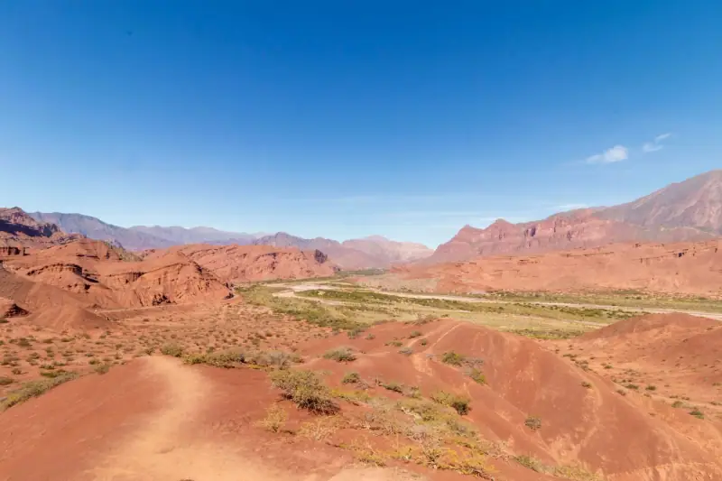
The second major route from Salta leads south to Cafayate along a road that crosses the Quebrada de las Conchas. The cliffs take astonishing shapes carved by erosion: amphitheater, Devil’s Throat, rocks with sculpted silhouettes. Many stops are set up along the road, and the late-afternoon light is especially beautiful.
Cafayate is the wine center of the region. Its vineyards, among the highest in the world, are best known for torrontés, an aromatic white grape, but there are also good malbecs and other reds. Many wineries can be visited and offer tastings, sometimes by reservation. To compare with the country’s most famous wine region, read our guide to Mendoza and its vineyards. Without a car, the bus or an excursion is enough: see how to visit Cafayate without a car.
Allow about three and a half to four hours on the road between Salta and Cafayate. That makes a busy day if you return in the evening: it is better to sleep there and continue, if you wish, to Cachi and its cactus landscapes along the Calchaquí Valleys road.
A 5- to 7-day itinerary
Here is a realistic proposal, to avoid overly long driving days:
- Day 1: Salta. Arrival, historic center, San Bernardo Hill, dinner with folk music.
- Day 2: Purmamarca. Road to the quebrada, Seven Colors loop, craft market, overnight there.
- Day 3: Tilcara and Humahuaca. Pucará de Tilcara in the morning, then Humahuaca and its surroundings in the afternoon.
- Day 4: back to Salta. Photo stops in the quebrada, or an excursion to the Salinas Grandes depending on how you feel.
- Day 5: Cafayate. Road through the Quebrada de las Conchas, torrontés tasting, night in Cafayate.
- Days 6 and 7: Calchaquí Valleys. Cachi and its high-altitude landscapes, before returning to Salta.
This route fits very well into a wider trip: see our 2-week Argentina itinerary.
A Buenos Aires – Salta flight?
Compare domestic flights and flights to Argentina by dates.
Getting around: bus, excursions or car
Several options coexist. Organized excursions from Salta are the simplest way to see the essentials in a day, but they leave little time in each village. Intercity buses reach Jujuy and the quebrada villages at lower cost, at the pace of the local population, and suit flexible travelers.
A rental car gives the most freedom, notably for the Salinas Grandes, the Cafayate road or the Calchaquí Valleys. The main roads are in good condition, but some side roads are dirt, and distances and bends at altitude are more tiring than you might think. Avoid driving at night: animals on the road and blind bends are common.
Practical tips
When to go: the dry season, from autumn to the end of the austral winter, brings clear skies and safe roads, but nights are very cold at altitude. The austral summer is hotter and rainier, with storms late in the day that can disrupt some roads. To refine, see our guide when to go to Argentina.
Gear: temperature swings between day and night are large. Bring warm layers, a windbreaker, sunglasses, a hat and high-SPF sunscreen, as radiation is intense at altitude.
Altitude: ask your doctor or a travel clinic, and see the official travel health pages (CDC in the US, TravelHealthPro in the UK).
Budget and bookings: prices for lodging, excursions and site entrances vary with the season and change regularly. Check them directly before you leave and book ahead in high season, notably for the quebrada villages, where supply is more limited than in Salta.
Frequently asked questions
How many days do you need to visit Salta and the Quebrada de Humahuaca?
Allow at least four to five days: one day in Salta, one or two in the Quebrada de Humahuaca and one for the Cafayate road. With seven days, you can sleep in the villages and avoid overly packed drives.
Should you worry about altitude in northwest Argentina?
Salta is at about 1,200 m (3,940 ft), while the Quebrada de Humahuaca climbs gradually to 3,000 m (9,840 ft) and more, and the salt flats and some passes are higher still. Ask your doctor or a travel clinic, and see the official travel health pages (CDC in the US, TravelHealthPro in the UK).
When is the best time to visit northwest Argentina?
The dry season, from autumn to the end of the austral winter (about March to October), brings clear skies and beautiful light, with cold nights at altitude. The austral summer is hotter and rainier, with storms late in the day.
Can you visit the Quebrada de Humahuaca without a car?
Yes. Buses link Salta to Jujuy and then to the quebrada villages, and many day excursions leave from Salta. A car does give more freedom for photo stops and side roads.
Is the Quebrada de Humahuaca a UNESCO site?
Yes, it has been a UNESCO World Heritage site since 2003 as a cultural landscape, a former route between the Andean highlands and the plains.
More Argentina guides
Keep reading
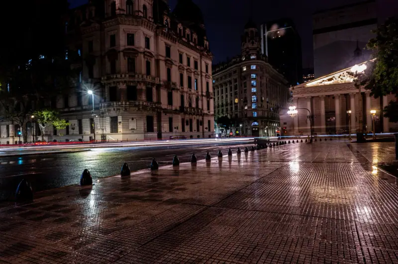
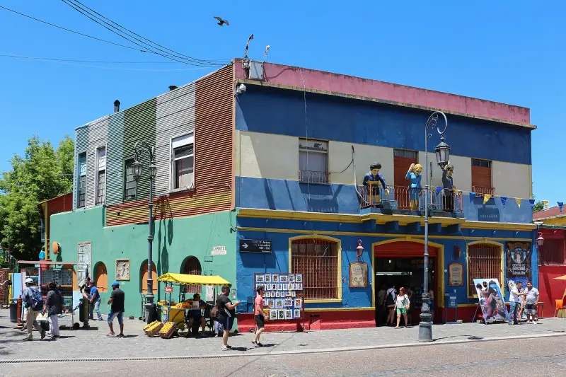
Visiting Buenos Aires: what to see and do in 3 days in the capital
Plaza de Mayo, San Telmo, La Boca, Recoleta, Palermo, Puerto Madero: a 3-day program to visit Buenos Aires, with transport and neighborhood tips.
Complete guide to visiting Argentina: regions, highlights and budget
Plan your trip to Argentina: regions, cities, highlights, best season, transport, lodging and budget. The pillar guide to organize your stay.
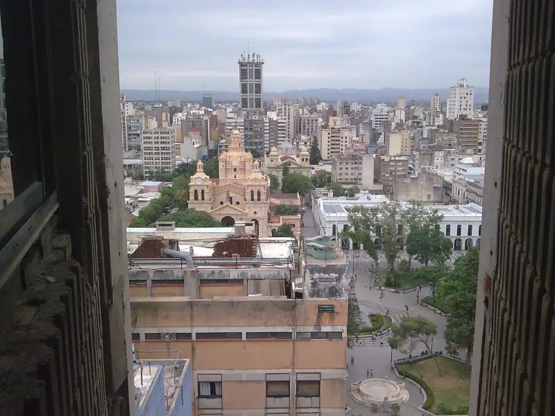
Visiting Córdoba, Argentina: Jesuit city, university and sierras
What to see in Córdoba: the UNESCO-listed Jesuit Block, the historic center, student life and excursions into the sierras. Tips for your stay.
Ready-made
Argentina itineraries
14 days
Argentina in 2 weeks: Buenos Aires, Iguazú, Salta and Mendoza
Buenos AiresPuerto IguazúSaltaMendoza
22 days
Argentina in 3 weeks: Buenos Aires, Iguazú, Northwest, Mendoza, Córdoba and Valdés
Buenos AiresPuerto IguazúSalta and the NorthwestMendozaCórdobaPuerto MadrynBuenos Aires
8 days
Northwest Argentina road trip: Salta, Cafayate, Cachi and Humahuaca in 8 days
SaltaCafayateCachiSaltaPurmamarcaTilcara