What to see
Visiting the Grand Canyon (South Rim): viewpoints, hikes and tips
We may earn a commission when you book through links on this page, at no extra cost to you. We don't visit or try the places we cover: we summarize published sources. How we work
In short
- The South Rim is open year-round and the easiest for a first trip; the North Rim is quieter but closes in winter because of snow.
- One day covers the main South Rim viewpoints; a night on site gives you sunrise and sunset, and two days leave room for a hike.
- Hikers should start early, carry far more water than they think they need, and turn around early: the climb back up is longer than the way down.
- Lodging in the park goes months ahead; Tusayan (south entrance) and Flagstaff (about 1 h 30 away) are the alternatives.
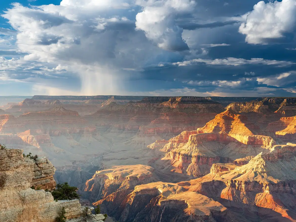
The Grand Canyon is one of the most impressive landscapes in the United States, and perhaps on the planet. Carved by the Colorado River, it stretches for well over 100 miles (several hundred km), reaches about 18 miles (30 km) wide in places and plunges roughly 5,900 ft (1,800 m) below the rim. No photo truly prepares you for that first look, the moment the ground falls away in front of you.
Most visitors arrive via the South Rim, the south side, open year-round and easy to reach from Las Vegas, Flagstaff or Page. This guide helps you organize your visit: understand the park’s geography, choose your viewpoints, decide whether to walk into the canyon and choose the right place to stay.
South Rim or North Rim: which side to choose?
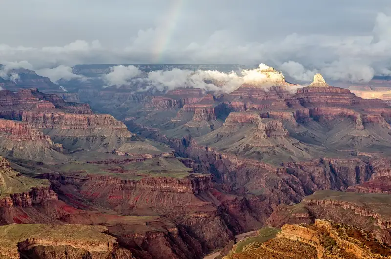
The national park has two main tourist areas, separated by the canyon itself. By road they are very far from each other: allow several hours to get from one to the other.
- The South Rim is the busiest. It has many viewpoints, a free shuttle, services, shops and lodging. It is accessible year-round.
- The North Rim is higher, cooler and much quieter. It closes during the cold season, because snow cuts the access road.
- The West Rim, outside the national park, is managed separately and mostly visited on excursions from Las Vegas.
For a first trip, and particularly as part of a 15-day American West road trip, the South Rim is the obvious choice: it fits easily between Monument Valley, Page and Las Vegas.
Getting to the South Rim and getting around
From Las Vegas, plan on a long day of driving or, better, a stop on the way: the drive is about four and a half hours. From Flagstaff, the road is much shorter, around an hour and a half. Most visitors arrive in a rental car, which gives the freedom to stop at roadside viewpoints.
One practical detail to remember: Arizona does not switch to daylight saving time. In summer, local time is therefore the same as in California and Nevada, but one hour behind Utah; in winter, it is one hour ahead of California and the same as Utah. Check it for your reservations and shuttle schedules.
Once in the park, the simplest is to leave the car in the parking lot and use the park’s free shuttles, which serve the viewpoints and trailheads. Some roads, such as Hermit Road, are reserved for shuttles for much of the year. Routes, schedules and service periods change: check the official National Park Service website before you go, along with entrance fees.
Where to stay near the Grand Canyon?
Tusayan and Flagstaff are the most practical bases. Book early in season: park rooms go months in advance.
The main South Rim viewpoints
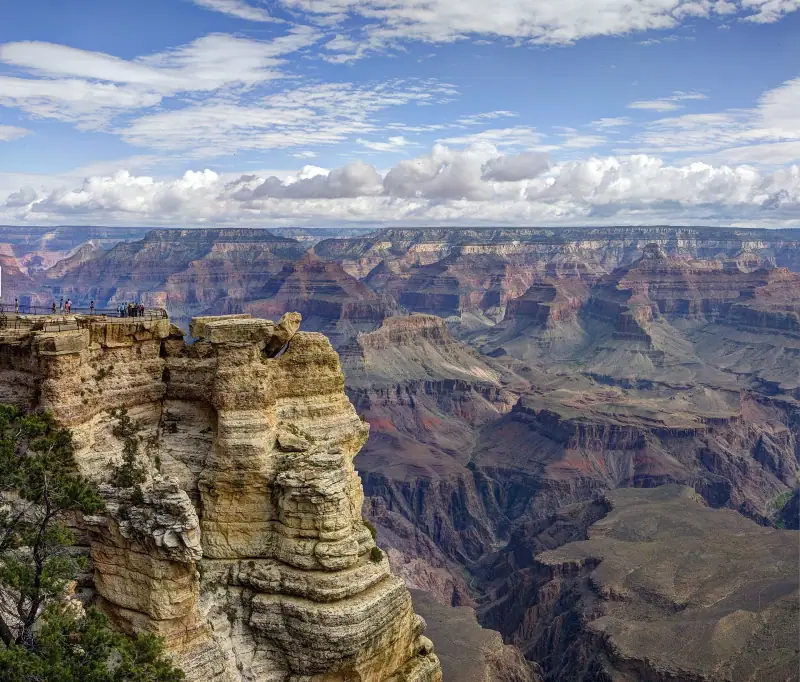
The area around Grand Canyon Village holds the most accessible panoramas, along a largely developed rim trail.
- Mather Point is generally the first stop: it is close to the visitor center and offers a very wide view on arrival.
- Yavapai Point gives a more complete view of the canyon and the river, with a geology museum.
- Hermit Road runs along the west rim for about 6 mi (10 km), with several overlooks. It is served by the shuttle in the main season.
- Hopi Point is known for sunset, because it juts far into the canyon and offers an open horizon.
The Rim Trail, which follows the canyon edge, lets you link several of these points on foot. It is largely flat and accessible, and is the best way to enjoy the canyon without athletic effort. Walk a few miles (a few kilometers), then take the shuttle back.
For sunrise and sunset, leave the village center and choose a less crowded viewpoint. The low light reveals the red, orange and ochre rock layers, which look almost flat at midday.
Desert View Drive: the road east
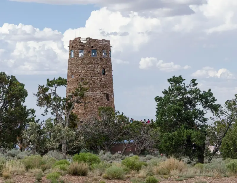
East of Grand Canyon Village, Desert View Drive follows the south rim for about 25 mi (40 km) to the Desert View Watchtower, a stone tower inspired by Native American architecture. This road is driven by car, with many overlooks where you can stop at your own pace.
The landscape changes: the canyon widens, the Colorado River appears more clearly in the depths and the crowds are thinner than around the village. It is also the direction to take when leaving the park for Page, Horseshoe Bend or Monument Valley, which makes it a natural exit from your visit.
Plan half a day if you stop at several viewpoints, more if you like to take photos. Fill up on gas and water before you set off: services are rare once you are on the road.
Grand Canyon excursions
Helicopter flight, guided walk or excursion from Las Vegas: compare the available activities.
Hiking in the canyon: Bright Angel and South Kaibab
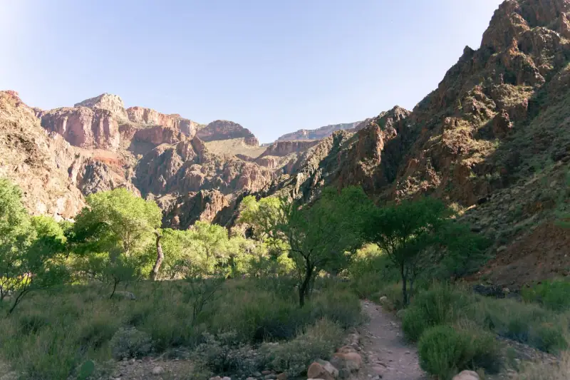
Going down into the Grand Canyon is a very different experience from a simple look from the rim, but it takes preparation. The principle to keep in mind: everything you go down must be climbed back up, and the climb is longer and harder, especially in the heat.
Two trails are the best known.
- The Bright Angel Trail starts near Grand Canyon Village. It is shaded in places and has seasonal water points, which makes it the trail best suited to occasional hikers.
- The South Kaibab Trail offers spectacular, very open views, but almost no shade or water. It is hard to recommend in summer.
For a first experience, half a day is more than enough. Go down for a short while, admire the change of perspective, then climb back well before you get tired.
A few essential safety rules:
- Start early in the morning, particularly from May to September.
- Carry much more water than you think you need, along with salty snacks.
- Wear good hiking shoes and a hat.
- Turn around early: the climb back generally takes longer than the descent.
- Avoid any descent to the river and back in a single day, which rangers advise against.
Conditions change quickly: check the notices posted at the visitor center or on the park’s website. Rangers are the best source of information on trail conditions and available water.
Other ways to discover the canyon
If you don’t want to walk into the canyon, other options exist.
- A helicopter or airplane flight, offered from Tusayan, gives an overview of the site’s immensity. It is a significant expense, but a memorable experience.
- The Grand Canyon Railway, which links the small town of Williams to the park, is an alternative to the car, with an old-fashioned travel atmosphere.
- Rafting trips on the Colorado River require booking very far ahead and suit travelers with more time.
- Guided talks on geology or Native American history, given by rangers, are free and often excellent.
Whatever option you choose, keep time to do nothing: sitting at the edge and watching the light change on the walls is, for many visitors, the best moment of the day.
Flights to Las Vegas or Phoenix
These two airports are the usual gateways to the Grand Canyon: compare flights for your dates.
When to visit the Grand Canyon
The south rim of the canyon sits at over 6,500 ft (2,000 m) elevation. Temperatures there are therefore cooler than at the bottom of the canyon or in the nearby desert. For the season-by-season detail, see our guide to when to go to the American West.
- Spring and fall are the most pleasant seasons: days are mild, the light is beautiful, and crowds stay bearable outside vacations.
- Summer is high season: the South Rim remains bearable, but late-afternoon thunderstorms are frequent, the crowds are heavy and the heat is intense in the canyon.
- Winter is quiet and photogenic, with sometimes snow on the rim. Cold and ice call for caution on the trails.
Whatever the season, arrive early: parking lots and viewpoints are much more pleasant before mid-morning.
Where to sleep and eat near the Grand Canyon
You have three main options for sleeping. To compare the areas in more detail, also read our guide to where to stay in the American West.
- In the park, at Grand Canyon Village: the most practical for sunrise and sunset, but rooms are scarce, expensive and booked far in advance.
- In Tusayan, just at the south entrance: motels and hotels, restaurants and services, a short distance from the park.
- In Flagstaff, about an hour and a half away: more choice, often gentler prices and a real small city with restaurants and breweries, at the cost of a longer drive.
For eating, the village has cafeterias, restaurants and grocery stores, suited to every budget. In season, lines can be long: a picnic prepared ahead and eaten at a viewpoint is an excellent alternative.
Practical tips before you go
- Park entrance: access is paid, per vehicle or per person. The annual national parks pass pays off if you visit several parks during your stay. Check current fees on the official website.
- Elevation: at over 6,500 ft (2,000 m), exertion is more tiring. Hydrate as soon as you arrive.
- Water and sun: sunscreen, a hat and a reusable water bottle are essential.
- Cell coverage: it can be limited. Download offline maps.
- Safe distance: never approach the edge for a photo, and keep your distance from wild animals, notably squirrels and deer.
- Insurance: good travel health insurance is strongly recommended in the United States, where care is expensive.
The Grand Canyon takes a bit of preparation, but it rewards every visitor with a spectacle that is never the same from one hour to the next. Part of a circuit with Zion, Monument Valley and Las Vegas, it becomes one of the great moments of your American West trip.
Frequently asked questions
How long does it take to visit the Grand Canyon?
One day is enough to discover the main South Rim viewpoints, but a night on site lets you enjoy sunrise and sunset, when the colors are most beautiful. Allow two days if you want to add a hike into the canyon.
Which side of the Grand Canyon should you choose, South Rim or North Rim?
The South Rim is open year-round, better served and the most practical for a first trip. The North Rim, more isolated and quieter, closes in winter because of snow. For a first stay in the American West, the South Rim is the simplest choice.
Can you hike to the bottom of the Grand Canyon and back in one day?
Park authorities strongly advise against a round trip to the river in a single day, especially in summer. The climb back is long and the heat in the canyon is much stronger than at the rim. It is better to do a partial hike and turn around early.
Do you need to book lodging far in advance?
Yes, especially for lodging inside the park, often full several months before high season. Tusayan, at the south entrance, and Flagstaff offer alternatives, but book early in spring, summer and fall.
What is the best season to visit the Grand Canyon?
Spring and fall offer pleasant temperatures at the canyon rim. Summer is hot, very busy and prone to thunderstorms. Winter is quiet and bright but cold, with sometimes snow and ice on the trails.
More American West guides
Keep reading
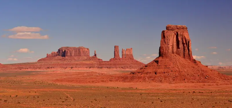
Visiting Monument Valley: buttes, scenic drive and Navajo-guided tours
Plan your Monument Valley visit: scenic drive, Navajo-guided tour, sunrise, Forrest Gump Point, lodging and where it fits in your road trip.
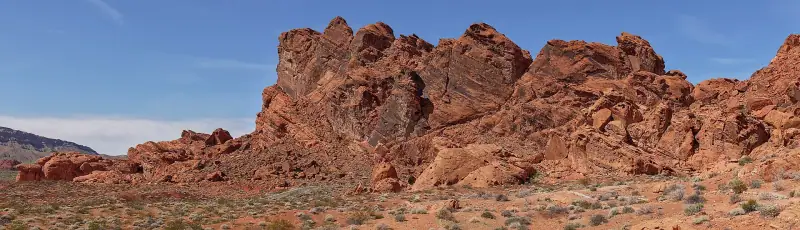
Valley of Fire or Red Rock Canyon: which to visit in half a day from Las Vegas?
Valley of Fire or Red Rock Canyon from Las Vegas: distance, fees, required reservation, hikes and a verdict based on your half day and profile.
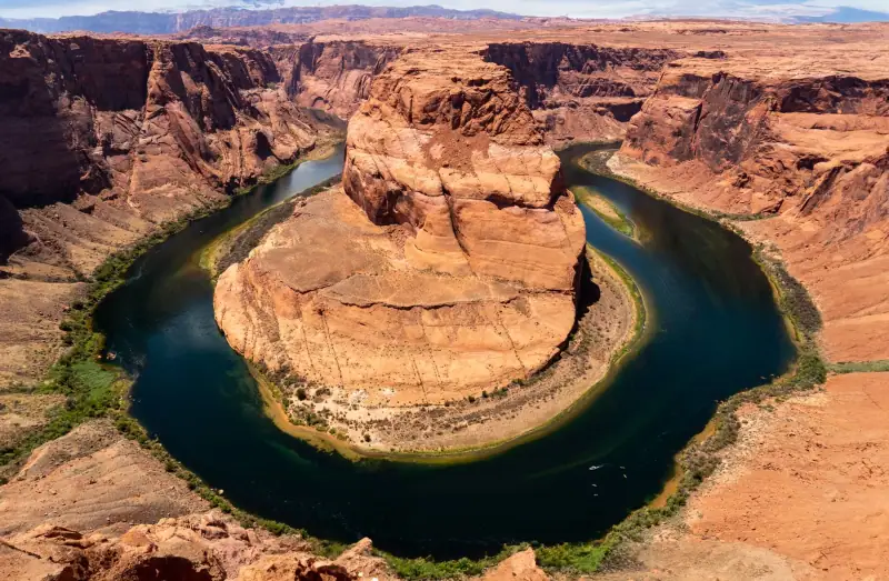
Complete guide to visiting the American West: parks, cities, budget and tips
Complete guide to the American West: regions, national parks, cities, when to go, flights, car, lodging and budget to prepare your road trip.
Ready-made
American West itineraries
8 days
American West road trip in December: 8-day itinerary and passable roads
Las VegasSpringdaleBryce CanyonPageGrand Canyon South Rim
8 days
8-day road trip from Las Vegas: Zion, Bryce, Page and the Grand Canyon
Las VegasSpringdaleBryce CanyonPageGrand Canyon South RimLas Vegas
9 days
9-day road trip: San Francisco, Yosemite, Death Valley and Las Vegas
San FranciscoYosemiteLee ViningLone PineDeath ValleyLas Vegas