Itineraries
9-day road trip: San Francisco, Yosemite, Death Valley and Las Vegas
We may earn a commission when you book through links on this page, at no extra cost to you. We don't visit or try the places we cover: we summarize published sources. How we work
Day by day
- Day 1Arrive in San Francisco
- Day 2San Francisco on foot and by public transit
- Day 3Drive San Francisco to Yosemite
- Day 4Yosemite Valley: hikes and viewpoints
- Day 5Tioga Pass road to Mono Lake and Lee Vining
- Day 6Route 395 along the eastern Sierra to Lone Pine
- Day 7Lone Pine to Death Valley, Furnace Creek area
- Day 8Death Valley to Las Vegas
- Day 9Las Vegas and departure
Where to sleep
- San Francisco2 nights
- Yosemite2 nights
- Lee Vining1 night
- Lone Pine1 night
- Death Valley1 night
- Las Vegas1 night
In short
- The one-way route from San Francisco to Las Vegas covers about 930 mi (1,500 km) in 9 days: two or three long driving days, the rest short legs or sightseeing.
- It depends on Tioga Pass, which usually closes in winter, often from November to May or June. Death Valley is best avoided from June to September.
- Book Yosemite lodging very early and check one-way drop-off fees for the rental car.
- Fill the tank and carry water before Death Valley, where gas stations are rare and cell coverage is very limited.
A foggy bay, granite cliffs, a salt lake at the foot of the mountains, then the lowest point in North America: this 9-day circuit between San Francisco and Las Vegas packs the contrasts of California and the desert into a single crossing. It passes through Yosemite, the eastern Sierra (Mono Lake) and Death Valley, before ending on the Strip.
It is a shorter and more “wild” alternative to our 15-day itinerary through the American West, and a complement to the 8-day loop around the parks of Utah and Arizona. Here you visit fewer cities and spend more time in nature.
The 9-day circuit at a glance
| Day | Stop | Approximate driving |
|---|---|---|
| 1 | Arrive in San Francisco | No car needed |
| 2 | San Francisco | On foot and by public transit |
| 3 | San Francisco → Yosemite | about 200 mi (320 km), 4 to 5 h |
| 4 | Yosemite (valley) | Hikes and viewpoints |
| 5 | Yosemite → Mono Lake (Lee Vining) | about 2 h over Tioga Pass, stops not included |
| 6 | Mono Lake → Lone Pine | about 3 h |
| 7 | Lone Pine → Death Valley | about 2 h |
| 8 | Death Valley → Las Vegas | about 2 h 30 |
| 9 | Las Vegas and departure | Depending on your flight time |
These times are approximate, excluding breaks, photo stops and traffic. They can vary with the season and roadworks.
Before you go: the right season and the right car
This itinerary rests on one constraint: crossing the Sierra Nevada on the Tioga Pass road, which links Yosemite to the eastern Sierra. This high-elevation road is closed in winter, generally for several months, and its reopening depends on snowpack. If you travel in early spring or late fall, check the park’s official information and have a plan B.
Death Valley requires the opposite: the hottest period, from June to September, is best avoided for hiking. The best windows are often May-June for Yosemite (abundant waterfalls, pass generally open depending on the year), then fall for the whole circuit. Our guide to when to go to the American West details the climate month by month.
On entry requirements: entry rules depend on your passport. Check the official travel advice of your government before you book: travel.state.gov (US), GOV.UK (UK), travel.gc.ca (Canada), Smartraveller (Australia) (checked November 2026). Because the route is one way, choose your arrival airport (San Francisco) and your departure airport (Las Vegas) when you book your flight.
Flights to San Francisco, return from Las Vegas
An "open jaw" ticket means you don't have to return the car where you picked it up.
Days 1 and 2: San Francisco
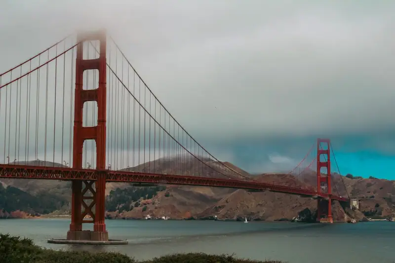
For the first two nights, stay in San Francisco without a car: the city is easy to visit on foot, by streetcar and on public transit, and parking is expensive and complicated. Use these two days to adjust to the time change.
Among the highlights are the Golden Gate Bridge, the Fisherman’s Wharf area, the slopes of Lombard Street, Chinatown and the Victorian houses of Alamo Square. Morning fog is frequent, even in summer: bring a jacket.
Choose a well-located place to stay rather than a cheap room far out: the time saved makes up for the price difference. Our article on where to stay in the American West gives pointers on neighborhoods and hidden fees.
Where to stay in San Francisco
Compare hotels for your dates and check the total price with taxes and fees.
Day 3: San Francisco to Yosemite
Pick up the car in the morning and leave the bay heading east, toward the Central Valley and then the foothills of the Sierra Nevada. Allow about 200 mi (320 km) and 4 to 5 h of driving to Yosemite Valley, more if there is traffic leaving the city. Start early to avoid congestion.
Don’t neglect the car reservation: the one-way San Francisco to Las Vegas rental often carries a drop-off fee. Book ahead and compare conditions.
Think about Yosemite lodging very early: spaces in the park are scarce, and the small towns nearby offer an alternative, with a longer daily drive. Camping is also an option, as detailed in our guide to camping in the national parks of the American West.
Day 4: a day in Yosemite Valley
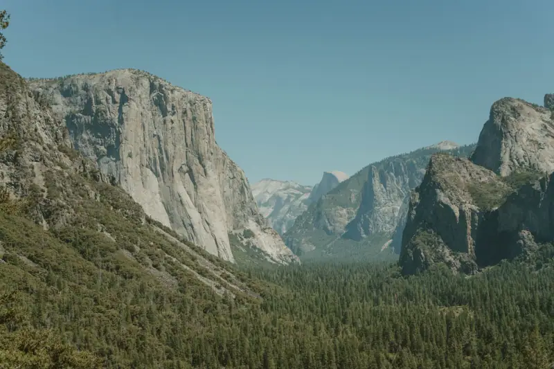
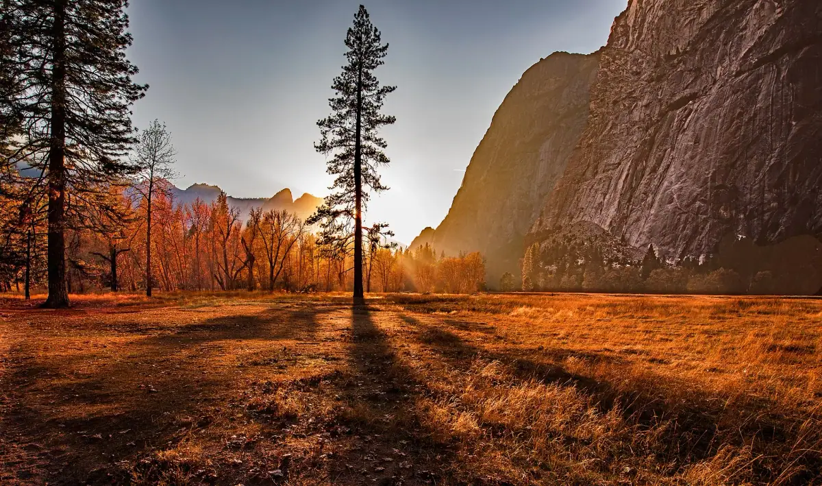
Yosemite is a park of granite, waterfalls and sequoia forests. The valley holds most of the park’s famous sights: the cliff of El Capitan, Half Dome, Yosemite Falls and the meadows where people like to watch the first rays of the sun.
Here is a realistic plan:
- Morning: an early hike, before the crowds. The easiest trails run along the Merced River and the meadows.
- Midday: picnic in the valley. Places to eat exist but can be overcrowded.
- Afternoon: a walk to the foot of a waterfall or a panoramic viewpoint, then sunset over the cliffs.
In early summer, snowmelt gives the falls an impressive flow; at the end of summer, some of them can be almost dry. Black bears frequent the park: store food in the lockers provided, never in the car.
Our guide to visiting Yosemite details the trails, the seasons and the reservation rules.
Excursions around Yosemite
Guided tours and day trips to discover the park without the stress of driving.
Day 5: over Tioga Pass to Mono Lake
This is one of the most beautiful roads in California: the Tioga Pass road leaves the forest, climbs through high granite plateaus, crosses subalpine meadows and lakes, then drops steeply toward the eastern Sierra. From Yosemite Valley, allow about 2 h of pure driving, but plan on much more with stops: several overlooks and lakes are worth the detour.
The road peaks at more than 9,800 ft (3,000 m) in elevation. Breathing is harder, nights are cold, and the weather changes quickly. If the road is closed, you have to go around the Sierra, which adds several hours.
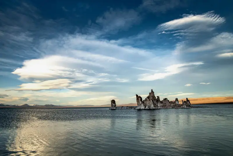
On the way down you reach Lee Vining, a small village on the shore of Mono Lake, an ancient salt lake known for its limestone formations called “tufas”. At sunset, the lake and the mountains change color. It is a striking contrast with the green valley you have just left.
For the night, Lee Vining offers simple lodging, often motels. Book ahead in high season.
Day 6: along the eastern Sierra to Lone Pine
Today the road follows the Sierra Nevada on its east side, along Route 395, with the mountains on your right and desert plateaus on your left. Allow about 3 h of driving to Lone Pine, more with stops.
On the way you can stop at Mammoth Lakes, a mountain resort, or at Bishop, a small valley town. Lone Pine is an Old West town: the Alabama Hills, with their rounded rocks in front of the Sierra range, have served as the setting for many films. Sunset over the granite arches and Mount Whitney, the highest peak in the United States outside Alaska, is a highlight.
Fill up on gas and water here: Death Valley is close, and gas stations there are rare and expensive.
Day 7: Lone Pine and Death Valley
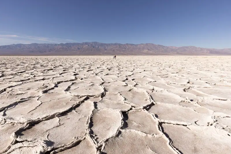
Leave Lone Pine heading east, toward Death Valley. Allow about 2 h to reach the Furnace Creek area, the center of the park, where you will have views over large plains of salt and sand.
Death Valley is a park of extremes:
- Badwater Basin: the lowest point in North America, about 282 ft (86 m) below sea level, covered with salt crusts.
- Dante’s View: a high-elevation overlook above the basin, very beautiful at dawn or at the end of the day.
- Mesquite Flat: sand dunes ideal for evening light.
- Zabriskie Point: eroded hills that turn golden at sunrise.
A few safety rules: drink plenty of water, avoid any hiking in the middle of the day in summer, do not leave the main road without knowing the condition of the track, and know that cell coverage is very limited. Note also that the temperature can climb very fast, even in spring.
Lodging in the park is scarce and expensive; book early. Failing that, some travelers sleep in Pahrump or Beatty, farther away.
Where to stay near Death Valley
Supply is limited and fills up fast: compare options before you lock in your dates.
Day 8: Death Valley to Las Vegas
The last driving leg: about 2 h 30 to reach Las Vegas from the center of Death Valley. Use the early morning to revisit a viewpoint in morning light, then take the road east. On arrival, in a few miles you go from the silent desert to the illuminated casinos.
The city is best discovered in the evening: the Strip with its spectacular casino resorts, its fountains and its street shows. Check the total price of your room, including the mandatory “resort fees”, which can change the final bill noticeably.
Return the car with a full tank, preferably at the airport or at the drop-off point agreed when you booked. For meals, see our guide to what to eat in the American West, and remember tipping in restaurants: it is practically mandatory.
Day 9: Las Vegas and departure
Depending on your flight time, use this last morning for a stroll, an American breakfast or a final tour of a themed casino resort. Leave a margin for the trip to the airport.
If you want to extend the trip, Las Vegas is also the ideal starting point for the parks of Utah and Arizona: Zion, Bryce Canyon and the Grand Canyon are half a day’s drive away. Our 8-day loop is a natural sequel to this circuit.
Budget and practical tips
The budget varies mainly with lodging, the car and the season. Our article on the budget for the American West offers three priced profiles. A few tips specific to this circuit:
- Book early: Yosemite and Death Valley have few beds, and the best lodging goes first.
- Manage fuel: between Lone Pine and Death Valley, and then in the park, gas stations are rare. Fill up whenever you pass a gas station.
- Hydration: plan on at least a gallon (several liters) of water per person per day in the desert.
- Cell coverage: download offline maps before you leave, as there is often no signal in the parks. Check your carrier’s international plan or use a travel eSIM.
- Gear: hiking shoes, a hat, sunscreen and a warm jacket for the elevation. Our selection of accessories for the American West will help you pack.
- Travel insurance: health care in the United States is very expensive; travel health insurance is recommended.
How to adapt the itinerary
If you have one more day, add a night in Yosemite: it is the stop where people most often regret leaving too quickly. A second night allows a real hike or a visit to another part of the park.
If you have one day less, drop the night in Lone Pine and go straight to Death Valley from Mono Lake in one long driving day. It works, but the day becomes very full.
If you travel with kids, choose short trails in Yosemite and avoid long hikes in Death Valley. The drives are long: plan regular breaks, water and activities in the car.
If the Tioga Pass road is closed, give up the eastern Sierra route. End your stay in western California by adding Los Angeles, or choose another time of year. In any case, check road conditions a few days before departure and the day before each mountain leg.
Frequently asked questions
Why drive from San Francisco to Las Vegas rather than the other way around?
Going west to east ends the trip in the desert, where the heat is strongest, and lets you discover the Sierra Nevada with fresh legs. Both directions work, though; what matters is choosing two different airports (one way) and checking the car's drop-off fees.
Is this itinerary possible year-round?
No. The mountain road that crosses Yosemite over Tioga Pass usually closes in winter, often from November to May or June depending on snow. Outside that period you have to go around the Sierra, which noticeably lengthens the trip. Check road conditions on the official websites before you go.
Can you visit Death Valley in summer?
It is not recommended: temperatures regularly exceed 113 °F (45 °C) in July and August, which makes hiking dangerous and strains vehicles. Spring, fall and early winter are much more pleasant.
Do you need to book Yosemite far in advance?
Yes, lodging in and around the park fills up very early, especially from late spring to early fall. Depending on the season, the park may also require an access reservation: check the official National Park Service website.
How many miles is this itinerary?
About 930 mi (1,500 km) for the whole circuit, but the distribution is uneven: two or three long driving days, the rest short legs or sightseeing days in one place.
Do you need a special vehicle?
No, a mid-size car is enough, since the main roads are paved. Do make sure the air conditioning is in good working order, fill the tank before each isolated section and carry extra water.
More American West guides
Keep reading
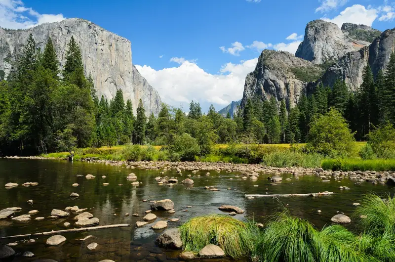
Visiting Yosemite: waterfalls, cliffs and tips for your road trip
Plan your Yosemite visit: valley, El Capitan, Yosemite Falls, Glacier Point, Mariposa Grove, Tioga Road, best season and where to stay.
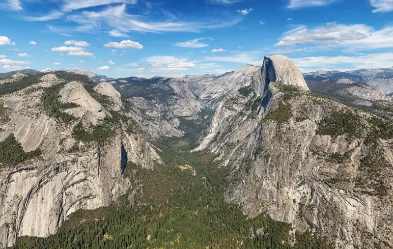
When to go to the American West? A month-by-month guide
When to go to the American West: Death Valley heat, snow at Bryce, closed roads at Yosemite, crowds. A season comparison for your road trip.
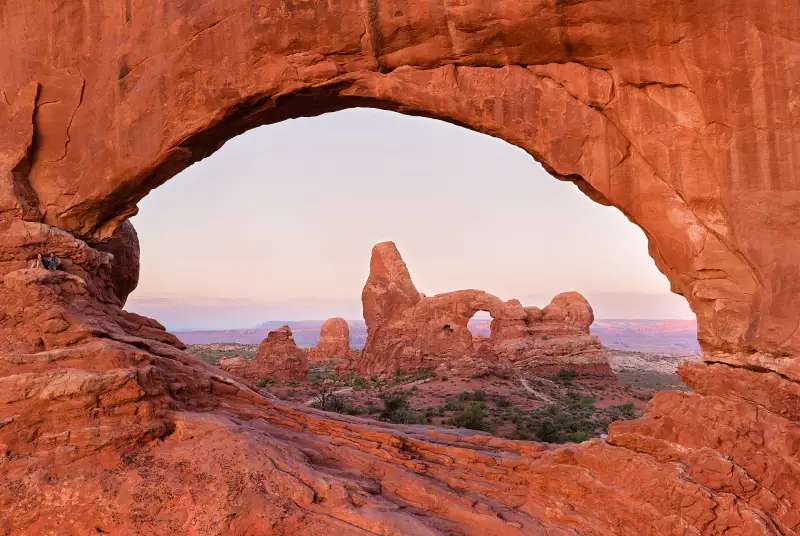
Visiting Arches National Park and Moab: arches, hikes and tips
Plan your Arches National Park visit from Moab: Delicate Arch, Windows, Devils Garden, light, heat, where to stay and your road trip.
Ready-made
American West itineraries
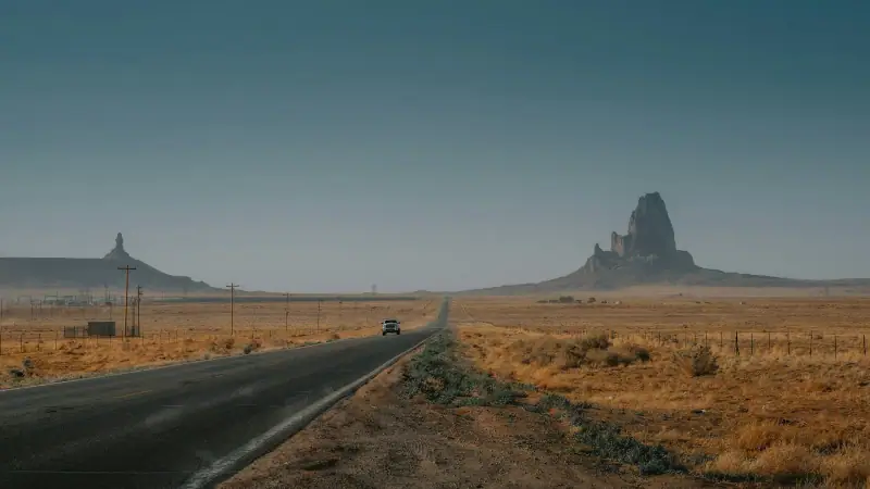
8 days
American West road trip in December: 8-day itinerary and passable roads
Las VegasSpringdaleBryce CanyonPageGrand Canyon South Rim
8 days
8-day road trip from Las Vegas: Zion, Bryce, Page and the Grand Canyon
Las VegasSpringdaleBryce CanyonPageGrand Canyon South RimLas Vegas
15 days
American West road trip in 15 days: day-by-day itinerary
Las VegasSpringdaleBryce CanyonPageMonument ValleyGrand Canyon South RimLas VegasDeath ValleyYosemiteSan FranciscoMonterey and Big Sur