Things to do
The Hà Giang Loop: a motorbike road trip in the northern mountains
We may earn a commission when you book through links on this page, at no extra cost to you. We don't visit or try the places we cover: we summarize published sources. How we work
In short
- The loop is about 350 km (217 mi) of winding mountain roads, done in 3 days at minimum and 4 days for a relaxed pace.
- Hà Giang town is about 300 km (186 mi) from Hanoi, 6 to 7 hours by road; there is no train.
- You can ride as a passenger with a local rider ("easy rider") or travel by car with a driver; riding yourself takes experience.
- September to November is the most popular season; summer brings rain and landslide risk, winter cold and fog.
In the far north of Vietnam, on the Chinese border, Hà Giang province offers one of the finest road trips in Southeast Asia: winding roads clinging to cliffs, gray limestone plateaus, deep valleys, ethnic minority villages and, at the end of the road, the Mã Pí Lèng Pass overlooking an impressive canyon. This Hà Giang Loop, about 350 km (217 mi) long, is traditionally ridden by motorbike in three or four days.
It has become very popular with travelers, and not always for good reasons: some set off unprepared, without the right license, without insurance. This guide gives you the essentials to decide whether it suits you, how to organize it, which itinerary to follow and how to do it safely. Distances and durations are orders of magnitude: roads and weather conditions change quickly in the mountains.
What is the Hà Giang Loop?
The “loop” is a mountain circuit that starts from Hà Giang town, crosses the Đồng Văn karst plateau, climbs to the edge of the border, then comes back down to Hà Giang by another road. This limestone plateau is part of a UNESCO-recognized geopark, which explains the lunar look of some landscapes: blocks of rock, steep slopes, small fields cultivated in the hollows, houses of stone or earth.
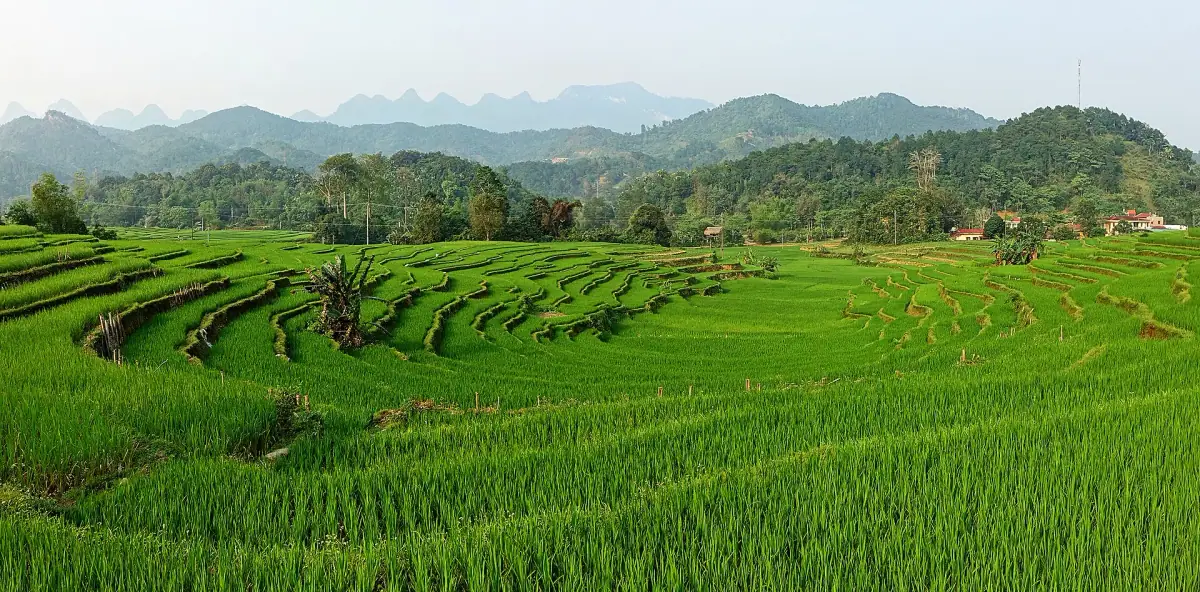
The route goes beyond scenery alone. You pass through territories where many ethnic minorities live, including the Hmong, the Dao, the Tày and the Lô Lô. Each market and village has its own costumes, cultures and rhythm. It is this mix of landscapes and local life that gives the trip its value.
To place Hà Giang among the other northern mountains, see our guide to Sapa and its rice terraces: the two destinations complement each other, but Hà Giang is wilder, more remote and more demanding.
Getting from Hanoi to Hà Giang
Hà Giang town is about 300 km (186 mi) from Hanoi, generally 6 to 7 hours by road depending on traffic and stops. There is no train: you get there by road.
- The day or night bus: lines leave from Mỹ Đình bus station in Hanoi. It is the cheapest option. Night sleeper buses save a night of accommodation.
- The minibus or private transfer: more flexible on schedules, sometimes with hotel pick-up. Compare reviews before booking.
- The organized tour: many agencies sell the loop from Hanoi, with round trip, accommodation and rider. It is the simplest if you have few days.
If you have not yet visited the capital, take a day to get acclimated: our guide Hanoi, what to see and do helps you organize this time before departure.
Find a flight to Hanoi
Hanoi is the gateway to Hà Giang and the northern mountains. Compare flights before fixing your dates.
The three ways to do the loop
Before talking about the itinerary, you have to choose how to travel. This choice affects safety, budget and enjoyment.
Riding yourself: only for experienced riders
Renting a motorbike in Hà Giang and riding alone gives great freedom. But it is also the riskiest option. The roads are narrow, often damaged, with tight corners, gravel, loaded trucks taking the middle of the lane, and animals and children on the road. Fog can come down within minutes.
The rules for riding a motorbike in Vietnam depend on your license and the engine size of the bike: check the official sources before you go. Police checks in the area are more frequent than before. Above all, an insurer can refuse to compensate you after an accident if you do not hold the right license. See our guide to the entry formalities for Vietnam to prepare your papers, and do not hesitate to give up riding if you lack experience.
Passenger with a local rider (“easy rider”)
This is the most common option among travelers. A professional rider who knows the road drives the motorbike; you are the passenger. Advantages: you enjoy the scenery, you avoid the riding risks, and you have a guide for villages and meals. Drawbacks: you have to accept the rider’s pace, and days are long and physically tiring, even when seated at the back.
Choose an operator with good recent reviews, helmets in good condition and a number of days consistent with the route. Beware of offers that are too cheap, which often cut costs on maintenance, training or insurance.
By car with a driver
A car with a driver is the best choice for families, people prone to motion sickness, those who do not want the risk of a motorbike, or when the weather is bad. You lose a bit of the thrill, but you gain comfort, luggage capacity and safety. The scenery is the same, and photo stops are easy to ask for.
Tours and excursions in Hà Giang
Accompanied loop, day excursion or transfer: browse the bookable activities, with the cancellation terms shown on each offer.
The loop in 3 or 4 days
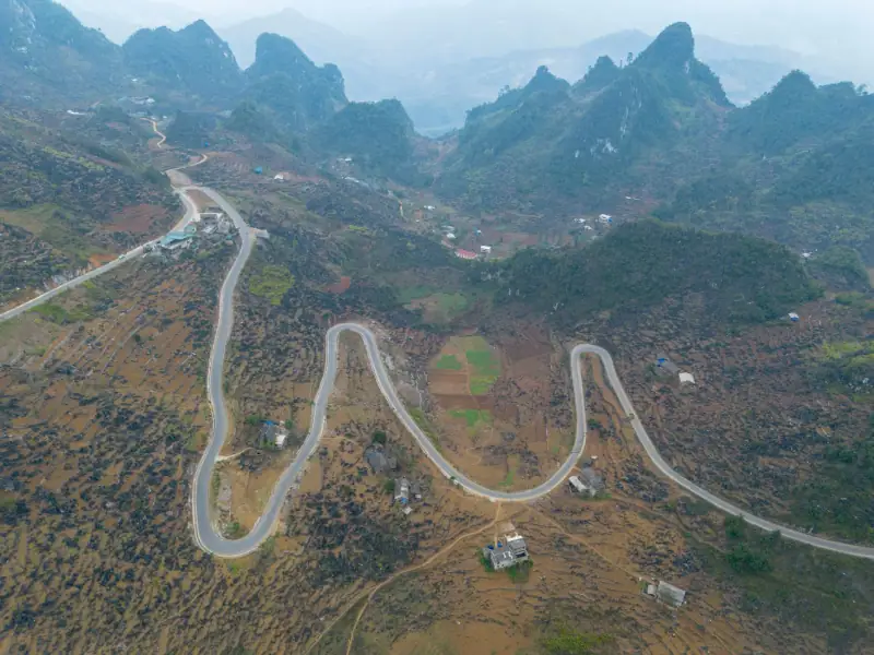
Here is a classic itinerary, with approximate distances. Real riding times are clearly longer than the kilometers would suggest: allow for stops, weather and roadworks.
Day 1: Hà Giang, Quản Bạ, Yên Minh (about 100 to 135 km / 62 to 84 mi)
The first day leaves Hà Giang town on the mountain road toward Quản Bạ. From the first kilometers, the road climbs. The first big stop is Heaven’s Gate (Cổng Trời), a pass from which you discover the Quản Bạ valley, with the famous “twin mountains” below, often nicknamed “Fairy Bosom” in English. Views are clearest when the sky is clear.
After Quản Bạ, the road continues toward Yên Minh, in an increasingly karstic landscape. It is a rather gentle first day, which lets you get used to the road. Depending on the operator, you sleep in Yên Minh or push on to Đồng Văn.
Day 2: Đồng Văn and Lũng Cú (about 90 to 135 km / 56 to 84 mi)
Đồng Văn, a small old town, is the heart of the plateau. Its old quarter, with its low houses, is pleasant to explore on foot, and its Sunday market is well known: you meet locals who have come down from their villages in costume. Ask locally for the exact days, as market days vary from place to place.
About twenty kilometers (12 mi) from Đồng Văn, the Lũng Cú flag tower marks the far north of Vietnam. You climb a staircase to take in a 360-degree panorama of the mountains and the border. It is a symbolic goal, much visited, but the view justifies the detour.
On the way, the Vương family palace in Sà Phìn deserves a stop: this former residence of a Hmong chief, in a style mixing local and Chinese influences, gives an idea of life in the past. Opening hours and entry fees vary, so check there.
Day 3: the Mã Pí Lèng Pass and Mèo Vạc (about 25 km / 16 mi, then the river)
The road between Đồng Văn and Mèo Vạc, about 24 km (15 mi), is the high point of the trip. The Mã Pí Lèng Pass, one of Vietnam’s great passes, overlooks the very deep canyon of the Nho Quế River, whose water takes on green tints. The switchbacks cling to the cliff; the road was cut by hand into the rock. Allow most of the morning if you stop at the viewpoints, the cafés with terraces and the photo spots.
From Mèo Vạc, you can go down to the river for a boat ride in the canyon: a calm moment after the switchbacks, much appreciated, but it adds time to the schedule. This is why many travelers choose to do the loop in 4 days.
Where to stay in Hà Giang?
Compare Hà Giang's hotels and guesthouses, in town before departure or on the road, depending on your dates and budget.
Day 4 (or end of day 3): back to Hà Giang
The return is often by a different road, along the Gâm River, with greener, gentler landscapes. Other operators come back via Yên Minh and Quản Bạ. In both cases, allow a long day: it can be 150 km (93 mi) or more depending on the route, and you often reach Hà Giang late in the afternoon. Avoid planning an international flight on the same evening as your return to Hanoi.
What to see along the way: the highlights
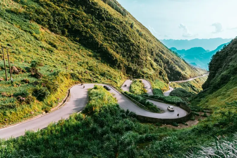
- Heaven’s Gate and the Quản Bạ valley: a first panorama, much photographed.
- The Đồng Văn karst plateau: the most characteristic landscapes, with their corn fields in the pockets of soil between the rocks.
- Ethnic minority villages: earth houses, markets, weaving. Respect the locals and ask before photographing a person.
- The Lũng Cú flag tower: the far north of the country.
- The Mã Pí Lèng Pass and the Nho Quế canyon: the highlight of the route.
- Seasonal crops: in fall, fields of buckwheat flowers color the landscape, while before the harvest the rice fields take on their golden hue.
To include Hà Giang in a big north-to-south trip, our 15-day Vietnam itinerary shows how to link the stops.
When to do the Hà Giang Loop
The timing matters as much as the itinerary. The province is mountainous and the weather changes quickly.
- September to November: generally the best season. The rice fields are golden in September-October, the sky is clearer, and buckwheat flowers appear in the fall. This period is also the busiest: book ahead.
- March to May: mild temperatures, green landscapes, spring blooms. Summer approaches, with the risk of showers.
- June to August: hot and very rainy. Roads can be slippery, with landslide risks. The landscapes are an intense green, but visibility is sometimes poor.
- December to February: cold, fog, sometimes very wet at altitude. Days are shorter and roads more dangerous.
To compare the seasons of all regions, see our guide when to go to Vietnam. Keep some slack in your dates: a storm may force you to postpone a departure by a day.
Safety: what you absolutely need to know
The Hà Giang Loop is beautiful, but it is not a simple outing. Accidents happen every year, and they almost always come from the same causes: speed, fatigue, inexperience, bad weather.
- Wear a real helmet, properly fastened, and if possible bring your own. Avoid the light “bowl” helmets provided by some rental shops.
- Dress properly: long pants, closed shoes, a jacket or gloves if you ride. Low-speed falls leave serious injuries on rough roads.
- Do not ride at night: lighting is limited, fog is frequent and obstacles are many.
- Check the motorbike before leaving: brakes, tires, lights, oil level.
- Do not go faster than your rider judges safe, and say so if they ride too fast for you.
- Avoid alcohol before getting on a motorbike, even as a passenger.
- Keep a charged phone and note the local emergency numbers from your accommodation. The nearest serious hospital may be far; some areas have no network.
Insurance is a point not to neglect. Check that your policy covers the motorbike, as rider or passenger, that it covers medical costs and repatriation, and under what license conditions. Some policies exclude motorized two-wheelers or require a specific license. Read the conditions and exclusions carefully before you buy any travel insurance.
Loop budget
Prices vary a lot with comfort level, season, number of days and mode of transport. As a guide, a package with a rider costs more than renting a motorbike, but it often includes accommodation, some meals and the rider’s local knowledge. For a motorbike rented alone, add fuel, insurance, any deposit and the risk of repairs.
A few points to estimate your budget:
- Accommodation: from dorms and budget hostels to small hotels and homestay guesthouses. Prices rise in high season.
- Meals: simple and inexpensive in roadside restaurants and small inns.
- Entry fees: some attractions such as the Lũng Cú tower or the Vương family palace require a ticket. Prices vary.
- Cash: ATMs are rare outside towns. Withdraw money in Hà Giang before heading up.
For an overview of your spending in Vietnam, read our guide Vietnam budget.
What to pack
- A waterproof jacket and a warm layer, even in summer, because altitude and rain cool things quickly.
- Gloves and a buff or scarf, for dust and cold.
- A power bank and a waterproof pouch for your phone.
- A small first-aid kit: bandages and antiseptic.
- Sunglasses and sunscreen, because sun exposure at altitude is strong when the sky is clear.
- A soft bag rather than a rigid suitcase, easier to strap onto a motorbike or fit in a trunk.
Should you do the Hà Giang Loop?
It is worth the trip if you like mountain landscapes, winding roads and meeting locals, and if you accept long, tiring days. It suits you less if you have little time, if you fear motorbikes, or if you want a comfortable trip without weather uncertainty. In that case, Sapa, more accessible, or Ha Long Bay may suit you better.
In all cases, set off with a trusted rider or driver, papers in order, suitable insurance and spare days. A well-prepared trip leaves room for what this region offers best: immense views, unforgettable roads and villages still deeply rooted in their traditions.
Final thoughts
The Hà Giang Loop is not a simple tourist circuit but a real mountain journey. By taking your time, choosing the right mode of transport and the right season, and keeping safety in mind, you will live one of the most memorable experiences in northern Vietnam. Plan 3 to 4 days, a buffer for the weather, and enjoy every bend.
Frequently asked questions
How many days do you need for the Hà Giang Loop?
Allow 3 days at minimum, and 4 days to ride without rushing and enjoy the stops. The loop is about 350 km (217 mi) on winding mountain roads: distances are short, but average speed is low. With one more day, you can add the Nho Quế River or a village off the main route.
Do you need to know how to ride a motorbike to do the Hà Giang Loop?
Not necessarily. You can ride as a passenger behind a local rider (the so-called "easy rider" option) or travel by car with a driver. Riding yourself takes experience: narrow roads, switchbacks, gravel, fog, trucks and animals on the road.
What license do you need to rent a motorbike in Vietnam?
Rules for riding a motorbike in Vietnam depend on your license and on the engine size. Check the official sources before you go, and check your insurance policy, because an insurer can refuse to cover you without the right license.
What is the best time for the Hà Giang Loop?
Fall, from September to November, is much loved: the rice fields are golden in September-October, and buckwheat flowers color the slopes in the fall. Spring is also pleasant. Summer is hot and rainy, with landslide risks; winter is cold and often foggy at altitude.
How do you get from Hanoi to Hà Giang?
Hà Giang is about 300 km (186 mi) from Hanoi. Day and night buses leave from Mỹ Đình bus station, and minibuses or private transfers also exist. Allow about 6 to 7 hours on the road depending on traffic. Many organized tours already include this transfer.
Is the Hà Giang Loop dangerous?
It requires caution. The risks come mostly from mountain riding: switchbacks, slippery roads, fog, excessive speed, fatigue. Choosing a professional rider or a driver, proper gear, a quality helmet and suitable travel insurance greatly reduce the risks.
More Vietnam guides
Keep reading
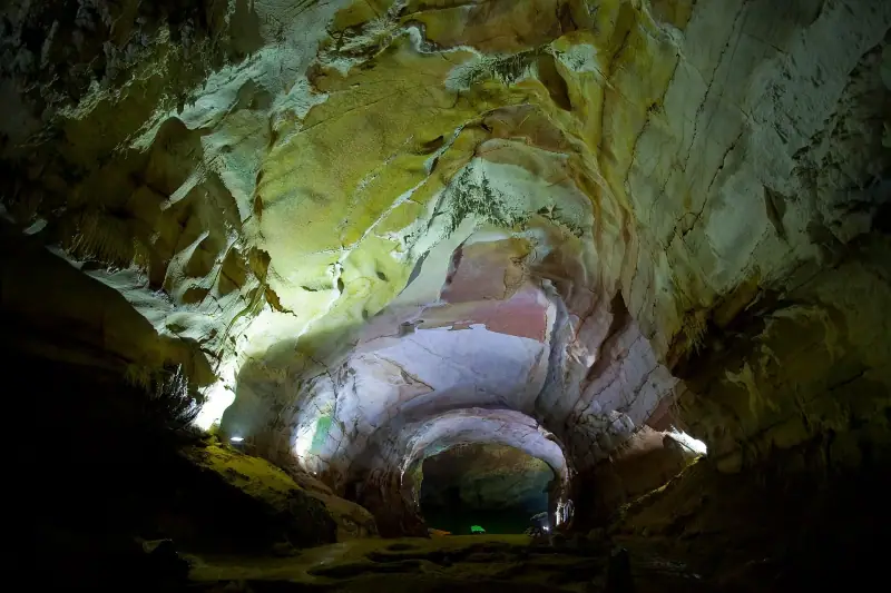
Phong Nha caves without a tour agency: prices, transport and which cave to choose
Visiting Phong Nha without an agency: ticket prices (Paradise Cave, Phong Nha, Dark Cave), access from Dong Hoi, rainy season and booking.

Mekong Delta: excursions, floating markets and tips for choosing well
Mekong Delta: My Tho, Ben Tre, Can Tho, Cai Rang floating market, Chau Doc. Day trip or 2-3 night stay, seasons, transport and tips.

Ha Long Bay cruise: choosing between Ha Long, Lan Ha and Bai Tu Long
Which Ha Long Bay cruise to choose? Ha Long, Lan Ha or Bai Tu Long, 1 or 2 nights, season, activities on board and tips for booking from Hanoi.
Ready-made
Vietnam itineraries

10 days
Vietnam in 10 days without a car: a realistic itinerary by train, bus and plane
Vietnam in 10 days without a car: Hanoi, Ninh Binh, Hue, Hoi An and Ho Chi Minh City, with distances, real travel times and train, bus or plane options.
7 days
Northern Vietnam in 7 days: Hanoi, Ninh Binh and Ha Long Bay
HanoiNinh BinhHa Long Bay cruise

15 days
Vietnam 15-day itinerary: north to south, day by day
HanoiNinh BinhHa Long or Lan Ha Bay cruiseHoi An