What to see
What to see in Maurienne: legendary passes, forts, villages and the Vanoise
We may earn a commission when you book through links on this page, at no extra cost to you. We don't visit or try the places we cover: we summarize published sources. How we work
In short
- Maurienne is the Arc valley, over 120 km (75 mi) long, from near Aiton up to Bonneval-sur-Arc at the foot of the Col de l'Iseran.
- Highlights: the cathedral of Saint-Jean-de-Maurienne, Valloire and the Col du Galibier (2,642 m / 8,668 ft), the Esseillon forts and Aussois, then Bessans and Bonneval-sur-Arc.
- The high passes (Galibier, Iseran) are closed in winter and reopen depending on snow; check dates before planning.
- Three to four days cover the essentials by car; the train serves several valley towns but passes and trailheads are far easier with a car.
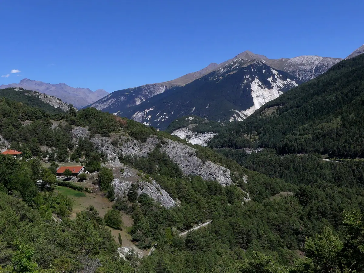
When you plan a stay in the Northern Alps, you readily think of Chamonix, Annecy or the big Tarentaise resorts. Maurienne stays more discreet. Yet it is one of the richest valleys of Savoie: a long inner-Alpine valley crossed by the Arc, dotted with famous passes, 19th-century forts, decorated chapels, villages of stone with slab roofs, and partly bordered by Vanoise National Park. It has proper ski resorts, but also enough to fill several days without ever putting on a pair of skis.
This guide helps you decide what to see in Maurienne, in what order and for how long. It complements our guide to the neighboring valley, What to see in the Tarentaise, with which Maurienne forms a very complementary pair.
Understanding Maurienne’s geography
Maurienne follows the course of the Arc, a tributary of the Isère. The valley is more than 120 km (75 mi) long: it descends from Bonneval-sur-Arc, at the northeast end, toward Modane, then bends northwest to the Aiton area, where the Arc joins the Isère. In practice, it is split into three parts:
- Lower Maurienne, around Aiguebelle and La Chambre: a wide, industrial valley, the gateway from Chambéry.
- Middle Maurienne, around Saint-Jean-de-Maurienne and Saint-Michel-de-Maurienne: the historic heart and the starting point of the great passes.
- Upper Maurienne, beyond Modane: Aussois, Termignon, Lanslebourg, Lanslevillard, Bessans and Bonneval-sur-Arc, high villages facing the high mountains.
Another feature: the valley is a historic passage between France and Italy. The Fréjus tunnels, rail and road, open at Modane, a border town. This role as a passage explains part of the heritage you will see, from fortifications to bridges.
To choose the best season for your stay, see our guide When to go to Savoie: seasons and weather.
Saint-Jean-de-Maurienne: the historic capital
Saint-Jean-de-Maurienne is the main town of the valley and its historic religious capital, about 70 km (43 mi) from Chambéry. Its Cathedral of Saint-Jean-Baptiste is the town’s top sight. It holds in particular a ciborium dated 1497 and carved walnut choir stalls from the end of the 15th century, commissioned by Bishop Étienne de Morel from the Geneva sculptor Pierre Mochet. Under the choir, a crypt recalls the long history of the place and the floods the town suffered over the centuries.
Close by, the old center mixes the bishop’s palace, quiet lanes and the Tour de la Correrie, the former bell tower of Notre-Dame church, whose spire dominates the district. The town is also linked to a famous brand: Opinel knives, whose blade bears the blessing hand, the town’s emblem, were born in the valley. A museum devoted to this iconic object helps you understand its history.
Plan half a day for the town, more if you like heritage visits. Opening hours for the monuments and the museum vary by season: ask the tourist office before you go. The train station is served by regional trains, which makes Saint-Jean-de-Maurienne a practical base if you travel without a car.
Sleeping in Maurienne
Compare hotels, chalets and apartments in the valley, from Saint-Jean-de-Maurienne to the village resorts.
Valloire, the Col du Télégraphe and the Col du Galibier
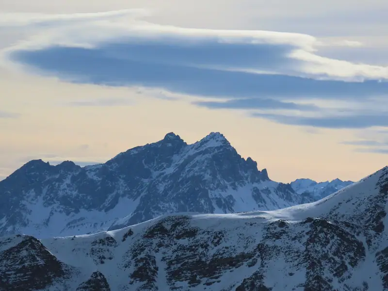
From Saint-Michel-de-Maurienne, a road climbs to the Col du Télégraphe (about 1,570 m / 5,150 ft), then descends to Valloire, a village resort with a very Savoyard character, with its Baroque church, lanes and chalets. In summer, Valloire is an ideal base for hiking and cycling; in winter, it is linked to Valmeinier to form a ski area.
From Valloire, the road continues to the Col du Galibier, one of the most famous passes in the Alps. It peaks at 2,642 m (8,668 ft) according to the IGN and links Savoie to the Hautes-Alpes, toward the Col du Lautaret, Briançon and La Grave. A few useful benchmarks:
- the road is closed in winter; it generally opens between late May and early June, depending on snow, and closes again in fall;
- a tunnel passes under the pass, but only motor vehicles use it: cyclists go over the actual summit;
- a monument pays tribute to Henri Desgrange, founder of the Tour de France, who often routed the race through here;
- the panorama over the glaciers and the peaks of the Écrins is exceptional in good weather.
Even in midsummer, it can be very cold at the summit: bring a warm jacket and leave early to avoid afternoon storms. Before going up, check traffic conditions on official sites, as closure can happen quickly in case of early snow.
The Esseillon barrier and Aussois
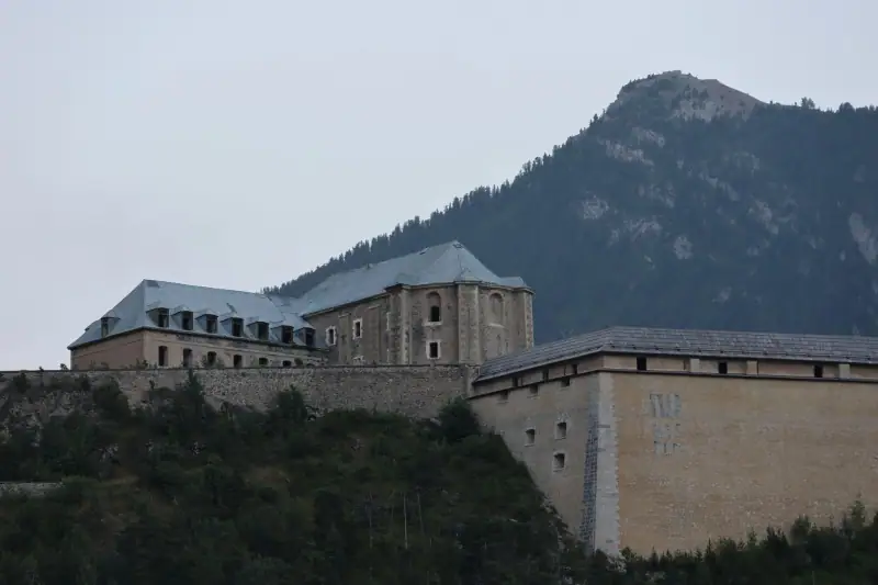
Between middle and upper Maurienne, the valley narrows at a glacial rock bar that gave rise to an exceptional fortified complex: the Esseillon barrier. These forts, built in the 19th century by the Kingdom of Piedmont-Sardinia to lock the valley, overlook the gorges of the Arc from their rocky promontory. Several of them can be visited in the warm season, and a suspension bridge links parts of the complex.
Nearby, Aussois is a village resort of character, set on a sunny shelf facing the peaks. The village keeps old lanes and a Baroque church, and is known for the rock art in its area. Aussois is also an excellent gateway to Vanoise National Park, with hikes starting from the village or its hamlets. Via ferrata fans also find routes in the region.
If you like historic sites and open landscapes, allow a full day to combine forts, gorges and village. As with all monuments, the days and hours of visit to the forts depend on the season: check with the tourist office before coming.
Modane, the border town
At the foot of the Esseillon, Modane is the town on the French-Italian border. This is where the Fréjus tunnels, rail and road, open, linking Maurienne to Piedmont. The rail tunnel, opened in the 19th century, deeply marked the valley’s history. Modane is not a charming destination in the classic sense, but it is a useful place: international train station, shops, practical lodging and a starting point toward the Aussois and Orelle area.
A few kilometers away, Orelle gives access, by gondola, to the Val Thorens ski area, which illustrates the link between Maurienne and the Three Valleys of the Tarentaise. For summer visitors, Modane is mostly a practical stop before heading up into upper Maurienne.
Upper Maurienne: Val Cenis, Bessans and Bonneval-sur-Arc
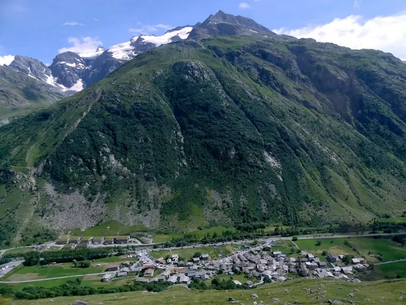
Beyond Modane, the valley takes on a wilder character. Termignon is a major gateway to Vanoise National Park: several trails leave from here toward glaciers and mountain huts. Lanslebourg and Lanslevillard form, with Termignon, the Val Cenis resort, which extends to the Mont-Cenis massif. In Lanslevillard, the chapel of Saint-Sébastien, decorated with old paintings, and a megalith site, including the Pierre aux Pieds, recall that the valley has been inhabited for millennia.
Higher up, Bessans is known for its wood-carving tradition and its carnival “devils”, as well as cross-country skiing. The village is a good example of high-mountain architecture, with its stone houses and chapels.
At the very end of the valley, Bonneval-sur-Arc, at about 1,800 m (5,905 ft) altitude, is ranked among Les Plus Beaux Villages de France (the Most Beautiful Villages of France). Its stone houses with slab roofs, narrow lanes and the absence of visible electric wires make it one of the most photogenic villages of Savoie. The village nestles at the foot of the Col de l’Iseran, which peaks at 2,764 m (9,068 ft) and is considered the highest paved pass in the Alps. It links Maurienne to Val d’Isère, in the Tarentaise: the route is spectacular, but it is open only in the warm season, after snow clearing.
Plan at least a whole day for upper Maurienne, and spend a night there if you want to hike. To complete it, read our article Visiting Val d’Isère, on the Tarentaise side of the Col de l’Iseran.
Hikes and outings in the Vanoise
Guided hikes, nature outings and mountain activities to book online.
The Vanoise on the Maurienne side: hikes and wildlife
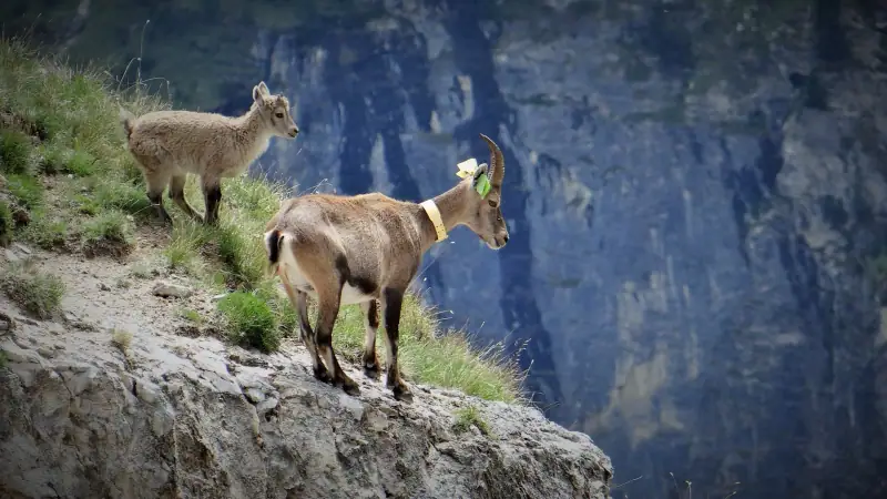
Vanoise National Park, the first national park created in France, in 1963, covers a large part of upper Maurienne. It has glacial valleys, high lakes, mountain pastures and well-known wildlife: ibex, chamois, marmots, and with luck eagles and bearded vultures. The Aussois, Termignon and Bonneval-sur-Arc areas are among the busiest.
For a first approach, favor short, well-marked hikes. Our selection of easy hikes in Savoie will give you ideas, and our article Watching wildlife in the Vanoise explains how to spot animals without disturbing them.
A few rules to respect in the park: stay on the trails, pick nothing, take your trash with you and find out about the regulations on dogs and bivouacking, which are strict. The mountain pastures are also workplaces for herders: close gates and keep your distance from herds and guard dogs.
The great passes by bike or car
Maurienne is a paradise for cyclists, who find here the legendary names of the Tour de France: Télégraphe, Galibier, Madeleine, Iseran, Mont-Cenis. The altitudes give an idea of the scale of the effort: about 1,570 m (5,150 ft) for the Télégraphe, 1,990 m (6,529 ft) for the Madeleine, 2,085 m (6,841 ft) for the Mont-Cenis, 2,642 m (8,668 ft) for the Galibier and 2,764 m (9,068 ft) for the Iseran.
If you are not a cyclist, these passes are just as beautiful by car, as long as you allow a margin: mountain roads are slow, and the weather can change quickly. The Col du Mont-Cenis, tied to a large high lake, opens onto Italy. Always check pass openings before leaving, and bring warm layers and water.
Flavors of Maurienne
Maurienne has its specialties, often close to those of Savoie, but with some local particularities. You can taste mountain-pasture cheeses, mountain cured meats, potato dishes and fondue. Among the products associated with the valley, people readily mention bleu de Termignon, a blue-veined cheese made in upper Maurienne, and beaufort, a cooked pressed cheese typical of the Northern Alps. In the villages, producers and cooperatives often sell their products directly.
To learn all about these cheeses and how to choose them, see our article Savoie cheeses: reblochon, beaufort, tomme. In high season, mountain restaurants and farm-inns fill quickly: book ahead and check the opening days, which vary from one season to the next.
Tastings and experiences in Savoie
Tastings of local products, cooking classes and food tours to book online.
Getting organized: getting there, getting around, how many days
Getting to Maurienne. From Chambéry, the road and the train go up the valley to Saint-Jean-de-Maurienne, about 70 km (43 mi) away, then to Modane. Regional trains serve several stations in the valley. Our guide Visiting Chambéry can serve as a stop before heading up the valley.
Getting around. A car gives you real freedom for the passes, villages and trailheads. You can compare rental companies and read our advice in Renting a car in Savoie. In winter, check the vehicle’s equipment (winter tires or chains) before heading up.
Here is a sample four-day itinerary, with reasonable stages by car:
- Day 1: middle Maurienne. Saint-Jean-de-Maurienne, its cathedral and old center.
- Day 2: Valloire and the Galibier. Col du Télégraphe, Valloire, then the climb to the Galibier if the pass is open.
- Day 3: Esseillon and Aussois. Forts, gorges of the Arc, the village of Aussois and a first hike in the Vanoise.
- Day 4: upper Maurienne. Termignon, Lanslevillard, Bessans, then Bonneval-sur-Arc and, in summer, a round trip toward the Col de l’Iseran.
With a week, add the Mont-Cenis, a longer hike in the Vanoise or a crossing to the Tarentaise via the Iseran. To estimate the overall cost, our budget for a stay in Savoie gives benchmarks.
Rent a car
Compare rental companies to explore the valley and its passes at your own pace.
Tips for a successful stay in Maurienne
- Choose a suitable base: Saint-Jean-de-Maurienne for convenience and the train, Valloire or Aussois for a village resort, Bonneval-sur-Arc for quiet and the high mountains.
- Watch the weather: afternoon storms are frequent in summer, so start early for hikes and passes.
- Allow for the altitude: on the passes and in the upper valley, the cold and the sun are stronger than you imagine.
- Check opening times for the passes, forts, museums and mountain restaurants: they depend on the season.
- Book early for the February holidays, Christmas and the month of August.
- Respect the national park and the mountain pastures.
- Consider insurance if you ski or do demanding hikes: check with your usual insurer what mountain rescue coverage you have.
In summary
Maurienne is best discovered at its own pace. From the cathedral of Saint-Jean-de-Maurienne to the Esseillon forts, from Valloire to the Col du Galibier, from the lanes of Aussois to the slab roofs of Bonneval-sur-Arc, it offers a concentrate of heritage and high mountains, with far fewer crowds than its neighbors. With three or four days and a little flexibility toward the weather, you will get a very fine panorama of the valley; with a week, you will have time to hike in the Vanoise, taste local products and cross the Col de l’Iseran into the Tarentaise.
Frequently asked questions
Where is Maurienne?
Maurienne is the valley of the Arc river, in the Savoie department. It stretches over more than 120 kilometers (75 mi), from the confluence of the Arc and the Isère downstream, up to Bonneval-sur-Arc, at the foot of the Col de l'Iseran. It neighbors the Tarentaise, Italy and the Hautes-Alpes.
What is there to see in Maurienne in a few days?
The highlights are the cathedral of Saint-Jean-de-Maurienne, the village resort of Valloire and the Col du Galibier, the Esseillon barrier and Aussois, then the upper Maurienne with Bessans, Lanslevillard and Bonneval-sur-Arc. Three to four days let you see the essentials without rushing.
What is the altitude of the Col du Galibier?
The Col du Galibier peaks at 2,642 meters (8,668 ft) according to the French mapping agency IGN, although the road sign says 2,645 meters. It separates Savoie from the Hautes-Alpes. The road is closed in winter and generally reopens in late spring or early summer, depending on snow.
Can you visit Maurienne without a car?
Only partly. The train serves Saint-Jean-de-Maurienne, Saint-Michel-de-Maurienne, Modane and other stations in the valley, and buses link some resorts. For the passes, high villages and trailheads, a car is far more practical. Check the timetables before you go.
What is the best time to visit Maurienne?
June to September for hiking, cycling and the passes, December to April for skiing. The high passes (Galibier, Iseran) are closed in winter and reopen depending on snow: find out the dates before planning your itinerary.
Is Maurienne suitable for families?
Yes. The village resorts such as Valloire, Aussois or Val Cenis offer varied activities in summer and winter, and many easy walks exist around the villages and lakes. Bring warm clothes even in summer: the weather changes fast at altitude.
What is the difference between Maurienne and the Tarentaise?
They are two neighboring valleys, separated by the Vanoise massif. The Tarentaise (Isère valley) is known for its big ski resorts; Maurienne (Arc valley) is more about history, fortifications, high villages and the great passes. The Col de l'Iseran links the two.
More Savoie guides
Keep reading
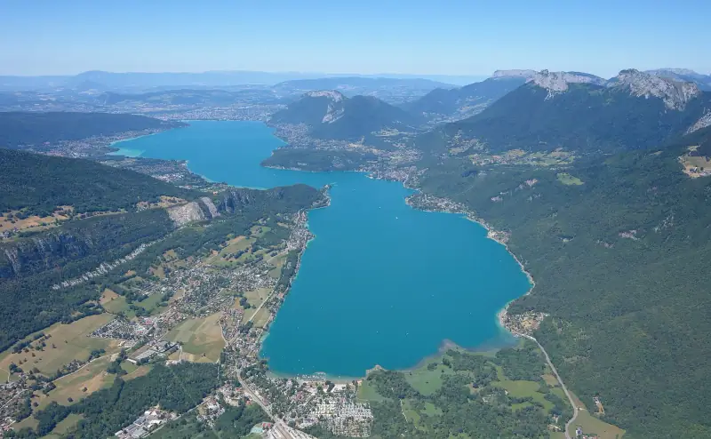
What to see around Lake Annecy: villages, castles and nature sites
What to see around Lake Annecy? Talloires, Menthon, Duingt, Bout-du-Lac, Roc de Chère: the prettiest villages and natural sites around the lake.
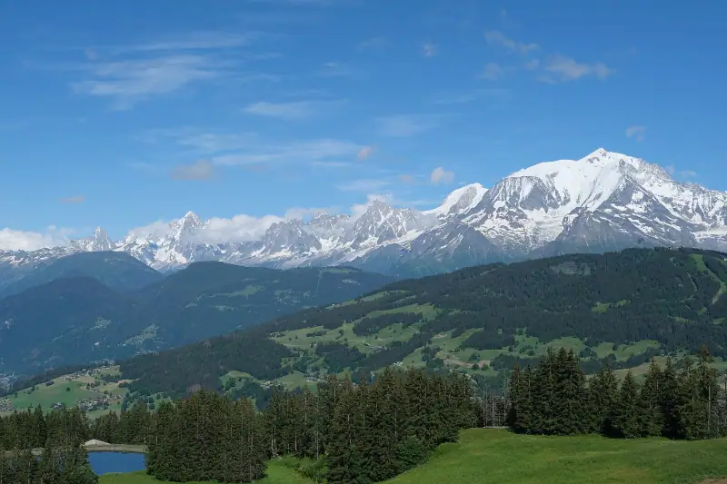
What to see in the Mont Blanc region: Saint-Gervais, Les Contamines, Megève and Passy
What to see around Mont Blanc? Saint-Gervais, Les Contamines, Combloux, Megève, Passy: tramway, Baroque chapel, lake and viewpoints, with planning tips.
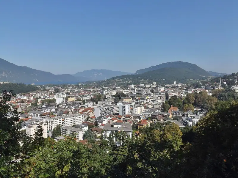
Visiting Aix-les-Bains: what to see and do on the shores of Lac du Bourget
What to see in Aix-les-Bains? Thermal baths, Roman remains, Faure Museum, harbor, beaches, Revard and Hautecombe Abbey: a guide to the Savoyard spa town.
Ready-made
Savoie itineraries
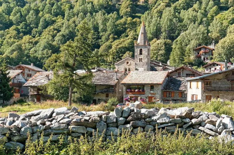
7 days
One week in Savoie: a day-by-day road trip itinerary
Chambéry or Aix-les-BainsAnnecyMegève or ChamonixTarentaise (Bourg-Saint-Maurice or Val d'Isère)
5 days
Savoie in 5 days without a car: a realistic itinerary by train and bus
ChambéryAnnecyChamonix
3 days
3 days around Lake Annecy: a day-by-day itinerary
What to do in 3 days in Annecy and around the lake? Old town, Talloires, Menthon, Duingt, cycling, swimming and Semnoz: a detailed, realistic itinerary.