Things to do
Mount Kenya: hiking and climbing Point Lenana from Nanyuki
We may earn a commission when you book through links on this page, at no extra cost to you. We don't visit or try the places we cover: we summarize published sources. How we work
In short
- Point Lenana (about 4,985 m / 16,355 ft) is the summit within reach of hikers; Batian and Nelion (about 5,200 m / 17,060 ft) need real rock-climbing technique.
- Three main routes: Sirimon (gentle progression, near Nanyuki), Naro Moru (most direct, shorter acclimatization) and Chogoria (most spectacular, more remote); a trek typically takes 3 to 5 days.
- Dry seasons, generally January to mid-March and late June to October, offer the best conditions; nights at altitude are freezing.
- Most hikers go with a local agency that provides guide, cook and porters and helps with permits; ask for a detailed quote.
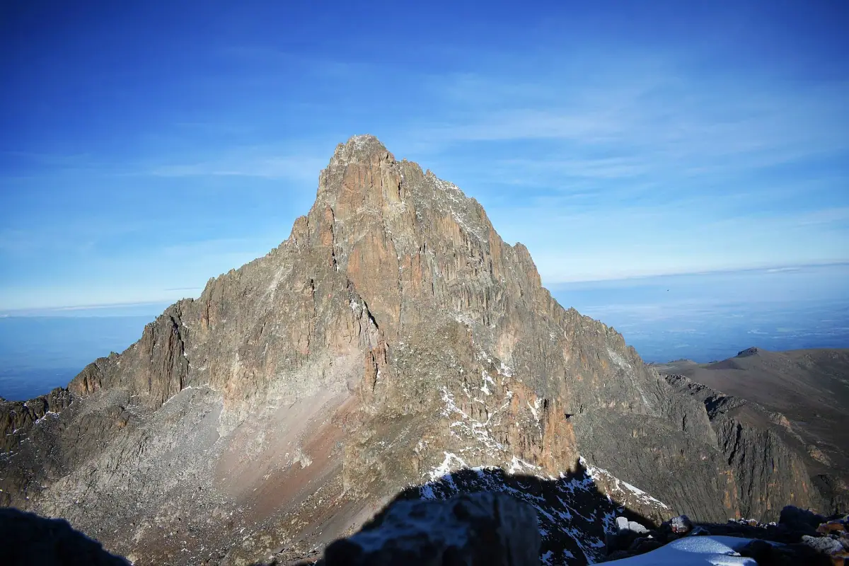
In central Kenya, straddling the equator, Mount Kenya is an eroded former volcano whose rocky peaks tower over the region’s plateaus. The second-highest peak in Africa after Kilimanjaro, it is a UNESCO World Heritage site and is far less crowded than its Tanzanian neighbor. For travelers who like to walk, it is one of the most beautiful high-altitude hikes on the continent.
This guide explains how to get organized from Nanyuki, the small town that serves as the base for most expeditions, which route to choose, how to acclimatize, what to put in your pack and how to fit this climb into a wider trip.
Mount Kenya in a few words
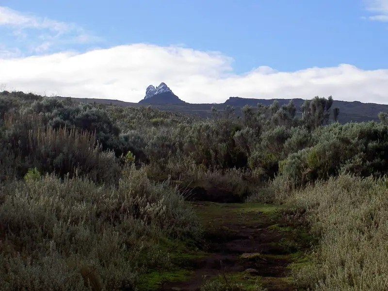
The massif peaks at about 5,200 m (17,060 ft) with its two main points, Batian and Nelion. These summits are reserved for experienced climbers: they require real rock-climbing technique and suitable gear. The summit within reach of hikers is called Point Lenana, at about 4,985 m (16,355 ft). It is the one the great majority of visitors aim for.
The landscape changes as you climb. At the start, you cross mountain forests and bamboo groves where elephants, buffaloes and colobus monkeys live. Higher up stretch high-altitude moorlands, dotted with giant lobelias and groundsels, astonishing plants unique to East African mountains. Finally, glacial valleys, small mountain lakes (tarns) and the last, receding glaciers announce the high mountain.
The massif is protected: part of it is a national park, the rest a forest reserve. Check entry fees and permits when you book, as their amounts and conditions change.
Nanyuki, the starting base
Nanyuki lies at the north-western foot of the massif, on the Laikipia plateau, a few hours by road from Nairobi. The town is lively, practical and well equipped: you find shops, banks, trek agencies and a range of lodging from simple hostels to comfortable lodges. The equator passes nearby, and the signs or shops marking it are part of the local folklore.
Getting to Nanyuki from Nairobi is done by car, minibus or a transfer arranged by your agency. Allow half a day, as the road time varies with traffic leaving the capital. If you want to spare your legs, arrive the day before departure for a good night’s sleep and a last check of your gear. Our guide to choosing where to stay in Kenya will help you split your stages.
Sleeping in Nanyuki before the trek
Compare the town's lodging to set off rested and ready to walk at dawn.
Choosing your climbing route
Most hikers use one of three main routes. Each has its own character, and many choose to go up by one route and come down by another to see more landscapes.
The Sirimon route
It starts on the north-west side, near Nanyuki, and climbs at a steady gradient through forest then moorland. It is the route often recommended for acclimatization because its gradual profile gives the body time to adapt. It is known for its varied landscapes and the chance to see wildlife in the lower parts. It is a good choice for a first experience.
The Naro Moru route
Naro Moru is the fastest and most direct route. It gains altitude faster, which makes it attractive for those with few days, but it leaves less time to acclimatize, and the crossing of the marshy section at the bottom can be very muddy. If you choose it, add margin to the schedule and follow your guide’s advice if altitude symptoms appear.
The Chogoria route
On the east side, the Chogoria route is considered by many the most spectacular: deep gorges, glacial valleys, waterfalls and mountain lakes. It is longer and farther from Nanyuki, which complicates logistics, but it rewards with exceptional panoramas. It suits the descent well, after going up by Sirimon.
| Route | Main asset | Good to know |
|---|---|---|
| Sirimon | Gentle progression, good acclimatization | Start near Nanyuki |
| Naro Moru | The most direct | Shorter acclimatization, trail sometimes muddy |
| Chogoria | Most spectacular scenery | More remote, longer logistics |
A typical 4- to 5-day trek
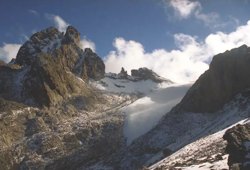
Each agency adapts the itinerary, but the pattern is often the same. Walking times are given as a guide: they depend on the group’s pace, the weather and the route.
Day 1: forest and moorland
You leave the park gate and walk through the forest, with the possibility of meeting large animals: caution is needed, and your guide knows the instructions to follow. The day ends at a camp or hut on the high moorland, already above 3,000 m (9,840 ft).
Day 2: climbing toward the valley
You climb steadily toward the central valley, at the foot of the peaks. This is a key stage for acclimatization: walk slowly. The cold starts to be felt as soon as the sun sets.
Day 3: acclimatization or approach
Depending on the program, this day is used for a short hike to a lake or viewpoint to acclimatize, then to reach the starting hut for the summit. The night cold is intense, and it is common for water to freeze in the bottles.
Day 4: the Point Lenana summit
The final push begins in the middle of the night, by headlamp, to reach the summit at sunrise. The walk is slow, cold and demanding, with a scree section to climb. At the summit, if the sky is clear, the view of the neighboring peaks, the glaciers and the plains below is unforgettable. You then descend, sometimes to a lower camp, or even to the park gate depending on the route.
Day 5: the descent
The last day is devoted to the descent and the return to Nanyuki. Knees suffer: trekking poles are useful.
Acclimatizing and altitude sickness
At nearly 5,000 m (16,400 ft), the air contains about half the oxygen of sea level. Acute mountain sickness can affect anyone, whatever their fitness. A few simple rules apply:
- climb slowly, this is the principle of “pole pole” (slowly in Swahili);
- tell your guide immediately in case of persistent headaches, nausea, dizziness or unusual breathlessness.
Ask your doctor or a travel clinic before departure, especially if you have a heart or respiratory history, and see the official travel health pages (CDC in the US, TravelHealthPro in the UK).
When to go
Mount Kenya is visible all year, but conditions vary. The driest periods, generally January to mid-March and late June to October, offer the best windows: more passable trails and a sky more often clear in early morning. During the rainy seasons, mud, showers and clouds complicate walking and hide the summits. Even in the dry season, nights are freezing and the weather changes fast: a bright morning can give way to a misty afternoon.
To compare seasons across the country and combine the hike with a safari, see our article when to go to Kenya.
Gear to bring
Cold is the main enemy. Nights drop well below freezing (0 °C / 32 °F) in the highest huts. The principle is to layer.
- Clothing: technical underwear, fleece, warm down jacket, waterproof jacket and pants, hat, gloves, neck gaiter.
- Footwear: high hiking boots, already broken in, and spare socks.
- Sleep: a sleeping bag suited to great cold (often rentable through the agency).
- Accessories: headlamp with spare batteries, trekking poles, sunglasses, high-SPF sunscreen, insulated bottle or bottles.
- Health: first-aid kit, water purification tablets, personal medications.
Part of this gear can be rented from the agencies locally, but check its condition before leaving. Our selection of travel accessories for Kenya can complete your suitcase.
Hikes and excursions in Kenya
Discover the treks and guided outings offered around Mount Kenya and Nanyuki.
Organizing your trek: agency, guide and porters
If you are not an experienced high-mountain climber, going through a recognized local agency is the simplest solution. It handles logistics: transport to the park gate, permits, guide, cook, porters, tents or hut reservations, meals. Ask what is included, how large the groups are, what rescue training the guides have, and what the cancellation conditions are.
Porters do intense physical work: check that the agency respects reasonable load limits and gives them proper equipment, and plan a tip at the end of the trek. Customs vary, so ask your agency for advice on amounts.
To estimate the total cost, count park fees, the guide, porters, food, transport and any gear rental. Our article on the budget for a trip to Kenya helps you place this expense within your whole stay. Rates change: always ask for a detailed quote.
Wildlife, flora and respect for the mountain
The mountain shelters remarkable flora. Giant lobelias and tree groundsels, adapted to extreme temperature swings between day and night, are the symbols of the Afro-alpine zone. In the forest, you may come across elephants, buffaloes, monkeys and many birds. Above the tree line, wildlife is more discreet: rock hyraxes, raptors and small rodents.
Follow a few rules:
- stay on the trails, keep your distance from animals;
- take all your trash back, including toilet paper;
- pick nothing and take no stones;
- use the provided toilets or follow your guide’s instructions to limit impact.
Extending with other visits around Nanyuki
The Laikipia plateau, at the foot of the mountain, is home to private conservancies where you see animals in open landscapes, and where walking or horseback safaris are sometimes offered. It is a good complement to a week of trekking, with gentler days after the effort. You can also consider a stop at Lake Naivasha or Nakuru: see our guide to Lake Naivasha and Nakuru park.
To fit Mount Kenya into a complete trip, our 10-day Kenya itinerary offers a basic pattern that you can adapt by adding 4 to 5 days of walking.
Flights to Nairobi
Compare offers for your dates before fixing the window for your trek.
Formalities and insurance
Before leaving, check the entry requirements for Kenya, notably the electronic travel authorization and the validity of your passport. Entry rules depend on your passport. Check the official travel advice of your government before you book: travel.state.gov (US), GOV.UK (UK), travel.gc.ca (Canada), Smartraveller (Australia) (checked November 2026). For a trek at altitude, insurance that covers high-mountain hiking and medical evacuation is strongly recommended: read the altitude limits in the contract carefully.
Last-minute practical tips
- Plan cash in Kenyan shillings for tips and small purchases before heading into the mountains.
- Charge your devices before departure: cold greatly reduces battery life, keep them close to you at night.
- Train several weeks ahead: hikes with elevation gain, walking with a pack, stairs.
- Protect yourself from the sun: at high altitude, UV is intense, even in cloudy weather.
- Keep a spare day at the end of the stay to absorb any delay.
Key takeaways
Mount Kenya offers a high-mountain experience accessible to good hikers, without the crowds of Kilimanjaro. Choose a route suited to your time and level, allow time to acclimatize, go in the dry season and use a reputable agency. Well prepared, this trek remains one of the highlights of a trip to Kenya: from elephant forests to equatorial glaciers, in just a few days.
Frequently asked questions
Do you need to be a mountaineer to climb Mount Kenya?
No. The Batian and Nelion summits require real climbing technique, but Point Lenana, the summit accessible to hikers, is reached on foot by a trail, without mountaineering gear in most conditions. You do need good physical fitness and preparation for altitude.
How many days should you plan for the hike?
Generally allow 3 to 5 days depending on the route chosen and the acclimatization pace. An extra spare day is advised to absorb bad weather or altitude-related delays.
What is the best period for the trek?
The dry seasons, generally January to mid-March and late June to October, offer the best conditions. The rainy seasons make trails muddy and summits more often in cloud. See also our guide on when to go to Kenya.
Is a guide mandatory?
Rules change and depend on the park authorities: check when you book. In practice, the great majority of hikers go with a local agency that provides guide, cook and porters, which also eases the permit procedures.
Is altitude sickness a real risk?
Yes, because the top of the hike exceeds about 4,900 m (16,080 ft). Climb gradually and tell your guide at once if you have persistent symptoms (strong headaches, nausea, dizziness). Ask your doctor or a travel clinic before departure, and see the official travel health pages (CDC in the US, TravelHealthPro in the UK).
Can you combine Mount Kenya with a safari?
Very well: Nanyuki is a practical base, with private wildlife reserves nearby, and the road to the Masai Mara or Samburu links up easily. It is a good complement to a first safari.
More Kenya guides
Keep reading
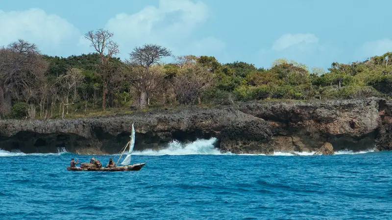
Wasini and Kisite-Mpunguti day trip from Diani: dolphins, snorkeling, prices and booking
Day trip from Diani to Wasini and Kisite-Mpunguti Marine Park: schedule, indicative prices, dolphins, snorkeling, booking in advance or locally.
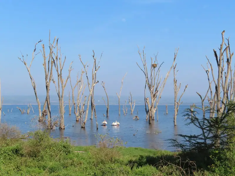
Lake Naivasha and Lake Nakuru: activities and wildlife viewing
Boat rides, biking in Hell's Gate, rhinos and flamingos at Nakuru: tips to organize two to three days of activities in Kenya's Rift Valley.
A first safari in Kenya: parks, lodging and tips
First safari in Kenya: choosing a park (Masai Mara, Amboseli, Nairobi), organizing the stay, understanding the packages and preparing for wildlife viewing.
Ready-made
Kenya itineraries
7 days
Kenya in 7 days: Naivasha, Nakuru and the Masai Mara without rushing
NairobiNaivashaMasai MaraNairobi
10 days
Kenya in 10 days: Nairobi, Amboseli, Masai Mara and Diani Beach
A day-by-day 10-day Kenya itinerary: Nairobi, Amboseli facing Kilimanjaro, a Masai Mara safari, then relaxing on Diani Beach. Budget and tips.