Things to do
Hiking Cap Blanc-Nez without an agency: loops from Escalles, timing and tides
We may earn a commission when you book through links on this page, at no extra cost to you. We don't visit or try the places we cover: we summarize published sources. How we work
In short
- No guide or ticket is needed: free parking at Haute-Escalles (D243), marked loops from 4 km (2.5 mi), about 1 hour, to 10 km (6.3 mi), about 3 h 30.
- Cliff edges are not fenced everywhere, and the beach at Escalles is reachable only at low tide.
- Pack a windbreaker and shoes with grip on wet chalk; use an up-to-date GPS track, because the coastal path was moved when the Grand Site was developed.
- Check tide times before going down to the beach; 196 is the emergency number at sea in France.
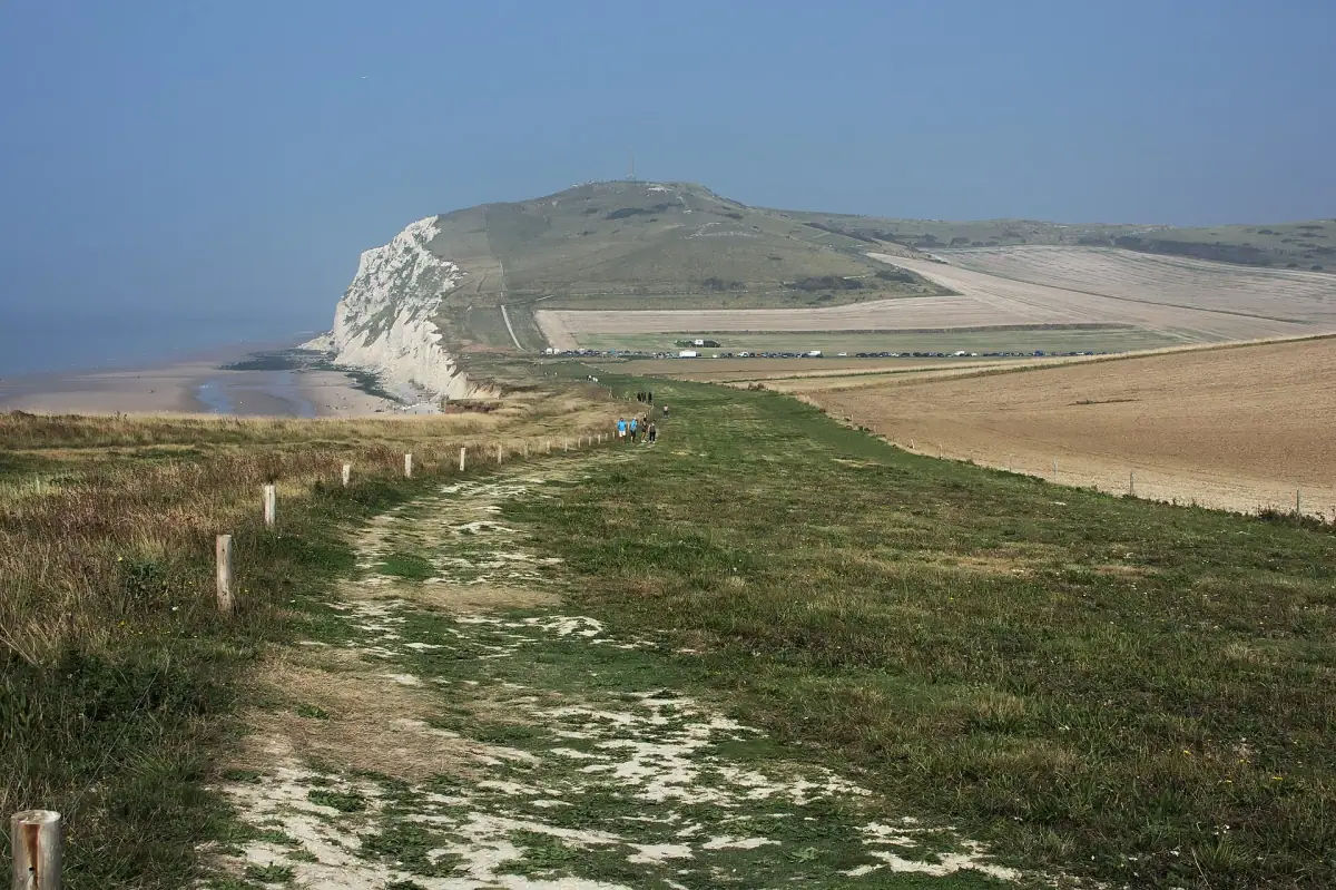
Cap Blanc-Nez can be hiked without an agency or a reservation: you park for free at Haute-Escalles, follow marked trails and choose your loop, from 4 km (2.5 mi, about 1 hour) to 10 km (6.3 mi, about 3 h 30). The only real calendar to respect is the tides, if you want to go down to the beach.
In short: no need for a guide or a ticket. Free start at the Haute-Escalles parking lot (D243), loops of 4 to 10 km (2.5 to 6.3 mi), cliffs not fenced everywhere, beach reachable only at low tide. Bring a windbreaker and shoes that grip on chalk. To sleep at the foot of the capes, see where to stay in Wissant.
Which loop to choose at Cap Blanc-Nez
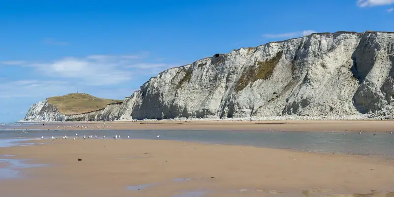
Several walks start from Escalles and Sangatte, the two villages that frame the cape. Here are the distances and durations given by the Grand Site des Deux Caps for classic walking:
| Loop | Start | Distance | Time |
|---|---|---|---|
| Les Noires Mottes | Haute-Escalles | 4 km (2.5 mi) | 1 h |
| La Boucle du Cap | Haute-Escalles | 4.5 km (2.8 mi) | 1 h 15 |
| Les Balcons d’Escalles | Escalles center | 7.8 km (4.8 mi) | 2 h |
| Le Fond Pignon | Sangatte | 5.2 km (3.2 mi) | 1 h 20 |
| Les Hauts de Sangatte | Sangatte | 6.8 km (4.2 mi) | 1 h 40 |
| Big Blanc-Nez loop (GR120 + Mont d’Hubert) | Haute-Escalles | 10.2 km (6.3 mi) | about 3 h 35 |
For a first hike, La Boucle du Cap is the best compromise: it reaches the cape without taking all day.
Hiking Cap Blanc-Nez in 1 hour: the Noires Mottes
If you have only an hour, start from the Haute-Escalles visitor area and take the Noires Mottes loop (4 km / 2.5 mi). The terrain is moderate, the view opens quickly onto the Channel, and you return to the parking lot without crossing any difficult zone. It is also the easiest to fit between two stops of a stay on the coast, for example with a visit to Wimereux.
The big 10 km loop via Mont d’Hubert
The Visorando sheet for the loop from Haute-Escalles gives 10.23 km (6.4 mi), about 3 h 35, a cumulative elevation gain of about 225 m (738 ft) and a “medium” difficulty. It follows the GR 120 along the coast, then the yellow circuit via Mont d’Hubert before heading back down to the parking lot.
What to know:
- The path was moved during the Grand Site development: an old map can lead you astray. Use a recent GPS track.
- Two roads to cross (D243 and D940): watch the traffic.
- A steep climb is reported by hikers, and the start of the route is often busy.
- Some hikers advise doing the loop in the other direction to have the sea in front of you longer.
Stay near the capes
To set out early on the trail, compare accommodation on the Opal Coast, from Wissant to Wimereux.
Where to park and how to get there
The Haute-Escalles parking lot, on the D243 between Escalles and Peuplingues, is free according to the Visorando sheet and accepts cars, buses and RVs. Parking at Mont d’Hubert is forbidden: do not try to park there, start from the visitor area or from the foot of the obelisk.
In high season and on fine weekends, arrive early: it gets very busy. Without a car, the simplest is to combine walking and local transport, but check schedules in advance, since service is uneven. Our guide to the Opal Coast gives the general context for organizing your travel. To continue to the neighboring cape, see where to park at Cap Gris-Nez.
Tides: when to go down to Escalles beach
The plateau path does not depend on the tides. The beach does: the loop sheet specifies that you need low tide to reach the beach at Cran d’Escalles. The Grand Site reminds visitors that the sea comes back fast, that a high coefficient combined with wind can create waves able to carry a person away, and that 196 is the emergency number at sea in France.
Simple rules:
- Check the tide times before leaving (the Grand Site cites maree.info).
- Go down at low tide, and come back up well before high tide.
- Do not stay at the foot of the cliff: the chalk collapses.
- Do not scrape the cliff to look for fossils.
On the GR 120, some sections run along the beach between Cap Blanc-Nez, Wissant and Tardinghen: they are impassable at high tide. Do not plan them without checking.
What to bring: shoes and wind
The wind is almost constant on the plateau, even in fine weather, and wet chalk is slippery. Two things really matter: good shoes and a windbreaker. Waterproof shoes with good grip prevent falls on the loop, and a light packable jacket fits in the bag and comes out in seconds.
Add water, a snack, sunscreen and, if you have a smartphone, the GPS track downloaded in advance: the network can be unreliable on the heights.
Hiking with children
The 4 km (2.5 mi) loops are the most suitable: they last about an hour, with frequent viewpoints that renew the desire to walk. The edge of the plateau is not fenced everywhere, so the youngest must stay close to you. For other family-friendly activity ideas on the coast, read our guide Opal Coast and Bay of Somme with kids.
Can you do the hike with a guide if you prefer?
It is possible, but it is not necessary for safety or for finding the way. If you want a commented visit of the region, compare the outings on offer.
Tours and activities on the Opal Coast
If you prefer a guided outing or another activity in the region, compare the offers available.
Sources
Frequently asked questions
Do you need a guide or an agency to hike Cap Blanc-Nez?
No. The trails are marked and free, and the loops of 4 to 10 km (2.5 to 6.3 mi) can be done on your own. A guide is only worth it for the geology or history of the site. Take a map (IGN 2103 ET) or an up-to-date GPS track, because the coastal path was moved when the Grand Site was developed.
How long does the Cap Blanc-Nez hike take?
Depending on the loop chosen: about 1 hour for Les Noires Mottes (4 km / 2.5 mi) and 1 h 15 for La Boucle du Cap (4.5 km / 2.8 mi) from the Haute-Escalles area. The big 10 km (6.3 mi) loop via Mont d'Hubert takes about 3 h 30 with photo stops.
Where do you park for Cap Blanc-Nez?
The Haute-Escalles parking lot, along the D243 between Escalles and Peuplingues, is free and is the starting point for several loops. Parking at Mont d'Hubert is not possible: start from the visitor area or from the foot of the obelisk.
Can you go down to Escalles beach?
Yes, but only at low tide. On the rising tide, the sea comes back fast and can cut off your return. Check the tide times before going down and come back up well before high tide.
Is the hike suitable for children?
The short 4 km (2.5 mi) loops are doable with children used to walking. The cliff edge is not fenced everywhere: keep them close, especially in strong wind, and stay on the paths.
Can you hike Cap Blanc-Nez in winter?
Yes, it is open all year. The wind is stronger, the days are short and the chalk is slippery: bring waterproof shoes and a windbreaker, and set out early to finish before dark.
More Hauts-de-France guides
Keep reading
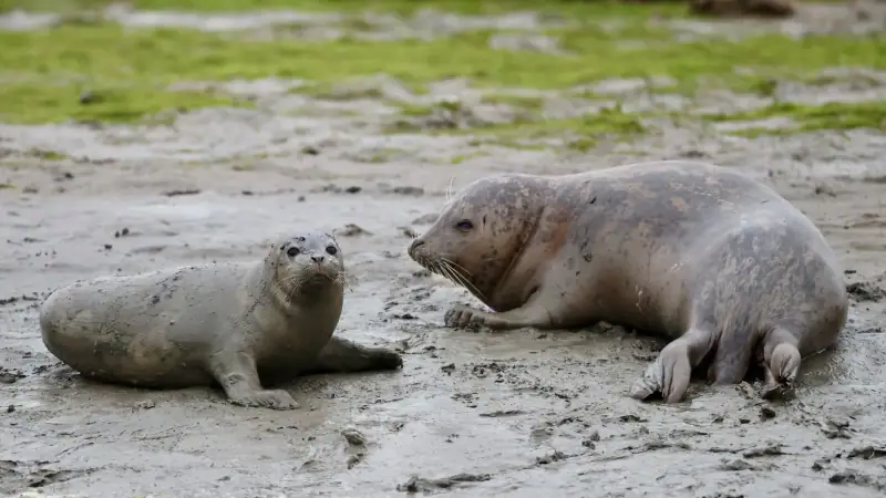
Seal watching in the Bay of Somme: a complete guide
Where and when to see seals in the Bay of Somme: Le Hourdel, guided kayak or walking outings, tides and the rules to respect.

Visiting Marquenterre park: a guide to bird watching
Plan your visit to the Marquenterre ornithological park in the Bay of Somme: species to see, routes, best season, access and tips for families.
When to go to the Bay of Somme: seasons, tides and weather
What is the best time to visit the Bay of Somme? Seasons, big tides, weather, crowds and tips to plan your stay calmly.
Ready-made
Hauts-de-France itineraries
2 days
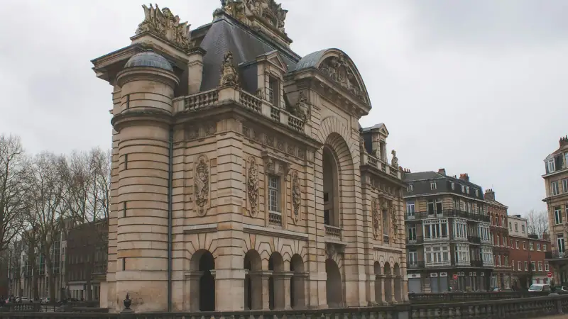
Weekend in Lille: what to see and do in 2 days
A weekend in Lille in 2 days: Old Lille, Grand'Place, Vieille Bourse, museums, the Citadelle, local dishes and practical tips for planning your stay.
2 days
Car-free weekend in the Bay of Somme: train, bike and tourist train
A weekend in the Bay of Somme without a car: arrive by train, stay in Saint-Valery or Le Crotoy, get around by tourist train and bike. Program and tips.
5 days
Hauts-de-France road trip in 5 days: from Lille to the Bay of Somme
CalaisBoulogne-sur-MerLe Touquet-Paris-PlageLe Crotoy
Can be adapted in the planner