Things to do
Kallur Lighthouse (Kalsoy): Ferry, 200 DKK Access Fee and Booking
We may earn a commission when you book through links on this page, at no extra cost to you. We don't visit or try the places we cover: we summarize published sources. How we work
In short
- The trail to the Kallur lighthouse costs 200 DKK per adult, 100 DKK for ages 13 to 17, and is free under 13. The ferry is paid separately.
- The Klaksvík to Kalsoy ferry (line 56) takes about 20 minutes and carries only 12 vehicles: book a car online at ssl.fo; foot passengers do not need to book.
- The hike from Trøllanes is 4 to 5 km (2.5 to 3 mi) round trip with 300 to 350 m (985 to 1,150 ft) of climbing; allow 2 to 3 hours.
- Card payment is accepted there; the fee may change under the new sustainable tourism law, so check before you go.
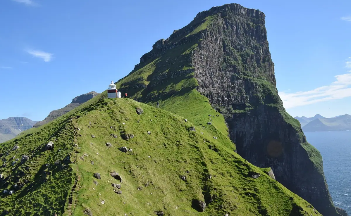
The Kallur lighthouse takes three steps to reach: a ferry from Klaksvík, a single-lane road to the village of Trøllanes, then an hour’s walk along the ridge. Access to the trail is paid (200 DKK per adult), the ferry takes only 12 cars, and neither should be left to chance in high season. Here is how to organize the day without bad surprises.
Kallur, Kalsoy: the basics
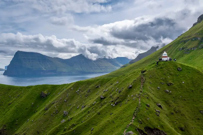
Kalsoy, nicknamed “the flute” for its long, narrow shape, is an island in the north of the archipelago, off Borðoy. A single road runs its length, cut through by single-lane tunnels. At the end of this road, the village of Trøllanes is the starting point for the lighthouse trail, set on a ridge above the Atlantic.
It is one of the most photographed hikes in the Faroe Islands. It already features in our selection of hikes by level and in the two-day itinerary around Borðoy. This page focuses on practical questions: how much it costs, how to get there, what to book.
Ferry to Kalsoy: timetable and booking
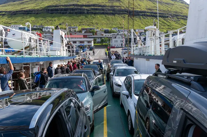
The Klaksvík - Syðradalur crossing (Strandfaraskip Landsins line 56) takes about 20 minutes. The boat makes several departures a day, with times that vary by day of the week, season and public holidays. On weekdays, the first departures from Klaksvík are early in the morning, then during the day; check the timetable for your exact date at ssl.fo.
What to remember:
- On foot, no booking: you board and pay for the crossing.
- By car, the ferry takes only 12 vehicles. Book online on the operator’s website and show up in the queue at least 15 minutes before departure.
- Some departures, marked “T” in the timetable, are booked by phone (generally before 7 pm on the same day, or the evening before for some public holidays).
- Plan your return before leaving: the last departure from Syðradalur is the constraint that decides when you leave Trøllanes.
Without a car, our guide to the Faroe Islands without a car: buses, ferries and prices details the public connections. To rent a vehicle, see renting a car in the Faroe Islands.
Trail access fee: 200 DKK per adult
The trail crosses private land. According to Visit Faroe Islands, visitors must pay a mandatory fee:
| Who | Rate |
|---|---|
| Adult | 200 DKK |
| Ages 13-17 | 100 DKK |
| Under 13 | Free |
| Guide | Not included |
Card payment is accepted there. The tourist office notes, however, that the new Faroese legislation on sustainable tourism may change these fees: check the official page before you go. For the full picture of paid sites (Trælanípa, Drangarnir, Mykines and more), read whether you need a guide to hike in the Faroe Islands.
Hike to the Kallur lighthouse: time and difficulty
From the Trøllanes parking lot, the trail climbs through moorland then joins a narrow ridge. After about 45 minutes to an hour, the lighthouse appears on the point, with sea on both sides.
- Distance: 4 to 5 km (2.5 to 3 mi) round trip.
- Elevation gain: 300 to 350 m (985 to 1,150 ft) cumulative.
- Time: 2 to 3 hours with stops.
- Level: moderate. The terrain is often muddy, and the last stretch exposed to wind.
A few common-sense rules: stay on the trail, keep away from the edge, and turn back if fog comes down or the wind picks up. Rescue is possible but expensive in some cases, as explained in mountain rescue in the Faroe Islands: who pays.
Guided tour to Kalsoy
No car, or no wish to handle the ferry? Compare guided trips to Kalsoy and the Kallur lighthouse.
When to go and at what time
The weather changes fast on Kalsoy. The best choice is to aim for the first half of the day, when the ferry gives the most margin for the return, and to watch the sky: if the summit is in cloud in the morning, visibility sometimes improves in early afternoon. Summer offers long days, but it is also when the Trøllanes parking lot fills up. The trail can be slippery in every season.
Where to stay for a day on Kalsoy
The simplest is to stay in Klaksvík, where the ferry leaves from: you avoid rushing in the morning to catch an early departure. Our Klaksvík guide and the page on where to stay in Klaksvík list the options.
Accommodation in Klaksvík
Sleep near the harbor to catch the first ferry to Kalsoy.
Gear for the ridge
Wind, drizzle and waterlogged ground: bring waterproof shoes, a windbreaker, a warm layer and something to drink and eat, as there are no shops on the trail. Poles help on the descent, especially if the ground is slippery.
Practical summary
| Question | Answer |
|---|---|
| Ferry departure | Klaksvík, line 56, about 20 min |
| Car on the ferry | 12 spaces, booking advised |
| Access fee | 200 DKK adult, 100 DKK ages 13-17, free under 13 |
| Payment | Card accepted there |
| Trail start | Trøllanes |
| Time | 2 to 3 h with stops |
For payment methods in general, see cash or card in the Faroe Islands.
Sources
Frequently asked questions
How much does the hike to the Kallur lighthouse cost?
The access fee is 200 DKK per adult and 100 DKK for ages 13 to 17; it is free for under 13s. The fee does not include a guide. The Klaksvík-Kalsoy ferry is paid separately. Visit Faroe Islands notes that the new sustainable tourism law may change these rates: check before you go.
Can you pay by card at Trøllanes?
Yes, bank cards are accepted there according to Visit Faroe Islands. Still, keep a little cash in Danish kroner as a backup in case the payment terminal does not work.
Do you need to book the Kalsoy ferry?
For foot passengers, no. For a car, yes: the boat takes only 12 vehicles and booking is done online at ssl.fo. Some crossings, marked "T" on the timetable, are booked by phone, generally before 7 pm on the day of departure. Be in the queue at least 15 minutes before the time.
How long does the hike to the lighthouse take?
Allow about 45 minutes to 1 h each way, so 4 to 5 km (2.5 to 3 mi) round trip with 300 to 350 m (985 to 1,150 ft) of cumulative climbing. With photo stops, allow two to three hours in total.
Is the Kallur trail dangerous?
The trail is moderate, but the final ridge is exposed to wind and drops to the sea on several sides. In fog or strong wind, turn back. Access to the promontory behind the lighthouse is for those without a fear of heights.
Can you do Kalsoy without a car?
It is possible by combining the ferry on foot with local transport, but connections are rare and the day is tight. A car on the ferry, or a guided excursion, makes the day much simpler.
More Faroe Islands guides
Keep reading
Slættaratindur Without a Guide: Trailhead, Time and Difficulty of the Hike
Climbing Slættaratindur (880 m) without a tour: Eiðisskarð or Gjógv start, time, difficulty, access fees, fog and gear. The practical guide.
Vestmanna Cliffs by Boat: Book Ahead or on the Spot?
Boat trip to the Vestmanna cliffs (Faroe Islands): whether to book ahead, season, duration, indicative price, weather and alternatives.
Faroe Islands Budget 2026: What Does It Really Cost?
Hotels, restaurants, car rental and activities: a complete budget guide to plan your trip to the Faroe Islands without bad surprises.
Ready-made
Faroe Islands itineraries
14 days
Faroe Islands Road Trip: A 10 to 14 Day Itinerary by Car
Faroe Islands road trip itinerary in 10 to 14 days. Scenic roads, subsea tunnels, remote villages and the essential natural sites.
2 days
Borðoy Road Trip: 2 Days Between Klaksvík and the Northern Islands
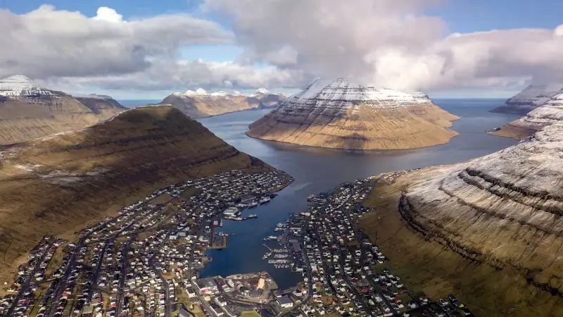
2-day itinerary on Borðoy: Klaksvík, Klakkur, the Kallur lighthouse on Kalsoy, Kunoy and Viðoy. The wild north of the Faroe Islands.
2 days
Suðuroy Road Trip: Complete Guide to the Island at the End of the World
Suðuroy road trip in the Faroe Islands: ferry, Fámjin, Beinisvørð cliffs, Tvøroyri, Vágur, Sumba. 2-day itinerary and practical tips.