Itineraries
Iceland's south coast: a 4-day itinerary from Reykjavik to Jökulsárlón
We may earn a commission when you book through links on this page, at no extra cost to you. We don't visit or try the places we cover: we summarize published sources. How we work
Day by day
- Day 1Seljalandsfoss and Skógafoss waterfalls, overnight in Vík
- Day 2Vík, Reynisfjara, Dyrhólaey, Sólheimajökull glacier, drive east
- Day 3Skaftafell and Svartifoss, Jökulsárlón lagoon and Diamond Beach
- Day 4Return drive to Reykjavik, about 380 km
Weather through the year on this route
| Jan | Feb | Mar | Apr | May | Jun | Jul | Aug | Sep | Oct | Nov | Dec | |
|---|---|---|---|---|---|---|---|---|---|---|---|---|
| High °F (°C) | 341 | 341 | 352 | 394 | 468 | 5211 | 5513 | 5513 | 4910 | 426 | 373 | 341 |
| Low °F (°C) | 28-2 | 27-3 | 28-2 | 310 | 373 | 436 | 468 | 468 | 426 | 352 | 310 | 28-2 |
Normals 1991–2020 at Reykjavik and Stykkishólmur: averages over 30 years, not a forecast. Source: NASA POWER (MERRA-2), grid of about 50 km. Figures computed by us in November 2026. Rain is shown only where a weather station confirms the figures.
In short
- Three to four days cover Reykjavik to Jökulsárlón at an easy pace: about 380 km (236 mi) each way, 5 to 6 hours of driving without stops.
- The itinerary stays under 200 km (124 mi) of driving per day, except the return.
- Route 1 is paved all year and all sites are reachable with a regular car; winter wind, ice and snow call for checking road conditions before each departure.
- Book lodging in advance from June to September, as villages have limited supply.
The south coast is the stretch of Route 1 that almost every traveler drives in Iceland, and over a few hundred kilometers it offers spectacular waterfalls, black sand beaches, basalt cliffs and stranded icebergs. It is done by car, at your own pace, with no track or river ford.
This four-day itinerary follows Route 1 from Reykjavik to the Jökulsárlón glacier lagoon, then comes back the same way. The stages stay reasonable, with room to stop, walk and take photos without driving at night in winter.
Preparing your south coast road trip
Reykjavik is about 185 km (115 mi) from Vík and about 380 km (236 mi) from Jökulsárlón. The full trip is therefore 5 to 6 hours of driving without stops each way, which means splitting the journey. The itinerary below stays under 200 km (124 mi) of driving per day, excluding the return.
A few points before you go:
- The road is Route 1, paved and well maintained. Speed limits are strict and checks frequent.
- The weather changes fast, with strong wind, rain and sometimes ice outside summer. Check forecasts and road conditions before each departure.
- Gas stations are farther apart east of Vík: fill up whenever you pass a pump.
- Booking lodging is essential from June to September, as supply is limited in the villages.
For car rental, compare offers before departure rather than deciding on arrival at the airport.
Day 1: Reykjavik, Seljalandsfoss and Skógafoss
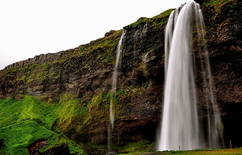
The first stretch is about 120 km (75 mi) to Seljalandsfoss, a little under two hours by road. Leave early: the waterfalls are more pleasant before the tour buses arrive.
Seljalandsfoss drops from a height of about sixty meters (197 ft) and has a rare feature: a path goes around the fall and lets you walk behind the curtain of water. Spray is abundant and the stones slippery, so put on a waterproof jacket and good shoes. A short trail leads to another waterfall, Gljúfrabúi, hidden in a crack in the cliff.
Skógafoss is a little farther east, in the village of Skógar. The waterfall is about 62 m (203 ft) high and about 25 m (82 ft) wide, and its roar can be heard from the parking lot. A staircase leads to the top, which offers a view of the coast. In sunny weather, a rainbow often forms in the spray. The Fimmvörðuháls hiking trail also starts here, between the Eyjafjallajökull and Mýrdalsjökull glaciers, a hike of several hours reserved for equipped walkers.
End the day in Vík, about 185 km (115 mi) from Reykjavik in all.
Staying in Vík or the area
Guesthouses, hotels and countryside lodging to compare, to be booked early in high season.
Day 2: Vík, Reynisfjara and the Sólheimajökull glacier
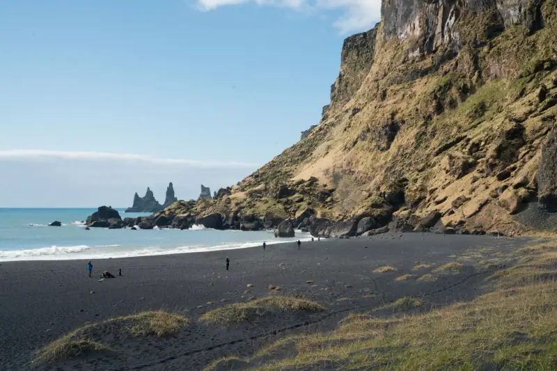
Devote the morning to the area around Vík, where the landscape changes: the coast becomes wilder and the sand is black.
Reynisfjara is the country’s most famous black sand beach. You discover basalt columns that recall an organ, a cave carved into the cliff and, offshore, the Reynisdrangar rock needles. The beach is beautiful but dangerous: sneaker waves surge without warning and run far up the sand. Stay well back from the water, never turn your back on the sea and follow the warning signs.
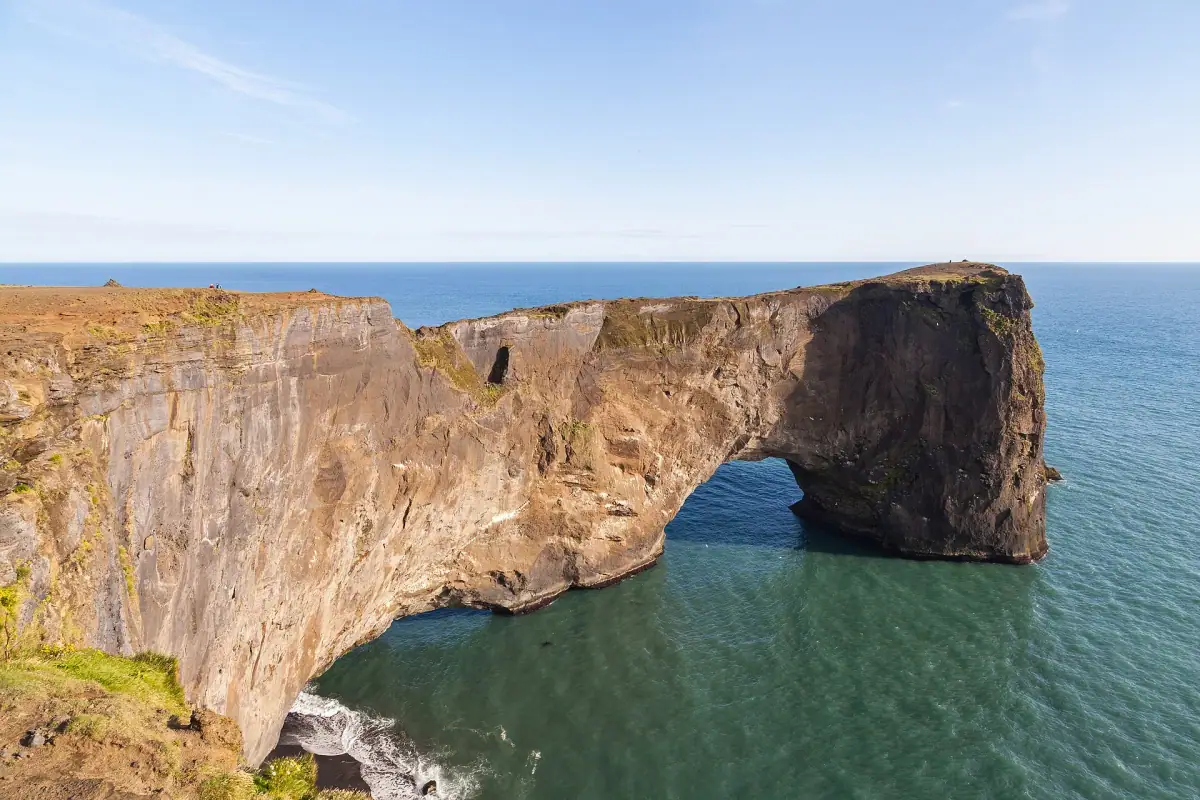
Dyrhólaey, a promontory a few kilometers west of Vík, offers a viewpoint over the coast and a large rock arch. Car access may be closed at certain times, notably in spring to protect nesting birds. In summer, puffins are often seen there.
In the afternoon, Sólheimajökull, a tongue of the Mýrdalsjökull glacier, is reached by a short path from the parking lot. Approaching the ice is tempting, but you should never walk on it without a guide: crevasses, snow bridges and melt make the terrain dangerous. Guided outings with crampons are offered by specialized operators.
Glacier hike with a guide
Compare guided outings with equipment, departing from the south coast.
At the end of the day, take the road east. Villages are rare on this stretch, and the moss-covered lava around Kirkjubæjarklaustur deserves a stop. You can stay overnight there, or continue to the Skaftafell area, depending on availability.
Day 3: Skaftafell and the Jökulsárlón lagoon
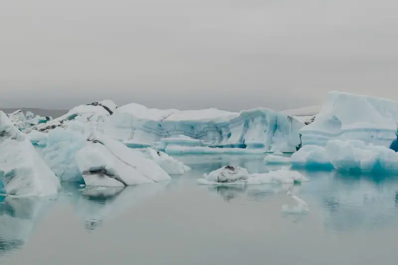
This day is the most spectacular, as it takes you into Vatnajökull National Park, home to Europe’s largest glacier by volume.
Skaftafell offers marked trails of varying difficulty. One of the best known leads to the Svartifoss waterfall, surrounded by dark basalt columns. Allow a good half day depending on the trail chosen.
Jökulsárlón is about 60 km (37 mi) farther east. The lagoon formed in the 20th century with the retreat of the Breiðamerkurjökull glacier, and its maximum depth reaches about 280 m (919 ft), making it one of the deepest lakes in the country. Ice blocks break off the glacier, float on the water, then reach the ocean through a short channel where seals come to fish.
On the other side of the road, on the beach known as Diamond Beach, pieces of stranded iceberg glitter on the black sand. Boat trips, by zodiac or amphibious vehicle, are organized on the lagoon: book them ahead in summer.
For the night, the Jökulsárlón and Höfn area has guesthouses and hotels, but supply is limited: it is better to book well in advance.
Staying near the lagoon
Lodging around Höfn and the glacier, limited in number and quickly full in season.
Day 4: the return to Reykjavik
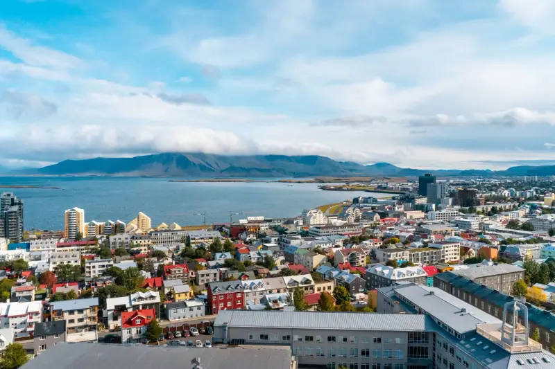
The return is about 380 km (236 mi), 5 to 6 hours of driving without stops. It is the longest day: leave early and plan the stops you missed on the way out, such as a waterfall or a viewpoint, rather than driving straight through.
If you have an extra day, break the trip with a night in Vík or Kirkjubæjarklaustur. You can also add the Golden Circle on the last day, described in our guide to the Golden Circle in Iceland.
When to go and what to plan
Summer is the simplest season: very long days, clear roads and access to all sights. Lodging is then expensive and quickly full. If you prefer winter, our guide to ice caves, snowmobiling and outings to book details what awaits you on the glacier.
Outside the season, the south coast remains accessible, but you must deal with wind, rain and ice. Days are short in winter, which limits sightseeing time each day, in exchange for possible northern lights and snowy landscapes. In all cases, bring layered clothing, a waterproof jacket and sturdy shoes.
Our take
The south coast deserves its status as a classic: it concentrates very different landscapes on a single road, with no driving difficulty apart from the weather. Four days let you cover it comfortably. By booking nights early and keeping a margin on schedules, it is an accessible road trip even for a first visit to Iceland.
Sources
- Visit South Iceland: figures checked November 2026
- Visit South Iceland: figures checked November 2026
Frequently asked questions
How many days do you need for Iceland's south coast?
Three to four days let you drive without rushing between Reykjavik and the Jökulsárlón lagoon, about 380 km (236 mi) each way. In a single day you can go as far as Vík and back, but then you see neither the glaciers nor the lagoon.
What is the distance between Reykjavik and Jökulsárlón?
Allow about 380 km (236 mi) on Route 1, 5 to 6 hours of driving without stops. With stops at waterfalls and beaches, it is better to split the trip over two days.
Do you need a 4x4 for the south coast?
No, Route 1 is paved all year and all sites on this itinerary are reachable with a regular car. In winter, however, wind, ice and snow call for caution and for checking road conditions before each departure.
Can you swim at Reynisfjara?
No. The beach is known for unpredictable sneaker waves that run far up the sand and have already swept visitors away. Stay a good distance from the water, never turn your back on the ocean and follow the signs posted there.
What is the best time for the south coast?
From June to August, very long days and clear roads make the stages easier. From September to March, you may see northern lights and ice caves in the glacier area, at the price of short days and changeable weather.
More Iceland guides
Keep reading
Iceland budget: real costs, 3 priced profiles and money-saving tips
Budget for a trip to Iceland in 2026: lodging, car, meals and activities item by item, three priced profiles and tips to spend less.
When to go to Iceland: seasons, northern lights and the midnight sun
When to go to Iceland depending on what you want: northern lights, midnight sun, puffins, whales, Highland roads. Month by month, no bad surprises.
Northern lights in Iceland: where and when to see them (complete guide)
See the northern lights in Iceland: best season, best spots around Reykjavik, the South, Snæfellsnes and the North, forecasts and photo tips.
Ready-made
Iceland itineraries
3 days
North Iceland in 3 days: Goðafoss, Mývatn and Húsavík
Lake Mývatn areaHúsavík
2 days
Snæfellsnes Peninsula: a 2-day itinerary from Reykjavik
Visit Iceland's Snæfellsnes Peninsula: Kirkjufell, Arnarstapi, Djúpalónssandur, Búðir and Stykkishólmur. A 2-day itinerary with drive times and tips.