Things to do
Hiking in Rwanda: the best treks from the volcanoes to Nyungwe
We may earn a commission when you book through links on this page, at no extra cost to you. We don't visit or try the places we cover: we summarize published sources. How we work
In short
- A guide is mandatory on every hike in the national parks (Volcanoes, Nyungwe, Akagera); the Volcanoes hikes start at Kinigi with registration at 7:00 am.
- Bisoke (3,711 m / 12,175 ft) takes 4 to 6 hours and costs USD 75; Karisimbi (4,507 m / 14,787 ft) is a 2-day trek, about USD 400.
- The Nyungwe canopy walk is the easiest hike (2 to 3 hours, about USD 60); the Congo Nile Trail is 227 km (141 mi) and takes 7 to 10 days.
- June to September is the best time; avoid March to May on the volcanoes.
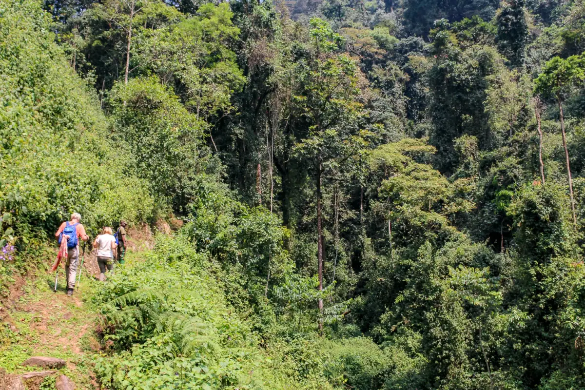
Rwanda is often called “the land of a thousand hills”, and for good reason. From the volcanic chain in the north to the misty forests of the southwest, Rwanda’s terrain offers some of the most spectacular treks in East Africa. Bisoke volcano and its emerald crater lake, the Karisimbi climb above 4,500 meters, the canopy walk 70 meters (230 ft) above Nyungwe forest, the Congo Nile Trail along Lake Kivu… Rwanda is a paradise for hikers.
This guide covers the country’s best hikes, from the accessible stroll to the demanding two-day trek.
Overview of hiking in Rwanda
The three main hiking areas
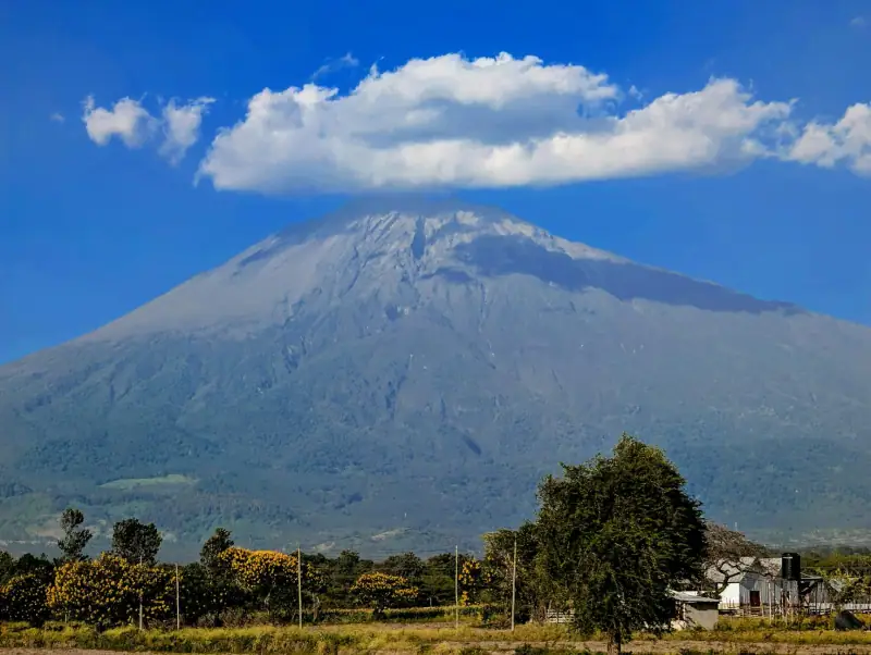
Rwanda concentrates its hikes in three distinct regions:
Volcanoes National Park (north): the Virunga chain forms the border with Uganda and the DRC. Five volcanoes can be hiked: Bisoke, Karisimbi, Sabyinyo, Gahinga and Muhabura. It is the heart of Rwandan trekking.
Nyungwe National Park (southwest): one of Africa’s largest mountain forests. Nyungwe’s trail network is dense (130 km / 81 mi) and offers very varied experiences, from the canopy walk to multi-day hikes.
The Congo Nile Trail (west): a trail running along Lake Kivu for 227 km (141 mi), from Rubavu in the north to Rusizi in the south. Split into stages, it crosses hills, tea plantations and rural villages in an exceptional setting.
What to know before you go
A few rules apply to all hikes in Rwanda:
- Mandatory guide in all national parks, no exception
- Booking ahead recommended for the volcanoes (especially in high season)
- Rain gear always in the pack: the weather is unpredictable even in the dry season
- Walking sticks strongly advised on the volcanoes (muddy slopes)
- Altitude: the volcanoes rise between 3,700 and 4,500 m (12,140 to 14,760 ft); start early to avoid the afternoon clouds
Hiking tours in Rwanda
Combine volcanoes, gorillas and Nyungwe with a professional guide.
Hikes in Volcanoes National Park
Volcanoes National Park (VNP) is the jewel of Rwandan trekking. The starting point for all hikes is Kinigi, a few kilometers from Musanze. Registration is at the Rwanda Development Board (RDB) office, where your guide is assigned.
Hours: registration starts at 7:00 am, and groups leave around 8 to 8:30 am at the latest.
How to get to Kinigi: from Kigali, allow 2 h 30 via national road RN2 through Muhanga. From Musanze, it is only 15 minutes.
Bisoke volcano hike (difficulty 3/5)
The most popular after the gorillas
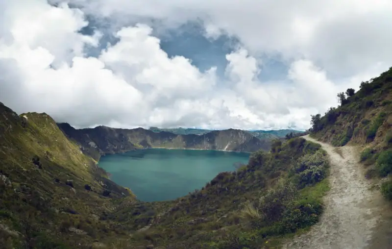
Bisoke (3,711 m / 12,175 ft) is Rwanda’s classic volcano hike. The reward at the summit is exceptional: an intense blue-green crater lake, one of the finest in the whole Virunga chain.
Key facts:
- Start: 2,337 m / 7,667 ft (RDB office Kinigi)
- Summit: 3,711 m / 12,175 ft
- Elevation change: +1,374 m / -1,374 m (+4,508 ft / -4,508 ft)
- Distance: 14 km (8.7 mi) round trip
- Duration: 4 to 6 hours depending on pace
- Difficulty: intermediate (good fitness is enough)
- Permit: USD 75 per person
The route: the climb begins in the vegetable fields of the lower slopes, then quickly enters the park’s mountain forest. You cross zones of bamboo, tree ferns and hagenia with moss-covered branches. The last 400 meters (1,312 ft) of elevation are on a windswept grassy slope.
At the summit: Bisoke’s crater lake is one of Rwanda’s most memorable sights. On a clear day you can see the Congo and Uganda in the distance. With luck, buffalo and antelope frequent the lake’s edges.
Tips: bring walking sticks (rentable at Kinigi, ~USD 5). Bring warm and waterproof clothing: the summit may be in the clouds. The climb takes 3-4 hours, the descent 2-3 hours.
View of the DRC side: from the summit of Bisoke you can also see the crater on the Congolese side, two countries, one mountain.
Karisimbi volcano climb (difficulty 5/5)
For seasoned hikers
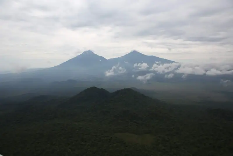
Karisimbi (4,507 m / 14,787 ft) is Rwanda’s highest peak and one of the highest volcanoes in the Virunga chain. The climb is done over two days with a night of camping at 3,700 m (12,140 ft), an unforgettable but demanding experience.
Key facts:
- Summit: 4,507 m / 14,787 ft
- Total elevation gain: +2,170 m (+7,119 ft)
- Duration: 2 days (Day 1: climb to camp, 6-8 h; Day 2: summit and descent, 8-10 h)
- Difficulty: hard (altitude, night cold, long duration)
- Permit: about USD 400 per person according to rates noted in 2026 (to confirm with the RDB), guide fees excluded
What awaits hikers:
On the first day, you climb to the camp at 3,700 m through the bamboo forest, the hagenia and hypericum zone, then high-altitude grassland. The night in a tent is cold (often below freezing); camping gear is supplied by the agencies.
On the second day, the start is at 3:00-4:00 am to reach the summit at sunrise, above the clouds. The spectacle, with the Nyiragongo and Nyamulagira volcanoes on the Congolese side (depending on their activity) and Lake Kivu below, is among the finest in Central Africa.
What to see on the way:
- Bamboo forests (golden monkeys possible)
- Giant lobelias and groundsels above 3,500 m (11,480 ft)
- Views over all of Rwanda on a clear day
Essential gear: sleeping bag rated 0 °C (32 °F) minimum, thermal clothing, rain jacket, gaiters, walking sticks, headlamp. Rentable from agencies in Musanze.
Lodging in Musanze
The ideal base for treks in the Volcanoes: hotels and guesthouses in Musanze.
Trek to Dian Fossey’s grave (difficulty 3/5)
History and high-altitude forest
Dian Fossey, the American primatologist who devoted her life to studying mountain gorillas, is buried on the slopes of Bisoke, in the heart of Volcanoes Park. Her grave lies beside those of her favorite gorillas at Karisoke camp, which she founded in 1967.
Key facts:
- Maximum altitude: about 3,000 m (9,843 ft)
- Duration: 3 to 4 hours round trip
- Difficulty: intermediate
- Permit: USD 75 (same permit as Bisoke)
- Interest: history + mountain forest + possible golden monkeys
What you will see: the hike climbs through hagenia-hypericum forest to Karisoke camp at 3,000 m. On the way you may glimpse golden monkeys, a species endemic to the Virunga. The graves of Dian Fossey and her gorillas are moving and recall her fight for conservation.
Historical background: Dian Fossey was murdered in her camp in 1985 in circumstances never fully explained. Her book Gorillas in the Mist and the film made from it helped make mountain gorillas known to the world.
The other VNP volcanoes
Sabyinyo volcano (3,634 m / 11,923 ft): the technically hardest of the accessible volcanoes. You cross exposed ridges and climb fixed ropes. Spectacular view of the Rwanda-Uganda-DRC tripoint at the summit. Duration: 7-8 hours. Very few visitors.
Gahinga volcano (3,474 m / 11,398 ft): the climb crosses a remarkable bamboo zone. Less spectacular than Bisoke but wilder. Duration: 5-6 hours. A good alternative if the weather on Bisoke is uncertain.
Muhabura volcano (4,127 m / 13,540 ft): second highest after Karisimbi. Long and demanding (8-10 h round trip). Rarely done. A beautiful crater lake at the summit in clear weather.
Hikes in Nyungwe National Park
Nyungwe National Park covers 1,019 km² (393 sq mi) of tropical mountain forest in southwestern Rwanda. It is one of Africa’s richest forests for biodiversity: 1,068 plant species, 322 bird species, 75 mammal species, 13 primate species.
The Canopy Walk (difficulty 4/5)
Nyungwe’s headline activity
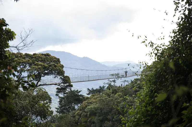
The Canopy Walk is Nyungwe’s best-known tourist attraction. A suspension bridge 160 meters (525 ft) long at 70 meters (230 ft) high crosses the forest canopy, offering a plunging view of the treetops and a unique glimpse of life in the trees.
Key facts:
- Start: Uwinka Visitor Center (Nyungwe park)
- Duration: 2-3 hours (access hike + bridge + return)
- Elevation gain: 100-150 m (328-492 ft) climb
- Difficulty: easy to intermediate
- Rate: about USD 60 per person, guide included according to operators (rate to confirm with the park or the RDB)
- Heights: not recommended if you are afraid of heights
The route: you climb from the Visitor Center through primary forest for 45-60 minutes, looking for primates and forest birds. The bridge itself is 160 m long and divided into three sections. Feeling the bridge sway underfoot, above the canopy, is a unique sensation.
What you see: the access trail runs through Angolan colobus territory (black-and-white primates). Forest birds are exceptional: Ruspoli’s turaco, bulbuls, tree frogs.
Deep-forest hikes in Nyungwe
Waterfall Trail (Kamiranzovu waterfall): 3-4 hours’ walk through the forest to a fine waterfall. Often combined with chimpanzee observation. Moderate difficulty.
Bigugu Trail: the top of Nyungwe (2,950 m / 9,678 ft), reached in 6-8 hours from the Uwinka Visitor Center. Panoramic view from the forest’s highest point. Demanding.
Karamba Trail: 4 hours on a forest path with good chances of seeing primates (colobus, guenons). Start from the Karamba Visitor Center in the south of the park.
Liana circuit: a 3-hour loop in semi-degraded forest on the periphery. Good for birds. Easy level.
Key tip: mornings are best for primates and birds. Arrive at the Visitor Center at opening (6:00 am).
See the guide to chimpanzees in Nyungwe for everything on chimpanzee trekking.
Activities in Nyungwe
Canopy walk, chimpanzee trekking and birdwatching outings in the forest.
The Congo Nile Trail: the great Lake Kivu crossing
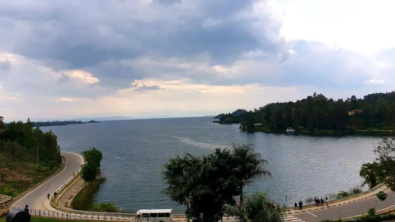
Introduction to the trail
The Congo Nile Trail is Rwanda’s emblematic long-distance hike. It runs along Lake Kivu for 227 km (141 mi), from Rusizi in the south to Rubavu in the north, along Lake Kivu. Developed as a hiking and mountain-bike trail since 2011, it crosses landscapes of extraordinary beauty.
General features:
- Total distance: 227 km (141 mi)
- Full duration: 7 to 10 days
- Cumulative elevation gain: significant, very hilly terrain
- Difficulty: intermediate to hard depending on pace
- Stages: no fixed rule, it is done in sections
Landscapes crossed
Tea plantations: the trail crosses several of Rwanda’s most beautiful tea plantations, notably in Nyamasheke district. The green terraces cascading toward the lake are the trail’s emblematic image.
Rural villages: unlike the national parks, the Congo Nile Trail passes through village communities. Authentic encounters guaranteed.
Hills and views of Lake Kivu: the trail climbs and drops constantly, offering successive panoramas of Lake Kivu, its islands and the Congolese mountains.
Nkora peninsula: a possible detour for charming lodging on a wooded peninsula in the middle of the lake.
Doing the trail in stages
It is entirely possible to do just one or two days of the Congo Nile Trail. The most popular stages:
Gisenyi to Rubengera stage: lake views from morning to evening, coffee and banana plantations. 1 day.
Kibuye (Karongi) to Cyangugu stage: the most varied section, with forests, tea plantations and descents to the lake. 3-4 days.
Gisenyi to Kibuye stage (partial): 2-3 days, very accessible, the one most travelers do.
The trail by mountain bike
The Congo Nile Trail was designed for both hiking and mountain biking. Bike rental is possible in Rubavu and Karongi. Biking is demanding (many bumps) but faster: the full trail takes 5-7 days by bike.
Trail logistics
Lodging: guesthouses and ecolodges dot the route every 15-25 km (9-16 mi). Quality varies. A local agency can book ahead.
Water and food: small kiosks are in the villages. Always carry a reserve of water and snacks for isolated sections.
Safety: the trail is used by travelers, but areas near the border with the DRC (Rubavu, Rusizi) have been the subject of warnings from several governments since the conflict in eastern Congo: check your government’s travel advice before booking (travel.state.gov in the US, GOV.UK in the UK, travel.gc.ca in Canada, Smartraveller in Australia; checked November 2026). An agency is recommended for luggage logistics (moto-taxi transfer between stages) and so you don’t get lost.
Also read: What to do at Lake Kivu to combine hiking and water activities.
Preparing your hike in Rwanda
Recommended gear
For all hikes:
- Waterproof hiking shoes with a lugged sole (terrain often muddy)
- Waterproof clothing (poncho or Gore-Tex jacket)
- Fleece or light down jacket (cold at height even in the dry season)
- 1.5-2 L water bottle (50-68 oz) and purification tablets
- Sunscreen and a hat (strong UV at altitude)
- 20-30 L backpack
For the volcanoes in addition:
- Walking sticks (or rental at Kinigi ~USD 5)
- Gaiters (for muddy climbs)
- Headlamp (dawn start)
- Light gloves (cold summit)
For Karisimbi in addition:
- Sleeping bag rated 0 °C (32 °F) minimum
- Multilayer thermal clothing
- Thermos
Bookings and permits
Volcanoes Park (Bisoke, Karisimbi, Sabyinyo, etc.):
- Permits sold by the Rwanda Development Board (RDB)
- USD 75 per hike per person (Bisoke, Dian Fossey); about USD 400 for Karisimbi (to confirm with the RDB)
- Booking possible online at rdb.rw or in person in Kinigi
- High season (July to August): book 2-3 weeks ahead
Nyungwe Park (Canopy Walk, treks):
- Entry + activity: about USD 60 for the canopy walk (rate to confirm with the park)
- Bookable at the Uwinka Visitor Center the same morning (outside high season)
Congo Nile Trail:
- No mandatory official permit
- Logistics through a local agency recommended
Recommended trekking agencies
Many agencies in Musanze and Kigali offer turnkey packages including transport, guide, permits and sometimes lodging:
- Certified local guides assigned by the RDB at the Kinigi office
- Agencies in Musanze: many guesthouses offer direct organization
- Agencies in Kigali: more complete for circuits combining volcanoes + Nyungwe + Akagera
When to go hiking in Rwanda
Long dry season: June to September (best)
This is the best period for mountain hikes. Trails are dry, views clear, temperatures pleasant (15-22 °C / 59-72 °F in the daytime at altitude). It is also high tourist season, so book your permits ahead.
Short dry season: December to January (good)
A good alternative, especially in December. Vegetation is green after the rains. Less crowded than in high season.
Long rainy season: March to May (warning)
Not advised for the volcanoes: very muddy trails, risk of slipping, views often blocked by clouds. Possible for Nyungwe (the forest stays beautiful in the rain) but tracks are difficult. The Congo Nile Trail becomes very demanding.
Short rainy season: October to November (warning)
Similar to March-May in conditions. Avoidable for the volcanoes but acceptable for forest treks.
Recommended itineraries
Volcano hiking weekend (2-3 days)
Day 1: arrive in Musanze, guesthouse lodging Day 2: Bisoke volcano trek (full day), leave Kinigi at 7:30 am, back 3-4 pm Day 3: gorilla option or back to Kigali
Volcanoes + Nyungwe combined (5-7 days)
Days 1-2: Kigali to Musanze, Bisoke trek or gorillas Day 3: drive Musanze to Nyungwe via Kibuye (Lake Kivu) Days 4-5: Nyungwe, canopy walk + chimpanzee trek Days 6-7: back to Kigali or continue on the Congo Nile Trail
See the 7-day Rwanda circuit for a complete itinerary including hikes and wildlife.
Grand Congo Nile Trail trek (7-10 days)
For seasoned hikers wanting a rural adventure on the shores of Lake Kivu, the full trail remains Rwanda’s most authentic experience.
Hiking in Rwanda is an experience in its own right. Whether you choose to climb Bisoke for its crater lake, lose yourself in the undergrowth of Nyungwe or follow Lake Kivu for several days, Rwanda’s “thousand hills” never disappoint. And unlike many African destinations, Rwandan hikes are well organized, safe and accessible to travelers of all levels.
To prepare your trip, see also the article on the best time to visit Rwanda. Entry rules depend on your passport. Check the official travel advice of your government before you book: travel.state.gov (US), GOV.UK (UK), travel.gc.ca (Canada), Smartraveller (Australia) (checked November 2026).
Frequently asked questions
Can you hike alone in Rwanda without a guide?
No, all hikes in the national parks (Volcanoes, Nyungwe, Akagera) must be accompanied by an official ranger guide. It is a strict safety rule and applies without exception. Guides are assigned at the starting point the same morning after registration.
What is the easiest hike in Rwanda?
The Nyungwe Canopy Walk is the most accessible hike: 2-3 hours on a well-marked path, moderate elevation gain and a spectacular suspension bridge 70 meters (230 ft) high. The Bisoke volcano trek (4 hours round trip) is a good intermediate level with a magnificent lake at the summit.
How much does the Bisoke volcano trek cost?
The Bisoke trek costs USD 75 per person (entry permit to Volcanoes Park), plus USD 15-30 for the guide. It is separate from the gorilla permit (USD 1,500 for a non-resident foreign visitor) and much more accessible. Book ahead at the RDB office in Kinigi or online.
Do you need to be very athletic to climb Karisimbi?
Karisimbi (4,507 m / 14,787 ft, 2 days) is a demanding hike that requires good fitness and experience at altitude. You camp at 3,700 m (12,140 ft) the first night. By contrast, Bisoke (3,711 m / 12,175 ft, 4 h round trip) is accessible to any healthy walker without specific training.
What is the best time to hike in Rwanda?
The long dry season (June to September) is ideal: less slippery trails, clear views over the volcanoes, pleasant temperatures. December to January is a good alternative. To avoid: March to May (long rainy season) on the volcanoes, when trails become muddy and views are often hidden.
Can the Congo Nile Trail be done independently?
Yes, the Congo Nile Trail is one of the few hikes that can be done partly independently, as it follows Lake Kivu on rural paths. However, a local agency is strongly recommended for logistics (lodging, luggage transfers, safety). The full route (227 km / 141 mi) takes 7-10 days.
More Rwanda guides
Keep reading
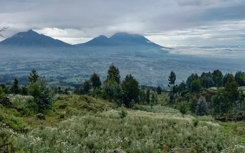
Volcanoes National Park, Rwanda: complete guide 2026
Mountain gorillas, Virunga hikes, golden monkeys and the Fossey memorial: everything you need to visit Volcanoes National Park in Rwanda.
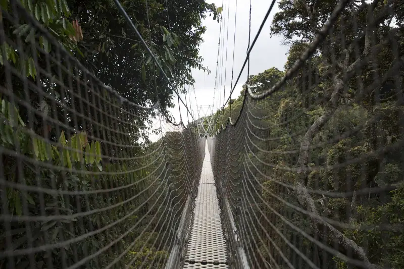
Nyungwe canopy walk: price, booking, hours and minimum age
Nyungwe canopy walk in Rwanda: USD 40 or 60 depending on the source, slots from 8 am to 3 pm, minimum age 6, online booking and vertigo.
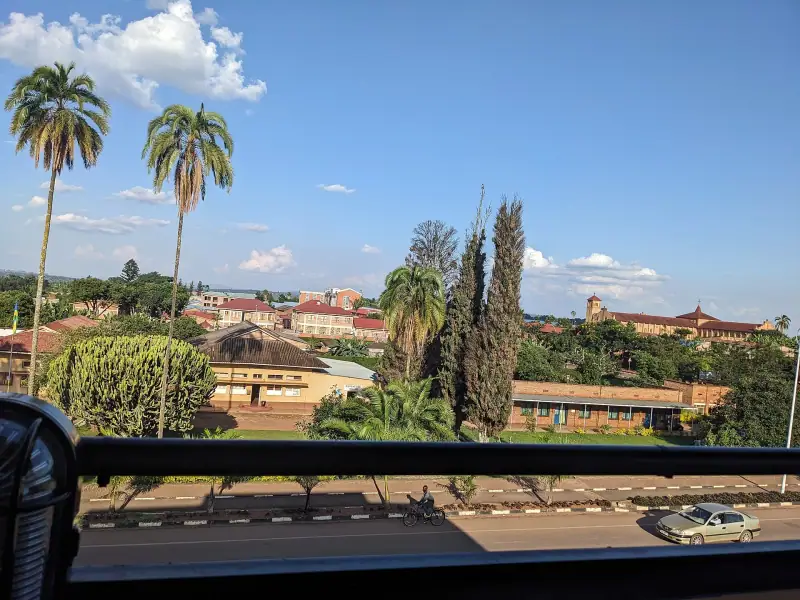
Visiting Huye (Butare): complete guide to Rwanda's cultural capital
Huye (Butare), Rwanda's cultural capital: National Museum, Nyanza Royal Palace, gateway to Nyungwe. A complete guide to visiting the town.
Ready-made
Rwanda itineraries
10 days
Rwanda in 10 days: complete itinerary with gorillas, safari, Lake Kivu and Nyungwe
KigaliAkagera National ParkMusanzeRubavu (Gisenyi)Nyungwe
7 days
Rwanda in 7 days: complete itinerary and practical tips
KigaliMusanzeGisenyi (Rubavu)
Can be adapted in the planner
3 days
Lake Kivu road trip: from Rubavu to Karongi along the Rwandan shore
Rubavu (Gisenyi)Karongi (Kibuye)