What to see
Cirque de Mafate: A Complete Guide to Réunion's Only Road-Free Cirque
We may earn a commission when you book through links on this page, at no extra cost to you. We don't visit or try the places we cover: we summarize published sources. How we work
In short
- Mafate is Réunion's only cirque with no road: you enter on foot by the Col des Bœufs, the Maïdo or the Rivière des Galets, or by helicopter.
- Plan 2 to 3 days minimum; experienced hikers often take 4 to 5. Book mountain gîtes well ahead, especially in July and August.
- Dorm beds run about €25 (~$29) per night and half board about €45-65 (~$52-75); cell coverage is limited, so tell someone your route.
- The dry season, May to October, is best; the cyclone season (January to March) brings a risk of sudden floods.
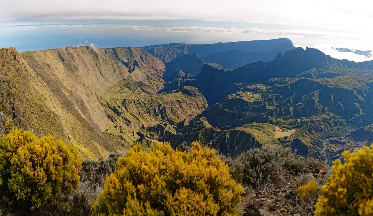
There is a place in Réunion where cars never arrive. Where roads stop at the edge of the walls and the only way in is to lace up boots and walk. It is called Mafate, and it is one of the last inhabited places in France where daily life goes on without asphalt, supermarkets or traffic jams: about 700 residents spread over around ten îlets (small hamlets) perched between 800 and 1,800 m (2,625 and 5,905 ft) in elevation, linked only by mountain trails or by helicopter.
The Cirque de Mafate is the wildest, most secret and, for many hikers, the most fascinating of the island’s three big cirques. Less touristy than Cilaos, less accessible than Salazie, it takes effort to reach, and that is exactly why the impression it leaves lasts so long. This guide gives you everything you need to venture into it safely.
Mafate: the cirque that said no to roads
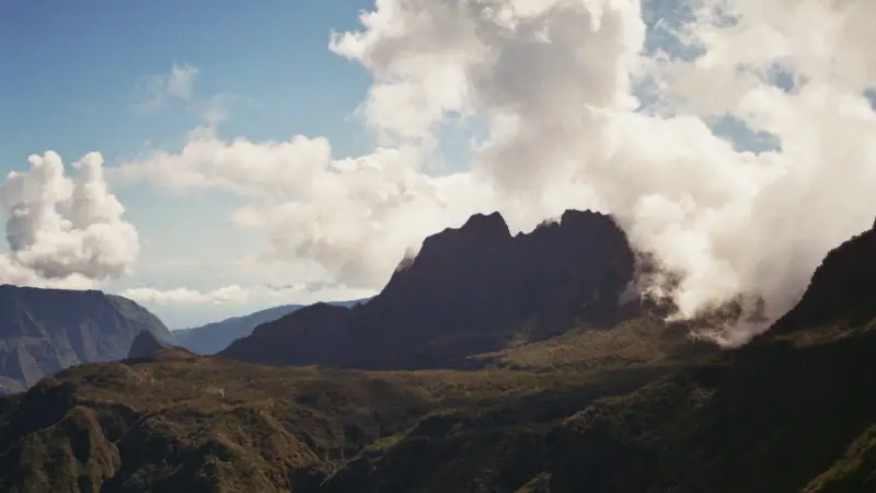
Like its two siblings, Cilaos and Salazie, the Cirque de Mafate was formed by the collapse of an ancient volcanic caldera. Millions of years of erosion carved a natural amphitheater of more than 95 km² (37 sq mi) into the western part of the island, ringed by walls that reach 2,000 m (6,560 ft) in places. All of Réunion is a volcanic island born from nothing, but Mafate, more than anywhere else, feels shaped to stay untouched.
The lack of a road is not an oversight by engineers. Road links were considered during the 20th century, but the cirque’s topography, its nearly vertical walls and the constant risk of landslides made them technically impossible or economically senseless. As a result, Mafate is today the only inhabited territory in France, mainland or overseas, that is completely inaccessible by car.
This has given it a special status. The people of the cirque, called “Mafatais,” have developed a self-reliant way of life built around helicopter resupply (for heavy goods), subsistence farming and hiking tourism. Children at the cirque’s schools (there are several, in La Nouvelle among others) walk home with their backpacks on the same trails used by hikers on vacation.
The geography of the cirque
Mafate opens to the northwest, toward the sea. The Rivière des Galets, which rises in the heart of the cirque, cuts a deep gorge toward the coast and is one of the historic routes into the cirque from the shore. The main îlets are spread over several elevation levels, some on the cirque floor (around 800-1,000 m / 2,625-3,280 ft), others clinging to the sides of the walls at much higher altitudes.
The cirque’s high point is not the Piton des Neiges, which sits on the ridge separating Mafate from Cilaos and Salazie, but several summits reached from the ridges easily top 2,000 m (6,560 ft). The Col des Bœufs, the main entry point from the Salazie side, is at about 1,950 m (6,400 ft).
Helicopter flight over Mafate
See the Cirque de Mafate from the air: a plunging view of the îlets and walls that only a scenic flight can give.
How to get to the Cirque de Mafate
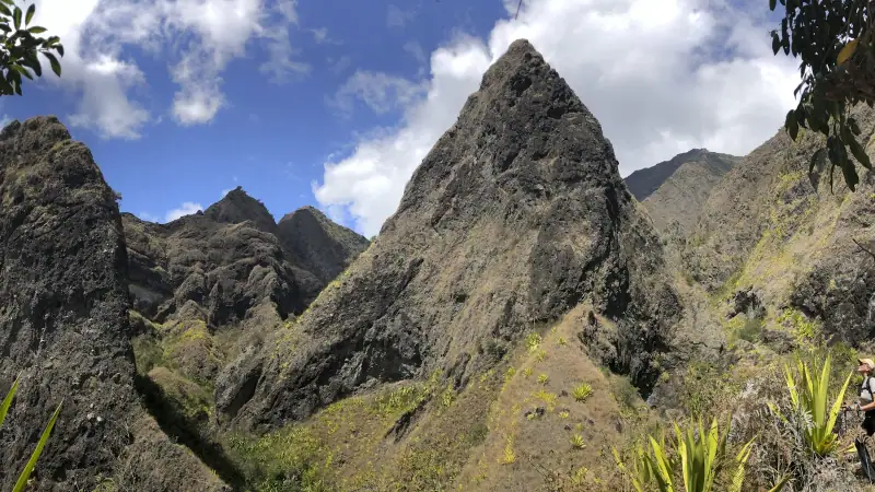
Entering Mafate is an experience in itself. Whichever access point you choose, at some point you will tip into another world, one where the walls close off the horizon and the noise of civilization gradually fades behind you.
The Col des Bœufs (Salazie side): the busiest entrance
The Col des Bœufs is the most used access point to Mafate. You reach it from Grand Ilet, in the Cirque de Salazie, by a paved road and then a forest road to the guarded Col des Bœufs parking lot, where the trail starts (parking is sometimes paid and often full early in the morning). The climb to the pass takes about 1 h 30 to 2 h depending on your pace.
Once at the pass, at about 1,950 m (6,400 ft), you look down on Mafate and its dizzying green. The descent to the first îlets (La Nouvelle, Roche-Plate or Marla depending on your destination) takes another 1 h 30 to 2 h 30, with a big elevation loss. Plan on strong knees for the descent.
By car: Reach Grand Ilet from the Cirque de Salazie (by the Hell-Bourg road and then inland), park in the designated parking lot and walk up.
The Maïdo (west side): for hikers from the coast
From the west of the island, access to Mafate is via the Maïdo, a spectacular viewpoint over the cirque at 2,205 m (7,235 ft). The Maïdo road from Saint-Paul can be driven. From the Maïdo parking lot, trails descend to the îlets of Aurère, Roche-Plate or La Nouvelle depending on the direction you choose.
The descent from the Maïdo is long and steep. Allow 2 to 3 hours of walking to reach the first îlets, and plan for the climb back, which will be grueling. This entrance is recommended for experienced hikers.
By car: From Saint-Paul, take the Maïdo Forest Road (RF8) toward the Maïdo. Check road conditions and parking restrictions (closures are possible) with the Département or the ONF (national forestry office). To simply admire the cirque from the viewpoint at dawn, see our guide to the Maïdo at sunrise.
The Rivière des Galets (north side): the historic coastal entrance
The entrance via the Rivière des Galets, from the coastal plain to the north, is the longest and most demanding. It enters the cirque along the riverbed, through narrow gorges. It is the historic access, once used by residents and supply porters. Today it is mostly taken by hikers looking for an “authentic,” less crowded entrance. It requires experience, a good sense of direction and good weather, because the riverbed can be dangerous in a flood.
Helicopter: for those who don’t hike
Regular helicopter links serve the cirque from heliports on the west coast, notably around Saint-Paul. These flights mainly carry supplies and residents, but tourists can book seats to enter and leave the cirque. The plunging view of the walls and îlets from a helicopter is worth the trip by itself. Book several weeks ahead, especially in high season.
The îlets of Mafate: timeless villages
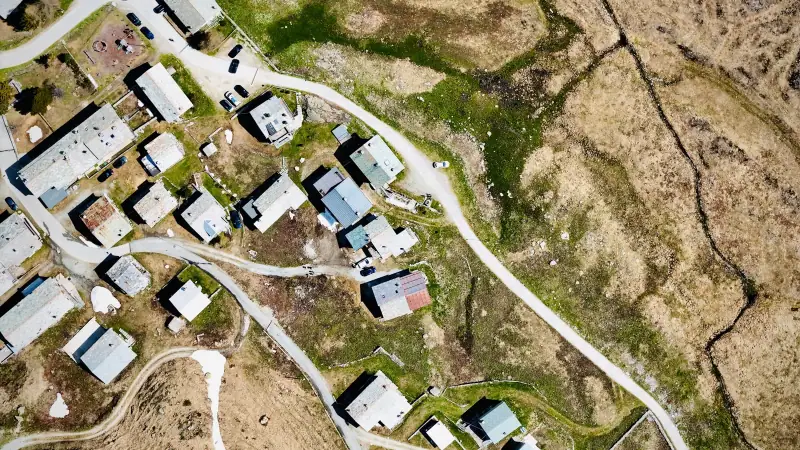
What makes Mafate unique among Réunion’s hiking destinations is these inhabited îlets: small hamlets perched in the cirque, with their vegetable gardens, poultry, schools and mountain gîtes. Crossing an îlet after several hours of walking, sitting down with a glass of pressed fruit juice and chatting with a resident is an experience few destinations in France can offer.
La Nouvelle: the heart of the cirque
La Nouvelle is the most populated and best-equipped îlet in Mafate. It has a school, a nursing clinic, several mountain gîtes and a heliport. It is often the start or end point of cirque crossings. The view from La Nouvelle of the surrounding walls is striking.
La Nouvelle can be reached from the Col des Bœufs (allow about 2 h of walking from the pass) or from the Maïdo by a descending trail. It is a good place for a first night in the cirque and to settle into the Mafatais pace of life.
Roche-Plate: perched in the clouds
Roche-Plate is one of the most spectacularly located îlets in Mafate, set on a plateau between two valleys with an open view of the walls and, in clear weather, toward the coast. Its setting is breathtaking and its atmosphere calmer than La Nouvelle. A few gîtes host hikers.
Marla: the îlet of the highlands
Marla sits at a higher elevation than most other îlets, in a setting that is often misty, giving it a mysterious feel. It is a waypoint for hikers crossing the cirque toward Salazie and the Piton des Neiges. The vegetation at this altitude (tree heath, highland tamarinds) differs from that of the cirque floor.
Aurère: the gateway to the Maïdo
Aurère is the îlet closest to the western edge of the cirque, below the Maïdo. Its position makes it easy to reach from the Maïdo entrance, so it is often the first stop for hikers arriving from Saint-Paul and the west coast. Its trail to Ilet à Malheur is one of the busiest in the cirque.
Ilet à Malheur: the hidden jewel
Despite its uninviting name (“Misfortune Islet”), Ilet à Malheur is one of the most appealing îlets in Mafate. Surrounded by walls on almost every side, it gives a feeling of total enclosure in the good sense of the word: being sheltered from the world. A few gîtes welcome hikers tired from the trails.
Guided hikes in the Cirque de Mafate
Explore Mafate with a local guide who knows the cirque, so you don't get lost and can find the best trails.
The must-do hikes in Mafate
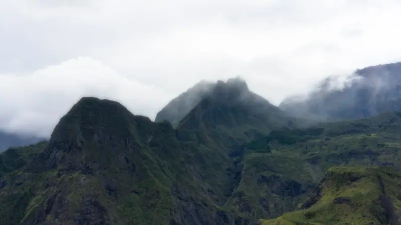
Mafate is above all a hiking destination, and its trails are among the finest in Réunion. Here are the most popular and most beautiful routes you can take.
Col des Bœufs – La Nouvelle – Maïdo crossing (2-3 days)
This is the classic crossing of Mafate, linking the eastern entrance of the cirque (Col des Bœufs, Salazie side) to the western entrance (Maïdo, Saint-Paul side). The two- to three-day route crosses the cirque’s most varied landscapes and passes through several îlets, so you can sleep in a gîte each night.
Day 1: Col des Bœufs → La Nouvelle (about 5-6 h, large elevation gain/loss) Day 2: La Nouvelle → Roche-Plate (about 4-5 h, panoramic trails) Day 3: Roche-Plate → Maïdo (steep climb, about 4-5 h)
This crossing is considered accessible for fit hikers with mountain experience. Booking gîtes is essential.
The loop on the cirque floor (3-4 days)
For those who want to immerse themselves deeply in Mafate without a crossing as the goal, a loop on the cirque floor visits several îlets and returns to the starting point. This kind of route goes through La Nouvelle, Grand Place, Cayenne and Ilet des Lataniers before climbing back to the Col des Bœufs. Allow 3 to 4 days to enjoy the variants without rushing.
Climbing the Piton des Neiges from Mafate
Mountaineers and experienced hikers can reach the Piton des Neiges (3,070 m / 10,070 ft, the highest point in Réunion and the Indian Ocean) from the Cirque de Mafate, following the ridges toward the Caverne Dufour (a high-altitude hut at the foot of the Piton des Neiges, on the Cilaos side; check its opening and booking conditions). This multi-day climb from Mafate is for very seasoned walkers, with gear suited to low temperatures at altitude (close to 0 °C / 32 °F at night). For more on the island’s big hikes, see our complete guide to hiking in Réunion.
The GR R2: the great crossing of Réunion
The GR R2 is Réunion’s long-distance crossing trail, linking Saint-Denis to the south of the island via the cirques and summits. Its section through Mafate, between the Col des Bœufs and the Maïdo via La Nouvelle, Marla and the Piton des Neiges, is considered the most spectacular of the whole route. Hikers who do the full island crossing therefore have to go through Mafate, which makes it a legendary stage for long-distance hiking fans in France.
Places to stay in the Cirque de Mafate
Accommodation in Mafate is unlike anything you know elsewhere. No hotels, no fiber internet, no spa. Mountain gîtes, often run by Mafatais families for several generations, offer the essentials with remarkable generosity: a bed, a hot meal, and sometimes the best view of your life from the gîte’s veranda.
Mountain gîtes
Each major îlet has at least one mountain gîte. They generally offer dorms of 4 to 8 people, sometimes double rooms, and meals on a half-board or full-board basis. The cooking is Creole, simple and generous: rice, pork or chicken carry, beans, rougail. Hot water is not always guaranteed, but after a day of hiking even a cold shower is a luxury.
Dorm rates are generally around €25 (~$29) per person per night, and half board about €45-65 (~$52-75) (check rates with each gîte), very reasonable prices for such a unique experience. Be sure to book ahead, by phone or through platforms specializing in Réunion’s mountain gîtes. In July and August and during school holidays, gîtes are full weeks in advance.
Camping in the cirque
Camping is allowed in certain areas of the cirque, notably in designated spots near some îlets. For hikers who want to skip the gîtes, it is an option that gives great freedom. You must, however, be fully self-sufficient in food and filtered water, and be ready for changing weather, especially at altitude. Nights can be cool even in the warm season.
Places to stay around Mafate
Before or after your hike in the cirque, find a place to stay on the coast or around Saint-Paul.
Life in Mafate: a timeless community
What sets Mafate apart from every other hiking destination in France is the presence of a real human community living there year-round. It is not a nature park emptied of its residents, nor a set rebuilt for tourists: it is an inhabited territory, with families, children, cultivated fields and a history of its own.
The Mafatais: keepers of a rare way of life
The roughly 700 permanent residents of the cirque are heirs to a complex history. Mafate was long a refuge for marginalized people: escaped slaves (maroons) in the 18th century, poor farmers, people fleeing hardship on the coast. These origins forged a culture of self-reliance and resourcefulness that still shows in daily life.
Today the Mafatais grow vegetables and fruit, raise poultry and pigs, and live in houses with no connection to the national power grid. Electricity comes from solar panels, water from spring catchments. Basic supplies arrive by helicopter or on the backs of porters who walk the trails.
Some residents have set up gîtes to host hikers, diversifying their income. Hiking tourism is now one of the cirque’s main economic activities, and it generally takes place with exemplary mutual respect: visitors bring income, and the Mafatais offer in return a hospitality and authenticity that few places in the world can still offer.
The cirque’s schools
Mafate has several primary schools, spread across the main îlets. Secondary students must go down to the coast to continue their schooling, often as boarders. This constraint is one of the reasons some families leave the cirque, causing a slow decline in population over the decades.
Teachers who work in Mafate’s schools receive remoteness and isolation allowances and are generally housed in the cirque. Their daily life is that of all Mafatais: no car, no supermarket, trails to get from one îlet to another.
Weather and best time to visit Mafate
Mafate is a cirque open to the northwest, less rainy than Salazie (open to the east, on the trade-wind side) but still subject to frequent rain, especially on the heights. Weather can change quickly, with clouds filling the walls within minutes.
Best time: The austral dry season, May to October, offers the most favorable conditions. Days are generally sunny in the morning, with clouds arriving in early afternoon. Temperatures on the cirque floor are pleasant (20-26 °C / 68-79 °F) but cool at altitude (10-15 °C / 50-59 °F at night on the ridges).
Rainy season (November to April): Rain can be heavy and trails slippery. The cyclone season (January to March) brings a risk of sudden floods in the cirque’s rivers, a risk not to be ignored. Trails can be cut and helicopter evacuations may be needed. To choose the best time for your overall stay in Réunion, see our guide to the best time to visit Réunion.
Practical tips for hiking in Mafate
Essential gear:
- Waterproof, high-top hiking boots (trails can be very muddy)
- Light waterproof jacket (showers arrive without warning)
- Trekking poles (steep descents on slippery ground are very tiring without poles)
- First aid kit and personal medication (there are no pharmacies in the cirque)
- 1:25,000 topographic map or a loaded GPS (phone coverage is very limited)
- Water: 2 to 3 L (about 2 to 3 qt) per day minimum, plus purification tablets as a backup
- Spare food for an extra day (in case a gîte is unreachable)
- Headlamp (early starts and late arrivals are common)
Before you go:
- Always tell someone your route and expected return date
- Check trail conditions with local tourist offices or the Réunion National Park (trails can be closed after rain)
- Book your gîtes several weeks ahead in high season
- Don’t go alone if you are a beginner on this kind of terrain
- Follow National Park rules: carry out your trash, don’t pick plants, don’t disturb wildlife
Sample budget:
- Dorm bed in a gîte (night only): about €15-25 (~$17-29) per person
- Half board in a gîte: about €35-55 (~$41-64) per person
- Quick meal in an îlet (if available): about €10-15 (~$12-17)
- Emergency helicopter (non-urgent evacuation): cost varies by provider, so get insurance that covers this risk
- Car rental to reach the access points: see the car rental comparison below
To rent a car and reach the Col des Bœufs or the Maïdo, you will need a rental car from the airport. For places to stay before and after your hike in the cirque, see our Saint-Gilles accommodation guide for the west coast, or our Cilaos accommodation guide if you combine the two cirques.
Car rental in Réunion
Essential to reach the access points to the Cirque de Mafate (Col des Bœufs, Maïdo). Book early in high season.
Wildlife and plants of Mafate
The Cirque de Mafate lies within the Réunion National Park, a UNESCO World Heritage site since 2010. This protection guarantees an exceptional level of preservation for an inhabited area.
The vegetation changes considerably with altitude. On the cirque floor, semi-dry vegetation dominates (400-900 m / 1,310-2,950 ft), with wooded ravines of filao and invasive guava. Going up, vegetation thickens: forests of characteristic highland tamarinds settle in between 1,000 and 1,700 m (3,280 and 5,575 ft), with twisted trunks and filtered light that create a primeval-forest atmosphere. Higher still, tree heath forms a scrubland with an almost Scottish look.
Wildlife is less visible but present: papangues (Réunion harriers), tec-tecs (small endemic songbirds) and Réunion bulbuls liven the mornings in the mountain forests. Panther chameleons (Furcifer pardalis, a species native to Madagascar that has been established in Réunion since the 19th century, locally called “lendormis”) live in some vegetated areas. The rivers hold shrimp and fish adapted to cold highland waters.
Mafate is not a destination you “do” like a checklist item. It is a place that takes you by surprise, slows you down, makes you walk, look, and accept that the world can work differently. Hikers who enter it for the first time often leave transformed by something hard to put into words, perhaps simply the discovery that an ordinary corner of France can be this extraordinarily wild. Whether you arrive via the Col des Bœufs under a blue winter sky or in the clouds of a rainy-season morning, Mafate will always welcome you in its own way: in silence, and with breathtaking beauty.
Frequently asked questions
How do you get to the Cirque de Mafate?
Mafate is the only cirque in Réunion that cannot be reached by a drivable road. You enter on foot through several passes: the Col des Bœufs (from Grand Ilet, on the Salazie side), the trails from the Maïdo (west side) or from the Rivière des Galets (north side). You can also fly in by helicopter from Saint-Paul or Saint-Denis for a spectacular aerial view.
How many days do you need to visit Mafate?
At least 2 to 3 days are recommended to cross the cirque and enjoy the unique atmosphere of the îlets. Experienced hikers often choose 4 to 5 days to visit several îlets, take detours to viewpoints and enjoy the timeless pace of life in the cirque. A single day from the Col des Bœufs to La Nouvelle and back is possible but exhausting.
Where do you sleep in the Cirque de Mafate?
The cirque has several mountain gîtes spread across the main îlets: La Nouvelle, Roche-Plate, Marla, Grand Place, Ilet à Malheur and Aurère, among others. They offer dorms and sometimes private rooms, plus hot meals (half board is common). Booking ahead is essential, especially in July and August and during school holidays.
Is Mafate suitable for beginner hikers?
Mafate is generally not recommended for beginner hikers on their own. Trails are often steep, with large elevation changes, slippery sections in wet weather and no quick rescue. That said, a fit hiker used to long mountain walks can go with good preparation, detailed maps and gîte reservations.
Are there electricity and water in Mafate?
Mafate is not connected to the power grid. Residents and gîtes use solar panels and generators. Running water comes from spring catchments and rain. Gîtes generally have the essentials. Phone coverage is very limited or absent in several îlets, so let your family and friends know before entering the cirque.
Can you see Mafate by helicopter without hiking?
Yes, several operators in Réunion offer helicopter flights over the Cirque de Mafate, with a plunging view of the îlets and the walls. Some flights may include a landing in the cirque. It is a good option for travelers who want to see Mafate without a multi-day hike. Expect to pay from about €240 (~$280) for a scenic flight, more depending on length and operator.
More Réunion guides
Keep reading
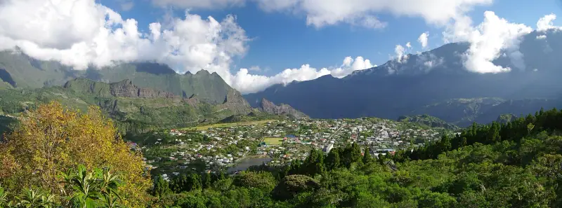
Visiting Cilaos: Complete Guide to Réunion's Volcanic Cirque
Cilaos: hot springs, local wine, lentils and Creole embroidery. Complete guide to hiking the Piton des Neiges and exploring the cirque.
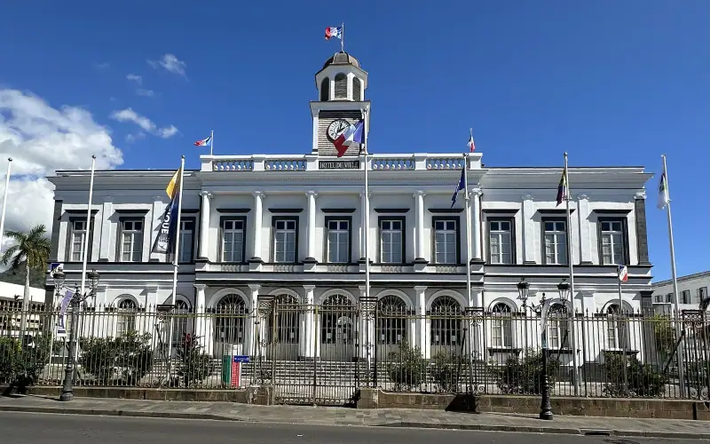
Saint-Denis: What to See and Do in Réunion's Capital
Saint-Denis guide: top sights, museums, markets, restaurants and neighborhoods to visit in Réunion's Creole capital.
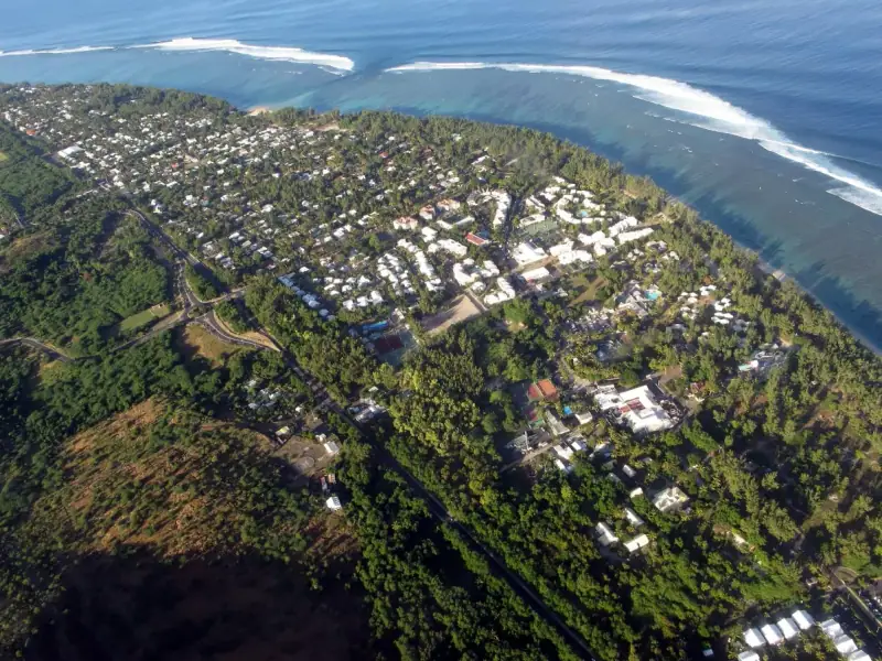
Visiting Saint-Gilles-les-Bains: Complete Guide to Réunion's Beach Resort
Saint-Gilles-les-Bains guide: beaches, lagoons, marina, diving, surfing and nightlife. Réunion's essential beach resort.
Ready-made
Réunion itineraries
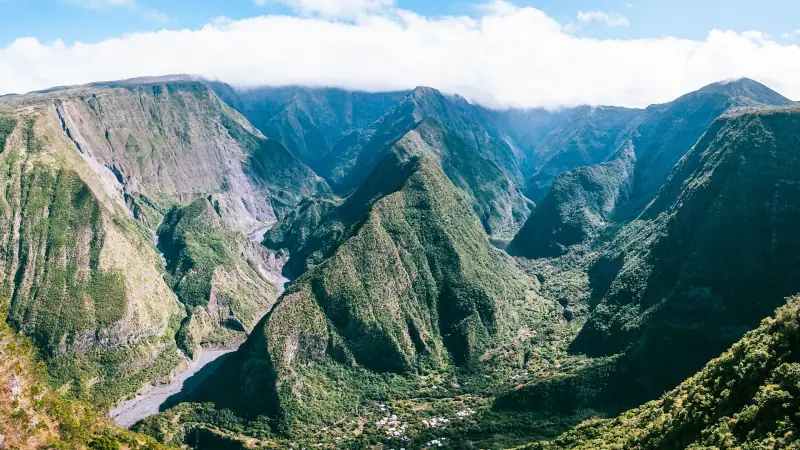
3 days
3 Days in Cilaos: A Weekend Hiking Itinerary in the Highlands
What to do in Cilaos in 3 days? Hikes, thermal baths, lentils and local wine. A full weekend itinerary for the cirque.
14 days
Réunion Road Trip: A 2-Week Driving Itinerary
The best 14-day road trip itinerary in Réunion: coasts, cirques, the volcano and Creole villages. Full guide with stops, places to stay and tips.
8 days
Réunion in 8 Days with Kids: Stops, Miles and a Realistic Pace
Saint-Gilles-les-BainsCilaosSaint-Pierre