Itineraries
Colombian Andes road trip: mountain ranges, colonial towns and coffee country
We may earn a commission when you book through links on this page, at no extra cost to you. We don't visit or try the places we cover: we summarize published sources. How we work
Day by day
- Days 1-2Bogotá: La Candelaria, Museo del Oro, Monserrate, Usaquén
- Days 3-4Villa de Leyva: Plaza Mayor, El Fósil, El Infiernito, Pozo Azul
- Days 5-6Barichara: Camino Real to Guane, San Gil adventure sports
- Days 7-8Medellín: El Poblado, Metrocable, Parque Arví, Museo de Antioquia
- Days 9-11Coffee region: Salento, Valle de Cocora, coffee fincas
In short
- The route runs 10 to 12 days: Bogotá (2 days), Villa de Leyva (2), Barichara and San Gil (2), Medellín (2) and the coffee region around Salento (3).
- Intercity buses are comfortable and cheap, so a rental car is not essential; it helps most around Villa de Leyva and Salento.
- The two dry seasons (December-February and June-August) are the best for hiking; April-May and October-November are rainier.
- Budget is about 200,000 to 300,000 COP per day on a shoestring and 400,000 to 600,000 COP per day at mid-range comfort.
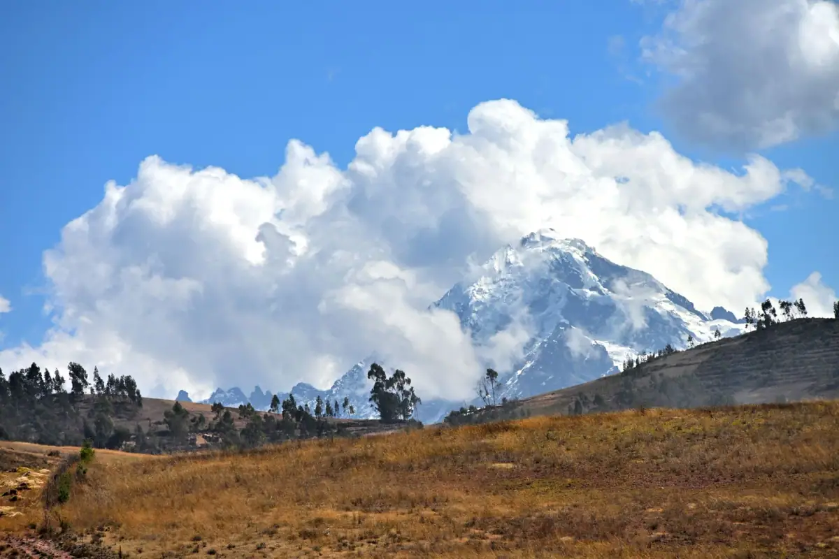
Three parallel mountain ranges run from south to north through the country, peaking above 5,000 meters (16,400 ft) and trapping in their valleys whitewashed colonial towns, emerald coffee plantations and villages hanging above precipices. The Colombian Andes are like nowhere else in South America: here the mountains have shaped a unique cultural identity, at the crossroads of indigenous, Spanish and African influences.
This 10 to 12 day road trip crosses the Colombian Andes from east to west and north to south, from Bogotá to the rolling roads of the Quindío, via the colonial towns of Villa de Leyva and Barichara, the urban laboratory of Medellín and the giant palms of the Valle de Cocora. Each stage is a world of its own. Linking these pieces of one massif helps explain why Colombians look at their mountains with a mix of pride and deep attachment.
The Colombian Andes in a few numbers
Colombia is one of the few countries where the Andes split into three distinct chains:
- Eastern Cordillera: the widest, home to Bogotá (2,600 m / 8,530 ft) and high plateaus called altiplanos
- Central Cordillera: the highest, with the volcanoes of Los Nevados National Park. The Nevado del Ruiz peaks at about 5,321 m (17,457 ft)
- Western Cordillera: the natural border with the Cauca valley, between Medellín and Cali
Between these three ranges lie the Magdalena and Cauca valleys, the country’s historic communication axes. Most of Colombia’s population, and most of its culture, coffee and colonial history, sits in this triple mountain architecture.
Altitude of the main towns:
- Bogotá: about 2,600 m (8,530 ft)
- Medellín: about 1,495 m (4,905 ft)
- Manizales: about 2,150 m (7,050 ft)
- Villa de Leyva: about 2,150 m (7,050 ft)
- Salento: about 1,895 m (6,215 ft)
- Popayán: about 1,760 m (5,775 ft)
Pack layers: mornings are cool at 2,000 m (6,560 ft), afternoons warm up, and nights can be cold. The golden rule in the Colombian Andes: always keep a windbreaker and a sweater in your daypack.
Flights to Bogotá
Bogotá (El Dorado airport, BOG) is the ideal entry point for this Andes trip.
Stage 1: Bogotá (2 days)
Every Andean adventure starts in Bogotá, the capital set at 2,600 m (8,530 ft) on the altiplano of the Eastern Cordillera. A sprawling city of more than ten million people, it can feel intimidating on arrival, but its historic and cultural neighborhoods are best explored on foot.
La Candelaria is the colonial heart: colorful facades, world-class museums (the Museo del Oro, one of the most important in South America for pre-Hispanic goldwork, and the Museo Botero with sculptures and paintings by the Colombian artist Fernando Botero), and restaurants and specialty cafés that rival the best cities on the continent.
To gain some height, take the Cerro Monserrate cable car (about 3,152 m / 10,340 ft): on a clear day the view over the Bogotá plateau is striking. The Usaquén neighborhood and its tree-lined lanes give a taste of residential Bogotá, with a craft market on Sundays.
Practical tip: Bogotá easily deserves two days, even three if you want to see more museums. Sleep in La Candelaria to be within walking distance of every attraction. See the full Bogotá guide for details on the visits.
Stage 2: Villa de Leyva (2 days)
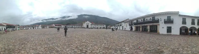
About 165 km (103 mi) north of Bogotá (roughly 3 h 30 to 4 h by bus from the transport terminal), Villa de Leyva is one of the most beautiful villages in Colombia. Founded in 1572, the town is a life-size conservatory of Spanish colonial architecture. Its cobbled streets, whitewashed facades and huge Plaza Mayor (one of the largest paved squares in South America, at 14,000 m² / 150,700 sq ft) have been a national monument since 1954.
What to do in Villa de Leyva
- Get lost in the lanes: colonial architecture is everywhere, with whitewashed rammed-earth walls, wooden balconies and flowered courtyards. The pedestrian streets of the center can be walked without a map.
- El Fósil: a few kilometers from the center, this museum holds the almost complete skeleton of a Kronosaurus (a giant marine reptile) found in the region. A striking reminder that these mountains were once at the bottom of the sea.
- El Infiernito: a pre-Hispanic archaeological site of the Muisca culture, with stone columns used for astronomical and ritual purposes. One of the best-preserved Muisca sites in the country.
- Hike to the Cascada de la Periquera: about 7-8 km (4-5 mi) round trip from the center, this waterfall reached on foot is popular on weekends but quiet on weekdays.
- Pozo Azul: natural pools with turquoise water fed by springs, a few kilometers from the center. Good for a swim in hot weather.
Where to stay in Villa de Leyva
The historic center is dotted with hotels and colonial posadas; expect 80,000 to 200,000 COP a night for a double room depending on comfort. Book ahead for weekends and during Holy Week (Semana Santa), which is very busy here.
Hotels in Villa de Leyva
Colonial posadas and boutique hotels in one of Colombia's most beautiful villages.
Stage 3: Barichara and Santander (2 days)
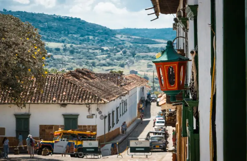
Head northeast from Bogotá or Villa de Leyva to reach Barichara, often nicknamed “the most beautiful village in Colombia”. Perched on a rocky promontory in the department of Santander, about 330 km (205 mi) north of Bogotá (roughly 8 h by bus with a change in San Gil, detailed in the guide Barichara from Bogotá by bus), Barichara is another colonial capsule, built of ocher-colored cut stone rather than white adobe.
Barichara, a stone jewel
The houses, streets and perimeter walls are all built of local cut stone (a blond stone quarried nearby), which gives the town a rare architectural coherence. The late-afternoon light, when the sun gilds the facades, is a photographer’s dream.
The Cathedral of the Immaculate Conception (18th century) overlooks the main square and shows the style of colonial architecture in this region well. Along the cliff edge, the malecón offers views over the Río Suárez valley below.
The Camino Real to Guane
Barichara’s great classic is the hike on the Camino Real, a pre-Hispanic and later colonial mule path linking Barichara to the village of Guane (about 5.5-6 km / 3.5-4 mi, 2 to 2 h 30 on foot). The stone path passes giant cacti, cliffs and isolated hamlets. Guane itself is a quiet village with a small paleontology museum.
Practical tip: start early in the morning (before 8 am) to avoid the heat, since the trail is exposed to the sun. The return from Guane is by local transport (a collective bus) or by chiva (a colorful country bus).
San Gil, adrenaline capital
About 22 km (14 mi) from Barichara, San Gil is Colombia’s extreme sports capital: rafting on the Río Fonce (class II to III), paragliding, caving, bungee jumping. If you want a dose of adrenaline between two colonial villages, this is where to spend half a day or a night.
Stage 4: Medellín (2 days)
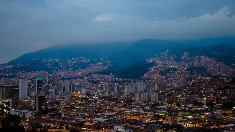
From Barichara, reach Medellín by bus via Bucaramanga (about 6 h) or, from Bogotá, directly by domestic flight (about 1 h, recommended to save time). Medellín deserves its own stop on this route; see the Medellín guide for details on neighborhoods and activities.
Medellín in two days
- El Poblado: residential and tourist neighborhood, a good place to settle in, with lively nightlife and specialty cafés on every corner
- Metrocable: the urban cable car system links the hillside working-class neighborhoods to the center. The Metrocable Line J to La Aurora gives a spectacular panorama of the city
- Parque Arví: a forest park reached via the Metrocable, at about 2,400 m (7,875 ft) above Medellín
- Museo de Antioquia: holds dozens of works by Fernando Botero, Colombia’s best-known artist internationally
- El Centro neighborhood: Parque Berrío and Plaza Botero (monumental bronze sculptures) are the historic and lively hearts of the city
Hotels in Medellín
From trendy hostels in El Poblado to boutique hotels in Laureles, find your base in Medellín.
Stage 5: The coffee region and Salento (3 days)
For many travelers the highlight of the Andes is the Eje Cafetero (coffee axis), a UNESCO World Heritage region spanning the departments of Caldas, Risaralda and Quindío. This is where Colombia’s high-altitude coffee grows, the coffee that built the country’s prosperity and whose aroma fills every hacienda.
Manizales and Los Nevados Park
If you come from Medellín (about 4 h by bus), Manizales is the northern gate of the Eje Cafetero. The capital of Caldas, at about 2,150 m (7,050 ft), is a lively university city with a fine view of the volcanoes on clear days. It serves as a base for visiting Los Nevados National Park and its snow-capped volcanoes, including the Nevado del Ruiz (about 5,321 m / 17,457 ft), Colombia’s highest active volcano. Guided excursions from Manizales get you close to Lake Otún and the páramo zones (high-altitude moorland) up to about 4,000 m (13,120 ft).
Important: access to the Nevado del Ruiz areas is regulated and sometimes closed depending on volcanic activity. Always check access conditions with the Parque Nacional before planning a visit.
Salento and the Valle de Cocora
About 85-90 km (53-56 mi) southwest of Manizales (or about 25-27 km / 16-17 mi from Armenia), Salento is the flagship village of the Eje Cafetero. Its colorful houses, carved balconies and authentic village life make it one of the most photographed places in Colombia.
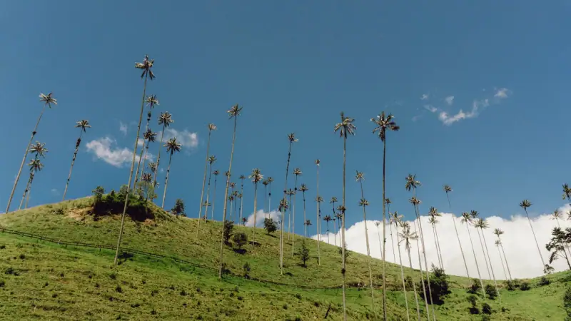
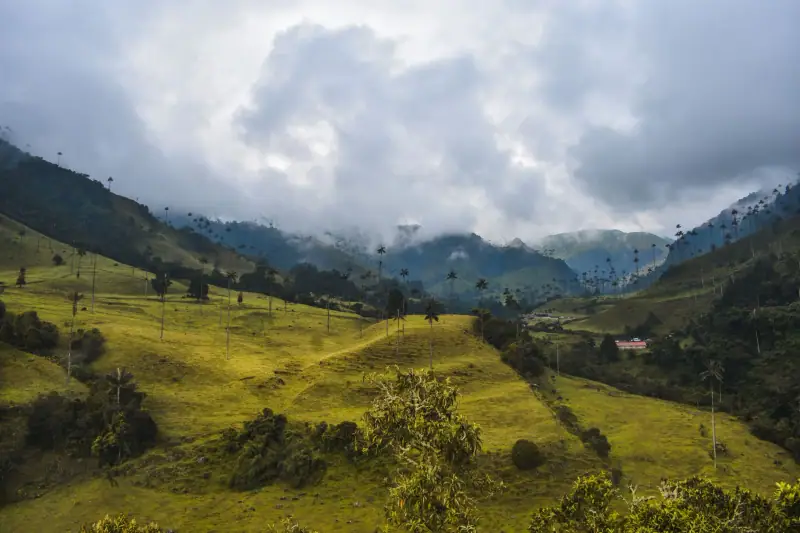
The main draw in Salento is the Valle de Cocora, about 12 km (7 mi) from the village (30 min by Willys jeep, now the motorized symbol of the region). The valley hides the tallest palm trees in the world, the wax palm (Ceroxylon quindiuense), Colombia’s national tree, which can reach 60 m (197 ft). Seeing them emerge from the morning Andean mist is a sight that justifies the trip by itself.
The Valle de Cocora hiking loop:
- Start from the Cocora parking area and climb through cloud forest
- Pass the Reserva Natural Acaime, a small forest refuge among the trees, where hummingbirds (sometimes about ten different species) feed at the feeders
- Descend into the open valley among the giant palms
- Total time: about 4-5 hours depending on pace, moderate level
See the full Salento guide for coffee finca visits, accommodation and restaurants in the village.
Coffee haciendas
One of the highlights of the Eje Cafetero is a visit to a traditional coffee finca. Several haciendas in the region offer guided tours covering picking, pulping, drying and tasting. Expect 25,000 to 60,000 COP per person depending on length and level of detail. Look for fincas certified by the Federación Nacional de Cafeteros and book through your local accommodation rather than through intermediaries.
Activities in the coffee region
Finca visits, jeep rides and guided excursions in the Eje Cafetero.
Getting between stages
| Route | Estimated time | Recommended mode |
|---|---|---|
| Bogotá → Villa de Leyva | ~3 h 30-4 h | Bus from the Terminal de Transporte |
| Villa de Leyva → San Gil | ~4 h 30-5 h | Bus (via Tunja or Barbosa) |
| San Gil → Barichara | ~30 min | Local transport (collective bus) |
| Barichara → Medellín | ~6-7 h | Bus via Bucaramanga, or flight Bogotá-Medellín |
| Medellín → Manizales | ~4 h | Direct bus (Expreso Brasilia or equivalent) |
| Manizales → Salento | ~2 h 30 | Bus via Pereira or Armenia |
| Salento → Bogotá | ~7-9 h | Bus via Armenia |
Tip: intercity buses in Colombia are comfortable (air conditioning, reclining seats), punctual and inexpensive. Buy your tickets the day before or the same morning at the terminals. Online booking is sometimes possible but not essential except in high season.
Accommodation by stop
| Town | Suggested type | Price range (double room) |
|---|---|---|
| Bogotá | Boutique hotel in La Candelaria or Chapinero | 150,000 – 300,000 COP |
| Villa de Leyva | Colonial posada in the historic center | 100,000 – 250,000 COP |
| Barichara | Casa particular or small charming hotel | 80,000 – 180,000 COP |
| Medellín | Hotel in El Poblado or Laureles | 120,000 – 350,000 COP |
| Salento | Hostel or finca | 50,000 – 150,000 COP |
Budget for this trip
| Item | Budget | Comfort |
|---|---|---|
| Accommodation (per night) | 50,000 – 80,000 COP | 120,000 – 250,000 COP |
| Meals (3 a day) | 30,000 – 50,000 COP | 60,000 – 120,000 COP |
| Intercity transport | 30,000 – 60,000 COP/trip | Same (comfort bus) |
| Activities/entry fees | 20,000 – 50,000 COP/day | 50,000 – 150,000 COP/day |
| Daily total | ~200,000 – 300,000 COP | ~400,000 – 600,000 COP |
At the November 2026 exchange rate, €1 ≈ 3,700 COP. These ranges are indicative and may change.
Preparing for an Andean trip
Clothing: layering is king. A T-shirt, a thermal base layer, a fleece and a light waterproof cover most situations between 1,500 m (4,920 ft) and 2,600 m (8,530 ft). For hikes above 3,500 m (11,480 ft) (Los Nevados), add a down jacket and gloves.
Health: altitude can affect travelers, including in Bogotá at 2,600 m (8,530 ft). Ask your doctor or a travel clinic, and see the official travel health pages (CDC in the US, TravelHealthPro in the UK).
Phone: a local SIM (Claro or Movistar, available at airports) with a data plan is very useful for offline maps (Maps.me or OsmAnd). You can also check your carrier’s international plan or use a travel eSIM. The network covers the tourist routes well.
Money: ATMs are found in all the stop towns. Withdraw cash before going to villages like Villa de Leyva or Barichara, where card terminals are less common.
The Colombian Andes do not offer the sanitized comfort of an organized tour. They ask for some curiosity, a little patience with night buses and the ability to marvel at very little: a small glass of tinto in a tiled room in Salento, the mist licking the giant palms at dawn, or the orange evening light on the stone of Barichara. In return they give something few regions of the world can still offer: the feeling that the mountain has a soul.
Sources
- Monserrate (operator): figures checked November 2026
- Colombia Travel (ProColombia): figures checked November 2026
- Colombia Travel (ProColombia): figures checked November 2026
Frequently asked questions
How many days do you need for a Colombian Andes road trip?
Plan 10 to 14 days to cover the essential stops: Bogotá, Villa de Leyva, Barichara, Medellín and the coffee region. With 10 days you can see the essentials by traveling mostly by bus. With 14 days you have more time to hike and soak up the atmosphere of the colonial villages.
Do you need to rent a car to explore the Colombian Andes?
Not necessarily. Colombia has a dense, comfortable intercity bus network (Flota Magdalena, Rapido Ochoa, Expreso Brasilia and others), and buses are the cheapest way to link the big cities. A rental car is useful in rural areas such as around Villa de Leyva or Salento, but local transport (mototaxis, jeeps) is also available there.
What is the best time for a road trip in the Andes?
The two dry seasons (December-February and June-August) are ideal for hiking and clear views. The Valle de Cocora, the volcanoes and the country roads are much more pleasant in good weather. Avoid April-May and October-November (rainy seasons) if you want to get the most out of outdoor activities.
What budget should you plan for 10 days in the Colombian Andes?
On a budget (hostels, local restaurants, buses), plan about €55-80 (about $65-95) per day. At mid-range comfort (boutique hotels, a few tourist restaurants), plan €110-160 (about $125-185) per day. The budget climbs if you add domestic flights (Bogotá-Medellín, for example) and premium guided activities.
Are the Colombian Andes safe for travelers?
The tourist areas of the Colombian Andes (Bogotá's tourist neighborhoods, Villa de Leyva, Barichara, Medellín, Salento) are generally described as very safe for travelers. The main risk is pickpocketing in big cities. Away from the beaten track, always ask locals and your accommodation about the local situation before heading into remote areas.
Can you do this trip without speaking Spanish?
In big cities and at tourist sites you will find some English. In villages and on public transport, however, Spanish is almost essential. A few basic phrases (numbers, directions, asking prices) are enough for most daily situations. Colombians are known for their patience and warm welcome toward foreigners.
Can you combine this trip with the Caribbean coast?
Absolutely. Many travelers end their Andes loop in Medellín and then take a domestic flight to Cartagena or Santa Marta (about 1 h 15 of flying) for a week on the Caribbean coast. It is a classic combination with a nice contrast between mountains and tropical beaches.
More Colombia guides
Keep reading
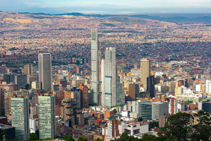
Visiting Bogotá: a complete guide to Colombia's capital
Everything you need to visit Bogotá: La Candelaria, Museo del Oro, Monserrate, Usaquén, budget, transport and practical tips for 2026.
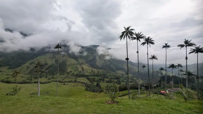
Valle de Cocora without a guide: jeep, prices, loop and difficulty
Hiking the Valle de Cocora without a tour: Willys jeep from Salento, prices, which loop to pick, difficulty and mistakes to avoid. A practical guide.
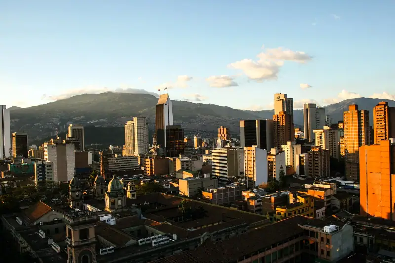
Visiting Medellín: a complete guide to the city of eternal spring
Everything you need to visit Medellín: El Poblado, Plaza Botero, Comuna 13, Guatapé, lodging, budget and practical tips for 2026.
Ready-made
Colombia itineraries
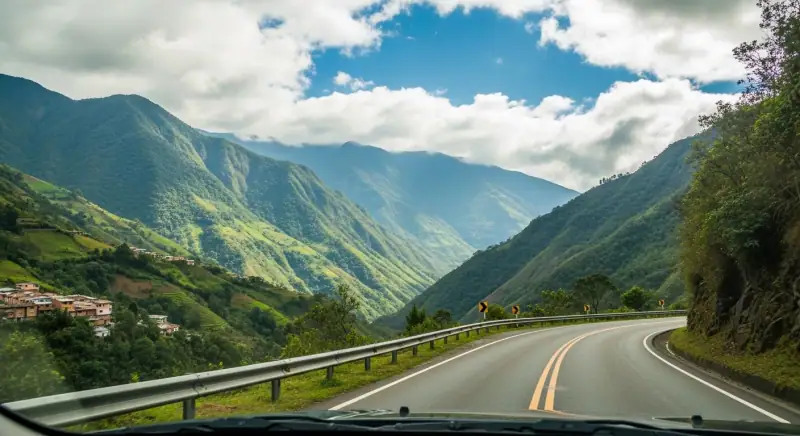
20 days
Colombia road trip: a 3-week itinerary by car
A 3-week Colombia road trip from Bogotá to Cartagena via the Andes, the coffee region and the Caribbean coast. Routes, stops and practical tips.
10 days
Colombia in 10 days without a car: a realistic itinerary by plane and bus
Colombia in 10 days without renting a car: Bogotá, Medellín, Salento, Cartagena. Stops, distances, travel times, flights and buses, transport budget.