What to see
Visiting El Hierro: Complete Guide to the Canary Islands' Wild Little Island
We may earn a commission when you book through links on this page, at no extra cost to you. We don't visit or try the places we cover: we summarize published sources. How we work
In short
- El Hierro is the smallest, westernmost and least touristy of the seven main Canary Islands, a UNESCO biosphere reserve known for hiking and diving.
- A rental car is essential: buses are very limited. Plan on 4 to 5 days; 3 days covers only the essentials.
- You reach the island via Tenerife North or Gran Canaria on Binter Canarias (about 30-40 minutes), or by ferry from Los Cristianos (2 h 30 to 3 h).
- Best seasons are spring and fall; summer (June to September) is optimal for diving in the Mar de las Calmas.
El Hierro is not an island you choose by accident. The smallest, westernmost and most remote of the seven main Canary Islands is also the least touristy, by a wide margin. While Tenerife welcomes millions of visitors a year and Gran Canaria spreads out its beach resorts, El Hierro remains a jealously guarded secret, a UNESCO biosphere reserve where you find yourself alone facing volcanic landscapes of startling beauty.
Nicknamed La Isla del Meridiano (the Meridian Island) because it once marked the zero point of world mapping, El Hierro has something absolute about it. A forest of juniper trees twisted by the trade winds, a giant bay born from a volcanic collapse, one of the best-preserved marine reserves in Europe, and a pioneering energy policy that makes it a global model. Here is the complete guide to planning your stay on the most authentic of the Canary Islands.
El Golfo: the giant bay at the heart of the island
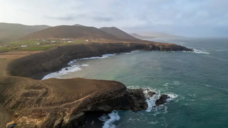
The first thing you see when arriving by air is this: a colossal gash in the northwest flank of the island, a semicircular bay about 12 km (7.5 mi) across, ringed by cliffs that drop as much as 1,000 m (3,280 ft). This is El Golfo, one of the largest volcanic collapses in the world, formed about 50,000 years ago when part of the island’s north flank slid into the Atlantic.
At the bottom of this natural amphitheater lies the La Frontera valley, the island’s second populated center, with its terraced fields, vineyards clinging to the slopes and white houses scattered among the greenery. The road down to El Golfo from the island’s heights offers one of the most spectacular panoramas in the Canary Islands: the sea below, red and black cliffs, and vines laid out like an amphitheater.
The Mirador de la Peña
Perched on the ridge above El Golfo at about 1,200 m (3,940 ft), the Mirador de la Peña is the island’s signature viewpoint. It was designed by the Canarian artist César Manrique, the same man behind the landscaping of Lanzarote: organic architecture blended into the rock, a panoramic restaurant and a terrace open to the void. The plunging view over El Golfo, the sunset over the Atlantic and the fanned-out cliffs make it one of the most photographed sites in the Canary Islands.
Tip: Arrive early in the morning to avoid the clouds that often form on the ridges during the day.
El Golfo’s natural pools: Charco de los Sargos and La Maceta
At the bottom of El Golfo bay, Charco de los Sargos is a natural pool carved into black volcanic rock, with calm, clear water that contrasts with the deep blue of the Atlantic. Easier to reach on the north side of the bay, La Maceta is a sheltered natural basin popular with locals for swimming. Both sites show how El Hierro relies on natural pools in the absence of large sandy beaches.
Car rental on El Hierro
Essential for exploring the island: a rental car gives you access to El Hierro's wildest corners at your own pace.
El Sabinar: the forest of twisted junipers
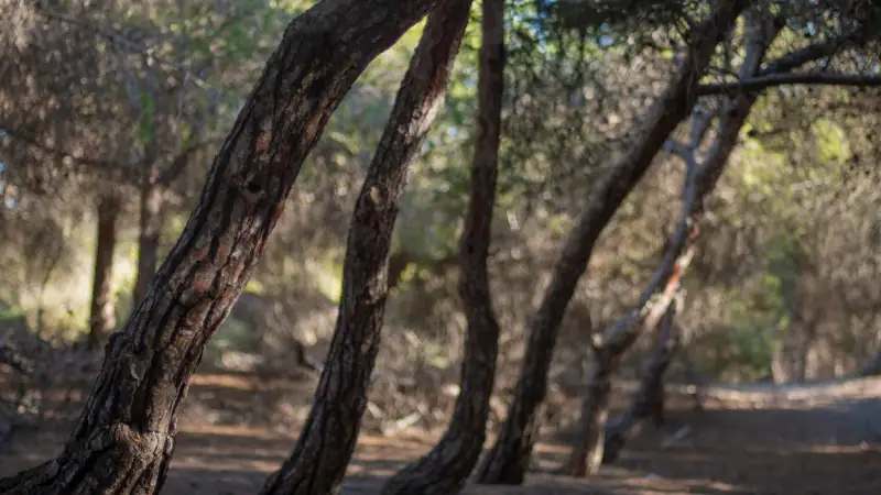
In La Dehesa, at the far west of the island, the El Sabinar woods are one of the most singular natural sights in the Canary Islands. Hundreds of Canary juniper trees (Juniperus turbinata ssp. canariensis), some several centuries old, all lean in the same direction under the trade winds that blow constantly from the northeast. Their gnarled trunks and warped branches have been sculpted by the wind over decades, creating ghostly silhouettes that seem to come out of a Tim Burton film.
The area is protected as a natural monument. A marked trail crosses the forest in about 45 minutes, letting you see the trees up close and understand how remarkably this species has adapted to a windswept, dune-like environment. No restaurant, no kiosk: just the forest, the wind and the junipers.
The volcanic cones of La Dehesa
Not far from El Sabinar, several minor volcanic cones can be reached on short trails in the La Dehesa area, with views over the lunar landscapes of the southwest plain. An information panel explains the island’s volcanic geology. El Hierro is one of the geologically youngest Canary Islands, with eruptions dating back only a few thousand years.
The Mar de las Calmas: diving in the marine reserve
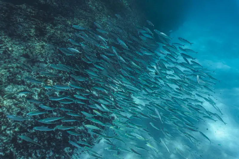
El Hierro is known to divers around the world for its Sea of Calm (Mar de las Calmas), the south and southeast side of the island. Sheltered from the trade winds by the relief, this stretch of coast has generally tranquil water, exceptional visibility of up to 30 m (100 ft) or more, and spectacular underwater life.
The El Hierro marine reserve, created in 1996, protects the coastal seabed and has allowed a remarkable recovery of fish populations. Emblematic species include:
- Giant moray eels (Muraena helena) in rocky crevices
- Groupers (Epinephelus marginatus) that approach divers fearlessly
- Stingrays on the sand
- Sea turtles (loggerhead, Caretta caretta) that regularly visit the reserve’s waters
- Schools of amberjack and barracuda
- Tropical parrotfish and surgeonfish, a sign of the nearby African waters
For non-divers, La Restinga, the small fishing village in the south of the island, offers introductory dives and snorkeling trips in the reserve.
Diving and snorkeling on El Hierro
Discover the Mar de las Calmas marine reserve with certified local guides, one of the best dives in Europe.
Natural pools: Charco Azul, Tamaduste and Las Palmeras
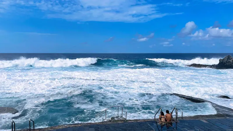
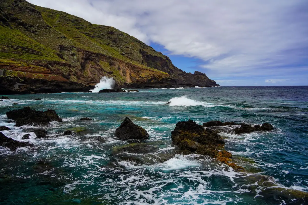
With no large sandy beaches, El Hierro has developed a special relationship with its natural pools: basins carved into volcanic rock by marine erosion, where swimming is protected from the waves.
Charco Azul
On the north coast, Charco Azul is the island’s best-known natural pool. It is a complex of connected basins cut into black rock, filled by the waves and protected by small walls. The water is clear and refreshing, and the contrast with the black lava is striking. Facilities there are very limited (check with the tourist office before you go): bring water and a towel.
Be careful on days of heavy swell (northeast current in fall and winter): waves can break over the edges of the basins. Check local weather conditions before going.
Tamaduste
A few kilometers north of Valverde, Tamaduste is a sheltered cove with a small natural lagoon at its base, reached by a staircase cut into the rock. The calm water, shallow at the entrance, is ideal for families with children. A few restaurants open in season line the beach.
Las Palmeras and La Maceta
On the north coast, La Maceta is another natural pool much loved by locals, framed by sculpted lava blocks. Less busy than Charco Azul, it has a wilder feel.
Valverde: the only island capital without a sea view
Valverde, the island’s capital, is a geographic curiosity in the archipelago: it is the only island capital in the Canary Islands not located by the sea. Perched at about 570 m (1,870 ft) on the northeast heights of the island, it has a cooler, often misty microclimate and spectacular views of the coasts below and, on clear days, of Tenerife.
The town is small (about 5,150 inhabitants), quiet and authentic. Its church, Nuestra Señora de la Concepción, overlooking the main square from a rise, is the capital’s signature image. The weekly market (Saturday morning) gathers local producers: sheep’s milk cheese, Herreño wine, vegetables from La Frontera’s vegetable gardens and homemade preserves.
The ethnographic museum and local crafts
The Museo Etnográfico in Valverde traces the traditional life of El Hierro’s people over several centuries: terrace farming, goat herding, small-scale fishing, and water-capture techniques, particularly important on an island where rain is scarce and irrigation difficult. Modest admission fee.
Local crafts stand out for their pottery made without a wheel (hand-pinched, a pre-Hispanic technique), embroidery and dwarf palm baskets, all more authentic souvenirs than palm-tree fridge magnets.
Lodging on El Hierro
Boutique hotels, casas rurales and apartments: find the right place for your stay on the most authentic of the Canary Islands.
El Pinar and the Canary pine forests
The El Pinar massif, in the south-central part of the island, is covered by a dense forest of Canary pines (Pinus canariensis), a species endemic to the archipelago that can regrow after fires thanks to dormant buds protected under the bark. These forests play a crucial role in capturing moisture from clouds (an ancestral technique called llovizna, or drizzle) and feed the island’s groundwater.
Hiking trails cross El Pinar, some leading to the Mirador de Las Playas, with panoramic views of the east coast and the sea. On clear days you can see La Palma and Tenerife from these heights.
The north coast: Pozo de Las Calcosas and fishing villages
On the island’s north coast, in the municipality of Valverde, a few hamlets preserve an authentic way of life that has changed little over generations.
Pozo de Las Calcosas
Reached by a trail descending from the roadside (municipality of Valverde, hamlet of El Mocanal), Pozo de Las Calcosas is a hamlet of tiny fishermen’s houses built of black volcanic stone beside small natural pools carved into the rock. Most of these homes are second residences used in summer by island families. The view of this miniature village from above is one of the most picturesque in El Hierro.
Gorona del Viento: the pioneer island of clean energy
A little-known side of El Hierro worth highlighting is its ambition in renewable energy. The Gorona del Viento plant, opened in 2014, combines a wind farm and a hydroelectric plant with a reservoir: when the wind produces more electricity than needed, the surplus is used to pump water to a reservoir at altitude; when the wind drops, the water flows back down to generate electricity.
This hybrid system makes El Hierro a global model of island energy transition, regularly cited at climate conferences. The island has already reached peaks of more than 100% renewable coverage of its instantaneous consumption. The goal is eventually to run with no fossil fuels at all.
Herreño food: simplicity and authenticity
El Hierro’s cooking is the most rustic and authentic in the Canary Islands, that of a farming and livestock island little influenced by mass tourism.
The essentials
Papas arrugadas con mojo: As across the archipelago, small local potatoes boiled in very salty water go with almost everything. Herreño mojos have a reputation for being among the spiciest in the Canary Islands.
Queso herreño: El Hierro cheese has a well-earned reputation. It is made from goat, cow or sheep milk (or a blend), often aged and sometimes smoked. Its firm texture and pronounced flavor make it one of the most characteristic cheeses of the archipelago.
Caldo de pescado: The local fish soup, simmered with root vegetables and gofio (toasted grain flour), is the dish of the interior, hot and hearty.
Grilled fish: In La Restinga and coastal restaurants, the whole grilled fish of the day (vieja, sama, cherne) is the obvious order. Fresh, simply prepared, and served with papas arrugadas and mojo.
Herreño wines: El Hierro has its own wine appellation (Denominación de Origen El Hierro). White wines from the Verijadiego grape, fresh and mineral, pair well with fish and local cheeses. The La Frontera area has most of the vineyards.
Suggested itinerary: 5 days on El Hierro
Day 1: Arrival, Valverde and the east coast
- Afternoon: Arrive at the airport, pick up the car, settle in Valverde
- Evening: Stroll through the capital, visit the Nuestra Señora de la Concepción church, dinner in the town center
Day 2: El Golfo and the Mirador de la Peña
- Morning: Drive down to La Frontera by the ridge road, stop at the Mirador de la Peña
- Mid-morning: Swim at Charco de los Sargos in El Golfo bay
- Afternoon: Explore the La Frontera valley, vineyards and terraces
- Evening: Sunset from El Golfo
Day 3: El Sabinar, Pozo de Las Calcosas and Charco Azul
- Morning: Drive west (La Dehesa), visit the El Sabinar woods
- Midday: Head down to Pozo de Las Calcosas
- Afternoon: Swim at Charco Azul
- Late afternoon: Return via Tamaduste for a swim in the lagoon
Day 4: Diving and La Restinga
- Morning: Dive in the Mar de las Calmas marine reserve (advance booking with local centers recommended)
- Lunch: Grilled fish in La Restinga
- Afternoon: Coastal walk around La Restinga, snorkeling from the rocks of the marine reserve
- Evening: Ermita de los Reyes (the island’s traditional pilgrimage site)
Day 5: El Pinar and departure
- Morning: Hike in the El Pinar massif, Mirador de Las Playas
- Midday: Last lunch in Valverde, shopping for Herreño cheese and local wine
- Afternoon: Departure
To fit El Hierro into a multi-island trip, see our guide to island hopping in the Canary Islands.
Practical information
Getting there
By air: El Hierro airport (IATA code: VDE) is in the northeast of the island, about 8 km (5 mi) from Valverde. Binter Canarias runs regular flights from Tenerife North (TFN) and Gran Canaria (LPA), usually several a day (check times on the airline’s website). Flight time is about 30 to 40 minutes. The regional airline Canaryfly also serves El Hierro in some seasons (check with them for flights from Gran Canaria).
Expect a connection in Tenerife or Gran Canaria and allow a full day of travel door to door.
By ferry: Fred. Olsen runs a service from Los Cristianos (Tenerife) to Puerto de la Estaca (El Hierro). The crossing takes about 2 h 30 to 3 h depending on the ship. Naviera Armas also sails this route (check frequencies with the company). The ferry is a good option if you want to bring your own vehicle.
Getting around the island
A rental car is essential. Buses (guaguas) link Valverde with La Frontera and a few other points, but service is very limited (often 2 to 4 runs a day) and does not reach the most interesting natural sites.
The roads are good but often narrow and winding. Driving is pleasant because traffic is almost nonexistent, and you can cross the whole island from north to south in under an hour.
Note: There is no public transport to El Sabinar, the remote natural pools or the high-altitude viewpoints. A car is the only option.
Budget
- Budget: about €50-70 (~$58-81) a day, as a guide (casa rural, grocery stores and cheap local restaurants); prices have risen, so check current rates
- Mid-range: €85-120 (~$100-140) a day (comfortable hotel, restaurants, one diving trip)
- Comfort: €150-200 (~$175-230) a day (parador or boutique hotel, guided diving, excursions)
El Hierro is one of the cheapest Canary Islands for lodging and dining because tourist pressure stays low. Our Canary Islands budget guide gives you the full benchmarks to plan your spending.
Weather
El Hierro has a very varied microclimate depending on altitude and orientation:
- The south coast (La Restinga, Mar de las Calmas) is dry, sunny and sheltered from the wind, ideal for diving all year.
- The El Golfo valley is greener and gets more rain thanks to moisture trapped by the cliffs.
- Valverde and the heights are often in clouds in the morning, with a cool, damp microclimate.
- The northwest (El Sabinar) is the most exposed to wind and spray from the trade winds.
Temperatures stay mild all year: 20-25 °C (68-77 °F) by the sea in summer, 15-18 °C (59-64 °F) at altitude in winter. For a stay mainly devoted to diving, summer (June to September) is optimal. For hiking, spring and fall are better.
To plan your trip by season, see our guide to the best time to visit the Canary Islands.
El Hierro in a nutshell
El Hierro is a lesson in humility for travelers used to tourist islands. Here, nobody will offer you a tour operator discount at the airport, signs are in Spanish only, and the local restaurant closes at hours that have nothing to do with visitors’ expectations. And that is why people love it.
It is the island where sea turtles and groupers approach divers because they have not learned to fear humans. The island where centuries-old junipers decided to grow bent rather than die standing. The island that draws its electricity from wind and falling water rather than oil.
For those who want to see the Canary Islands as they were before mass tourism, El Hierro is a rare destination, an island that has not yet compromised its soul to fill hotels.
Thinking of swimming there? Our guides to the best hikes in the Canary Islands and diving in the Canary Islands will cover the essentials.
Frequently asked questions
Is El Hierro really worth the detour compared with the other Canary Islands?
Yes, if you want to avoid mass tourism. El Hierro is the opposite of Tenerife or Gran Canaria: no giant resort complexes, no crowded beaches, no shopping malls. It is the island of hikers, divers and anyone seeking an authentic connection with Canarian nature. Its UNESCO status and 100% renewable energy policy make it a conscious and unique destination.
How do you get to El Hierro?
Plan on a connection through Tenerife North (TFN) or Gran Canaria (LPA), then a Binter Canarias flight to El Hierro airport (VDE). The inter-island flight lasts about 40 minutes. The ferry from Los Cristianos (Tenerife) with Fred. Olsen or Naviera Armas takes about 2 h 30 to 3 h depending on the ship.
Do you need a rental car on El Hierro?
Absolutely. The island has only a very limited bus network, mostly between Valverde and La Frontera. Without a car you will be stuck in the capital or at your lodging. Roads are often narrow and winding, but traffic is very light, so even a small car is enough.
What is the best time to visit El Hierro?
Spring (March to May) and fall (September to November) are the best seasons: pleasant temperatures (22-26 °C / 72-79 °F by the sea), calm water on the south coast and clear hiking trails. Summer is hot and dry, ideal for diving. Winter sometimes brings rain and fog to the high ground, but the coast stays accessible.
Is El Hierro a good scuba diving destination?
It is one of the best diving destinations in Europe. The Mar de las Calmas on the south coast offers exceptional visibility (up to 30 meters / 100 ft) and remarkable marine life: rays, turtles, moray eels, giant groupers and schools of tropical fish. The marine reserve has protected the seabed since 1996. Local dive centers offer introductory dives and training all year.
How many days do you need to visit El Hierro?
Plan on at least 4 to 5 days to explore the island properly. In 3 days you can see the essentials (El Golfo, El Sabinar, a dive, Valverde), but you will miss the wildest corners of the north coast and the El Pinar massif. A full week is ideal for hikers and divers who want to go deeper.
Can El Hierro run on 100% renewable energy?
That has been the stated goal since the Gorona del Viento wind-hydro hybrid plant opened in 2014. In practice, El Hierro covers a large share of its electricity needs with this installation, unique in the world, with peaks that sometimes exceed 100% of instantaneous consumption. It is a global reference for island energy transition.
More Canary Islands guides
Keep reading
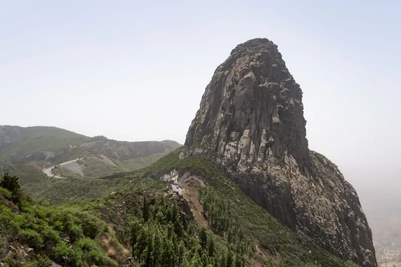
La Gomera: a complete guide to the island of forests and whistled language
La Gomera travel guide: Garajonay, El Silbo, Valle Gran Rey, hiking and food. Everything you need to visit the quietest of the Canary Islands.
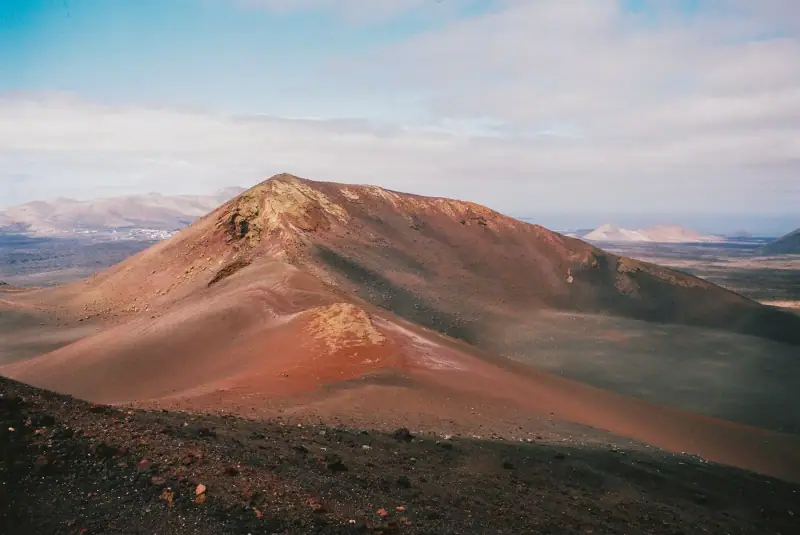
Lanzarote: a complete guide to the Canary Islands' volcanic island
Lanzarote guide: Timanfaya, César Manrique, Jameos del Agua, La Geria and Papagayo beaches. Everything you need to plan your trip to the volcanic island.
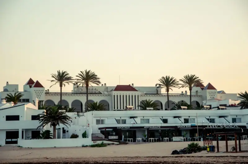
Visiting Corralejo: Complete Guide to Fuerteventura's Beach Town
Corralejo, Fuerteventura: white-sand beaches, the Corralejo dunes, water sports, where to stay and what to do. A complete guide to plan your trip.
Ready-made
Canary Islands itineraries
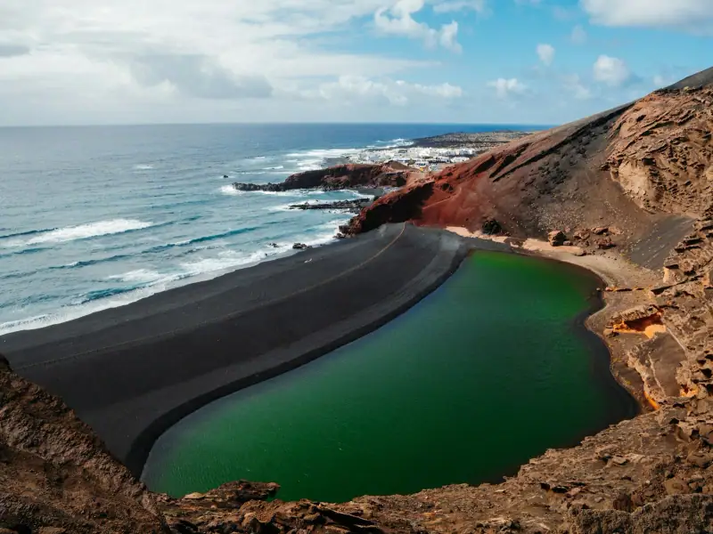
5 days
Lanzarote in 5 Days: A Complete Itinerary for the Volcanic Island
5-day Lanzarote itinerary: Timanfaya, Jameos del Agua, Playa Papagayo, César Manrique. A day-by-day plan to make the most of the volcanic island.
Can be adapted in the planner
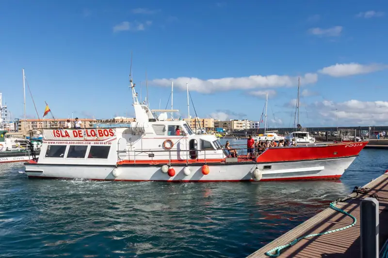
Island Hopping in the Canary Islands: Visiting Several Islands in One Trip
Island hopping in the Canary Islands: ferries, flights, multi-island itineraries and tips to combine Tenerife, Gran Canaria, Lanzarote and Fuerteventura.
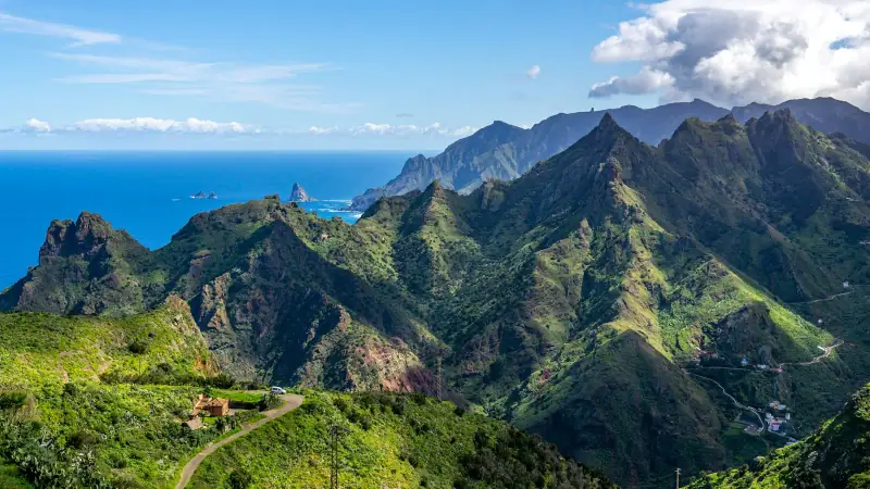
5 days
Tenerife in 5 Days Without a Car: A Realistic Bus and Tram Itinerary
Puerto de la CruzLos Cristianos