Things to do
Piton de la Fournaise: complete guide to visiting the active volcano
We may earn a commission when you book through links on this page, at no extra cost to you. We don't visit or try the places we cover: we summarize published sources. How we work
In short
- The classic Craters loop from Pas de Bellecombe is 8 km (5 mi), 3 to 4 hours round trip, with about 300 m (985 ft) of climbing.
- The Dolomieu summit (2,632 m / 8,635 ft) is a hard 6 to 8 hour round trip and can be closed around eruptions.
- Check the OVPF site for eruption alerts and the road status before you leave; the road to Pas de Bellecombe can close.
- The Gîte du Volcan (€50 to €70, about $58 to $81, half board) is the closest lodging; Plaine des Cafres is 45 minutes away.
The Piton de la Fournaise is one of the most active volcanoes in the world and arguably the most spectacular site on Réunion. With an eruption on average every three to four months, it gives lucky travelers the rare sight of glowing lava flowing toward the Indian Ocean.
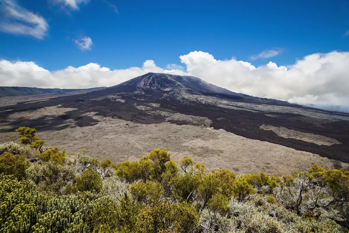
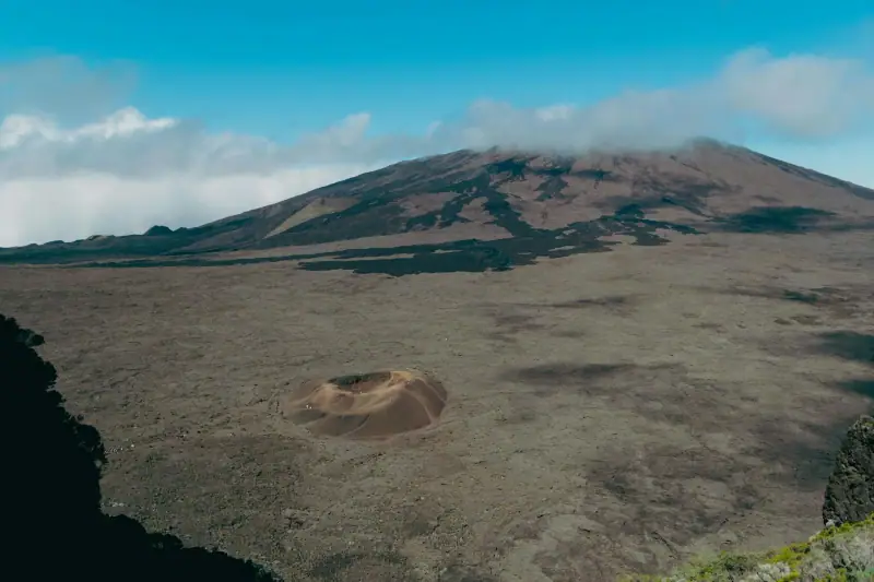
Even between eruptions, hiking in the Enclos Fouqué, the volcano’s huge eruptive caldera, feels like another planet. The landscape is entirely mineral, with colors running from brick red to charcoal gray to shiny black, and an atmosphere charged with a primal energy you will not find anywhere else.
About the Piton de la Fournaise
Key facts
- Elevation: 2,632 m (8,635 ft) (summit of the Dolomieu crater)
- Last significant rest: Each eruption is distinct; the volcano is almost continuously active
- Eruption frequency: 2 to 5 per year on average
- Area of the Enclos Fouqué: 100 km² (39 sq mi)
- Volcano type: Effusive basaltic shield (fluid lava, spectacular but non-explosive eruptions)
The geology of the Piton de la Fournaise
The Piton de la Fournaise is a “hot spot” volcano, fed by magma rising from the Earth’s mantle. It is the same mechanism as the Hawaiian volcanoes. Eruptions are generally effusive (lava flows) rather than explosive, which makes them observable and relatively predictable.
The volcano sits inside the Enclos Fouqué, a huge natural amphitheater bounded by cliffs 200 to 400 meters (660 to 1,310 ft) high. These walls form a natural barrier that channels most lava flows inside the enclosure.
How to get to the Piton de la Fournaise
Access by road
Pas de Bellecombe (2,311 m / 7,580 ft) is the main starting point for hiking to the volcano. It is reached by the RN3 from the Plaine des Cafres.
From Saint-Denis: About 2 h 30 by the RN3 (90 km / 56 mi) From Saint-Pierre: About 1 hour by the RN3 (65 km / 40 mi) From Saint-Gilles: About 2 hours via the Route des Tamarins, then the RN3 (90 km / 56 mi)
The road is paved all the way to the Pas de Bellecombe parking lot. An SUV or a regular car will do.
Note: The road between the Plaine des Cafres and Pas de Bellecombe can be closed in poor visibility, heavy rain or when an eruption is near the walls. Check Réunion’s road site (dir.re) before leaving.
The Cité du Volcan and the OVPF
In Bourg-Murat, on the Plaine des Cafres, on the road to the Piton de la Fournaise, the Cité du Volcan has exhibits on the volcano’s geology and monitoring techniques (the OVPF, which monitors the volcano, is based in the same area). It is an informative stop to understand what you are about to see. There is an admission fee: check hours and prices before you come.
Piton de la Fournaise excursions
Guided hikes, helicopter flights and 4x4 volcano safaris.
Hiking the Piton de la Fournaise
Craters loop (standard route, 8 km / 5 mi, 3 to 4 hours)
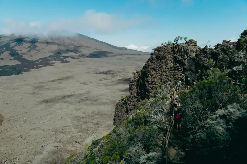
This is the classic Piton de la Fournaise hike, suited to intermediate hikers.
Start: Pas de Bellecombe parking lot (2,311 m / 7,580 ft) Route:
- Descent into the Enclos Fouqué (200 m / 660 ft of elevation loss in 30 min)
- Crossing the lava fields to the Formica Leo (a small secondary crater)
- Heading to the foot of the Piton de la Fournaise’s central dome
- Climb to the rim of the Bory crater (lower level)
- Return to Pas de Bellecombe
What you will see:
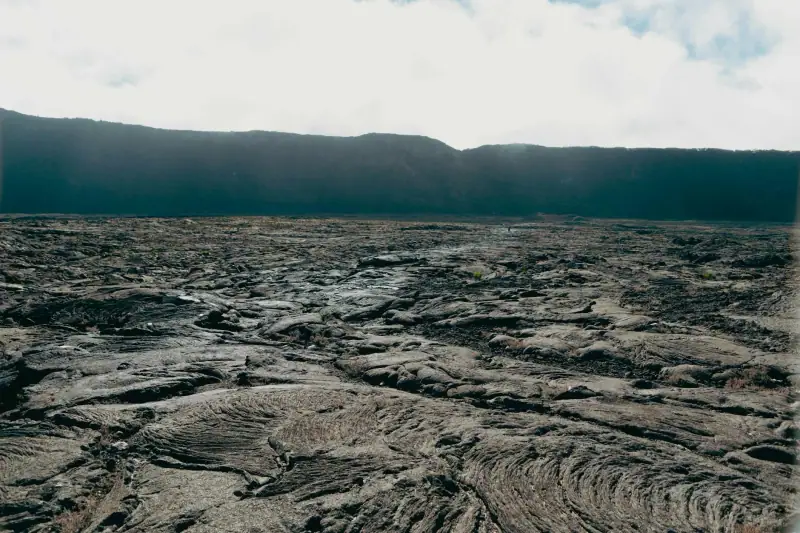
- Recent lava flows (pahoehoe and aa)
- The Bory crater with its fumaroles
- The central dome of the Piton de la Fournaise
- In good conditions: views of the Piton des Neiges and the ocean
Tips:
- Start before 7 am to avoid late-morning clouds
- Bring at least 1.5 L (about 50 oz) of water: there is no water source in the Enclos
- The lava is sharp: do not walk without closed shoes
- Rain gear is essential: weather changes fast at altitude
Summit climb (Dolomieu, 2,632 m / 8,635 ft, 5 to 7 hours)
For hikers in good shape, the climb to the rim of the Dolomieu crater is the ultimate goal.
Note: The rim of the Dolomieu crater can be closed as eruptions approach, and after an eruption access to the Enclos may be limited to certain trails only (this was the case after the 2026 eruptions). Check with the OVPF or the prefecture before leaving.
Elevation gain: 600 m (1,970 ft) from Pas de Bellecombe Total time: 6 to 8 hours round trip Level: Hard (significant climbing, uneven terrain)
What you will see at the summit: The Dolomieu crater, a pit 1,100 m (3,610 ft) across and 200 m (660 ft) deep. A plunging view into the caldera with its fumaroles. In clear weather, a 360° panorama of the whole island.
Experiencing an eruption of the Piton de la Fournaise
Watching an eruption live is one of the most extraordinary travel experiences there is. The Piton de la Fournaise’s lava is basaltic and very fluid, which lets it flow fast and form spectacular fire fountains.
When an eruption happens
- The OVPF issues an alert on its website and social media as soon as the first magma intrusions occur
- The authorities define access zones according to the location and intensity of the eruption
- Local operators run night excursions to the authorized observation zones
- Local media cover the eruption in real time with practical information
Watching lava safely
If you are on the island during an eruption:
- Follow the signs and the authorities’ instructions strictly
- Never cross closed zones, even if others do
- The air near an active flow contains SO2 (sulfur dioxide): an FFP2 mask is recommended
- Keep your distance: an accelerating flow can catch up with a walker
Night viewing: Lava is far more spectacular at night. Fire fountains light up the sky and the flows draw bright orange lines in the darkness. If you are in Réunion during an eruption, do not miss a night viewing.
Lodging near the volcano
To compare the mountain gîte with the lodging in Bourg-Murat, read our guide to sleeping near the Piton de la Fournaise.
The Gîte du Volcan
The Gîte du Volcan, at over 2,200 m (7,220 ft), about a 15-minute walk from Pas de Bellecombe, is the lodging closest to the Piton de la Fournaise. It lets you make the climb at sunrise from an ideal starting point.
- Capacity: Dorms and a few double rooms
- Half board: Required and recommended (family-style Réunion cooking)
- Price: €50 to €70 (about $58 to $81) per person with half board
- Booking: Required well in advance in high season
Lodging on the Plaine des Cafres
The Plaine des Cafres, a highland plateau at 1,200 m (3,940 ft), is 45 minutes from Pas de Bellecombe. It is an excellent base for the volcano, with several gîtes, hotels and guesthouses.
Stays on the Plaine des Cafres
Stay near the volcano to start early in the morning.
Photographing the Piton de la Fournaise
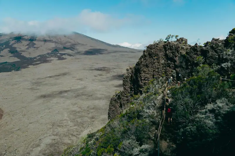
The volcano is an exceptional photo subject. Here are a few tips for bringing back good images:
Outside eruptions:
- The best light is sunrise (if you leave before dawn) and late afternoon
- Use a tripod for low-light shots
- The contrast between black lava and blue sky is spectacular mid-morning
During an eruption:
- Night offers the most dramatic photos of fire fountains and flows
- A telephoto lens (200 to 300 mm) lets you photograph active zones from a safe distance
- Protect your camera gear from dust and fine spatter
The Piton de la Fournaise is the beating heart of Réunion. Every visit is unique, and every eruption reshapes an already extraordinary landscape a little more. Whether you go during a quiet period or in the middle of eruptive activity, this volcano will remain one of the strongest images of your trip to the intense island.
Frequently asked questions
Is the Piton de la Fournaise dangerous to visit?
Hiking the Piton de la Fournaise is generally safe when the volcano is not actively erupting. Access is well marked and the trail is busy. During an eruption, the authorities set strict safety zones. Always follow signs and trail closures.
How do I know whether the Piton de la Fournaise is erupting?
Check the OVPF (Piton de la Fournaise Volcano Observatory) website before your visit: www.ipgp.fr/fr/ovpf. During an eruption, information is updated hourly. Local media (Réunion 1ère) also relay alerts in real time.
Can you see lava during an eruption of the Piton de la Fournaise?
Yes. When the volcano is erupting and safety conditions allow, access to an observation zone is authorized. Lava flowing at night is especially spectacular. Local operators run night excursions during eruptions.
How long is the hike to the Piton de la Fournaise?
The classic Craters loop from Pas de Bellecombe takes 3 to 4 hours round trip (8 km / 5 mi, 300 m / 985 ft of climbing). The climb to the summit of the Piton de la Fournaise (2,632 m / 8,635 ft) from Pas de Bellecombe takes about 5 to 6 hours round trip.
Is there lodging near the Piton de la Fournaise?
The Gîte du Volcan, at over 2,200 m (7,220 ft), about a 15-minute walk from Pas de Bellecombe, is the closest lodging. It lets you make the climb at sunrise. On the Plaine des Cafres (45 minutes away), several gîtes and hotels make a good base.
More Réunion guides
Keep reading
Maïdo at sunrise: when to leave, the road and the fog risk
Watching sunrise at Maïdo: when to leave from Saint-Gilles or Saint-Paul, the forest road, the cold, fog and a plan B if the view is socked in.
Canyoning in Réunion: The Best Canyons and a Practical Guide
Canyoning in Réunion ranks among the world's best. See the top canyons, how to pick an operator, what it costs and what to bring for an unforgettable day.
Cirque de Mafate: A Complete Guide to Réunion's Only Road-Free Cirque
Cirque de Mafate: multi-day hikes, access, villages (îlets), places to stay and practical tips for Réunion's only cirque with no road.
Ready-made
Réunion itineraries
3 days
3 Days in Cilaos: A Weekend Hiking Itinerary in the Highlands
What to do in Cilaos in 3 days? Hikes, thermal baths, lentils and local wine. A full weekend itinerary for the cirque.
14 days
Réunion Road Trip: A 2-Week Driving Itinerary
The best 14-day road trip itinerary in Réunion: coasts, cirques, the volcano and Creole villages. Full guide with stops, places to stay and tips.
8 days
Réunion in 8 Days with Kids: Stops, Miles and a Realistic Pace
Saint-Gilles-les-BainsCilaosSaint-Pierre