Things to do
Trolltunga and Preikestolen: Guide to Norway's Two Iconic Hikes
We may earn a commission when you book through links on this page, at no extra cost to you. We don't visit or try the places we cover: we summarize published sources. How we work
In short
- Preikestolen is 7.6 km (4.7 mi) round trip with 604 m (1,980 ft) of climbing, about 4 to 6 hours; it suits intermediate hikers.
- Trolltunga is 22-27 km (14-17 mi) round trip, 8 to 12 hours; it is for fit, experienced hikers.
- Hike Trolltunga unguided from June 1 to September 30 (depending on snow); outside that period a guide is recommended.
- If you only do one, do Preikestolen: the effort-to-reward ratio is excellent.
Trolltunga and Preikestolen are the two most famous hikes in Norway, and among the most photographed in Europe. The “Troll’s Tongue” and “Pulpit Rock” have flooded Instagram and inspired millions of travelers to lace up their hiking boots to reach these seemingly impossible viewpoints. But behind the spectacular photos are two very different hikes in terms of difficulty, logistics and experience. Here is everything you need to know.
Preikestolen: Pulpit Rock
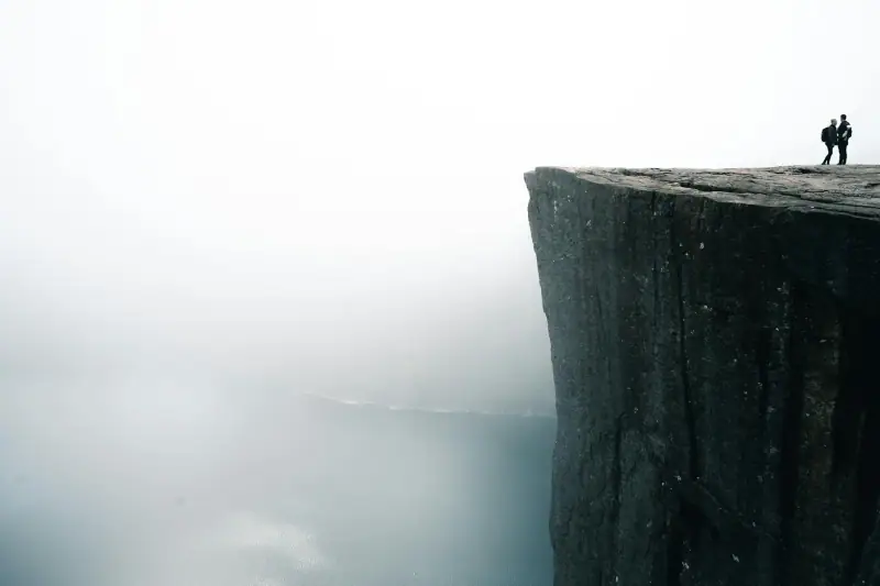
What is Preikestolen?
Preikestolen is a table-shaped rock plateau, about 25 x 25 meters (82 x 82 ft), hanging 604 meters (1,980 ft) above the Lysefjord. The name means “preacher’s pulpit” in Norwegian, because of its lectern shape. It is reached by a 7.6 km (4.7 mi) round-trip hike from the parking lot (3.8 km / 2.4 mi each way).
It is the most visited tourist site in Norway, with up to 300,000 visitors a year. On a July day you can expect 2,000 people on the trail.
The trail in detail
Start: Preikestolen Mountain Lodge, 35 km (22 mi) from Stavanger by road (or by shuttle).
Distance: 3.8 km (2.4 mi) each way (7.6 km / 4.7 mi total)
Elevation: 604 m (1,980 ft) up, 604 m (1,980 ft) down
Time: 2 h up, 1 h 30 down (4 h round trip on average)
The route:
- First 2 km (1.2 mi): well-made trail through forest
- Km 2-3: rocky terrain with a few sections over granite slabs
- Last km: final plateau with a gradually opening view of the Lysefjord
- Arrival: the Preikestolen plateau, with a 604 m (1,980 ft) view over the fjord
Difficulty: Intermediate. Accessible to people in good physical shape who walk regularly. Not technically difficult but physical.
Minimum gear:
- Waterproof hiking boots (essential in rain)
- Waterproof jacket
- Water: 1-1.5 liters (34-50 oz)
- Snacks for the break at the top
- Trekking poles (useful for the descent)
Preikestolen excursions from Stavanger
Shuttles, guided tours and Lysefjord cruises.
Preikestolen logistics
Getting there from Stavanger:
- By shuttle (recommended): Shuttles (bus + ferry) leave downtown Stavanger for Preikestolen Fjellstue, with several departures a day in high season (check schedules). Price: about 300 NOK round trip, ferry included (fare noted in 2020, check current price). Booking recommended.
- By car: From Stavanger, the official site recommends the Ryfast tunnel; the alternative is the Stavanger-Tau ferry (check the fare with the operator), then the road to the parking lot (about 25 min). Parking: about 250-300 NOK per day (check the price).
Lodging:
- Preikestolen Fjellstue (Preikestolen BaseCamp): right at the start of the trail, with lodging (dorms and rooms), a restaurant and a café. It lets you start early in the morning before the crowds.
- Stavanger: the nearest large city, with many hotels. A one-night stay is advised.
Season:
- Ideal: July to mid-September
- Doable: May to October (with precautions)
- Not recommended: November to April (snow, ice, fog)
Tips to avoid the crowds:
- Start before 7 am in July-August
- Come on a weekday rather than a weekend
- September and October are much quieter
Trolltunga: the Troll’s Tongue
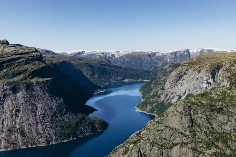
What is Trolltunga?
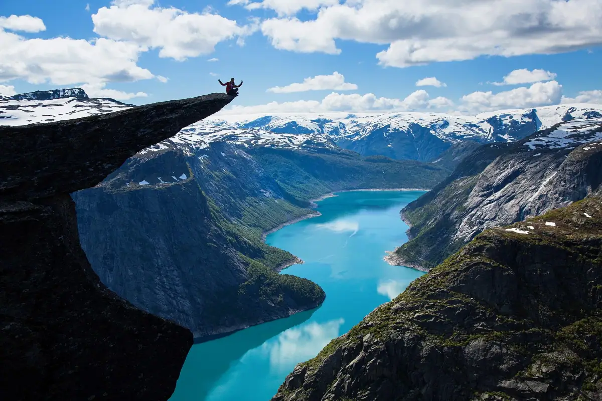
Trolltunga (the “Troll’s Tongue”) is a rock that juts out horizontally 700 meters (2,300 ft) above Lake Ringedalsvatnet. The rock was formed 10,000 years ago by glacial pressure. It hangs out over empty space, and photos of travelers standing at the end of the rock often look faked because the view is so dizzying.
The trail in detail
P2 start: Skjegredral (the most common). The P3 start (higher up, 600 NOK parking, plus about 220 NOK toll) saves 600 m (1,970 ft) of elevation gain.
Distance: 22-27 km (14-17 mi) round trip (depending on the start)
Elevation gain: 800 to 1,100 m (2,600 to 3,600 ft) depending on the starting point
Time: 8 to 12 hours round trip. A long day.
Season: unguided hike from June 1 to September 30 for experienced hikers (depending on snow cover). The rest of the year, a guided hike is recommended.
Difficulty: Hard. You need to be in good physical shape, used to mountain hiking and well equipped.
The route:
- Phase 1 (0-5 km / 0-3 mi): sustained climb through forest, then onto an open plateau. The elevation gain is continuous.
- Phase 2 (5-11 km / 3-7 mi): crossing the mountain plateau (800-1,000 m / 2,600-3,280 ft altitude). Marked trail but varied terrain (boulder fields, leftover snow, bogs).
- Arrival at Trolltunga: the rock is visible from 100 m (330 ft) away. The line for the photo can be long (30-90 min in mid-July).
- Return: same trail in reverse (another 5-6 hours).
Practical organization
Shuttles needed in July-August: Shuttles from Odda to the P2 trailhead are run by Odda Buss and Odda Taxi (service from late May to late September in 2026, some lines only from mid-June to mid-August). Fares are not published on trolltunga.com, so check with the operators. Booking is recommended because seats are limited. To choose between the two starting villages, see our guide to staying in Odda or Tyssedal for Trolltunga.
Recommended start:
- 7 am for a normal day
- 6 am or earlier if you want to avoid long waits at Trolltunga
Check-in required: Rangers (“fjellvakt”) are on the trail in season, from mid-May to mid-October. Check trolltunga.com for the current gear and safety requirements before you go.
Camping on the plateau: Wild camping (allemannsretten, the right to roam) is allowed. Camping on the plateau to see the sunrise over Trolltunga is a magical experience. Bring: a 4-season tent, a warm sleeping bag, a stove, ground insulation.
Places to stay near Trolltunga
Odda and Tyssedal: the best bases for the Trolltunga hike.
Essential gear for Trolltunga
Required (rangers may refuse access without it):
- Waterproof, high-cut hiking boots
- Waterproof jacket and windbreaker
- Waterproof pants or softshell
- Warm mid-layer (fleece or light down jacket)
- Hat and gloves
- Water: 2-3 liters (68-100 oz), plus purification tablets
- Food for a full day (sandwiches, bars, fruit)
Recommended:
- Trekking poles (essential for the long descent)
- Gaiters (leftover snow possible even in August)
- Power bank (long day = dead phone)
- Offline map (Ut.no)
Safety: what you absolutely must know
Trolltunga is dangerous out of season. Every year, hikers have to be rescued because they tried Trolltunga outside the summer period (June 1 to September 30). Snow makes the slopes deadly. Out of season, go with a guide.
The weather can change within an hour. Check the weather on Yr.no the same morning and always plan for the worst. Storms can strike even on a beautiful morning.
Do not climb onto the rock if it is not advisable. When the rock is wet or frosty, it is slippery. Fatal accidents on Trolltunga do happen. Assess your ability soberly.
Charged phone and emergency number: 112 is the emergency number in Norway.
Which one should you choose?
| Criterion | Preikestolen | Trolltunga |
|---|---|---|
| Difficulty | Intermediate | Hard |
| Distance | 7.6 km (4.7 mi) RT | 22-27 km (14-17 mi) RT |
| Time | 4-6 h | 8-12 h |
| Elevation | 604 m (1,980 ft) | 800-1,100 m (2,600-3,600 ft) |
| Season | May-October | June to September |
| Crowds | Very touristy | Touristy but less so |
| View | Fjord (604 m / 1,980 ft) | Lake (700 m / 2,300 ft) |
| Suited to | Intermediate hikers | Experienced hikers |
Our advice: If you only do one, do Preikestolen. The effort-to-reward ratio is excellent, the view over the Lysefjord is spectacular, and the hike is accessible. Trolltunga is one of the most beautiful hikes in Europe but it demands serious preparation and is not for everyone.
Car rental for your hikes
Get easy access to the Preikestolen and Trolltunga trailheads.
Frequently asked questions
Trolltunga or Preikestolen: which one should you choose?
Preikestolen suits intermediate hikers (4-6 hours round trip). Trolltunga is much more demanding (8-12 hours, 22 km / 14 mi) and reserved for people in very good physical shape. If you are unsure, start with Preikestolen.
Can you hike Trolltunga without a guide?
Yes, Trolltunga can be done independently if you are experienced at hiking, well equipped and the weather is good. The trail is well marked. But for inexperienced hikers, a guide is strongly recommended for safety.
When is the Trolltunga hiking season?
The official site (trolltunga.com) says experienced hikers can do Trolltunga unguided from June 1 to September 30, depending on snow cover. From October 1 to May 31, a guided hike is recommended: snow and ice make the route dangerous without winter mountain experience.
How much do the Trolltunga shuttles cost?
Shuttles between Odda and the P2 trailhead are run by Odda Buss and Odda Taxi (fares are not posted on trolltunga.com, so check with these operators). The paid P3 parking (Mågelitopp) skips part of the climb but costs 600 NOK for the day, plus a road toll of about 220 NOK.
Can you camp on the Trolltunga plateau?
Yes, wild camping is legal in Norway. Camping on the Trolltunga plateau to watch the sunrise is an unforgettable experience. Bring suitable gear: nights can be cold even in summer (0-5 °C / 32-41 °F).
More Norway guides
Keep reading
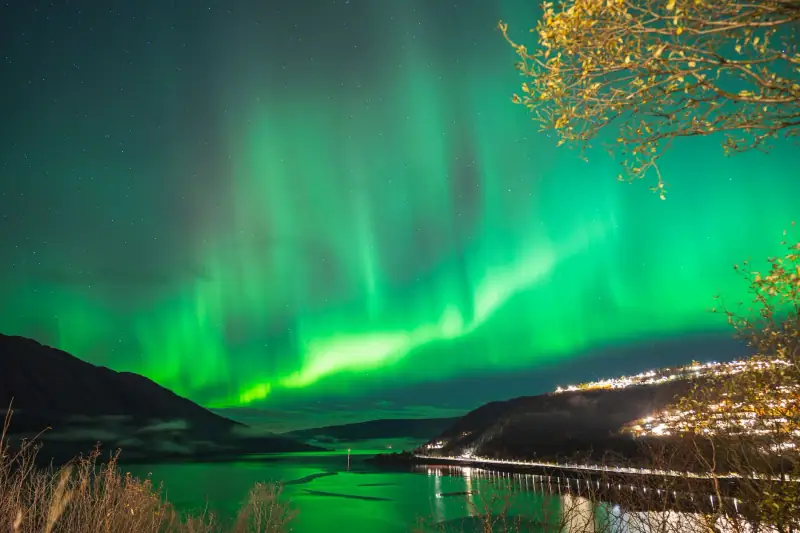
Northern Lights in Norway: Where and When to See Them
Complete guide to seeing the northern lights in Norway. Best places, ideal season, photo tips and excursions from Tromsø and the Lofoten Islands.
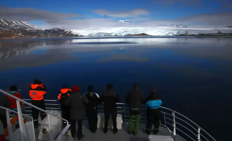
Cruising the Norwegian Fjords: Complete Guide 2026
All about Norwegian fjord cruises: Hurtigruten, fjord cruises, day trips from Bergen. Prices, routes and practical tips.
Norway Trip Budget: How Much Does a Trip Cost in 2026?
How much to budget for a trip to Norway? Detailed prices for lodging, food, transport and activities, plus tips to save money.
Ready-made
Norway itineraries

7 days
Norway in 7 Days: Complete Itinerary for Oslo, Bergen and the Fjords
OsloBergen
Can be adapted in the planner
Road Trip Through the Norwegian Fjords: Itinerary and Tips
Complete guide to a fjords road trip in Norway: scenic routes, Geirangerfjord, Nærøyfjord, stops and practical driving tips.
7 days
Lofoten and Tromsø in one week: doable or too ambitious?
Combining Lofoten and Tromsø in 7 days: real distances, travel times, a day-by-day plan and alternatives if the pace is too tight.