Itineraries
Icefields Parkway Road Trip: Lake Louise to Jasper
We may earn a commission when you book through links on this page, at no extra cost to you. We don't visit or try the places we cover: we summarize published sources. How we work
Day by day: 2-day Icefields Parkway drive
- Day 1Banff or Lake Louise, Bow Lake, Peyto Lake viewpoint, Columbia Icefield
- Day 2Sunwapta and Athabasca Falls, wildlife, arrival in Jasper
Weather through the year on this route
| Jan | Feb | Mar | Apr | May | Jun | Jul | Aug | Sep | Oct | Nov | Dec | |
|---|---|---|---|---|---|---|---|---|---|---|---|---|
| High °F (°C) | 25-4 | 30-1 | 415 | 5211 | 6116 | 6820 | 7524 | 7524 | 6619 | 5211 | 362 | 27-3 |
| Low °F (°C) | 9-13 | 12-11 | 21-6 | 28-2 | 373 | 468 | 5211 | 5010 | 415 | 30-1 | 21-6 | 12-11 |
| Rain in (mm) | 0.615 | 0.615 | 1.025 | 1.640 | 2.870 | 4.1105 | 2.460 | 2.460 | 1.845 | 1.025 | 1.025 | 0.820 |
Normals 1991–2020 at Calgary: averages over 30 years, not a forecast. Source: NASA POWER (MERRA-2), grid of about 50 km. Figures computed by us in November 2026.
In short
- The Icefields Parkway links Lake Louise and Jasper over about 230 km (143 mi), roughly 3 hours without stops.
- With viewpoints, short walks and a lunch break, plan 6 to 8 hours, or split the drive with a night halfway.
- Services are scarce: fill up your tank before leaving Lake Louise or Jasper, and download offline maps.
- A Parks Canada entry fee is required to drive through and stop in the parks; check the road status in winter.
The Icefields Parkway is often described as one of the most beautiful roads in the world. It links Lake Louise and Jasper through Banff and Jasper National Parks, beneath snowy peaks, hanging glaciers and milky blue lakes. It is not just a drive: it is a destination in its own right.
In short: about 230 km (143 mi), a full day if you really want to stop, viewpoints at every bend and very few services. This article gives you a route of stops, practical tips and mistakes to avoid. To choose where to sleep at both ends, read the Banff or Jasper comparison too.
Preparing the drive: direction, duration and season
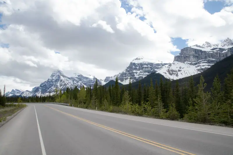
Most travelers drive from south to north, from Lake Louise to Jasper, because they arrive via Calgary and Banff. The opposite direction is just as beautiful: some prefer to start from Jasper to see the glaciers in the morning light. The main thing is not to rush through in just a few hours.
Without any stop, the road takes about three hours. With viewpoints, short walks and a lunch break, plan on 6 to 8 hours. If you have more time, split the drive with a night halfway: the atmosphere early in the morning or in the evening, once the tour buses have left, is worth the detour.
The speed limit is low and wildlife often crosses the road: drive carefully, especially at dawn and dusk. A Parks Canada entry fee is required to drive and stop in the parks: buy it in advance or at the entrance according to the current rules, and keep it visible in the vehicle.
The season matters a lot. Summer offers the longest days and the fullest access, but also the biggest crowds. Early fall brings golden colors and more calm. In winter, the road can be snowy or temporarily closed: check the road conditions before leaving and equip your vehicle accordingly. Our guide on when to go to Canada covers the seasons in detail.
As for entry requirements, they depend on your passport. Check the official travel advice of your government before you book: travel.state.gov (US), GOV.UK (UK), travel.gc.ca (Canada), Smartraveller (Australia) (checked November 2026).
Sleep in Lake Louise before you set off
A night there lets you start early on the road. Compare lodging for your dates.
From Lake Louise to Bow Lake: the first lakes
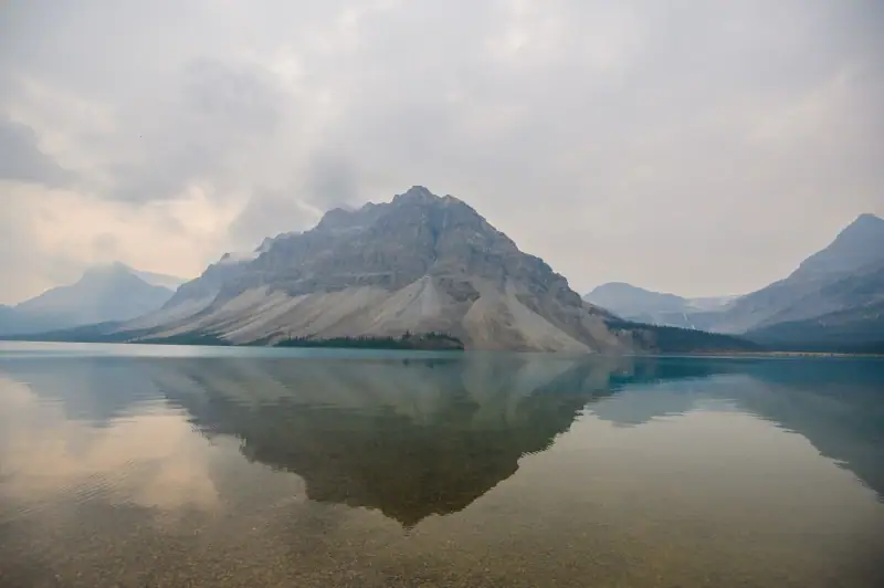
From Lake Louise, the road climbs gradually north along the Bow Valley. The first kilometers set the scene: conifer forests, jagged peaks and first views of glaciers clinging to the rock walls.
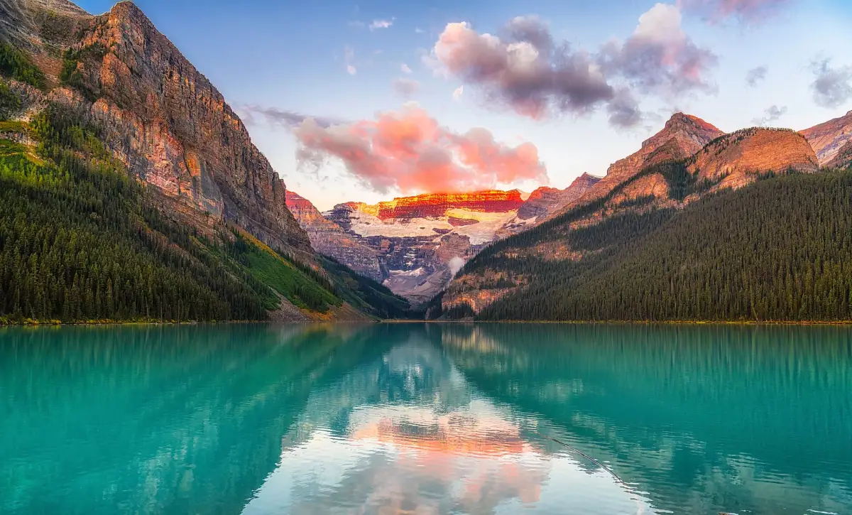
Bow Lake is one of the first big stops. This glacial lake, an intense blue-green in good weather, can be seen from a parking lot at the water’s edge. A few steps are enough to find a clear viewpoint, and a lakeshore trail lets you extend the walk if you have time.
A little further on, the Peyto Lake viewpoint, from the Bow Summit area, is one of the most famous shots of the Rockies. A short climb from the parking lot leads to the viewing platform. In high season the spot is very busy: arrive early in the morning or late in the day to enjoy the view with fewer people.
Leave some margin in your schedule: these two stops easily take up a good part of the morning, especially if you like taking photos.
From the Columbia Icefield to the glaciers
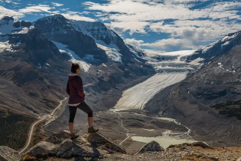
In the middle of the route lies the Columbia Icefield, one of the largest icefields in the Rockies. The Athabasca Glacier, one of its tongues, comes down almost to the road and can be seen from a dedicated access point.
At the icefield, a visitor center offers information, services and glacier excursions depending on the season. Guided tours in a special vehicle or on foot let you approach the ice safely. Never venture onto the glacier alone: crevasses are dangerous and invisible under the snow.
Rangers insist on one point: weather conditions change very quickly at altitude. Even in summer, bring a warm jacket, a windbreaker and good shoes. The wind can be icy near the glacier while the sun shines a few kilometers lower down.
Excursions in the Rockies
Guided tours, glacier outings and excursions around Jasper: browse the available offers.
Waterfalls and the approach to Jasper
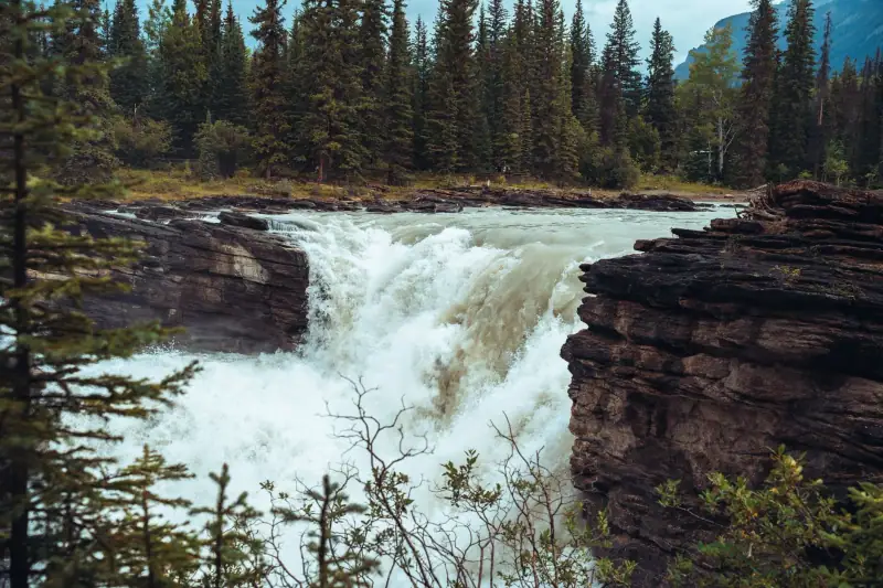
Heading north, the road crosses the Sunwapta Valley and then the Athabasca Valley. Two stops deserve a pause: Sunwapta Falls and Athabasca Falls. They are not giant waterfalls, but their power is impressive, as the water pours into narrow canyons cut into the rock. Walkways and short trails make the visit easy, but stay behind the barriers: wet rocks are slippery.
This stretch of the road is also one of the best for spotting wildlife. Bighorn sheep, mountain goats, elk and sometimes bears can appear at the roadside. If you see an animal, slow down, park only in a safe spot and watch from the car. A safe distance is essential, and feeding animals is prohibited.
After these last kilometers, the mountains part and the valley opens onto Jasper, a quiet small town surrounded by peaks. Plan at least one night to enjoy the end of the day: the atmosphere there is calmer than in Banff.
Practical tips: fuel, weather and booking
Services are scarce on the Icefields Parkway. Fill up before you leave, whichever direction you go, and check in advance which refueling points are open depending on the season. Bring water, snacks and a picnic: dining options are limited and often seasonal. Mobile coverage is poor, even nonexistent in places: download your maps offline before leaving.
Rent a car in advance if you arrive via Calgary: it is the most flexible option, especially for early morning stops. Book it at the same time as your flights to compare rates.
Flights to Calgary
Calgary is the most convenient gateway to reach Lake Louise: compare several dates before booking.
For safety, remember that you are in bear country: stay together on trails, make noise and follow the signs posted by Parks Canada. In summer, bring insect repellent. Finally, adapt your pace: it is better to pick four or five stops and enjoy them than to try to see everything in a rush.
A two-day itinerary idea
Day one: leave Banff or Lake Louise in the morning, stop at Bow Lake and the Peyto Lake viewpoint, picnic lunch, then drive to the Columbia Icefield for a guided visit if you wish. Spend the night there or nearby, depending on availability.
Day two: continue north, stopping at Sunwapta and Athabasca Falls, watching for wildlife, and arrive in Jasper at the end of the day. If you have more time, add a day of hiking around Jasper to extend the trip.
Sleep in Jasper
Book your arrival stop in advance: in high season, the best options go early.
Sources
- Parks Canada: figures checked November 2026
Frequently asked questions
How long is the Icefields Parkway?
The road links Lake Louise and Jasper over about 230 km (143 mi). Without stops it takes around three hours, but plan a full day to enjoy the viewpoints.
Do you need a pass to drive the Icefields Parkway?
Yes, the road crosses Banff and Jasper National Parks, so a Parks Canada entry fee is required if you stop. Check the official Parks Canada website for current rates and conditions.
Can you drive the Icefields Parkway in winter?
The road generally stays open in winter, but it can be snowy, icy or temporarily closed. Appropriate equipment is recommended and you should check the road status before leaving.
Where can you fill up on the way?
Gas stations are rare along the route. Fill up before leaving Lake Louise or Jasper, and check which services are open halfway depending on the season.
Can you see wild animals?
Yes, bears, elk, bighorn sheep and mountain goats are regularly seen. Stay in your vehicle at a reasonable distance and never feed them.
More Canada guides
Keep reading
Jasper in Winter: Skiing at Marmot Basin, Snowshoeing, Skating and Stargazing
Jasper in winter: Marmot Basin, snowshoeing, skating on Mildred Lake, ice walks and dark skies. When to go, how to organize and what to book.

Where to Stay in Jasper: Areas and Types of Lodging
Downtown, lodges, campgrounds or nearby towns: how to choose where to stay in Jasper, in the Rockies, with budget, seasons and booking tips.
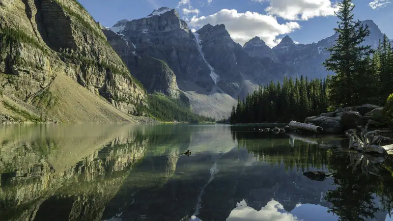
When to Visit Canada: Seasons, Weather and the Best Time by Region
Summer in the Rockies, fall colors in Ontario, winter under the snow: our guide to choosing the best time to visit Canada.
Ready-made
Canada itineraries

3 days
Toronto in 3 Days: What to See and Do on a First Visit
Toronto in 3 days: CN Tower, the islands, markets, neighborhoods and a Niagara excursion. A day-by-day itinerary with lodging and transit tips.
7 days
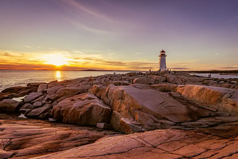
Nova Scotia in 7 Days: Halifax, the South Shore and the Cabot Trail
A one-week Nova Scotia itinerary: Halifax, Peggy's Cove, Lunenburg, then the Cabot Trail on Cape Breton. Stages, distances and practical tips.

3 days
Vancouver in 3 Days: An Itinerary Between Ocean and Mountains
What to see in Vancouver in 3 days? Stanley Park, Granville Island, Gastown, Grouse Mountain and an excursion: a practical day-by-day itinerary.