Things to do
Hiking on the French Riviera: the most beautiful coastal trails
We may earn a commission when you book through links on this page, at no extra cost to you. We don't visit or try the places we cover: we summarize published sources. How we work
In short
- The Nietzsche Path links Èze-sur-Mer station to Èze village in about an hour of steady climbing. The Cap Ferrat loop is roughly 10 km (6 mi); the Cap d'Antibes path takes one to two hours.
- Spring and fall are the best seasons; in summer, start early and carry plenty of water, as water points are rare on the trails.
- The Esterel can be restricted or closed on some summer days because of fire risk: check official information the day before and the same morning.
- Many trailheads are reachable by regional train or bus; check the return times before you set off.
People readily associate the French Riviera with beaches, yachts and the terraces of the Croisette. Yet the region is also a wonderful hiking ground. Between sea, cliffs, wooded capes and hilltop villages, many trails reveal a coastline that roads and concrete often hide. Some last an hour, others half a day; almost all can be reached by train or bus from Nice, Antibes or Cannes. Here is a selection of walks not to miss, with practical tips for setting off well equipped, at the right time and without unpleasant surprises.
How to choose your hike on the French Riviera
Before lacing up your shoes, three criteria matter: elevation gain, sun exposure and accessibility. Most coastal trails are easy on paper, but take more effort than you imagine once the heat joins in. A few pointers to guide you:
- Flat seaside walks (Cap d’Antibes, loops around a peninsula) suit families and occasional walkers. They alternate built path, rocks and small coves.
- Climbs to hilltop villages (Èze, for example) are short but steep: you climb in little time and enjoy an exceptional panorama.
- Inland massifs (the Esterel and the Nice hinterland) offer more athletic outings, with steeper climbs and little shade on some stretches.
Also think about the logistics of the return. On a loop hike, you get back to your starting point; on a point-to-point hike, you need to plan a train or bus to come back. Our guide to getting around the French Riviera without a car will help you combine walking and public transport.
The Nietzsche Path, from Èze-sur-Mer to Èze village
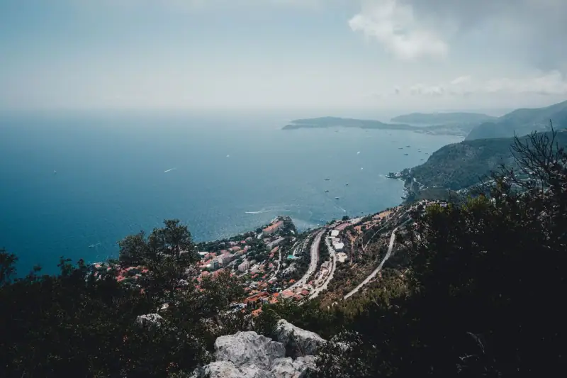
This is the classic of classics. The Nietzsche Path links Èze-sur-Mer station, on the shore of the Mediterranean, to the village of Èze, perched on its rocky peak. It owes its name to the German philosopher Friedrich Nietzsche, who is said to have used it during stays in the region in the late 19th century and to have found inspiration there for part of his work.
The path climbs through Mediterranean vegetation: Aleppo pines, agaves, aromatic plants. Allow about an hour of climbing, with a steady elevation gain, on stony and sometimes slippery ground. Several viewpoints open onto the bay, Cap Ferrat and, on a clear day, the coast as far as Italy. Once in Èze, reward yourself by strolling the medieval lanes, visiting the Exotic Garden or treating yourself to a coffee on a terrace.
Tips:
- Set off early in the morning or late in the afternoon in summer: the trail is very exposed and crowds grow fast.
- Climb rather than descend if you can: the descent is harder on knees and ankles.
- If you lack time or energy, a bus links Nice to the village, which lets you walk down and take transport up.
The Cap Ferrat loop
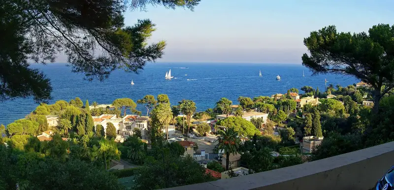
The Saint-Jean-Cap-Ferrat peninsula is known for its sumptuous villas, but it can also be walked thanks to a coastal path that goes all the way around. It follows the sea, passing coves, lighthouses and gardens, with views of Villefranche-sur-Mer, Beaulieu and the Monaco coast.
This route, about ten kilometers (6 mi) depending on variants, is accessible to most walkers. It has no major technical difficulty, but some sections are rocky and the strip of asphalt alternates with dirt paths. Allow half a day to cover it at a leisurely pace, enjoying a swim break in a small cove if the weather allows. The advantage of this walk: it combines easily with a visit to Villefranche-sur-Mer, served by train from Nice.
Stay near the Nice Riviera trails
Nice, Villefranche or Èze: a well-placed base lets you chain hikes without a car. Compare the accommodation available.
The Tire-Poil path on Cap d’Antibes
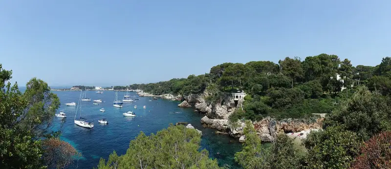
Here is an easy walk, ideal for a first approach. In Antibes, the Cap d’Antibes coastal path, often called the Tire-Poil path, follows the rocky coast of the peninsula, facing the Mediterranean. It alternates flat stretches, stairs cut into the rock and viewing platforms, with views of the Lérins Islands, the Bay of Angels and, on a clear day, the snow-capped Alpine peaks in winter.
The walk does not require great fitness, but watch out for sea spray and rocks wet in bad weather. It takes one or two hours depending on pace and photo stops. To extend the day, you can visit Antibes old town, its Provençal market and ramparts, or combine the outing with a crossing to the islands: see our article on the Lérins Islands from Cannes.
Good to know: on this kind of path, private properties sometimes line the way. Respect the signs and do not leave the marked route. To the east, the Cap Martin path leads to the architecture of Le Corbusier and Eileen Gray, which you visit by reservation: see our guide to Villa E-1027 and the Cabanon.
The Esterel: red mountains and wild coves
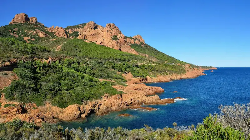
West of Cannes, the Esterel massif shows a very different face of the French Riviera. Its deep red volcanic rocks plunge straight into a turquoise sea, forming wild inlets and tiny coves. The trails are more athletic than on the eastern coast, with climbs that can be steep and little shade.
Two main types of outings stand out:
- Coastal trails, between Agay and Théoule-sur-Mer, which follow the shore over stretches of varying difficulty and let you dive into the clear water.
- Climbs to the summits, such as Pic du Cap Roux, which reward the effort with a 360-degree panorama over the coast and the islands.
The Esterel is a sensitive massif: fire risk is closely monitored there in dry periods, and access may be limited or forbidden on certain summer days. Always check the official guidelines before leaving, carry plenty of water (there are no water points on the trails) and never light a fire. If you are not used to navigating in the mountains, a guided outing is a good option.
The Nice hinterland: another French Riviera
Only a few dozen kilometers from the beach, the landscapes change radically: deep valleys, gorges, stone villages and peaks that exceed 3,000 meters (9,840 ft) in the Mercantour massif. The Vésubie valley and its surroundings offer day hikes accessible to regular walkers.
These outings are more committing than the coastal walks: the weather changes fast at altitude, paths are sometimes stony, and you quickly move away from shops. Check the weather, set off with a map or an offline mapping app, and tell someone your route. In summer, late-afternoon thunderstorms are frequent: leave early to be back before.
Public transport serves some villages, but a car remains the most practical way to explore this area. If you do not have one, consider an organized excursion.
Guided hikes and excursions from Nice
No car or want company? Compare nature excursions and guided hikes on the French Riviera.
Gear and safety: the essentials to carry
A seaside hike seems harmless, but heat, sun and rocks can make it tiring. Here is our basic list:
- Plenty of water: more than a liter (about a quart) per person, more in summer. Water points are rare on the trails.
- Walking or trail shoes, with good grip.
- Sun protection: hat, sunglasses, sunscreen. Exposure is strong even in spring.
- Snacks: dried fruit, cereal bars, fresh fruit.
- A swimsuit and a light towel if you plan to swim in a cove.
- A charged phone with a mapping app and, ideally, a route downloaded offline.
- A small first-aid kit.
Finally, follow a few common-sense rules: stay on marked trails, leave no trash, and avoid hiking in strong mistral or thunderstorms. The European emergency number, 112, works throughout the region.
Which season to hike?
Spring is probably the finest period: the vegetation is in flower, the air is mild and the trails stay quiet. Fall offers similar conditions, with a sea still pleasant for a swim after the effort. Winter suits coastal walks well, which enjoy a mild climate and superb light; days are short, however, and mountain trails can be snowy. In summer, heat and crowds mean setting off at dawn and favoring short outings with a swim.
Fitting hiking into your stay
A simple idea is to devote a morning to a hike, then the afternoon to discovering a village or the beach. For example, climb to Èze by the Nietzsche Path in the morning, have lunch there, then come down by bus for an evening in Nice. If you are preparing a longer stay, our 3 days on the French Riviera by train from Nice itinerary can serve as a base, to which you add a walk. To extend into the hinterland, a detour via Saint-Paul-de-Vence is easy to combine with a nature outing.
If you need a vehicle to reach the Esterel or the Vésubie, rent it for one or two days rather than for the whole stay.
In short
The French Riviera is much more than a beach destination: its coastal trails and massifs offer spectacular landscapes, accessible all year. Start with an easy walk such as Cap d’Antibes or the Cap Ferrat loop, try the Nietzsche Path if you like fine views, then venture into the Esterel or the hinterland if you want something wilder. Set off early, carry water and always check local conditions before leaving: safety guidelines change with the weather and fire risk.
Stay in Antibes or Cannes to branch out
A base in Antibes or Cannes gives access to Cap d'Antibes, the Lérins Islands and the Esterel. Discover the accommodation available.
Frequently asked questions
Can you hike on the French Riviera all year?
Yes, it is one of the region's assets. Spring and fall are the best seasons: pleasant temperatures, soft light and quieter trails. Winter suits coastal walks very well, while summer means leaving early in the morning and carrying plenty of water.
What is the most famous hike on the French Riviera?
The Nietzsche Path, which links Èze-sur-Mer station to the medieval village of Èze, is probably the best known. It takes about an hour of climbing, with a steady slope and fine views of the sea.
Do you need good shoes for the coastal trails?
Yes. Even on short walks, the ground can be stony, uneven or slippery. Walking or trail shoes with grippy soles are recommended; flip-flops and thin sandals are best avoided.
Can you reach the hikes by public transport?
For many of them, yes. The regional train serves stations near the start of the trails at Èze, Cap d'Ail or the Esterel, and buses climb to some villages. Check return times before you leave. Our guide on getting around without a car details the options.
Are the massifs sometimes closed because of fire risk?
Yes. In summer, access to some forest massifs, notably the Esterel, can be restricted or forbidden depending on fire risk. Check the information from the prefecture or metropolitan authority concerned the day before and the same morning.
Are dogs allowed on the trails?
It depends on the site. In protected natural areas, dogs generally must be on a leash, and some areas may be closed to them. Find out before you leave, and bring water for your animal.
Do you need a guide to hike on the French Riviera?
Not for the marked coastal trails, which are accessible to most walkers. For the hinterland or mountain routes, a guided outing can be a good idea if you are not used to navigation.
More French Riviera guides
Keep reading
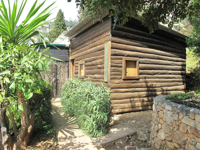
Visiting Villa E-1027 and Le Corbusier's Cabanon: book ahead, prices and access
Villa E-1027 and Le Corbusier's Cabanon in Roquebrune-Cap-Martin: booking required, fares, season, access by train and tips for the visit.
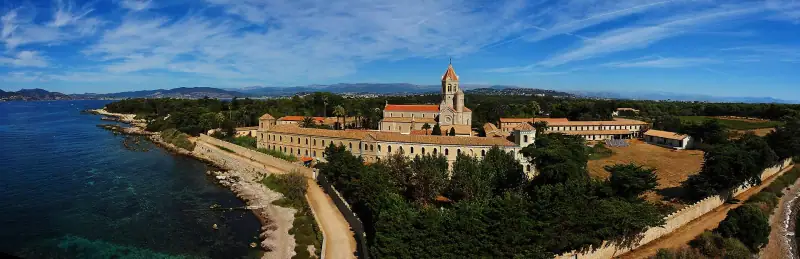
Visiting the Lérins Islands from Cannes: Sainte-Marguerite and Saint-Honorat
Sainte-Marguerite and Saint-Honorat in a day from Cannes: crossing, Fort Royal, abbey, vineyard, beaches and tips to organize your excursion.
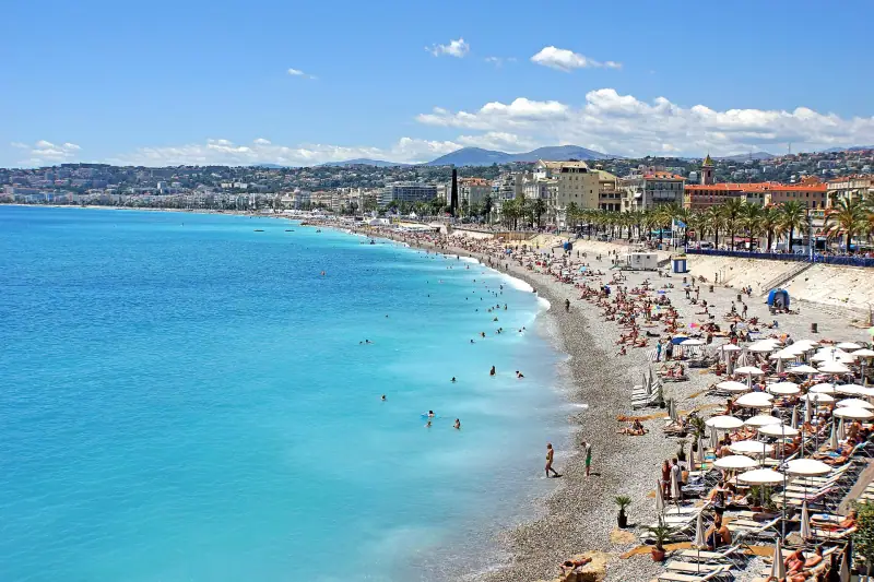
French Riviera budget: what a trip costs, item by item (3 profiles)
Accommodation, transport, meals, activities: the cost of a French Riviera trip, three budget profiles (tight, comfort, premium) and tips to spend less.
Ready-made
French Riviera itineraries
4 days
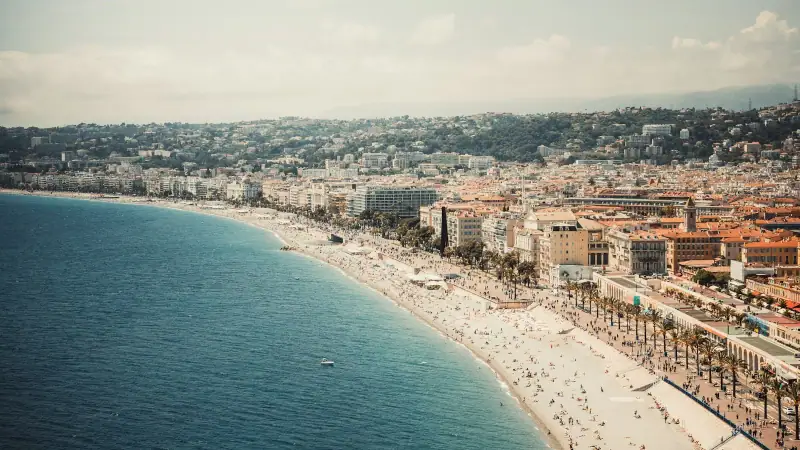
French Riviera in 4 days with kids: stops and pace
The French Riviera with kids in 4 days: a realistic plan from Nice, with travel times in minutes, short days, beaches and breaks, no car required.
Can be adapted in the planner
3 days
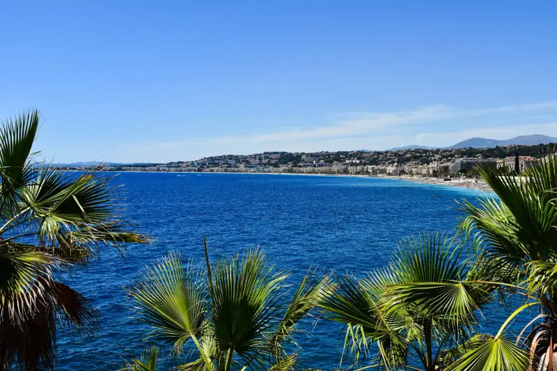
3 days on the French Riviera from Nice: a car-free itinerary by train
Nice, Villefranche, Èze, Menton, Antibes and Cannes in 3 days: a day-by-day itinerary by train and bus, with timing advice and tips to avoid crowds.
5 days
French Riviera road trip in 5 days: from Menton to Saint-Tropez by car
A 5-day road trip between Menton and Saint-Tropez: corniche roads, hilltop villages, the Esterel and parking tips to avoid traffic jams.