Things to do
Hiking in Auvergne: volcanoes, lakes and ridges not to miss
We may earn a commission when you book through links on this page, at no extra cost to you. We don't visit or try the places we cover: we summarize published sources. How we work
In short
- The Puy de Dôme (1,465 m / 4,806 ft) is the best first hike: a well-marked trail of a little over an hour, with a cog railway for the descent.
- The Lake Pavin loop is the easiest option for families, taking one to two hours.
- The Puy de Sancy (1,886 m / 6,188 ft) is reached by cable car then a path; the Puy Mary (1,780 m / 5,840 ft) by a short, steep trail.
- Best months are May to October, with June and September often the best compromise; Europe's emergency number is 112.
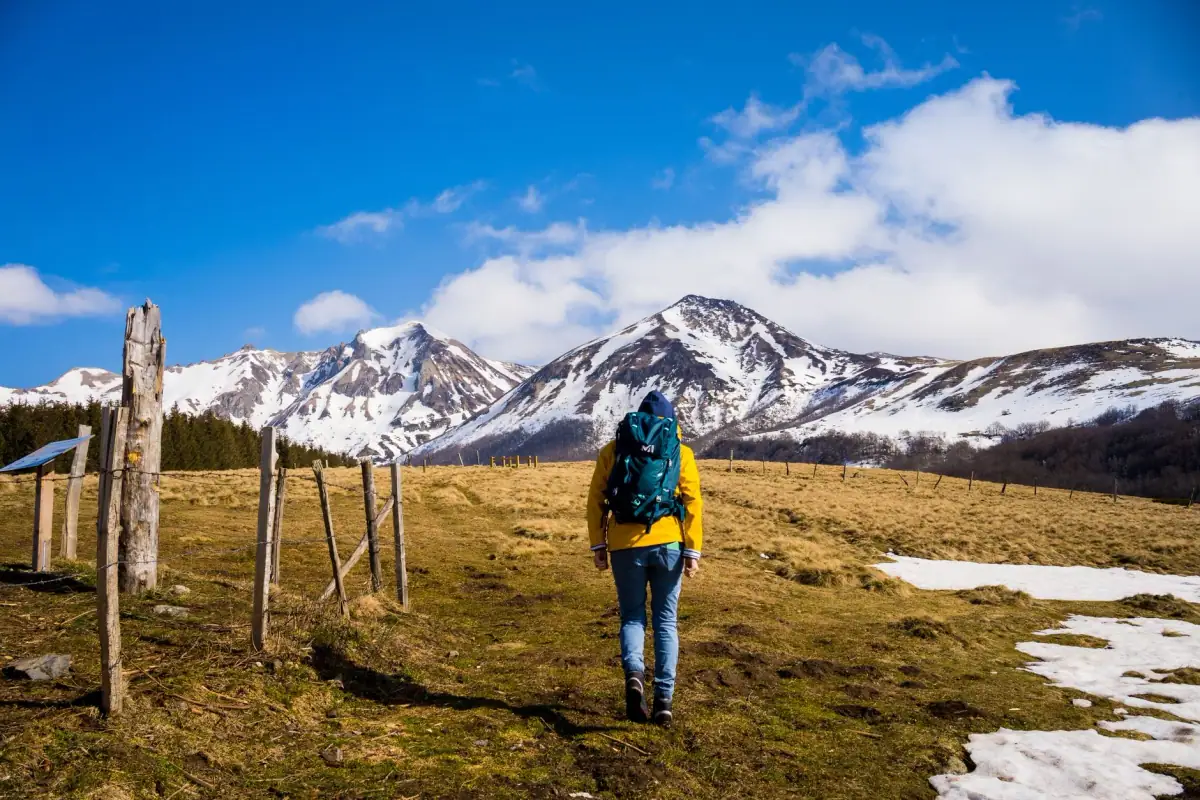
Auvergne is one of those rare places in France where you can spend the morning at the summit of a volcano, the afternoon by a lake nestled in a crater, and the evening in a dark-stone village, without ever driving more than two hours. For walkers, it is a remarkable playground: marked trails, open high-altitude landscapes, very varied difficulty levels and few crowds outside the handful of emblematic sites.
This guide presents the region’s great hikes, area by area: the Chaîne des Puys, the Sancy Massif, the Monts du Cantal, then a few leads to go further. For each route, you will find what to know about level, season, pitfalls to avoid and how to fit it into a stay. Durations are rough estimates: they vary a lot with your pace, your breaks and the weather, and it is always better to check marking and access information on official sites before leaving.
Understanding the terrain before walking
Before choosing a hike, it helps to understand why Auvergne’s landscapes are so different from one area to another. The region is the result of several successive volcanic episodes, later eroded by glaciers and rivers.
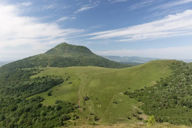
- The Chaîne des Puys gathers many volcanic cones that are relatively recent on a geological scale. Their shapes are readable: bowl craters, regular slopes, short grass. It is listed as a UNESCO World Heritage Site together with the Limagne fault.
- The Sancy Massif is a large, heavily eroded volcano, with deep valleys and jagged ridges. It holds the highest point of the Massif Central, at about 1,886 m (6,188 ft).
- The Monts du Cantal form an immense dismantled stratovolcano, whose radiating valleys were carved by glaciers. Landscapes there are greener, broader, dominated by summer pastures.
This diversity has a practical consequence: do not expect the same experience everywhere. In the Chaîne des Puys, you walk on short but steep slopes, often exposed to wind. In the Sancy, you alternate forests, waterfalls and ridges. In the Cantal, you string together long crossings of summer pasture where you meet herds.
The Puy de Dôme and the Chaîne des Puys
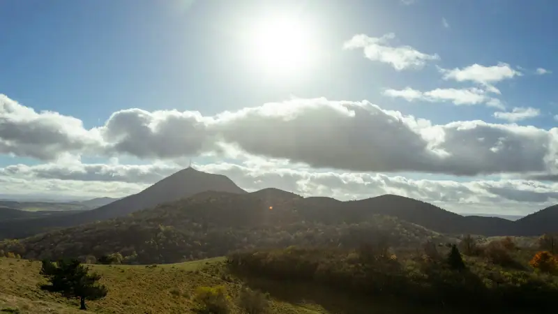
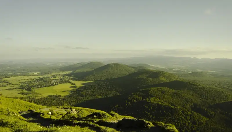
This is the region’s most famous hike, and it deserves its reputation. The Puy de Dôme peaks at about 1,465 m (4,806 ft) and overlooks the whole chain that bears its name. From its summit, you take in the other puys lined up like a row of sleeping craters, the Limagne plain to the east and, on a clear day, the distant reliefs of the Massif Central.
The different ways up
Two main options are open to you. The first is the climb on foot by the historic trail known as the “Chemin des Muletiers”, which starts from the Col de Ceyssat area. It is well marked, steady, and generally takes a little over an hour going up for an average walker. The second is to take the cog railway that climbs from the foot of the volcano, practical for people with reduced mobility, young children or if time is short. You can very well combine the two: climb on foot, come down by train, or the reverse.
At the summit, besides the view, you will discover the remains of a Gallo-Roman temple dedicated to Mercury, a reminder that these heights have been visited since Antiquity. The place is also very exposed: the wind can be cold even in midsummer.
Going further in the chain
If the Puy de Dôme whetted your appetite, other neighboring volcanoes offer calmer climbs. Some puys let you follow the edge of a crater or descend into a bowl of vegetation, with a sense of silence that you do not always have on the main summit. There are many loop routes linking several puys: ask the local tourist offices for current maps and marking, as some access routes are regulated to protect fragile soils.
Practical tips
- Arrive early: the light is better and crowds are lighter.
- Always keep a windbreaker layer in the bag, even in very fine weather.
- Stay on the trails: erosion is a real problem on these volcanic slopes.
- Watch the weather: a storm at altitude builds quickly and there is no shelter on the summit.
Guided hikes on the volcanoes
Outings with a guide, discovery of geology and activities to book in advance.
The Sancy Massif: summits, waterfalls and ridges
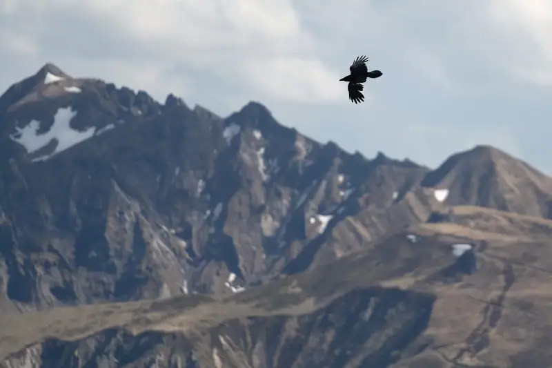
The Sancy is the favorite destination of hikers in Auvergne. The massif is vast, its trails very numerous, and you find both two-hour walks and multi-day crossings. Le Mont-Dore and Besse-et-Saint-Anastaise are the two main gateways.
Climbing the Puy de Sancy
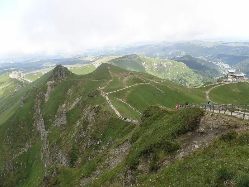
At about 1,886 m (6,188 ft), the Puy de Sancy is the highest point of the Massif Central. From Le Mont-Dore, a cable car covers a large part of the elevation gain. Then a developed path, partly in stairs, leads to the summit in a relatively short time. The climb is therefore accessible to many people, but do not underestimate it: altitude, wind and weather changes make conditions demanding, especially off season. More athletic walkers can climb entirely on foot, by routes that let you fully enjoy the valleys.
The panorama from the summit is wide and readable: you can pick out the neighboring ridges, glacial valleys and, in the background, the other volcanic massifs.
Ridges and valleys
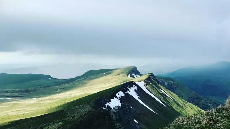
Beyond the summit, the Sancy is discovered in its valleys. Waterfalls line several trails around Le Mont-Dore, especially beautiful in spring or after heavy rain. Longer loops follow the ridges, with fine views over both sides of the massif. The Chaudefour valley, a nature reserve, is an example of a site where nature protection imposes precise rules: stay on the trails and respect the signs posted at the entrance.
The Lake Pavin loop
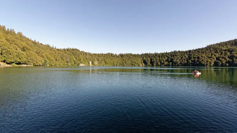
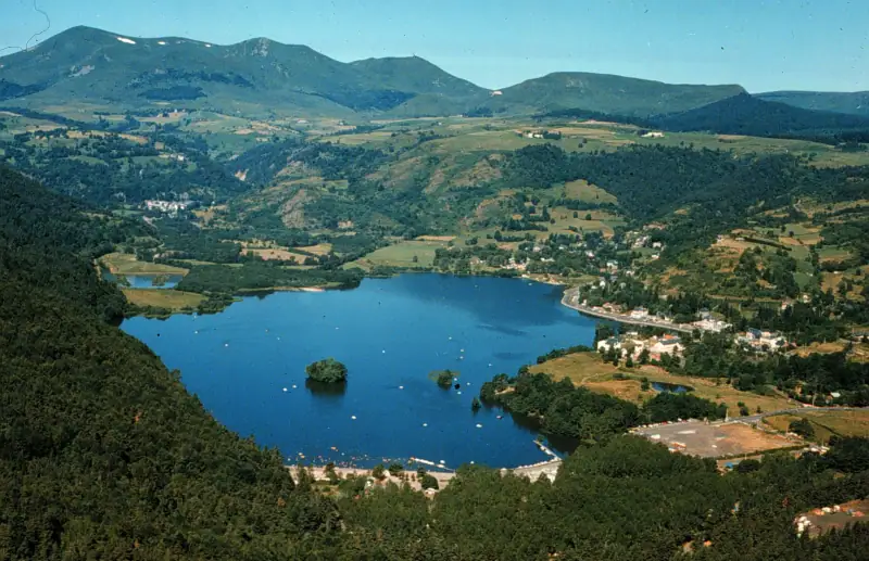
Near Besse-et-Saint-Anastaise, Lake Pavin is an almost circular crater lake, surrounded by forest. A trail goes around it: the loop is easy, suited to families, and generally takes one to two hours depending on your breaks. It is an excellent option on days when the weather rules out summits, or as an end-of-day walk to complement a more athletic climb. The forest that borders the lake gives the landscape an almost Nordic character, especially in fall.
You can continue to other bodies of water in the area, such as Lake Chambon, better suited to relaxing and leisure activities, but busier in summer.
Besse-et-Saint-Anastaise and Le Mont-Dore as bases
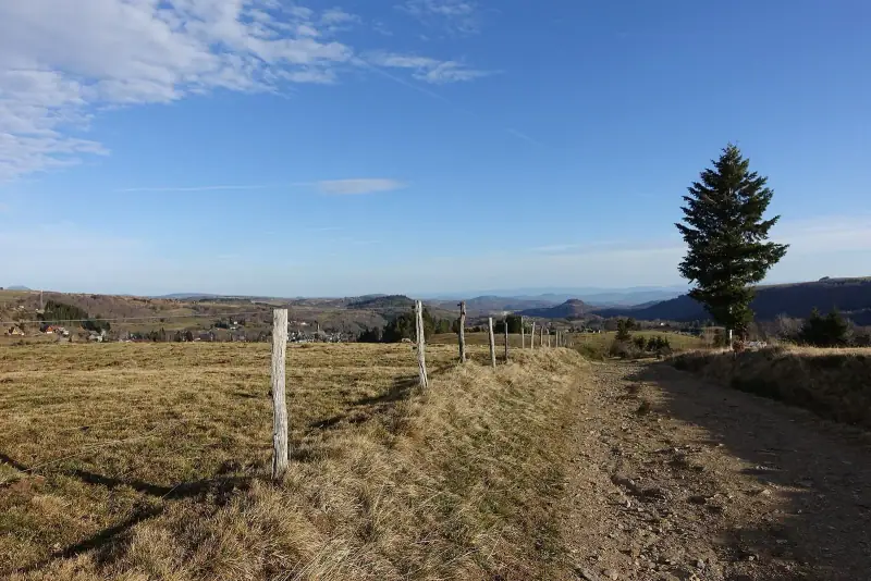
To range around the massif, staying in the area is a real comfort: you avoid morning drives and gain flexibility when the weather changes. Le Mont-Dore offers more services and a resort atmosphere; Besse-et-Saint-Anastaise is smaller, more medieval, with cobbled lanes and lava houses.
Stay at the foot of the Sancy
Hotels, gîtes and bed and breakfasts in Le Mont-Dore to set off walking at dawn.
The Monts du Cantal and the Puy Mary
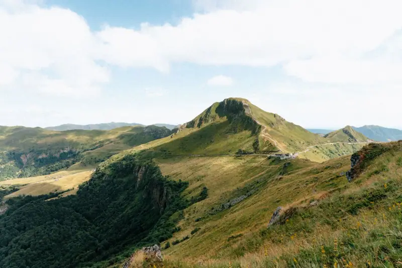
If the Sancy is the most visited massif, the Cantal is perhaps the most spectacular. Its star-shaped valleys, summer-pasture plateaus and pyramid-shaped summits offer hikes of great scale, in a greener and more pastoral setting than in the Sancy.
The Puy Mary
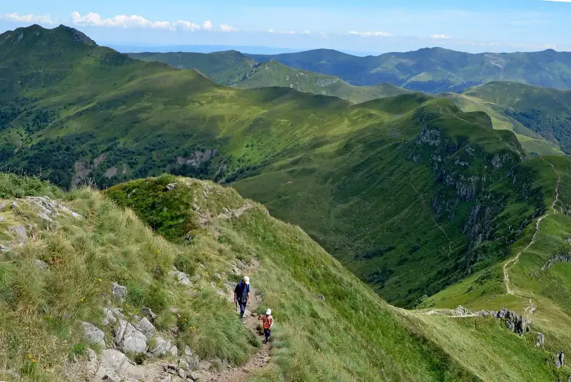
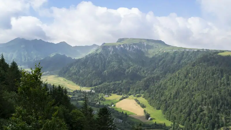
The Puy Mary is one of the most emblematic sites of the Cantal. Its summit, at about 1,780 m (5,840 ft), is reached by a short but steep trail, partly developed, which starts from the Pas de Peyrol area, one of the highest road passes of the massif. The climb is brief, but the reward is significant: a panorama over the radiating valleys that spread on either side, proof of the ancient structure of the great volcano.
Because of its popularity, the site is sometimes very busy in summer. To avoid the crowd, arrive early or, better, late in the day when the light turns golden. The area is also sensitive: rules protecting soil and vegetation must be respected, and it is important not to leave the developed trails.
Ridges and summer pastures
Around the Puy Mary, several routes extend the walk to neighboring ridges and passes, which lets you turn a simple climb into a half-day or full-day hike. You will cross summer pastures where Salers cattle graze, recognizable by their mahogany coats. Keep your distance from herds, always close gates and keep dogs on a leash.
Salers as a stop
The village of Salers, with its dark volcanic stone houses, makes a pleasant base for exploring the Cantal. After a day of walking, nothing beats a meal of local products; our guide to the AOP cheeses of Auvergne will help you tell Cantal, Salers and their cousins apart.
Le Puy-en-Velay and the pilgrimage routes
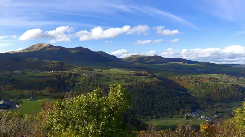
Le Puy-en-Velay is famous as the starting point of a route to Santiago de Compostela, the GR 65. Even if you do not plan to walk to Spain, you can walk a stretch of a few hours or a day toward the west or south. The landscape changes: you leave the craters for rolling plateaus, villages with character and sunken lanes that tell of several centuries of pilgrimage.
The town itself, with its volcanic pinnacles topped with religious buildings, is an experience in its own right: you can climb to some of these sites, which amounts to a small urban hike, with remarkable views over the roofs and the surrounding mountains. The Allier gorges, farther west, offer another kind of walk, along an enclosed river.
Visits and nature outings in Auvergne
Day excursions, guided walks and local experiences to book online.
Livradois-Forez: the quiet hike
The Livradois-Forez regional nature park, in the east of the region, offers a gentler alternative to the great volcanic summits. Its mid-mountain landscapes mix forests, meadows, scattered hamlets and small valleys. It is the ideal area if you look for quiet walks, far from the busiest sites, or if you travel with children or walkers who are not well trained. Trails there are more shaded, which is valuable on hot days.
Choosing your hike by level
Here is a simple benchmark to compose your program. Durations are indicative and do not include your breaks.
| Profile | Route ideas | Key point |
|---|---|---|
| Family, beginner | Lake Pavin loop, walks around Le Mont-Dore | Short loops, little elevation gain |
| Occasional walker | Puy de Dôme on foot or by train, Puy Mary | Brief but exposed climbs |
| Regular walker | Puy de Sancy on foot, Sancy ridges, loops in the Cantal | Elevation gain and weather to watch |
| Enthusiast | Multi-day crossings, sections of the GR 65 | Logistics and lodging to prepare |
If you have little time, our 3-day itinerary in Auvergne shows how to combine the Chaîne des Puys, the Sancy and Salers in a coherent stay, with realistic travel times.
Equipment and safety
In Auvergne, the mountain is mid-height, but it is still mountain. The most frequent mistakes come from overconfidence linked to altitudes that seem modest.
What to bring
- Hiking shoes with a lugged sole, even for easy trails: volcanic slopes are sometimes slippery after rain.
- A windproof, waterproof jacket as well as a warm layer: the temperature drops quickly at altitude.
- Enough water: water points are rare on the ridges and are not always drinkable.
- Sun protection: hat, glasses, sunscreen. Summits offer very little shade.
- A map or an offline app: mobile coverage is patchy in some valleys.
- A small snack and a headlamp if you start early or come back late.
Good habits
Check the weather the evening before and the same morning, in particular any mention of storms, which build quickly in the afternoon in summer. Tell someone your route and expected return time. Do not head onto a ridge if fog falls: turn back. If there is a problem, call 112, Europe’s emergency number.
Also respect rural life: the summer pastures are working spaces, not only landscapes. Close gates, do not disturb herds, avoid dogs off leash, and take your trash with you.
When to go by season
Spring (April to June). Meadows bloom, waterfalls are powerful, but patches of snow can persist on the ridges early in the season. It is a very beautiful period for valley walks.
Summer (July-August). All trails are passable and days are long. It is also the peak period: to avoid the crowd and the heat, start early and keep a margin against afternoon storms.
Fall (September to October). Often the best period: forest colors, soft light, reduced crowds. Days shorten, so plan to be back before nightfall.
Winter. The Sancy and the Cantal turn into snowshoe and ski terrain. Summer routes are no longer valid as they are: find out about snow conditions and risks before leaving, and consider hiring a professional.
Where to stay for hiking
To limit driving, choose a base close to the areas you want to explore. Le Mont-Dore and Besse-et-Saint-Anastaise are ideal for the Sancy; Clermont-Ferrand is practical for the Chaîne des Puys and for reaching the other areas; Salers or Aurillac suit the Cantal; Le Puy-en-Velay suits the Haute-Loire. For a stay of several days, it is better to change base once than to make repeated round trips.
Book ahead in summer and during school holidays, as mountain lodging fills up quickly. Whatever your address, check for parking and, if possible, a space to dry clothes after a rainy day.
Lodging in Auvergne
Compare gîtes, hotels and bed and breakfasts according to your hiking area.
Final thoughts
Hiking in Auvergne means alternating spectacular moments, like the summit of the Puy de Dôme or the Puy Mary, and calmer instants, like a lake loop under the firs or a walk in a forgotten valley. Choose an area, a base, routes suited to your level, and always keep a margin for the weather. You will leave with landscapes unlike any other French massif, and probably the wish to come back in another season.
Frequently asked questions
What is the most beautiful hike in Auvergne for a first time?
The Puy de Dôme is the most obvious choice: the trail is well laid out, the panorama over the Chaîne des Puys is spectacular and you can come back down by train if you are tired. The Lake Pavin loop is the easiest alternative for families.
What is the best time to hike in Auvergne?
May to October in general. June and September often offer the best compromise between stable weather and moderate crowds. In winter, snow-covered ridges call for suitable equipment (snowshoes, sometimes crampons) and good reading of the weather.
Do you need a guide to walk in the Sancy Massif or the Cantal?
Not for marked routes in fine weather. A mountain guide is useful, however, for less-visited routes, to learn to read the volcanic landscape or if the weather is uncertain.
Can you hike with children?
Yes, provided you choose short loops: the Lake Pavin loop, walks around Le Mont-Dore or the gentlest part of the Chaîne des Puys trails. Bring water, snacks and a time margin for breaks.
Are dogs allowed on the trails?
Often yes, but on a leash, notably in summer-pasture areas where herds graze, and rules are stricter in nature reserves. Check local rules before leaving.
What should you do if fog or a storm arrives at altitude?
Do not try to continue at all costs: come back down by the route you know, avoid ridges and isolated summits in a storm, and tell someone your route before leaving. Europe's emergency number is 112.
Do you need to book to climb the Puy de Dôme?
Access on foot does not require a reservation, but the cog railway and some busy periods may require planning ahead. Check the site's official page before coming to learn the current arrangements.
More Auvergne guides
Keep reading
Auvergne with kids: 15 activities sorted by age and weather
What to do in Auvergne with children? Volcanoes, lakes, animals, summer luge and rainy-day ideas, sorted by age, with tips for parents.
Things to do in Auvergne besides hiking: volcanoes, lakes, skiing and festivals
Paragliding, Vulcania, lake swimming, canoeing on the Allier, skiing, spa towns and festivals: what to do in Auvergne when you want more than walking.
What to see in the Sancy Massif: summits, lakes and villages not to miss
What to see in the Sancy Massif: Puy de Sancy, Le Mont-Dore, Lake Pavin, Chambon, Murol, Saint-Nectaire, Besse and Orcival. Plan 2 to 4 days.
Ready-made
Auvergne itineraries
7 days
A week in Auvergne with kids: day-by-day itinerary
Clermont-FerrandLe Mont-DoreSalers
3 days
3 days in Auvergne: an itinerary of volcanoes, lakes and stone villages
Clermont-FerrandLe Mont-Dore or Besse-et-Saint-Anastaise
7 days
Auvergne road trip in 7 days: volcanoes, Cantal and Haute-Loire
A 7-day driving itinerary in Auvergne: Puy de Dôme, Sancy, Lake Pavin, Salers, Puy Mary, Le Puy-en-Velay. Stops, realistic drives and practical tips.